Glacier County is located in the U.S. state of Montana. As of the 2020 census, the population was 13,778. The county is located in northwestern Montana between the Great Plains and the Rocky Mountains, known to the Blackfeet as the "Backbone of the World". The county is geographically and culturally diverse and includes the Blackfeet Indian Reservation, Glacier National Park, and Lewis and Clark National Forest. The county is bordered by 75 miles of international boundary with two ports of entry open year-round and one seasonal international border crossing into Alberta, Canada.

Evergreen is a census-designated place (CDP) in Flathead County, Montana, United States. Its population was 8,149 at the 2020 census, up from 7,616 at the 2010 census, and 6,215 in 2000.

Browning is a former town in Glacier County, Montana, United States. It is the headquarters for the Blackfeet Indian Reservation and was the only incorporated town on the Reservation. The population was 1,018 at the 2020 census.

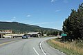
Cut Bank is a city in and the county seat of Glacier County, Montana, United States, located just east of the "cut bank" (gorge) along Cut Bank Creek. The population was 3,056 at the 2020 census, The town began in 1891 with the arrival of the Great Northern Railway.

East Glacier Park is an unincorporated community and census-designated place (CDP) in Glacier County, Montana, United States. As of the 2020 census, it had a population of 354.

St. Regis or Saint Regis is an unincorporated community and census-designated place (CDP) in Mineral County, Montana. The population was 313 at the time of the 2020 census.

Stevensville is a town in Ravalli County, Montana, United States. The population was 2,002 at the 2020 census.

Glacier National Park is an American national park located in northwestern Montana, on the Canada–United States border, adjacent to Waterton Lakes National Park in Canada—the two parks are known as the Waterton-Glacier International Peace Park. The park encompasses more than 1 million acres (4,000 km2) and includes parts of two mountain ranges, more than 130 named lakes, more than 1,000 different species of plants, and hundreds of species of animals. This vast pristine ecosystem is the centerpiece of what has been referred to as the "Crown of the Continent Ecosystem," a region of protected land encompassing 16,000 sq mi (41,000 km2).

The Saint Mary River is a cross-border tributary of the Oldman River, itself a tributary of the South Saskatchewan River. The Saint Mary together with the Belly River and Waterton River drains a small portion of Montana, in the United States, to the Hudson Bay watershed in Canada.

The Blackfeet Nation, officially named the Blackfeet Tribe of the Blackfeet Indian Reservation of Montana, is a federally recognized tribe of Siksikaitsitapi people with an Indian reservation in Montana. Tribal members primarily belong to the Piegan Blackfeet band of the larger Blackfoot Confederacy that spans Canada and the United States.
Carway is a hamlet in southern Alberta, Canada within Cardston County. It is a port of entry into the U.S. state of Montana opposite of Port of Piegan. Just on the other side of the border is the Blackfeet Indian Reservation in Glacier County, Montana.
Lewis and Clark National Forest is located in west central Montana, United States. Spanning 2,912 square miles (7,500 km2), the forest is managed as two separate zones. The eastern sections, under the Jefferson Division, is a mixture of grass and shrublands dotted with "island" pockets of forested areas. Here, cattle leases to local ranchers as well as timber harvesting are the norm. The western Rocky Mountain Division, which straddles the Continental divide, is managed chiefly for environmental preservation, as much of the land has been designated as wilderness. Forest headquarters are located in Great Falls, Montana. Local ranger district offices have been established in Choteau, Harlowton, Neihart, Stanford, and White Sulphur Springs.

Going-to-the-Sun Mountain is a 9,647-foot (2,940 m) mountain peak located in Glacier National Park in the U.S. state of Montana. It rises dramatically above St. Mary Valley just north of the Going-to-the-Sun Road. The mountain was named by James Willard Schultz in 1888.

Two Medicine is the collective name of a region located in the southeastern section of Glacier National Park, in the U.S. state of Montana. It has a campground alongside Two Medicine Lake. From the period starting in the late 1890s until the completion of the Going-to-the-Sun Road in 1932, Two Medicine was one of the most visited sections of the park. Once part of a larger chalet complex, the Two Medicine Store is located along the shores of Two Medicine Lake and the building is a National Historic Landmark. The region is a starting point for many trails and tourboats take visitors out on Two Medicine Lake, where the steep south face of Rising Wolf Mountain towers above the lake. The region was considered sacred ground by several Native American tribes including the Blackfeet and they performed Vision quests here. Aside from Chief Mountain, the Two Medicine area is the most sacred section of the park to the Blackfeet.
Babb is a small unincorporated farming and ranching community in Glacier County, Montana, United States, on the Blackfeet Indian Reservation. The community experiences a large influx of tourists in the summer months as it is the gateway to the Many Glacier area of Glacier National Park. For statistical purposes, the United States Census Bureau has defined Babb as a census-designated place (CDP). It had a population of 174 at the 2010 census.
Del Bonita, also known as Port of Del Bonita, is an unincorporated community in Glacier County, Montana, United States. Its elevation is 4,363 feet (1,330 m) and it is located at 48°59′53″N112°47′17″W. It is on the Canada–United States border, south of Del Bonita, Alberta, and is connected to its Canadian counterpart by the Del Bonita Border Crossing.

James Willard Schultz, or Apikuni, was an American writer, explorer, Glacier National Park guide, fur trader and historian of the Blackfeet Indians. He operated a fur trading post at Carroll, Montana 47°34′25″N108°22′24″W and lived among the Pikuni tribe during the period 1880-82. He was given the name Apikuni by the Pikuni chief, Running Crane. Apikuni in Blackfeet means "Spotted Robe." Schultz is most noted for his 37 books, most about Blackfoot life, and for his contributions to the naming of prominent features in Glacier National Park.

The Regional designations of Montana vary widely within the U.S state of Montana. The state is a large geographical area that is split by the Continental Divide, resulting in watersheds draining into the Pacific Ocean, Gulf of Mexico and Hudson's Bay. The state is approximately 545 miles (877 km) east to west along the Canada–United States border and 320 miles (510 km) north to south. The fourth largest state in land area, it has been divided up in official and unofficial ways into a variety of regions. Additionally, Montana is part of a number of larger federal government administrative regions.
Sula is a census-designated place (CDP) in Ravalli County, Montana, United States. It is named after the community of Sula, which it encompasses, and was established about 2010, prior to that year's census. The population of the CDP was 37 at the 2010 census.
Sapphire Ridge is a census-designated place (CDP) in Judith Basin County, Montana, United States. The community is more commonly known as Sapphire Village. It is in the southern part of the county, on the west side of the valley of the Judith River, a northeast-flowing tributary of the Missouri River.