Stauning Alps

Last updated
Stauning Alps
Stauning Alper
Staunings Alpen(js)1.jpg
One of the massive ranges at the southern end of the Stauning Alps viewed from the Nordvestfjord
Highest point
Peak Dansketinden
Elevation 2,842 m (9,324 ft)
Dimensions
Length120 km (75 mi)N/S
Width50 km (31 mi)E/W
Area6,000 km2 (2,300 sq mi)
Geography
Greenland edcp relief location map.jpg
Red triangle with thick white border.svg
Stauning Alps
Country Greenland
Range coordinates 72°0′N25°0′W / 72.000°N 25.000°W / 72.000; -25.000
Geology
Type of rock Metamorphic rock [1]

The Stauning Alps (Danish : Stauning Alper) [2] are a large system of mountain ranges in Scoresby Land, King Christian X Land, northeastern Greenland. Administratively the Stauning Alps are part of the Northeast Greenland National Park zone.

Contents

This mountainous area was named after Danish politician Thorvald Stauning (1873–1942) who had helped to finance expeditions to east Greenland planned and carried out by Danish explorers. [3]

History

The Stauning Alps had been partly mapped earlier and named Rink Bjerge by Lauge Koch’s 1926–27 expeditions, being referred to as a "wild and jagged range of mountains." The range thus described obviously corresponded to the eastern end of the Stauning Alps and the adjacent Werner Range, but the name was not approved owing to the lack of detailed maps. Finally the range was thoroughly surveyed and mapped in 1932 by Koch during aerial surveys made during the 1931–34 Three-year Expedition to East Greenland. [3]

There is almost full documentation of climbing in the Stauning Alps by the successive expeditions having visited the mountain system. Most of the available climbing reports have either been published or deposited in the archives of the Danish Polar Center (DPC), the Royal Geographical Society of London (RGS) or the British Mountaineering Council (BMC). [3]

Dansketinden, the highest point of the Stauning Alps was first climbed by Swiss mountaineers John Haller (1927–1984), Wolfgang Diehl (1908–1990) and Fritz Schwarzenbach on 5 August 1954. [4] The second ascent was made by a 1964 Italian expedition led by Guido Monzino (1928 – 1988). [3]

Geography

The Stauning Alps are bound to the north by the King Oscar Fjord and its Segelsällskapet Fjord branch, to the east by the Skel Valley, the Schuchert Flod river and the Holger Danske Briller lakes, to the west by the Alpefjord —a branch of the Segelsällskapet Fjord beyond which lies Nathorst Land— and the Borgbjerg Glacier, and to the south by a part of the Nordvestfjord, the NW branch of the Scoresby Sound.

The range is very rugged with numerous high rocky peaks and active glaciers in almost all valleys. It is made up of granite, harder in the northern than in the southern subranges. Therefore, the mountains in the north of the Stauning Alps are generally more craggy, while those in the south are more eroded and have a relatively smoother appearance. [5]

The whole area of this vast range system is an uninhabited, desolate mountainous expanse. The nearest settlement is Ittoqqortoormiit and the nearest airfields are Nerlerit Inaat Airport at Constable Point to the east and Mestersvig to the north. [6] Access to the range requires a special permit. [7]

Subranges and other features

The Murchison Range (Murchison Bjerge) ( 72°18′N25°0′W / 72.300°N 25.000°W / 72.300; -25.000 ) is a subrange located in the northwestern area of the Stauning Alps that was named after Scottish geologist Roderick Impey Murchison (1792–1871). It stretches between the Sedgwick Glacier and the Alpefjord. [8]

The Syltoppene ( 72°20′N24°33′W / 72.333°N 24.550°W / 72.333; -24.550 ) are a mountain ridge with needle-like summits at the northern end of the Stauning Alps that was named by A.G. Nathorst in 1899. [9] Satan's Gallery ( 72°4′N25°7′W / 72.067°N 25.117°W / 72.067; -25.117 ) is a ridge with a series of formidable peaks NNE of Korsspids and south of the Gully Glacier that was named by the 1963 Cambridge University Expedition. [3]

The Alliance Col is a 2,250 m high mountain pass named by the 1992 Scottish Stauning Alps Expedition. [3]

Mountains

The Stauning Alps have a big concentration of mountains higher than 2,700 metres (8,860 ft). The highest point is Dansketinden (2,842 m). Other noteworthy peaks [3] are:

Glaciers

Practically all the valleys in the Stauning Alps are filled by active glaciers that mostly flow towards the North, East or South. Generally those glaciers flowing towards the west are steep and have dangerous icefalls with deep crevasses. [5]

Some of the glaciers in the range system are very large, such as the Spaerre Glacier (Spærregletscher) and Sefstrøm Glacier to the west, the Skjoldungebrae to the north and the Bersaerkerbrae (Bersærkerbræ) to the east. [2] Other important glaciers in the Stauning Alps are:

Climate

The Stauning Alps lie in the high Arctic zone. Polar climate prevails in the area of the range, the average annual temperature in the area being -16 °C . The warmest month is July when the average temperature rises to -2 °C and the coldest is January with -21 °C. [10]

Bibliography

See also

Related Research Articles

<span class="mw-page-title-main">Grossglockner</span> Highest mountain in Austria

The Grossglockner, or just Glockner, is, at 3,798 metres above the Adriatic (12,461 ft), the highest mountain in Austria and the highest mountain in the Alps east of the Brenner Pass. It is part of the larger Glockner Group of the Hohe Tauern range, situated along the main ridge of the Central Eastern Alps and the Alpine divide. The Pasterze, Austria's most extended glacier, lies on the Grossglockner's eastern slope.

<span class="mw-page-title-main">Mont Forel</span> Mountain in Sermersooq Municipality, Greenland

Mont Forel is a mountain in King Christian IX Land, Sermersooq Municipality, Greenland. It is part of the Schweizerland range, also known as 'Schweizerland Alps'.

<span class="mw-page-title-main">Watkins Range</span> Mountain range in Greenland

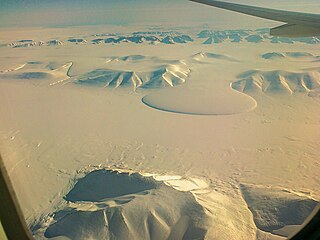
The Watkins Range is Greenland's highest mountain range. It is located in King Christian IX Land, Sermersooq municipality.

Dansketinden is the highest mountain in the Stauning Alps range, Eastern Greenland.

Norsketinden is a mountain in the Stauning Alps, Eastern Greenland.

Payer Peak, is a mountain in King Christian X Land, Northeast Greenland. Administratively it is part of the Northeast Greenland National Park zone.

Petermann Peak,, also known as Petermann Fjeld, Petermanns Topp and Petermann Point is a mountain in King Christian X Land, Northeast Greenland. Administratively it is part of the Northeast Greenland National Park zone.

<span class="mw-page-title-main">Schweizerland</span> Mountain range in eastern Greenland

Schweizerland, also known as Schweizerland Alps, is a mountain range in King Christian IX Land, eastern Greenland. Administratively this range is part of the Sermersooq Municipality. Its highest point is one of the highest peaks in Greenland.

<span class="mw-page-title-main">Princess Caroline-Mathilde Alps</span> Mountain range in Greenland

The Princess Caroline-Mathilde Alps are a mountain range system in the Holm Land Peninsula, King Frederick VIII Land, northeastern Greenland. Administratively this range is part of the Northeast Greenland National Park zone.

<span class="mw-page-title-main">Queen Louise Land</span> Mountainous region in northeastern Greenland

Queen Louise Land is a vast mountainous region located west of Dove Bay, King Frederik VIII Land, northeastern Greenland. Administratively it is part of the Northeast Greenland National Park zone.

<span class="mw-page-title-main">Gronau Nunataks</span> Greenlandic mountain range

The Gronau Nunataks is a mountain range in King Christian IX Land, eastern Greenland. Administratively this range is part of the Sermersooq Municipality.

<span class="mw-page-title-main">Ejnar Mikkelsen Range</span> Mountain range in Greenland

Ejnar Mikkelsen Range is a mountain range in King Christian IX Land, eastern Greenland. Administratively it is part of the Sermersooq Municipality.

<span class="mw-page-title-main">Princess Elizabeth Alps</span>

The Princess Elizabeth Alps is a mountain range in King Frederick VIII Land, northeastern Greenland. Administratively this range is part of the Northeast Greenland National Park zone.

Helvetia Tinde is the highest mountain in the Roosevelt Range, Northern Greenland. It is also the highest mountain of the northernmost mountain range on Earth.

<span class="mw-page-title-main">Roosevelt Range</span>

The Roosevelt Range or Roosevelt Mountains is a mountain range in Northern Greenland. Administratively this range is part of the Northeast Greenland National Park. Its highest peak is the highest point in Peary Land.

<span class="mw-page-title-main">Daly Range</span>

The Daly Range or Daly Mountains is a mountain range in Peary Land, Northern Greenland. Administratively this range is part of the Northeast Greenland National Park.

<span class="mw-page-title-main">Gertrud Rask Land</span>

Gertrud Rask Land is an area in Peary Land, North Greenland. Administratively it is part of the Northeast Greenland National Park.

References

  1. Haller, J. 1958: Der ‘Zentrale Metamorphe Komplex’ von NE-Grönland. Part 2. Die geologische Karte der Staunings Alper und des Forsblads Fjordes. Meddelelser om Grønland 154(3), 153 pp.
  2. 1 2 "Stauning Alper". Mapcarta. Retrieved 18 June 2016.
  3. 1 2 3 4 5 6 7 8 "Catalogue of place names in northern East Greenland" (PDF). Geological Survey of Denmark. Retrieved 30 December 2016.
  4. Higgins, Anthony K. (2010). "Dansketinden". Exploration history and place names of northern East Greenland. Vol. 21. Copenhagen: Geological Survey of Denmark and Greenland. ISBN   978-87-7871-292-9.
  5. 1 2 Colwyn Jones: Greenland Expedition 1996 (PDF; 2,7 MB), Expedition Report, Scottish Mountaineering Club, p. 8
  6. 1 2 3 4 5 6 7 8 9 10 11 12 13 14 15 16 17 18 19 20 21 22 23 24 25 26 27 28 29 30 31 32 33 34 35 36 37 38 39 40 41 42 43 Google Earth
  7. "Climbing and Mountaineering in Greenland". Lonely Planet. Retrieved 18 June 2016.
  8. "Murchison Bjerge". Mapcarta. Retrieved 4 January 2017.
  9. "Syltoppen". Mapcarta. Retrieved 4 January 2017.
  10. "NASA Earth Observations Data Set Index". NASA. Retrieved 8 June 2016.