
The Bahamas, known officially as The Commonwealth of The Bahamas, is a sovereign country within the Lucayan Archipelago of the West Indies in the Atlantic. It takes up 97% of the Lucayan Archipelago's land area and is home to 88% of the archipelago's population. The archipelagic state consists of more than 700 islands, cays, and islets in the Atlantic Ocean, and is located north of Cuba and northwest of the island of Hispaniola and the Turks and Caicos Islands, southeast of the American state of Florida, and east of the Florida Keys. The capital is Nassau on the island of New Providence. The Royal Bahamas Defence Force describes The Bahamas' territory as encompassing 470,000 km2 (180,000 sq mi) of ocean space.
This article talks about transportation in the Bahamas, a North American archipelagic state in the Atlantic Ocean.

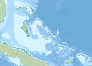
The Abaco Islands lie in the northern Bahamas, 180 miles off the South Florida coast. They comprise the main islands of Great Abaco and Little Abaco, along with smaller barrier cays. The northernmost are Walker's Cay, and its sister island Grand Cay. To the south, the next inhabited islands are Spanish Cay and Green Turtle Cay, with its settlement of New Plymouth, Great Guana Cay, private Scotland Cay, Man-O-War Cay, and Elbow Cay, with its settlement of Hope Town. Southernmost are Tilloo Cay and Lubbers Quarters. Another of note off Abaco's western shore is onetime Gorda Cay, now a Disney Island and cruise ship stop and renamed Castaway Cay. Also in the vicinity is Moore's Island. On the Big Island of Abaco is Marsh Harbour, the Abacos' commercial hub and the Bahamas' third largest city, plus the resort area of Treasure Cay. Both have airports. A few mainland settlements of significance are Coopers Town and Fox Town in the north and Cherokee and Sandy Point in the south. Administratively, the Abaco Islands constitute seven of the 31 Local Government Districts of the Bahamas: Grand Cay, North Abaco, Green Turtle Cay, Central Abaco, South Abaco, Moore's Island, and Hope Town.

Exuma is a district of The Bahamas, consisting of over 365 islands, also called cays.

Ragged Island is a small island 23 km2 (8.9 sq mi) and district in the southern Bahamas. Ragged Island is part of the Jumentos Cays and Ragged Island Chain. The crescent-shaped chain measures over 180 km (110 mi) in length and includes cays known as Raccoon Cay, Hog Cay and Double-Breasted Cay. On 8 September 2017, Duncan Town took a direct hit from Hurricane Irma.

Elbow Cay is an eight-mile-long (13-kilometre) cay in the Abaco Islands of the Bahamas. Originally populated by British loyalists fleeing the newly independent United States of America in 1785, it has survived on fishing, boat building, and salvage. Its main village of Hope Town surrounds a protected harbor with a noted red-and-white-striped one-hundred-and-twenty-foot-tall (37-metre) lighthouse built in 1863. On September 1, 2019, Elbow Cay took a direct hit from Category 5 Hurricane Dorian, with sustained winds of 185 mph (295 km/h). The lighthouse survived.

Norman's Cay is a small Bahamian island in the Exumas, a chain of islands south and east of Nassau, that served as the headquarters for Carlos Lehder's drug smuggling operation from 1978 until around 1982.
Man-O-War Cay is a small island in the Abaco region of the Bahamas. It had a population of 215 at the 2010 census.

Great Harbour Cay is the major island in the north Berry Islands. It has a population of 353.

Great Guana Cay is an islet in The Bahamas. It is a long, narrow islet, 7 miles (11 km) long. It is in the centre of the Abaco Islands and is near Gumelemi Cay. It is about 8 miles from Marsh Harbour. Approximately 150 people live on the island, mostly along the five and a half mile long stretch of beach.
Green Turtle Cay is one of the barrier islands off mainland Great Abaco, The Bahamas. It can only be reached via ferry from the mainland or boat. There is not an airport on the island. It is considered part of the "Abaco Out Islands" and is 3 miles (4.8 km) long and ½ mile wide. It was named after the once abundant green turtles that inhabited the area. In 1977, Key West, Florida became a sister city to New Plymouth, Green Turtle Cay's village.

Cyclura cychlura inornata, the Allen Cays rock iguana or Allen Cays iguana, is a subspecies of the northern Bahamian rock iguana that is found on Allen's Cay and adjacent islands in the Bahamas. Its status in the IUCN Red List is critically endangered. The population has been growing over the last century. Although it was considered extinct in 1916, there are as of 2018 at least 482 mature adult animals counted on two islands, Leaf Cay and U Cay, and a few hundred on at least five other nearby islands where they have recently spread to by unknown means, as well as many juveniles.
The following outline is provided as an overview of and topical guide to The Bahamas:
The Bahamas National Trust is a non-profit organisation in the Bahamas that manages the country's 32 national parks. Its headquarters is located in New Providence in the Bay Street Business Centre, East Bay Street. Its office was formally located at The Retreat Gardens on Village Road. The Bahamas National Trust was created by an Act of Parliament in 1959, through the efforts of two groups of conservationists.

The following is an alphabetical list of topics related to the Commonwealth of The Bahamas.

The Exuma Cays Land and Sea Park is a protected area in the Exuma Cays of the Bahamas. The protected area extends from Shroud Cay in the north to Bell Cay in the south. The vegetation consists of mangrove communities, with the east sides being clad in low scrub and the western sides with taller scrub. There are many epiphytic orchids and bromeliads.

Pig Beach located on Big Major Cay is a beach on an uninhabited island located in Exuma, the Bahamas. The island takes its unofficial name from the fact that it is populated by a colony of feral pigs which live on the island. It has become a tourist attraction in modern times.

Long Island is an island in the Bahamas that is split by the Tropic of Cancer. It is one of the Districts of the Bahamas and is known as the most scenic island in the Bahamas. Its capital is Clarence Town. The population of Long Island is 3,094 inhabitants.
Staniel Cay is an island located in The Exuma Cays, a district of The Bahamas.
