Stockland, Illinois

Last updated
Stockland, Illinois
Unincorporated community
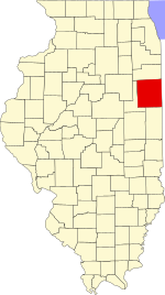
Map of Illinois highlighting Iroquois County.svg
Iroquois County's location in Illinois
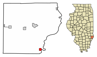
Location map of Iroquois County, Illinois.svg
Red pog.svg
Stockland
Stockland's location in Iroquois County
Coordinates: 40°36′52″N87°35′34″W / 40.61444°N 87.59278°W / 40.61444; -87.59278 Coordinates: 40°36′52″N87°35′34″W / 40.61444°N 87.59278°W / 40.61444; -87.59278
Country Flag of the United States.svg  United States
State Flag of Illinois.svg  Illinois
County Iroquois County
Township Stockland Township
Elevation 673 ft (205 m)
ZIP code 60967
GNIS feature ID 0419152 [1]

Stockland is an unincorporated community in Stockland Township, Iroquois County, Illinois.

Stockland Township, Iroquois County, Illinois Township in Illinois, United States

Stockland Township is one of twenty-six townships in Iroquois County, Illinois, USA. As of the 2010 census, its population was 243 and it contained 122 housing units. Stockland Township formed as Crab Apple Township in September 1864, but changed its name to Stockland Township on an unknown date.

Iroquois County, Illinois county in Illinois, United States

Iroquois County is a county located in the northeast part of the U.S. state of Illinois. According to the 2010 census, it has a population of 29,718. It is the only county in the United States to be named Iroquois, after the American Indian people. The county seat is Watseka. The county is located along the border with Indiana.

Illinois State of the United States of America

Illinois is a state in the Midwestern region of the United States. It has the 5th largest Gross Domestic Product by state, is the 6th-most populous U.S. state and 25th-largest state in terms of land area. Illinois is often noted as a microcosm of the entire United States. With Chicago in the northeast, small industrial cities and great agricultural productivity in northern and central Illinois, and natural resources such as coal, timber, and petroleum in the south, Illinois has a diverse economic base, and is a major transportation hub. Chicagoland, Chicago's metropolitan area, contains over 65% of the state's population. The Port of Chicago connects the state to other global ports around the world from the Great Lakes, via the Saint Lawrence Seaway, to the Atlantic Ocean; as well as the Great Lakes to the Mississippi River, via the Illinois Waterway on the Illinois River. The Mississippi River, the Ohio River, and the Wabash River form parts of the boundaries of Illinois. For decades, Chicago's O'Hare International Airport has been ranked as one of the world's busiest airports. Illinois has long had a reputation as a bellwether both in social and cultural terms and, through the 1980s, in politics.

Geography

Stockland is located at 40°36′52″N87°35′34″W / 40.61444°N 87.59278°W / 40.61444; -87.59278 .

Related Research Articles

St. Francisville, Illinois City in Illinois, United States

St. Francisville is a city in Lawrence County, Illinois, United States. The population was 759 at the 2000 census.

Waverly, Illinois City in Illinois, United States

Waverly is a city in Morgan County, Illinois, United States. The population was 1,346 at the 2000 census. It is part of the Jacksonville Micropolitan Statistical Area.

Birmingham Erdington (UK Parliament constituency) Parliamentary constituency in the United Kingdom, 1974 onwards

Birmingham, Erdington is a constituency represented in the House of Commons of the UK Parliament since 2010 by Jack Dromey of the Labour Party.

Toyota Technological Institute at Chicago

In 2003, the Toyota Technological Institute of Nagoya, Japan opened the Toyota Technological Institute at Chicago (TTIC), jointly with the University of Chicago. The stated purpose of the institute is research and education in computer science.

Pittsburg, Indiana Unincorporated community in Indiana, United States

Pittsburg is an unincorporated community in Tippecanoe Township, Carroll County, Indiana. It is part of the Lafayette, Indiana Metropolitan Statistical Area.

Freeland Park, Indiana Unincorporated community in Indiana, United States

Freeland Park is an unincorporated community in Parish Grove Township, Benton County, Indiana. It is part of the Lafayette, Indiana Metropolitan Statistical Area.

Prairie Green Township, Iroquois County, Illinois Township in Illinois, United States

Prairie Green Township is one of twenty-six townships in Iroquois County, Illinois, USA. As of the 2010 census, its population was 183 and it contained 92 housing units. Prairie Green Township was originally named Prairie Township, and was formed from Stockland Township, originally known as Crab Apple Township, in March 1857. The name was changed to Prairie Green Township in March 1858.

Garabito (canton) Cantón in Puntarenas, Costa Rica

Garabito is the eleventh canton in Puntarenas Province in Costa Rica. The canton covers an area of 316.31 km², and has a population of 21,473. Its capital city is Jacó.

Sanekuy

Sanekuy is a Bobo village and commune in Mali. It is located 27 km from Tominian in the south, situated in west Mandiakuy. It has about 5000 inhabitants.

Bané Department Department in Boulgou Province, Burkina Faso

Bané is a department or commune of Boulgou Province in eastern Burkina Faso. Its capital lies at the town of Bané. According to the 1996 census the department has a total population of 22,923.

Lchavan Place in Gegharkunik, Armenia

Lchavan is a village located southeast of Lake Sevan in the Gegharkunik Province of Armenia. The village has Bronze Age tombs and a church dating to the 13th-14th century with khachkars.

Bullbegger is an unincorporated community in Accomack County, Virginia, United States.

Heyvali (village) Place

Heyvali is a village de jure in the Kalbajar Rayon of Azerbaijan, de facto in the Martakert Province of the Nagorno-Karabakh Republic.

Cain Rock is a locality in Humboldt County, California. It is located on the Northwestern Pacific Railroad 3 miles (4.8 km) south-southeast of Alderpoint, at an elevation of 381 feet (116 m).

Pampa is an unincorporated community in Gloucester County, in the U. S. state of Virginia.

Old Stone Fort was a fort that existed in 1814 in Rockport, Massachusetts. It was also known as Sea Fensibles Barrack during its existence. Today, a plaque is located on the Transit Tower, which was built on the site of the fort. Stones from the former fort were used in the construction of the harbor's breakwater.

Olive Green is an unincorporated community in Noble County, in the U.S. state of Ohio.

Rahm, Indiana Unincorporated community in Indiana, United States

Rahm is an unincorporated community in Union Township, Vanderburgh County, in the U.S. state of Indiana.

Meramec Township is a township in St. Louis County, in the U.S. state of Missouri. Its population was 39,731 as of the 2010 census.

References

  1. "Stockland". Geographic Names Information System . United States Geological Survey . Retrieved 2010-10-15.