Storkow, Brandenburg

Last updated
Storkow
Storkow Kirche.jpg
Town centre and parish church
Storkow (Mark) - Wappen.png
Location of Storkow within Oder-Spree district
Storkow (Mark) in LOS.pngBriesenFriedlandGrünheideStorkowVogelsangWoltersdorf
Germany adm location map.svg
Red pog.svg
Storkow
Brandenburg location map.svg
Red pog.svg
Storkow
Coordinates: 52°15′12″N13°55′48″E / 52.25333°N 13.93000°E / 52.25333; 13.93000
Country Germany
State Brandenburg
District Oder-Spree
Subdivisions13 Ortsteile
Government
   Mayor (201927) Cornelia Schulze-Ludwig [1] (SPD)
Area
  Total179.96 km2 (69.48 sq mi)
Elevation
37 m (121 ft)
Population
 (2021-12-31) [2]
  Total9,373
  Density52/km2 (130/sq mi)
Time zone UTC+01:00 (CET)
  Summer (DST) UTC+02:00 (CEST)
Postal codes
15859
Dialling codes 033678
Vehicle registration LOS
Website storkow.de

Storkow (Mark) is a town in Oder-Spree district, in Brandenburg, Germany.

Contents

Geography

Storkow is situated in the western part of Oder-Spree district, about 15 km (9.3 mi) southwest of Fürstenwalde. The municipal area comprises several lakes of the Dahme-Heideseen Nature Park; in the south, the Spreewald biosphere reserve stretches into Lower Lusatia.

Division of the town

The following villages of the former Amt Storkow were incorporated into the present municipality with effect from 26 October 2003:

  • Alt-Stahnsdorf (population: 384)
  • Bugk (population: 194)
  • Görsdorf (population: 556)
  • Groß Eichholz (population: 141)
  • Groß Schauen (population: 178)
  • Kehrigk (population: 325)
  • Kummersdorf (population: 499)
  • Limsdorf (population: 377)
  • Philadelphia (population: 258)
  • Rieplos (population: 132)
  • Selchow (population: 269)
  • Schwerin (population: 131)
  • Wochowsee (population: 60)

The municipalities of Alt Stahnsdorf, Limsdorf, Schwerin, Wochowsee had merged with the town of Storkow on 31 March 2002. Storkow proper already included the hamlets of Karlslust, Neu Boston and Wolfswinkel.

The villages of Philadelphia and Neu Boston were named after their American counterparts by Frederick the Great in 1772. [3]

History

Storkow Castle Storkow Burg Palas 1.jpg
Storkow Castle

The town of Storkow was first mentioned in a 1209 deed issued by Emperor Otto IV; it thereby is one of the oldest towns in Brandenburg. In early medieval times, the area was settled by Polabian Slavs, it was incorporated by the Saxon margrave Gero in his vast marca Geronis and by 965 formed part of the Imperial March of Lusatia (or Saxon Eastern March). During the German Ostsiedlung migration, maybe under the rule of the Wettin margrave Conrad the Great in the mid 12th century, Storkow Castle was erected. It probably arose at the site of a former Slavic marsh fortress and served as administrative seat of Wettin ministeriales ruling over the extended Lusatian lordship ( Herrschaft ) of Storkow.

With Lower Lusatia, Storkow passed to the Lands of the Bohemian Crown in 1367; it was located near the northern border with the Margraviate of Brandenburg. From 1518, Storkow Castle was pawned to the Bishops of Lebus as an episcopal residence. Upon the death of the last Catholic bishop in 1555, it was presented as a gift to the Hohenzollern margrave John of Brandenburg-Küstrin by King Ferdinand I of Bohemia and, together with neighbouring Beeskow, finally merged into the Brandenburg electorate upon John's death in 1571.

Lower Sorbian was spoken by a significant proportion of the population until the early 17th century. Devastated during the Thirty Years' War, Storkow Castle was rebuilt in a Renaissance style under the rule of the "Great Elector" Frederick William. The town became part of the newly established Kingdom of Prussia in 1701. King Frederick the Great decisively promoted the local trade of weavers, bleachers and dyers.

From 1815 to 1947, Storkow was part of the Prussian Province of Brandenburg.

After World War II, Storkow was incorporated into the State of Brandenburg from 1947 to 1952 and the Bezirk Frankfurt of East Germany from 1952 to 1990. Since 1990 Storkow is again part of Brandenburg. In January, 1946, Storkow issued 16 postage stamps of its own, the final two semi-postals to raise funds for "victims of fascism." Storkow Castle was destroyed by a blaze in 1978; it was rebuilt after German reunification and today is a listed monument.

Demography

Storkow (Mark): Population development
within the current boundaries (2020) [4]
YearPop.±% p.a.
1875 6,004    
1890 5,738−0.30%
1910 6,172+0.37%
1925 6,847+0.69%
1939 7,824+0.96%
1950 9,297+1.58%
1964 8,626−0.53%
YearPop.±% p.a.
1971 8,581−0.07%
1981 8,890+0.35%
1985 8,801−0.25%
1990 9,671+1.90%
1995 9,320−0.74%
2000 9,522+0.43%
2005 9,476−0.10%
YearPop.±% p.a.
2010 9,077−0.86%
2015 9,020−0.13%
2016 9,070+0.55%
2017 9,097+0.30%
2018 9,180+0.91%
2019 9,226+0.50%
2020 9,352+1.37%

Politics

Town hall Rathaus Storkow (Mark) 01.jpg
Town hall

Seats in the town's assembly (Stadtverordnetenversammlung) as of 2014 local elections:

Twin towns — sister cities

Storkow is twinned with:

Related Research Articles

<span class="mw-page-title-main">Cottbus</span> Town in Brandenburg, Germany

Cottbus or Chóśebuz is a university city and the second-largest city in the German state of Brandenburg after the state capital of Potsdam. With around 98,000 inhabitants, it is the most populous city in Lusatia. Cottbus lies in the Sorbian settlement area of Lower Lusatia, and is the second-largest city on the River Spree after Berlin, from which it is situated around 125 km (78 mi) upstream. The city is located on the shores of Cottbus Eastern Lake, which will be Germany's largest artificial lake by surface area when flooding is completed.

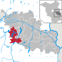
Dahme-Spreewald is a district in Brandenburg, Germany. It is bounded by the districts of Oder-Spree, Spree-Neiße, Oberspreewald-Lausitz, Elbe-Elster and Teltow-Fläming, and by the city of Berlin.

Oder-Spree is a Kreis (district) in the eastern part of Brandenburg, Germany. Neighboring are the district Märkisch-Oderland, the district-free city Frankfurt (Oder), Poland, the districts Spree-Neiße and Dahme-Spreewald, and the Bundesland Berlin.

<span class="mw-page-title-main">Schwedt</span> Town in Brandenburg, Germany

Schwedt is a town in Brandenburg, in northeastern Germany. With the official status of a Große kreisangehörige Stadt, it is the largest town of the Uckermark district, located near the river Oder, which forms the border with Poland.

<span class="mw-page-title-main">Guben</span> Town in Brandenburg, Germany

Guben is a town on the Lusatian Neisse river in Lower Lusatia, in the state of Brandenburg, Germany. Located in the Spree-Neiße district, Guben has a population of 20,049. Along with Frankfurt (Oder) and Görlitz, Guben is a divided city on the border between Germany and Poland, having been separated into Guben and Gubin in 1945 by the Oder–Neisse line.

<span class="mw-page-title-main">Neuzelle</span> Municipality in Brandenburg, Germany

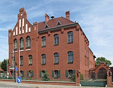
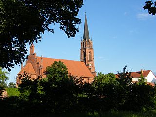
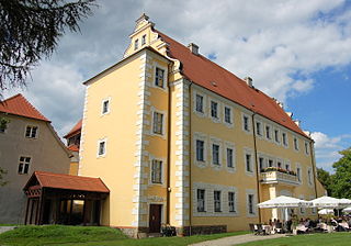
Neuzelle is a municipality in the Oder-Spree district of Brandenburg, Germany, the administrative seat of Amt Neuzelle. It is best known for Cistercian Neuzelle Abbey and its Neuzeller Kloster Brewery.

<span class="mw-page-title-main">Doberlug-Kirchhain</span> Town in Brandenburg, Germany

Doberlug-Kirchhain is a German town in the district of Elbe-Elster, Lower Lusatia, Brandenburg.

<span class="mw-page-title-main">Lübbenau</span> Town in Brandenburg, Germany

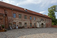
Lübbenau is a town in the Upper Spree Forest-Lusatia District of Brandenburg, Germany. It is located in the bilingual German/Sorbian region of (Lower) Lusatia, on the river Spree, where this forms a large inland delta surrounded by woodland, called "Spree Forest", about 82 km (51 mi) southeast of Berlin. The town is best known through the incorporated villages of Lehde/Lědy and Leipe/Lipje, villages where there just exist anabranches of the Spree River instead of streets.

<span class="mw-page-title-main">Lower Lusatia</span> Geographic region in Europe

Lower Lusatia is a historical region in Central Europe, stretching from the southeast of the German state of Brandenburg to the southwest of Lubusz Voivodeship in Poland. Like adjacent Upper Lusatia in the south, Lower Lusatia is a settlement area of the West Slavic Sorbs whose endangered Lower Sorbian language is related to Upper Sorbian and Polish.

<span class="mw-page-title-main">Forst (Lausitz)</span> Town in Brandenburg, Germany

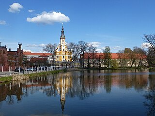
Forst (Lausitz) (German) or Baršć (Łužyca) (Lower Sorbian) is a town in Lower Lusatia, Brandenburg, Germany. It lies east of Cottbus, on the river Lausitzer Neiße which is also the German-Polish border, the Oder-Neisse line. It is the capital of the Spree-Neiße district. It is known for its rose garden and textile museum. The town's population is 18,651. In Forst, there is a railway bridge across the Neiße belonging to the line Cottbus–Żary which is serviced by regional trains and a EuroCity train between Hamburg and Kraków (2011). There is also a road bridge across the river north of Forst.

<span class="mw-page-title-main">Fürstenwalde</span> Town in Brandenburg, Germany

Fürstenwalde/Spree is the most populous town in the Oder-Spree District of Brandenburg, Germany.

<span class="mw-page-title-main">Lübben (Spreewald)</span> Town in Brandenburg, Germany

Lübben (Spreewald) is a town of 14,000 people, capital of the Dahme-Spreewald district in the Lower Lusatia region of Brandenburg, Germany.

<span class="mw-page-title-main">Senftenberg</span> Town in Brandenburg, Germany

Senftenberg is a town in Lower Lusatia, Brandenburg, Germany, capital of the Oberspreewald-Lausitz district.

<span class="mw-page-title-main">Altlandsberg</span> Town in Brandenburg, Germany

Altlandsberg is a historic town in the district of Märkisch-Oderland, in Brandenburg, Germany. It is situated about 22 km (14 mi) east of Berlin.

<span class="mw-page-title-main">Drebkau</span> Town in Brandenburg, Germany

Drebkau is a town in the district of Spree-Neiße, in Lower Lusatia, Brandenburg, Germany. It is situated 14 km southwest of Cottbus.

<span class="mw-page-title-main">Friedland, Brandenburg</span> Town in Brandenburg, Germany

Friedland is a town in the Oder-Spree district, in Brandenburg, Germany. It is situated in the historic Lower Lusatia region, about 8 km (5.0 mi) south of Beeskow, and 39 km (24 mi) north of Cottbus.

<span class="mw-page-title-main">Golßen</span> Town in Brandenburg, Germany

Golßen or Golssen is a town in the district of Dahme-Spreewald, in Brandenburg, Germany. It is the administrative seat of the Amt Unterspreewald.

<span class="mw-page-title-main">Grünheide (Mark)</span> Municipality in Brandenburg, Germany

Grünheide (Mark) is a municipality in the Oder-Spree District, in Brandenburg, Germany. It is situated 30 kilometres south-east of Berlin city centre, on the River Löcknitz. In 2020 Tesla, Inc. began to build Gigafactory Berlin-Brandenburg in Grünheide near the Autobahn A10.

<span class="mw-page-title-main">Steinhöfel</span> Municipality in Brandenburg, Germany

Steinhöfel is a municipality in the Oder-Spree district, in Brandenburg, Germany. Since the beginning of 2019 it belongs to the collective municipality "Amt Odervorland"

<span class="mw-page-title-main">Neuhausen/Spree</span> Municipality in Brandenburg, Germany

Neuhausen/Spree is a municipality in the district of Spree-Neiße, in Lower Lusatia, Brandenburg, Germany.

References

  1. Landkreis Oder-Spree Wahl der Bürgermeisterin / des Bürgermeisters, accessed 2 July 2021.
  2. "Bevölkerungsentwicklung und Flächen der kreisfreien Städte, Landkreise und Gemeinden im Land Brandenburg 2021" (PDF). Amt für Statistik Berlin-Brandenburg (in German). June 2022.
  3. Lenze, Franz (7 August 2003). "This is not America: Dabei ist die Rede von Boston und Philadelphia. Das aber sind zwei Dörfer, klein und unscheinbar. Sie liegen mitten in Brandenburg" (in German). Die Zeit.
  4. Detailed data sources are to be found in the Wikimedia Commons.Population Projection Brandenburg at Wikimedia Commons