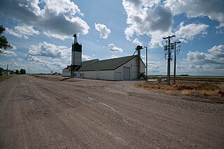
Polk County is a county in the U.S. state of Minnesota. The population was 37,600 at the 2010 census. Its county seat is Crookston, and the largest community is East Grand Forks.

Marshall County is a county in the U.S. state of Minnesota. As of the 2010 census, the population was 9,439. Its county seat is Warren.

"Greater Grand Forks" is the name used by some people to designate the twin cities of Grand Forks, North Dakota and East Grand Forks, Minnesota, together with their surrounding areas. The two cities lie directly across from each other on both sides of the Red River of the North, but Grand Forks, with a population of 52,838, is more than five times larger than East Grand Forks, with a population of 8,601. The metropolitan area includes all of the related two counties in the two states: Grand Forks County in North Dakota and Polk County in Minnesota. As of the 2010 census, the MSA had a population of 98,461, and in 2014 estimates placed the total population at 101,842.

The Turtle River is a 74.9-mile-long (120.5 km) tributary of the Red River of the North in northeastern North Dakota in the United States. It flows for almost its entire length in Grand Forks County. Via the Red River, Lake Winnipeg and the Nelson River, the Turtle River is part of the watershed of Hudson Bay.
KUND-FM is a radio station licensed to Grand Forks, North Dakota. The station was owned by the University of North Dakota until September 2018 when it was purchased by Prairie Public Radio. It airs a format consisting of jazz, classical music and news and talk programming.
Grand Prairie Township is a civil township in Barnes County, North Dakota, USA. As of the 2000 census, its population was 49.

Joliette is an unincorporated community located along Interstate 29 in Joliette Township in Pembina County in the U.S. state of North Dakota. It was established in 1879 as a rural post office. It was settled by French Canadians and named for Joliette, Quebec, the hometown of the town's first settler. Even though it is unincorporated, the post office is sadly not operating anymore and shares the ZIP code of 58271 with the city of Pembina.

Cecil Township is a civil township in Bottineau County in the U.S. state of North Dakota. As of the 2000 census, its population was 28.
Ardoch Township is a township in Walsh County, North Dakota. 50.5% (47) of the population are male, and the other 49.5% (46) are female.
Cleveland Township is a township in Walsh County, North Dakota. 53.5% (53) of the population are male, and the other 46.5% (46) are female.
Eden Township is a township in Walsh County, North Dakota. 44.6% (25) of the population are male, and the other 55.4% (31) are female.
Grafton Township is a township in Walsh County, North Dakota. 51.1% (167) of the population are male, and the other 48.9% (160) are female. As of the 2010 census, the population of Grafton Township is 327.
Lampton Township is a township in Walsh County, North Dakota.
Martin Township is a township in Walsh County, North Dakota.
Pulaski Township is a township in Walsh County, North Dakota.
Walshville Township is a township in Walsh County, North Dakota.
Allendale Township is a township in Grand Forks County, North Dakota, United States. It has a population of 368 people. It has a population density of ten people per square mile.
Americus Township is a township in Grand Forks County, North Dakota, United States. It has a population of 162 people. It has a population density of five people per square mile.
Arvilla Township is a township in Grand Forks County, North Dakota, United States. It has a population of 334 people. It has a population density of nine people per square mile.


