
Morgan County is a county located in the U.S. state of Indiana. As of the 2020 United States Census, the population was 71,780. The county seat is Martinsville.

Madison County is a county in the U.S. state of Indiana. The 2020 census states the population is standing at 130,129. The county seat since 1836 has been Anderson, one of three incorporated cities within the county.

Hamilton County is a county in the U.S. state of Indiana. The 2020 United States Census recorded a population of 347,467. The county seat is Noblesville.

Connersville is a city in Fayette County, east central Indiana, United States, 66 miles (106 km) east by southeast of Indianapolis. The population was 13,481 at the 2010 census. The city is the county seat of and the largest and only incorporated town in Fayette County. The city is in the center of a large rural area of east central Indiana; the nearest significant city is Richmond, 26 miles (42 km) to the northeast by road. Connersville is home to the county's only high school. The economy is supported by local manufacturing, retail, and healthcare. Employment and population have been declining since the 1960s and it is among the poorest areas of the state in median household income and other economic measures.

Fishers is a city in Fall Creek and Delaware townships, Hamilton County, Indiana, United States. As of the 2010 census the population was 76,794, and by 2019 the estimated population was 95,310. A suburb of Indianapolis, Fishers has grown rapidly in recent decades: about 350 people lived there in 1963, 2,000 in 1980, and only 7,500 as recently as 1990.

Noblesville is a city in and the county seat of Hamilton County, Indiana, United States, a part of the north Indianapolis suburbs along the White River. The population was 69,604 at the 2020 census, making it the state's 10th most populous city, up from 14th in 2010. The city is part of Delaware, Fall Creek, Noblesville, and Wayne townships.
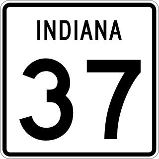
State Road 37 (SR 37) is a major route in the U.S. state of Indiana, running as a four-lane divided highway for 110 miles of its course.

The Treaty of St. Mary's may refer to one of six treaties concluded in fall of 1818 between the United States and Natives of central Indiana regarding purchase of Native land. The treaties were

Conner Prairie is a living history museum in Fishers, Indiana, United States, which preserves the William Conner home. The home is listed on the National Register of Historic Places, and the museum recreates 19th-century life along the White River. The museum also hosts several programs and events, including outdoor performances by the Indianapolis Symphony Orchestra and summer camps.

William Conner was an American trader, interpreter, military scout, community leader, entrepreneur, and politician. Although Conner initially established himself as a fur trader on the Michigan and Indiana frontiers, his business interests later expanded to include ownership of Indiana farms, mills, distilleries, and mercantile shops. He was also a land speculator. Conner served the American forces in several capacities during the War of 1812, and as an interpreter and witness at several treaty negotiations with Native American tribes that resulted their removal from Indiana and established the state's geographical boundaries.

Clay Township is one of nine townships in Hamilton County, Indiana, United States. As of the 2010 census, its population was 83,293 and it contained 32,375 housing units. Since the annexation of Home Place, Indiana; Carmel is now completely coterminous with the township.

Delaware Township is one of nine townships in Hamilton County, Indiana, United States. As of the 2010 census, its population was 30,617 and it contained 13,553 housing units. Records show the township to have had 43,352 residents in 2007.
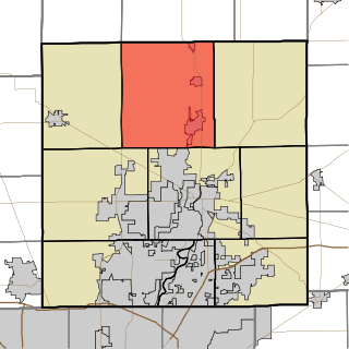
Fall Creek Township is one of nine townships in Hamilton County, Indiana, United States. As of the 2010 census, its population was 51,613 and it contained 17,542 housing units.
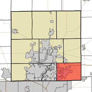
Jackson Township is one of nine townships in Hamilton County, Indiana, United States. As of the 2010 census, its population was 10,368 and it contained 4,367 housing units.

Noblesville Township is one of nine townships in Hamilton County, Indiana, United States. As of the 2010 census, its population was 50,564 and it contained 20,122 housing units.

Wayne Township is one of nine townships in Hamilton County, Indiana, United States and serves as one of two townships within Noblesville, Indiana's jurisdiction. As of the 2010 census, its population was 7,886 and it contained 3,252 housing units, an increase from 2415 in 2000, as Noblesville continues to expand eastward and Fishers reaches its northern limits. In 2007, Noblesville officially opened one of the largest mixed use developments in the state, called the Noblesville Corporate Campus. A portion of the development is located within the township. When completed, it will include a large industrial/commercial park, several housing developments, hotels, greenspace and a large outdoor shopping center called Hamilton Town Center, being built by the Simon Property Group, headquartered in nearby Indianapolis.

White River Township is one of nine townships in Hamilton County, Indiana, United States. As of the 2010 census, its population was 2,486 and it contained 1,028 housing units. It is the least developed township in the county and the only one without an incorporated community of any kind within its boundaries.
Fall Creek is a navigable in law waterway in the U.S. state of Indiana, and a tributary of the White River. It is 57.5 miles (92.5 km) long and has a watershed drainage area of 318 square miles (820 km2) in central Indiana before flowing into the White River in Indianapolis. As it flows southwest, Fall Creek is the namesake of three townships in Indiana, in Henry County, Madison County, and then Hamilton County.
Mekinges Conner was a Lenape woman.
Roberts Settlement was an early rural settlement in Jackson Township, Hamilton County, Indiana. Dating from the 1830s, its first settlers were free people of color, most of whom migrated from Beech Settlement, located 40 miles (64 km) southeast in rural Rush County, Indiana. Many of Roberts Settlement's early pioneers were born in eastern North Carolina and Virginia. Some of its settlers were ex-slaves. The neighborhood received its name from the large contingent of its residents who had the surname of Roberts. By the 1870s the farming community had a population of approximately 300 residents. In the late nineteenth and early twentieth centuries, the settlement's population began to decline, largely due to changing economic conditions that included rising costs of farming. Fewer than six families remained at the settlement by the mid-1920s. Most of Indiana's early black rural settlements, including Roberts Settlement, no longer exist. Roberts Chapel, listed on the National Register of Historic Places, serves as the site for the community's annual reunions of its friends and the descendants of former residents.


