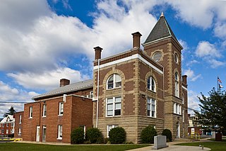
Mineral County is a county in the U.S. state of West Virginia. It is part of the Cumberland, MD-WV Metropolitan Statistical Area. As of the 2010 census, the population was 28,212. Its county seat is Keyser. The county was founded in 1866.

Highland County is a county located in the Commonwealth of Virginia. As of the 2010 census, the population was 2,321, in 2015, the population was estimated at 2,214. Its county seat is Monterey. Known as "Virginia's Switzerland" or "Virginia's Little Switzerland", Highland County is the least populous county in Virginia. Highland lays claim to being one of the least populous counties and one of the highest average elevations east of the Mississippi River.

Bristol is an independent city in the Commonwealth of Virginia. As of the 2010 census, the population was 17,835. It is the twin city of Bristol, Tennessee, just across the state line, which runs down the middle of its main street, State Street. The Bureau of Economic Analysis combines the city of Bristol, Virginia, with neighboring Washington County, Virginia, for statistical purposes. Bristol is a principal city of the Kingsport–Bristol–Bristol, TN-VA Metropolitan Statistical Area, which is a component of the Johnson City–Kingsport–Bristol, TN-VA Combined Statistical Area – commonly known as the "Tri-Cities" region.

Stromness is the second-most populous town in Orkney, Scotland. It is in the southwestern part of Mainland Orkney. It is also a parish, with the town of Stromness as its capital.

Mount Vernon is a census-designated place (CDP) and unincorporated community in Fairfax County, Virginia, United States. The population was 12,416 at the 2010 census. Primarily due to its historical significance and natural recreation and beauty, the Mount Vernon area receives over one million touring visitors each year.

Tysons, formerly known as Tysons Corner, is a census-designated place (CDP) and unincorporated community in Fairfax County, Virginia, United States. Located in Northern Virginia between the community of McLean and the town of Vienna along the Capital Beltway (I-495), it lies within the Washington Metropolitan Area. Tysons is home to two super-regional shopping malls—Tysons Corner Center and Tysons Galleria—and the corporate headquarters of numerous companies such as Intelsat, DXC Technology, Gannett, Hilton Worldwide, Cvent, Freddie Mac, Capital One, and Booz Allen Hamilton. Tysons is Fairfax County's central business district and a regional commercial center. It has been characterized as a quintessential example of an edge city. The population was 19,627 as of the 2010 census.

Ridgeway is a town in Henry County, Virginia, United States. The population was 742 at the 2010 census. It is part of the Martinsville Micropolitan Statistical Area. Martinsville Speedway, a NASCAR racetrack, is located between Ridgeway and the Martinsville city limits.

West Point is an incorporated town in King William County, Virginia, United States. The population was 3,306 at the 2010 census.

Christiansburg is a town in Montgomery County, Virginia, United States. The population was 21,041 at the 2010 census. It is the county seat of Montgomery County. Christiansburg, Blacksburg, and Radford are the three principal municipalities of the Blacksburg-Christiansburg-Radford Metropolitan Statistical Area which encompasses those municipalities and all of Montgomery County.

Cape Charles is a town / municipal corporation in Northampton County, Virginia, United States. The population was 1,009 as of the 2010 U.S.Decennial Census.

Duffield is a town in Scott County, Virginia, United States. The population was 91 at the 2010 census. It is part of the Kingsport–Bristol (TN)–Bristol (VA) Metropolitan Statistical Area, which is a component of the Johnson City–Kingsport–Bristol, TN-VA Combined Statistical Area – commonly known as the "Tri-Cities" region.

Marion is a town in and the county seat of Smyth County, Virginia, United States. The general Marion area is well known for its scenic beauty. The population is approximately *6,000 as of 2018. The town is named for American Revolutionary War officer Francis Marion. *6,000 is the approximate town limits population. The inclusion of suburban residents who possess a Marion address and zip code (24354) leaves Marion, Virginia with a total population of approximately 15,300, which is about half of the county's total population.
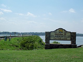
Clarksville is a town in Halifax and Mecklenburg counties in the U.S. state of Virginia, near the southern border of the commonwealth. The population was 1,139 at the 2010 census. Since the town has numerous buildings of the 18th-, 19th-, and early 20th-century architecture, the downtown area of Clarksville has been designated a Historic District on the National Register of Historic Places and Virginia's Historic Register. Clarksville claims the title of Virginia's only Lakeside town. Nearby the town of Clarksville is Occoneechee State Park.

Lake Strom Thurmond, officially designated J. Strom Thurmond Reservoir at the federal level, and Clarks Hill Lake by the state of Georgia, is a reservoir at the border between Georgia and South Carolina in the Savannah River Basin. It was created by the J. Strom Thurmond Dam during 1951 and 1952 by the U.S. Army Corps of Engineers near the confluence of the Little River and the Savannah River. At 71,000 acres (290 km2), it is the third-largest artificial lake east of the Mississippi River, behind the Kentucky Lake on the Tennessee River and Lake Marion on the Santee River. The J. Strom Thurmond Dam is located upstream from Augusta, Georgia.

The Greater Richmond Region, the Richmond metropolitan area or Central Virginia, is a region and metropolitan area in the U.S. state of Virginia, centered on Richmond. The U.S. Office of Management and Budget (OMB) defines the area as the Richmond, VA Metropolitan Statistical Area, a Metropolitan Statistical Area (MSA) used by the U.S. Census Bureau and other entities. The OMB defines the area as comprising thirteen counties, including the principal cities of Richmond, Petersburg, Hopewell, and Colonial Heights. As of 2016, it had a population of 1,263,617, making it the 45th largest MSA in the country.

Douthat State Park is a state park located in the Allegheny Mountains in Virginia. It is in Bath County and Alleghany County. The park is 4,545 acres (18 km2) total with a 50-acre (20 ha) lake.
False Cape Natural Area Preserve is a 3,573-acre (14.46 km2) Natural Area Preserve located in Virginia Beach, Virginia, just north of the state border with North Carolina. The preserve covers a one-by-six-mile strip of largely undeveloped land located on False Cape between the Atlantic Ocean and Back Bay, and is one of the most undisturbed areas of coastal habitat remaining in the Mid-Atlantic.

Virginia is a town on the rural outskirts of Adelaide, the capital city of South Australia. Port Wakefield Road, the main highway taking traffic to the north of Adelaide, passes through the area and used to pass straight through Virginia. Market gardening is the main activity there.

The Laurel Fork is a 15.7-mile-long (25.3 km) stream in Virginia and West Virginia, United States. The stream flows north from Highland County, Virginia, where its source and the majority of its length is located, to its mouth in Pendleton County, West Virginia. Laurel Fork is a tributary to the North Fork South Branch Potomac River, making it a part of the Potomac River watershed. The area surrounding Laurel Fork is home to several plant and animal species found nowhere else in Virginia, and is a prime example of a northern boreal forest in the state.

Short Hills Wildlife Management Area is a 4,232-acre (17.13 km2) Wildlife Management Area (WMA) in Rockbridge and Botetourt counties, Virginia. It covers approximately 10 miles (16 km) of ridgeline along the Short Hills range.


