Sumner Hill, California

Last updated

Sumner Hill
California Locator Map with US.PNG
Red pog.svg
Sumner Hill
Location in California
Usa edcp location map.svg
Red pog.svg
Sumner Hill
Sumner Hill (the United States)
Coordinates: 36°57′20″N119°45′01″W / 36.95556°N 119.75028°W / 36.95556; -119.75028
Country United States
State California
County Madera County
Elevation
[1]
535 ft (163 m)

Sumner Hill is an unincorporated community in Madera County, California. [1] Lying at an elevation of 535 feet (163 m), [1] it is 6+12 miles north of Woodland Park in Fresno. [2] It was created in 1985 as a 49-lot subdivision on a bluff on the eastern section of Peck Ranch, [3] [4] on the Madera County side of the San Joaquin River. [5] The gated community developed a reputation for its high-priced homes. [5] [6] In the 1990s, the entire 15,000-acre area south of Little Table Mountain and east of Highways 41 and 45, including Sumner Hill, started being called "Rio Mesa". [7] [3]

Contents

In a six-year legal battle, the Sumner Hill Homeowners' Association fought to protect the subdivision's exclusive access to the San Joaquin River via Killkelly Road, with a Fresno appellate court affirming in 2012 that the statute of limitations had expired for Rio Mesa developers to claim public access. [8] [9] As of 2012, Sumner Hill remained the only significant residential development in the Rio Mesa area. [7] In a subsequent lawsuit, the Rio Mesa developers won a $25 million judgment against a national title insurance company for failing to defend their access to the river through Sumner Hill. [10]

Background

In 1983, the County of Madera approved the creation of Sumner Hill as a residential subdivision, on the condition that a security gate and perimeter fence were installed. [9] This was to minimize the need for local law enforcement to travel to the community's remote location. [9]

The 670-acre development opened in 1985. [4] The 49 lots ranged in size from 1+12 to six acres. [2] Early Sumner Hill residents included members of the Peck family, who were fourth-generation farmers in San Joaquin Valley. [2] Street names within the subdivision were personally selected by Carolyn Peck, owner of Peck Ranch, and included names like Rose of Trailee Place, Killarney Drive, and Bonny-Kerry Lane. [2]

On one side, the bluff overlooks Friant Dam, Lost Lake, the San Joaquin River, and the Sierra foothills. [2] On another side, it offers a view of Madera and Fresno counties toward Clovis and the Fresno skyline. [2] The two-lane road leading to Sumner Hill passes vineyards and pastures, [5] and citrus orchards are also visible in the surrounding area. [2] Wildlife in the area included deer and geese, as well as skunks, raccoons, and coyotes. [6]

By 1992, Sumner Hill was referred to as "Pill Hill" because so many doctors had moved there from Fresno. [6] In 2007, The Fresno Bee described the community as having some of the most elegant homes in the Fresno area. [5] Sumner Hill relies on the San Joaquin River as its main water source. [11]

Access road to river

The final subdivision maps recorded in 1984 and 1985 showed Killkelly Road, a dirt road traversing the tract to provide homeowners with unrestricted access to the San Joaquin River. [9] In 1993, Madera County vacated its interest in Killkelly Road, deeming it unnecessary for public use, and vacated its interest in all other roads in the Sumner Hill subdivision in 1994. [9] The rights were conveyed to the Sumner Hill Homeowners Association. [9]

Lawsuits

In the mid-1990s, Madera County officials started planning a new city called Rio Mesa, including Sumner Hill, [3] as it sought to convince University of California officials to locate its new campus in the area – ultimately losing out to Merced. [7] Around 2004, the McCaffrey Group and two partners acquired 1,600 acres of the Peck Ranch for a proposed new development of 5,200 homes. [8] Sumner Hill residents filed a lawsuit in 2006, after the developers tried to prevent them from accessing the San Joaquin river bottom by installing gates and hiring security guards, and invited the general public to enter their subdivision. [8]

In 2008, the Madera County Superior Court ruled that Sumner Hill was a "private, gated subdivision" with exclusive access to the river and needed to be maintained as such, precluding new developers from running trails and other access routes through that tract. [3] [10] In 2009, a jury awarded the homeowners $3.2 million in punitive damages. [12] In 2012, the Fresno 5th District Court of Appeal upheld the jury's award for slander of title and other claims, and affirmed the 2008 decision on the basis that the Rio Mesa developers had filed their claim of public access under the Subdivision Map Act well after the statute of limitations had expired. [9] [8]

However, the court also noted that the Constitution of California had protected public access to navigable waters since 1879, [13] ruling in favor of the Rio Mesa developers on this point, but declined to decide what it deemed as "a basic uncertainty in the law of navigability." [9] The case Sumner Hill Homeowners' Association, Inc. v. Rio Mesa Holdings, LLC has also been cited for affirming that "an interest as small (or large) as a simple right-of-way easement can serve as a basis for a slander of title suit. [14]

In 2016, the Rio Mesa developers won a $25 million judgment against Fidelity National Title Insurance for its failure to defend the developers' access to the river through Sumner Hill. [10] Lawyers for the developers claimed that the verdict was a warning to title companies across the country to be more careful, particularly with regard to California insurance law. [10]

Related Research Articles

<span class="mw-page-title-main">Madera County, California</span> County in California, United States

Madera County, officially the County of Madera, is located at the geographic center of the U.S. state of California. It features a varied landscape, encompassing the eastern San Joaquin Valley and the central Sierra Nevada, with Madera serving as the county seat. Established in 1893 from part of Fresno County, Madera County reported a population of 156,255 in the 2020 census.

<span class="mw-page-title-main">Fresno, California</span> City in California, United States

Fresno is a major city in the San Joaquin Valley of California, United States. It is the county seat of Fresno County and the largest city in the greater Central Valley region. It covers about 115 square miles (300 km2) and had a population of 542,107 as of the 2020 Census, making it the fifth-most populous city, in California, the most populous inland city in California, and the 34th-most populous city in the nation.

<span class="mw-page-title-main">Madera, California</span> City in Madera County, California, United States

Madera is a city and county seat of Madera County, California. As of the 2020 United States census, the city's population was 66,224.

<i>San Joaquins</i> Amtrak service in San Joaquin Valley, California

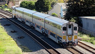
The San Joaquins is a passenger train service operated by Amtrak in California's San Joaquin Valley. Six daily round trips run between its southern terminus at Bakersfield and Stockton, with onward service to Sacramento and Oakland.

<span class="mw-page-title-main">California State Route 41</span> Highway in California

State Route 41 is a state highway in the U.S. State of California, connecting the Central Coast with the San Joaquin Valley and the Sierra Nevada. Its southern terminus is at the Cabrillo Highway in Morro Bay, and its northern terminus is at SR 140 in Yosemite National Park. It has been constructed as an expressway from near SR 198 in Lemoore north to the south part of Fresno, where the Yosemite Freeway begins, passing along the east side of downtown and extending north into Madera County.

<span class="mw-page-title-main">Central California</span> Region of California in the United States

Central California is generally thought of as the middle third of the U.S. state, of California, north of Southern California, which includes Los Angeles, and south of Northern California, which includes San Francisco. It includes the northern portion of the San Joaquin Valley, part of the Central Coast, the central hills of the California Coast Ranges and the foothills and mountain areas of the central Sierra Nevada.

<span class="mw-page-title-main">Fresno River</span> River in California, United States

The Fresno River is a river in Central California and a major tributary of the San Joaquin River. It runs approximately 83 miles (134 km) from the Sierra Nevada Range to the San Joaquin River if measured from the source of Rainier Creek, near Raymond Mountain in Yosemite National Park. Although called the 'Fresno' River, it is one of the largest and longest river systems in Madera County.

The Chowchilla River is a river in central California, United States and a minor tributary of the San Joaquin River. It flows for 54.2 miles (87.2 km) from the western side of the Sierra Nevada Range to the San Joaquin River system in the San Joaquin Valley.

California's 13th congressional district is a congressional district in the U.S. state of California. John Duarte, a Republican, has represented this district since January 2023.

<span class="mw-page-title-main">Woodward Park (Fresno)</span> Public park located in Fresno, California, US

Woodward Park is a public park located in Fresno, California, abutting the San Joaquin River, opened in 1968. It is named after the late Ralph Woodward who bequeathed a portion of his estate to provide a regional park and bird sanctuary in Fresno. The park has a multi-use amphitheatre, an authentic Japanese Garden, disc golf course, BMX course, three children's playgrounds, a lake and trails that connect to the Lewis S. Eaton Trail.

<span class="mw-page-title-main">Millerton, Madera County, California</span> Former settlement in California, United States

Millerton was a settlement located on the San Joaquin River and was the original county seat of Fresno County. Millerton was populated from about 1853 to the 1880s and is now inundated by the waters of Millerton Lake.

Berenda was an unincorporated community in Madera County, California. It is located on the north bank of Berenda Creek 3.3 miles (5.3 km) southeast of Fairmead, and 7 miles (11 km) northwest of Madera, at an elevation of 253 feet (77 m). Berenda is located on the Southern Pacific Railroad.

<span class="mw-page-title-main">Fort Miller, California</span> Former settlement in California, United States

Fort Miller is a former fort on the south bank of the San Joaquin River in what is now Fresno County, California, United States. It lay at an elevation of 561 feet. The site is now under Millerton Lake, formed by the Friant Dam in 1944. It is registered as California Historical Landmark #584.

Indian Lakes Estates is an unincorporated community in Madera County, California. It borders the Chukchansi Gold Resort and Casino to the east, and is south of Coarsegold. As of 2000, it was a wooded enclave of 485 homes to working families and retirees, using the two-lane Road 417 as their main residential road. It lies at an elevation of 2247 feet.

<span class="mw-page-title-main">Yosemite Area Regional Transportation System</span> Public transit bus service in California, US

The Yosemite Area Regional Transportation System (YARTS) is a public transit bus line based in Merced, California. YARTS provides scheduled fixed route service between Yosemite National Park and gateway communities. Service operates year-round on Highway 140, providing access to Merced and Mariposa counties. During the peak summer months, additional service is added along Highway 120 providing access to Tuolumne County, Highway 41 providing access to Fresno and Madera counties, and eastern Highway 120/US 395 providing access to Mono County.

George Washington Mordecai served in the California State Assembly for the 70th district from 1891 to 1893 and the 62nd district from 1893 to 1895 and during the American Civil War he served in the Army of the Confederate States of America.

Temple's Ranch, was the ranch and a home of F. P. F. Temple, a wealthy land owner in Los Angeles County, with large business and land holdings of thousands of acres in Madera County and Fresno County including this ranch in Fresno County near the Merced County border.

<span class="mw-page-title-main">San Joaquin River Viaduct</span> Viaduct in Fresno County, California and Madera County, California

The San Joaquin River Viaduct is a bridge built to carry California High-Speed Rail over the San Joaquin River.

<span class="mw-page-title-main">Empire Tract</span> Island in California

The Empire Tract is an island in the Sacramento–San Joaquin River Delta in San Joaquin County, California, United States. It has been used for agriculture since the 1800s; in the early 20th century it was used to plant potatoes, and United States president Herbert Hoover operated a beet farm there. In the 1960s, natural gas deposits were discovered beneath the island. In 1936, it was connected to the mainland by the Eight Mile Road Bridge, across King Island. As with many islands in the Delta, the Empire Tract has experienced considerable subsidence, and is well below sea level.

<span class="mw-page-title-main">Thomas Edwin Hughes</span> California pioneer and businessman (1830 – 1919)

Thomas Edwin Hughes (1830-1919) was a nineteenth century real estate developer and investor who, through business ventures and civic involvement, contributed to the initial development of Fresno, California.

References

  1. 1 2 3 U.S. Geological Survey Geographic Names Information System: Sumner Hill, California
  2. 1 2 3 4 5 6 7 "A chunk of Peck Ranch will become homesites". The Fresno Bee . April 28, 1985. Retrieved November 30, 2023 via Newspapers.com.
  3. 1 2 3 4 Clemings, Russell (April 16, 2008). "River subdivision residents keep trails out – Sumner Hill fought new developers' plan for access routes". The Fresno Bee. pp. B5. Retrieved November 30, 2023 via Newspapers.com.
  4. 1 2 "Sumner Hill preview scheduled today". The Fresno Bee . October 6, 1985. Retrieved November 30, 2023 via Newspapers.com.
  5. 1 2 3 4 Clemings, Russell (June 12, 2007). "Tempers roiling on the river: Rio Mesa developer wants access through Sumner Hill community – which has other ideas". The Fresno Bee . Retrieved December 2, 2023 via Newspapers.com.
  6. 1 2 3 Steinberg, Jim (April 19, 1992). "New homes in Fresno expand higher-priced end of market". Press Democrat . Santa Rosa, California. Retrieved December 2, 2023 via California Digital Newspaper Collection.
  7. 1 2 3 McCarthy, Charles (April 20, 2012). "Madera's Rio Mesa residential, retail projects still on table". Business Journal Serving Fresno & the Central San Joaquin Valley. Retrieved December 1, 2023 via EBSCOHost.
  8. 1 2 3 4 Lopez, Pablo (May 8, 2012). "Homeowners win case on river access". Fresno Bee . Retrieved November 30, 2023 via Newspapers.com.
  9. 1 2 3 4 5 6 7 8 "Sumner Hill Homeowners Association, Inc. v. Rio Mesa Holdings, LLC". The Recorder. American Lawyer Media. May 3, 2012. Retrieved November 30, 2023.
  10. 1 2 3 4 Lopez, Pablo (March 22, 2016). "Rio Mesa developer wins $25 million judgment in San Joaquin River case". The Fresno Bee . Retrieved November 30, 2023 via Newspapers.com.
  11. Bergstrom, Danielle (June 18, 2021). "Wells are failing in southeastern Madera County. What to know about the water situation". Fresno Bee . Retrieved November 30, 2023.
  12. Ellis, John (June 20, 2009). "Rio Mesa homeowners win lawsuit". The Fresno Bee . Retrieved November 30, 2023 via Newspapers.com.
  13. Sivas, Deborah A. (2016). "California Coastal Democracy at Forty: Time for a Tune-up" (PDF). Stanford Environmental Law Journal. 36 (109): 109–144.
  14. Ritchie, J. Zak (2013). "A Fresh Look at an Old Tort: Litigating Slander of Title in Mineral Disputes". West Virginia Law Review. 115 (3): 1097–1126 via HeinOnline.