Suttons Bay, Michigan

Last updated

Suttons Bay, Michigan
Village of Suttons Bay
Sutton Park.jpg
Sutton Park, on the shores of the eponymous Suttons Bay, an inlet of Grand Traverse Bay
Suttons Bay (village), MI location.png
Location within Leelanau County
USA Michigan location map.svg
Red pog.svg
Suttons Bay
Location within the state of Michigan
Usa edcp location map.svg
Red pog.svg
Suttons Bay
Location within the United States
Coordinates: 44°58′30″N85°39′04″W / 44.97500°N 85.65111°W / 44.97500; -85.65111 Coordinates: 44°58′30″N85°39′04″W / 44.97500°N 85.65111°W / 44.97500; -85.65111
Country Flag of the United States.svg United States
State Flag of Michigan.svg  Michigan
County Flag of Leelanau County, Michigan.svg Leelanau
Township Suttons Bay
Founded1854
Incorporated1898
Government
[1]
  Type Village council
  PresidentSteve Lutke
   Clerk Shar Fay
Area
[2]
  Total1.28 sq mi (3.33 km2)
  Land1.28 sq mi (3.33 km2)
  Water0.00 sq mi (0.00 km2)
Elevation
597 ft (182 m)
Population
 (2020)
  Total613
  Density477.41/sq mi (184.26/km2)
Time zone UTC-5 (EST)
  Summer (DST) UTC-4 (EDT)
ZIP code(s)
49682
Area code 231
FIPS code 26-77600 [3]
GNIS feature ID0639135 [4]
Website Official website
Suttons Bay Village Hall Suttons Bay village hall (Michigan).jpg
Suttons Bay Village Hall

Suttons Bay is a village in Leelanau County in the U.S. state of Michigan. The population was 613 at the 2020 census. Located within Suttons Bay Township, the community lies upon the shore of the eponymous Suttons Bay, a smaller inlet of Grand Traverse Bay, a bay of Lake Michigan.

Contents

History

The community is named for one of the first settlers of European descent, Harry C. Sutton, who arrived in 1854. He arrived with a crew of woodsmen to supply fuel for passing wood steamboats.[ citation needed ]

In 1903 the Traverse City, Leelanau, and Manistique Railroad began a route between Traverse City to the South and Northport to the North, stopping at Suttons Bay, as well as Hatch's Crossing, Fountain Point, Bingham, Keswick, and Omena. [5]

Before the turn of the 20th century, four churches had been established—two Lutheran, one Roman Catholic, and one Congregational.[ citation needed ]

In 1920, Leelanau County voters approved moving the county seat to Suttons Bay, but the move never took place.[ citation needed ]

Suttons Bay has a school; the sports mascot is a Viking, hence the nickname "Suttons Bay Norsemen."[ citation needed ]

The town is home to the county's only movie theater, opened in 1946. It is now owned by Bob Bahle, and was renovated in 1977. Its fare consists of unique art house films, and occasionally the theater hosts plays and concerts.[ citation needed ]

The town has a clothing store that has been owned by one family over four generations called "Bahles." The original store started as a "dry-goods" business in 1876 by Lars Bahle, an immigrant from Norway.[ citation needed ]

Suttons Bay is also home to one of the oldest continuously operated food establishments in the entire region. Since 1871, the restaurant has gone through several owners and is currently known as The V I Grill.[ citation needed ]

Culture

Like many other communities in northern Michigan, Suttons Bay relies heavily on tourism to generate revenues for its economy.[ citation needed ]

Activities include the Suttons Bay Jazzfest and the Suttons Bay Art Festival.[ citation needed ]

Suttons Bay also is highly embedded in the cherry industry, producing sweet and tart cherries of many varieties. Harvest operations usually take place in mid-July and run into August.[ citation needed ]

In August 2013, the community held an event to attempt to break the Guinness Book of World Records for most kayaks and canoes rafted together. The effort followed an attempt a year earlier, which missed the record of 1902 boats set by a group near Inlet, New York in 2011. [6] [7]

Geography

According to the United States Census Bureau, the village has a total area of 1.25 square miles (3.24 km2), all land. [8] The town is located on the shore of Suttons Bay, an inlet Grand Traverse Bay, itself an inlet of Lake Michigan. The town is fifteen miles north of Traverse City.

Just north of the village is a sign marking the 45th parallel north, halfway between the North Pole and the Equator. This is one of six Michigan sites, and 29 in the U.S., where such signs are known to exist. [9] [10]

Major highways

Demographics

Historical population
CensusPop.
1900 398
1910 4021.0%
1920 392−2.5%
1930 43912.0%
1940 4707.1%
1950 4853.2%
1960 421−13.2%
1970 52224.0%
1980 504−3.4%
1990 56111.3%
2000 5895.0%
2010 6184.9%
2020 613−0.8%
U.S. Decennial Census [11]

2010 census

As of the census [12] of 2010, there were 618 people, 273 households, and 175 families residing in the village. The population density was 494.4 inhabitants per square mile (190.9/km2). There were 453 housing units at an average density of 362.4 per square mile (139.9/km2). The racial makeup of the village was 93.7% White, 0.2% African American, 2.8% Native American, 1.1% Asian, and 2.3% from two or more races. Hispanic or Latino of any race were 0.3% of the population.[ citation needed ]

There were 273 households, of which 16.1% had children under the age of 18 living with them, 54.6% were married couples living together, 6.2% had a female householder with no husband present, 3.3% had a male householder with no wife present, and 35.9% were non-families. 32.2% of all households were made up of individuals, and 15.1% had someone living alone who was 65 years of age or older. The average household size was 2.02 and the average family size was 2.48.[ citation needed ]

The median age in the village was 58.8 years. 12.8% of residents were under the age of 18; 3.5% were between the ages of 18 and 24; 14.5% were from 25 to 44; 29.8% were from 45 to 64; and 39.3% were 65 years of age or older. The gender makeup of the village was 44.7% male and 55.3% female.[ citation needed ]

2000 census

As of the census [3] of 2000, there were 589 people, 271 households, and 179 families residing in the village. The population density was 538.7 inhabitants per square mile (208.0/km2). There were 374 housing units at an average density of 342.0 per square mile (132.0/km2). The racial makeup of the village was 96.94% White, 0.34% African American, 1.19% Native American, 0.34% Asian, 1.02% from other races, and 0.17% from two or more races. Hispanic or Latino of any race were 2.72% of the population.[ citation needed ]

There were 271 households, out of which 21.8% had children under the age of 18 living with them, 56.1% were married couples living together, 7.4% had a female householder with no husband present, and 33.6% were non-families. 28.8% of all households were made up of individuals, and 12.5% had someone living alone who was 65 years of age or older. The average household size was 2.17 and the average family size was 2.62.[ citation needed ]

In the village, the population was spread out, with 19.5% under the age of 18, 4.6% from 18 to 24, 20.7% from 25 to 44, 32.6% from 45 to 64, and 22.6% who were 65 years of age or older. The median age was 47 years. For every 100 females, there were 92.5 males. For every 100 females age 18 and over, there were 90.4 males.[ citation needed ]

The median income for a household in the village was $44,063, and the median income for a family was $52,321. Males had a median income of $38,173 versus $22,045 for females. The per capita income for the village was $24,097. About 3.6% of families and 6.0% of the population were below the poverty line, including 8.4% of those under age 18 and 3.8% of those age 65 or over.[ citation needed ]

Related Research Articles

<span class="mw-page-title-main">Leelanau County, Michigan</span> County in Michigan, United States

Leelanau County is a county located in the U.S. state of Michigan. As of the 2020 Census, the population was 22,301. Since 2008, the county seat has been located within Suttons Bay Township, one mile east of the unincorporated village of Lake Leelanau. Before 2008, Leelanau County's seat was Leland. Leelanau County is included in the Traverse City Micropolitan Statistical Area of Northern Michigan. The largest settlement in Leelanau County by population is Greilickville, itself a suburb of Traverse City.

<span class="mw-page-title-main">Torch Lake Township, Antrim County, Michigan</span> Civil township in Michigan, United States

Torch Lake Township is a civil township of Antrim County in the U.S. state of Michigan. Located in the Northern Lower Peninsula, the township comprises an isthmus between the eponymous Torch Lake and Grand Traverse Bay, a bay of Lake Michigan. As of the 2020 census, the township population was 1,212, a slight increase from 1,194 at the 2010 census.

<span class="mw-page-title-main">Blaine Township, Michigan</span> Civil township in Michigan, United States

Blaine Township is a civil township of Benzie County in the U.S. state of Michigan. As of the 2010 census, the township population was 551. It is located in the southwest portion of the county. There are no significant population centers in the township; the nearest towns are Arcadia to the south, Benzonia to the northeast, and Elberta to the northwest. M-22 is the township's main thoroughfare.

<span class="mw-page-title-main">Thompsonville, Michigan</span> Village in Michigan, United States

Thompsonville is a village in Benzie County in the U.S. state of Michigan. The population was 441 at the 2010 census. The village is located in the south of the county on the boundary between Weldon Township and Colfax Township.

<span class="mw-page-title-main">Garden, Michigan</span> Village in Michigan, United States

Garden is a village in Delta County of the U.S. state of Michigan. The population was 221 at the 2010 census. The village is located within Garden Township.

<span class="mw-page-title-main">Resort Township, Michigan</span> Civil township in Michigan, United States

Resort Township is a civil township of Emmet County in the U.S. state of Michigan. The southwesternmost township of Emmet County, Resort Township is immedately adjacent Petoskey, the county seat and largest city in Emmet County. Resort Township also has a shoreline on Little Traverse Bay, a bay of Lake Michigan. At the 2020 census, the population was 2,835, an increase from 2,697 at the 2010 census.

<span class="mw-page-title-main">Garfield Township, Grand Traverse County, Michigan</span> Charter township in Michigan, United States

Garfield Township, officially the Charter Township of Garfield, is a charter township of Grand Traverse County in the U.S. state of Michigan. As of the 2020 census, the township had a total population of 19,499. This makes it the most populous municipality in Northern Lower Michigan.

<span class="mw-page-title-main">Long Lake Township, Michigan</span> Charter township in Michigan, United States

Long Lake Township, officially the Charter Township of Long Lake, is a charter township of Grand Traverse County in the U.S. state of Michigan. The population was 9,956 at the 2020 census, and increase from 8,662 at the 2010 census. Long Lake Township is very suburbanized due to its location near Traverse City. It is one of three charter townships in Grand Traverse County, the others being East Bay Township and neighboring Garfield Township.

<span class="mw-page-title-main">Centerville Township, Michigan</span> Civil township in Michigan, United States

Centerville Township is a civil township of Leelanau County in the U.S. state of Michigan. The population was 1,243 at the 2020 census. The township is bounded to the east by Lake Leelanau.

<span class="mw-page-title-main">Cleveland Township, Michigan</span> Civil township in Michigan, United States

Cleveland Township is a civil township of Leelanau County in the U.S. state of Michigan. The population of Cleveland Township was 1,103 at the 2020 census. Part of the township is located within Sleeping Bear Dunes National Lakeshore.

<span class="mw-page-title-main">Elmwood Charter Township, Michigan</span> Charter township in Michigan, United States

Elmwood Township is a charter township of Leelanau County in the U.S. state of Michigan. The population was 4,892 at the 2020 census, making it the largest township in Leelanau County by population. The southeasternmost township of Leelanau County, Elmwood Township is suburbanized, as it is immediately adjacent Traverse City, the largest city in Northern Michigan.

<span class="mw-page-title-main">Empire, Michigan</span> Village in Michigan, United States

Empire is a village on Lake Michigan in the northwestern Lower Peninsula of Michigan. Located in southwestern Leelanau County, its population was 362 at the 2020 census. The village is located within Empire Township, and is famous for its proximity to the Sleeping Bear Dunes National Lakeshore. Empire is home to the lakeshore's headquarters, the Philip A. Hart Visitor Center.

<span class="mw-page-title-main">Empire Township, Michigan</span> Civil township in Michigan, United States

Empire Township is a civil township of Leelanau County in the U.S. state of Michigan. The population was 764 at the 2020 census. On the shores of Lake Michigan, Empire Township contains a substantial amount of land within the Sleeping Bear Dunes National Lakeshore.

<span class="mw-page-title-main">Greilickville, Michigan</span> Census-designated place & unincorporated community in Michigan, United States

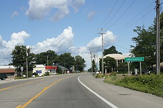
Greilickville is an unincorporated community in Leelanau County in the U.S. state of Michigan. It is a census-designated place (CDP) used for statistical purposes and has no legal standing as a municipality. The population was 1,530 at the 2010 census, up from 1,415 at the 2000 census.

<span class="mw-page-title-main">Kasson Township, Michigan</span> Civil township in Michigan, United States

Kasson Township is a civil township of Leelanau County in the U.S. state of Michigan. The population was 1,647 as of the 2020 census. A small portion of the township is included in the Sleeping Bear Dunes National Lakeshore.

<span class="mw-page-title-main">Leelanau Township, Michigan</span> Civil township in Michigan, United States

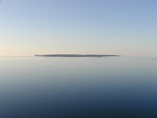
Leelanau Township is a civil township of Leelanau County in the U.S. state of Michigan. At the northern tip of the Leelanau Peninsula, Leelanau Township is part of Northern Michigan, and is home to the village of Northport. Leelanau Township also includes the Fox Islands, as well as mainland shorelines on both Lake Michigan and Grand Traverse Bay. The township population was 1,552 at the 2020 census.

<span class="mw-page-title-main">Leland Township, Michigan</span> Civil township in Michigan, United States

Leland Township is a civil township of Leelanau County in the U.S. state of Michigan. As of the early 2000s, the unincorporated community of Leland, which lies totally within the township, was the county seat of Leelanau County. However, county voters on August 3, 2004, approved a proposal to build a new governmental center in adjacent Suttons Bay Township; the move to the new facility was completed in 2008. As of the 2020 census, Leland Township population was 2,126.

<span class="mw-page-title-main">Northport, Michigan</span> Village in Michigan, United States

Northport is a village in Leelanau Township within Leelanau County in the U.S. state of Michigan. The population was 526 according to the 2010 U.S. census. When Leelanau County was formed in 1863, Northport served as the first county seat from 1863 to 1883.

<span class="mw-page-title-main">Suttons Bay Township, Michigan</span> Civil township in Michigan, United States

Suttons Bay Township is a civil township and county seat of Leelanau County in the U.S. state of Michigan. The population was 2,270 at the 2020 census. The village of Suttons Bay is located within the township along Grand Traverse Bay.

<span class="mw-page-title-main">Bingham Township, Leelanau County, Michigan</span> Civil township in Michigan, United States

Bingham Township is a civil township of Leelanau County in the U.S. state of Michigan. As of the 2020 census, the township population was 2,577. The township is named for Kinsley S. Bingham, a U.S. Representative, U.S. Senator, and Governor of Michigan.

References

  1. Village of Suttons Bay (2020). "Village Council" . Retrieved October 23, 2020.
  2. "2020 U.S. Gazetteer Files". United States Census Bureau. Retrieved May 21, 2022.
  3. 1 2 "U.S. Census website". United States Census Bureau . Retrieved January 31, 2008.
  4. "US Board on Geographic Names". United States Geological Survey. October 25, 2007. Retrieved January 31, 2008.
  5. Suttons Bay Chamber of Commerce Archived August 14, 2007, at the Wayback Machine . Retrieved September 15, 2008.
  6. Detroit News, September 1, 2013
  7. MLive Media Group, September 1, 2013
  8. "US Gazetteer files 2010". United States Census Bureau. Archived from the original on January 12, 2012. Retrieved November 25, 2012.
  9. Photographs, Suttons Bay 45th Parallel signs.
  10. List and map of 45th Parallel markers, with links to pictures (accessed 17 December 2007).
  11. "Census of Population and Housing". Census.gov. Retrieved June 4, 2015.
  12. "U.S. Census website". United States Census Bureau . Retrieved November 25, 2012.

Further reading