
Interstate 44 (I-44) is an Interstate Highway in the central United States. Although it is nominally an east–west road as it is even-numbered, it follows a more southwest–northeast alignment. Its western terminus is in Wichita Falls, Texas, at a concurrency with U.S. Route 277 (US 277), US 281, and US 287; its eastern terminus is at I-70 in St. Louis, Missouri. I-44 is one of five Interstates built to bypass US 66; this highway covers the section between Oklahoma City and St. Louis. Virtually the entire length of I-44 east of Springfield, Missouri, was once US 66, which was upgraded from two to four lanes from 1949 to 1955. The section of I-44 west of Springfield was built farther south than US 66 in order to connect Missouri's section with the already completed Will Rogers Turnpike, which Oklahoma wished to carry their part of I-44.
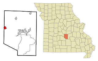
Pulaski County is a county located in the U.S. state of Missouri. As of the 2020 census, the population was 53,955. Its county seat is Waynesville. The county was organized in 1833 and named for Kazimierz Pułaski, a Polish patriot who died fighting in the American Revolution.

Crocker is a city in Pulaski County, Missouri, United States. The population was 1,110 at the 2010 census.

Dixon is a city in northern Pulaski County, Missouri, United States, with a population of 1,549 at the time of the 2010 census.

St. Robert or Saint Robert is a city in Pulaski County, Missouri, United States. The population was 5,192 at the 2020 census. It is a gateway community to the United States Army installation at Fort Leonard Wood.

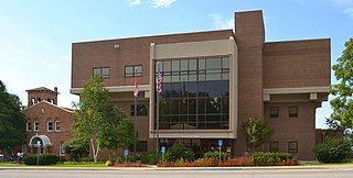
Waynesville is a city in and the county seat of Pulaski County, Missouri, United States. Its population was 5,406 at the 2020 census. Located in the Missouri Ozarks, it was once served by Route 66.

Waynesville is the county seat of Haywood County, North Carolina. It is the largest town in North Carolina west of Asheville. Waynesville is located about 30 miles (50 km) southwest of Asheville between the Great Smoky and Blue Ridge Mountains.
Richland is a city in Camden, Laclede, and Pulaski counties in the U.S. state of Missouri. The population was 1,863 at the 2010 census.

Devils Elbow is an unincorporated community in Pulaski County, Missouri, United States on historic U.S. Highway 66. It is situated on the Big Piney River and is named for a tight incised meander in the river known as a "devil of an elbow". The community is approximately five miles (8 km) east of St. Robert.

Route 7 is a state highway with its northern terminus at U.S. Route 24 in northeast Independence and its southern terminus at Interstate 44 southeast of Richland. The section between Harrisonville and Clinton provides an important link for traffic between Springfield and Kansas City.

Hazelgreen is an unincorporated community in eastern Laclede County, Missouri, United States. It lies along historic U.S. Route 66, now an outer road of Interstate 44. The town is split by I-44, one mile west of the I-44 - Missouri Route 133 junction in adjacent Pulaski County. The Gasconade River is just north and west of the site.

Buckhorn is a community in Pulaski County, Missouri, United States. It is on Route 17 just south of its junction with Interstate 44 It is also on historic U.S. Route 66. The community is within the Mark Twain National Forest and the northwest corner of Fort Leonard Wood is three miles to the east. Waynesville is six miles to the northeast along Route 44 and Laquey is two miles to the southwest off of Route 17.
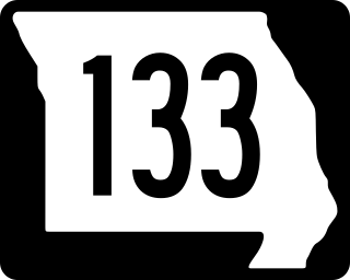
Route 133 is a highway in central Missouri. Its northern terminus is at U.S. Route 63 near Westphalia; its southern terminus is at Interstate 44 about fourteen miles (21 km) west of Waynesville.
Plato is an incorporated village in northwestern Texas County, Missouri, United States. It is located approximately 20 miles northwest of Houston and 10 miles south of Fort Leonard Wood on Route 32. The population was 82 at the 2020 census.

Laquey is an unincorporated community in Pulaski County, Missouri, United States. It has Zip Code: 65534 and Area Code: 573.

Nine business routes of Interstate 44 (I-44) exist, all of them within the state of Missouri.
Interstate 44 (I-44) in the US state of Missouri runs northeast from the Oklahoma state line near Joplin to I-70 in Downtown St. Louis. It runs for about 293 miles (472 km) in the state, and is the longest Interstate Highway in the state.
Fort Leonard Wood is a U.S. Army training installation located in the Missouri Ozarks. The main gate is located on the southern boundary of The City of St. Robert. The post was created in December 1940 and named in honor of General Leonard Wood in January 1941. Originally intended to train infantry troops, in 1941 it became an engineer training post with the creation of the Engineer Replacement Training Center. During World War II Italian and German POWs were interned at the fort. In 1984, as part of the Base Realignment and Closure process, most of the U.S. Army Engineer School's operations were consolidated at Fort Leonard Wood. Before that, officer training was conducted at Fort Belvoir, Virginia.
Saint Annie was an unincorporated community in northeast Laclede County, Missouri, United States. The community was on Missouri Route U about one mile west of the Laclede-Texas county line approximately five miles north of Lynchburg. The community of Winnipeg is about two miles to the northwest.
Bear Creek is a stream in Laclede and Pulaski counties the U.S. state of Missouri. It is a tributary of the Gasconade River.

