Taki, India

Last updated

Taki
City
Taki Road rail station 02.jpg
West Bengal location map.svg
Red pog.svg
Taki
Location in West Bengal, India
India location map 3.png
Red pog.svg
Taki
Taki (India)
Coordinates: 22°35′N88°55′E / 22.59°N 88.92°E / 22.59; 88.92
CountryFlag of India.svg  India
State West Bengal
District North 24 Parganas
Government
  Type Municipality
  BodyTaki Municipality
  Municipality ChairmanSomnath Mukhopadhaya [1]
Elevation
5 m (16 ft)
Population
 (2001) [2]
  Total38,263
Languages
  Official Bengali, English
Time zone UTC+5:30 (IST)
STD Code - 03217Pin Code- 743429
Vidhan Sabha constituency Basirhat Dakshin
Website https://takimunicipality.in

Taki is a city and a municipality under the Hasnabad police station of the Basirhat subdivision [3] in North 24 Parganas district in the Indian state of West Bengal.

Contents

Geography

Taki, India
Invisible Square.svg
Mapscaleline.svg
8km
5miles
Red pog.svg
B
A
N
G
L
A
D
E
S
H
Bidyadhari
River
Burokalabati
River
Raimangal River
Ichhamati
River
Sarapul
R
Invisible Square.svg
Sandeshkhali
R
Invisible Square.svg
Sandelerbil
R
Invisible Square.svg
Nazat
R
Invisible Square.svg
Murarisha
R
Invisible Square.svg
Matia
R
Invisible Square.svg
Malancha
R
Invisible Square.svg
Kalinagar
R
Invisible Square.svg
Iswarigachha
R
Invisible Square.svg
Hemnagar
RV
Invisible Square.svg
Hasnabad
R
Invisible Square.svg
Haroa
R
Invisible Square.svg
Ghojadanga
check post
R
Invisible Square.svg
Bamanpukuria
R
Invisible Square.svg
Swarupnagar
R
Invisible Square.svg
Taki
M
Basirhat
M
Invisible Square.svg
Baduria
M
Invisible Square.svg
Uttar Bagundi
CT
Invisible Square.svg
Sadigachhi
CT
Invisible Square.svg
Raghunathpur
CT
Invisible Square.svg
Mathurapur
CT
Invisible Square.svg
Minakhan
CT
Invisible Square.svg
Itinda
CT
Invisible Square.svg
Hingalganj
CT
Invisible Square.svg
Dhanyakuria
CT
Invisible Square.svg
Deora
CT
Invisible Square.svg
Dakshin Chatra
CT
Invisible Square.svg
Dandirhat
CT
Invisible Square.svg
Balihati
CT
Invisible Square.svg
Cities, towns and locations in Basirhat subdivision, North 24 Parganas district
M: municipal town, CT: census town, R: rural/ urban centre
Owing to space constraints in the small map, the actual locations in a larger map may vary slightly

Location

Taki is located at 22°35′N88°55′E / 22.59°N 88.92°E / 22.59; 88.92 . [4] It has an average elevation of 5  metres (16  feet) at the bank of Ichamati River.

Area overview

The area shown in the map is a part of the Ichhamati-Raimangal Plain, located in the lower Ganges Delta. It contains soil of mature black or brownish loam to recent alluvium. Numerous rivers, creeks and khals criss-cross the area. The tip of the Sundarbans National Park is visible in the lower part of the map (shown in green but not marked). The larger full screen map shows the full forest area. [5] A large section of the area is a part of the Sundarbans settlements. [6] The densely populated area is an overwhelmingly rural area. Only 12.96% of the population lives in the urban areas and 87.04% of the population lives in the rural areas. [7] [8]

Note: The map alongside presents some of the notable locations in the subdivision. All places marked in the map are linked in the larger full screen map.

Demographics

According to the 2011 Census of India, Taki had a total population of 38,263, of which 19,562 (51%) were males and 18,701 (49%) were females. Population in the age range 0–6 years was 3,419. The total number of literate persons in Taki was 28,939 (83.05% of the population over 6 years). [9]

As of 2001 India census, [10] Taki had a population of 37,302. Males constitute 53% of the population and females 47%. Taki has an average literacy rate of 68%, higher than the national average of 59.5%: male literacy is 73%, and female literacy is 61%. In Taki, 10% of the population is under 6 years of age.

Culture and education

Sonar Bangla Hotel, Taki Sonar Bangla Hotel, Taki.jpg
Sonar Bangla Hotel, Taki
Canopy walk at Golpata Forest Golpata Forest, Taki 2.jpg
Canopy walk at Golpata Forest

There are a Library (Taki District Library) and a college named Taki Government College situated in Taki town. Taki Government High School, is the oldest school of this area. Other renowned schools like Taki S. L. Girls High School and Taki Bhabanath High School are there. Ramakrishna Mission also established a branch with Taki Ramakrishna Mission High School and hostel facilities in Taki.

Taki is known for its sweets called "Chhanar Malpoa". Other than local Kali Puja, Durga Puja, etc. this place became a tourist picnic spot beside the Ichamati river due to the international border between India and Bangladesh.

Taki Government College was established in 1950. Affiliated to the West Bengal State University, it offers honours courses in Bengali, English, Sanskrit, history, philosophy, political science, economics, geography, mathematics, chemistry, physics, botany and zoology, and a post-graduate course in Bengali. [11]

Transport

Taki Road railway station is on the Barasat-Hasnabad line, which is part of the Kolkata Suburban Railway system. [12]

State Highway 2 passes through Taki. [13] [14]

Healthcare

Taki Rural Hospital at Taki with 50 beds functions as the main medical facility in Hasnabad CD Block. There are primary health centres at Bhurkundu (Bhawanipur PHC with 10 beds), Bhebia (Ghola PHC with 6 beds) and Bara Bankra (Barunhat PHC with 10). [15]

Notable people

Related Research Articles

<span class="mw-page-title-main">Basirhat</span> City in West Bengal, India

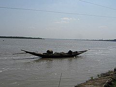
Basirhat is a city of West Bengal, India. It is located on the banks of the Ichamati (Ichhamati) River.

<span class="mw-page-title-main">Baduria</span> City in West Bengal, India

Baduria is a city and a municipality in Basirhat subdivision of North 24 Parganas district in the Indian state of West Bengal.

<span class="mw-page-title-main">Dhanyakuria</span> Census Town in West Bengal, India

Dhanyakuria is a census town in the Basirhat II CD block in the Basirhat subdivision in the North 24 Parganas district in the state of West Bengal, India.

<span class="mw-page-title-main">Basirhat subdivision</span> Subdivision in West Bengal, India

Basirhat subdivision is an administrative subdivision of the North 24 Parganas district in the Indian state of West Bengal.

Dandirhat is a census town in the Basirhat I CD block in the Basirhat subdivision of the North 24 Parganas district in the state of West Bengal, India.

Haroa is a village in the Haroa CD block in the Basirhat subdivision of the North 24 Parganas district in the state of West Bengal, India.

Hasnabad is a village and a gram panchayat in the Hasnabad CD block in the Hasnabad subdivision of the North 24 Parganas district in the state of West Bengal, India. Hasnabad is called the' Second Gateway of Sunderban'.

<span class="mw-page-title-main">Murarisha</span> Village in West Bengal, India

Murarisaha or Murarisha Chowmatha is a village and a gram panchayat in the Hasnabad CD block in the Basirhat subdivision of the district of North 24 Parganas in the state of West Bengal in India.

Hingalganj is a census town in the Hingalganj CD block in the Basirhat subdivision of the North 24 Parganas district in the state of West Bengal, India.

Hemnagar is a village in the Hingalganj CD block in the Basirhat subdivision of the North 24 Parganas district in the state of West Bengal, India. It is the southernmost habitation in North 24 Parganas district, beyond which the Sunderbans are spread.

Matia is a village in the Basirhat II CD block in the Basirhat subdivision of the North 24 Parganas district in the state of West Bengal, India.

Iswarigachha is a village in the Baduria CD block in the Basirhat subdivision of the North 24 Parganas district in the state of West Bengal, India.

Mathurapur is a census town in the Basirhat II CD block in the Basirhat subdivision of the North 24 Parganas district in the state of West Bengal, India.

Sarapul is a village in the Swarupnagar CD block in the Basirhat subdivision of the North 24 Parganas district in the state of West Bengal, India.

Sandelerbil is a village and a gram panchayat in the Hingalganj CD block in the Basirhat subdivision of the North 24 Parganas district in the state of West Bengal, India. Sandelerbil is about 6 km from Hingalganj.

Uttar Bagundi is a census town in the Basirhat I CD block in the Basirhat subdivision of the North 24 Parganas district in the state of West Bengal, India.

Raghunathpur is a census town in the Basirhat II CD block in the Basirhat subdivision of the North 24 Parganas district in the state of West Bengal, India.

Sadigachhi is a census town in the Hasnabad CD block in the Basirhat subdivision of the North 24 Parganas district in the state of West Bengal, India.

Bankra is a census town in the Hingalganj CD block in the Basirhat subdivision of the North 24 Parganas district in the state of West Bengal, India.

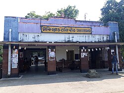
Ghojadanga is a border checkpoint in the Basirhat II CD block in the Basirhat subdivision of the North 24 Parganas district in the state of West Bengal, India.

References

  1. Official District Administration site Archived 2007-01-15 at the Wayback Machine
  2. "Census of India: Search Details". Archived from the original on 24 September 2015. Retrieved 22 May 2014.
  3. District-wise list of statutory towns Archived 2007-09-27 at the Wayback Machine
  4. Falling Rain Genomics, Inc - Taki
  5. "District Census Handbook North Twenty Four Parganas, Census of India 2011, Series 20, Part XII A" (PDF). Page 13. Directorate of Census Operations, West Bengal. Retrieved 16 April 2018.
  6. "District Human Development Report: South 24 Parganas". Chapter 9: Sundarbans and the Remote Islanders, p 290-311. Development & Planning Department, Government of West Bengal, 2009. Archived from the original on 5 October 2016. Retrieved 3 November 2019.
  7. "District Statistical Handbook". North 24 Parganas 2013, Tables 2.1, 2.2, 2.4b. Department of Statistics and Programme Implementation, Government of West Bengal. Archived from the original on 21 January 2019. Retrieved 2 May 2018.
  8. "District Census Handbook North Twenty Four Parganas, Census of India 2011, Series 20, Part XII A" (PDF). Map of North Twenty Four Parganas with CD Block HQs and Police Stations (on the fifth page). Directorate of Census Operations, West Bengal. Retrieved 2 May 2018.
  9. "2011 Census – Primary Census Abstract Data Tables". West Bengal – District-wise. Registrar General and Census Commissioner, India. Retrieved 29 May 2018.
  10. "Census of India 2001: Data from the 2001 Census, including cities, villages and towns (Provisional)". Census Commission of India. Archived from the original on 16 June 2004. Retrieved 1 November 2008.
  11. "Taki Government College". College Admission. Retrieved 8 May 2018.
  12. "33311 Barasat-Hasnabad local". Time Table. India Railinfo. Retrieved 30 May 2018.
  13. "District Census Handbook North Twenty Four Parganas, Census of India 2011, Series 20, Part XII A" (PDF). Map of Hasnabad CD Block, Page 671. Directorate of Census Operations, West Bengal. Retrieved 30 May 2018.
  14. "List of State Highways in West Bengal". West Bengal Traffic Police. Retrieved 30 May 2018.
  15. "Health & Family Welfare Department". Health Statistics. Government of West Bengal. Retrieved 30 May 2018.
External videos
Nuvola apps kaboodle.svg Bijoya Dashami 2011 on the Ichhamati at Taki