History
The area now known as Tallawang (originally often spelled Tallewang) lies on the traditional lands of Wiradjuri people. [3]
In the 1830s the area was settled by Europeans, originally raising sheep. The Tallawang area is in the valley of Tallawang Creek, which flows south into Wyaldra Creek and then subsequently to the Cudgegong River west of Gulgong.
There was an inn at Tallawang on the track and stock route which is now the Castlereagh Highway. In the 1860s gold was discovered at Tallawang and it became the site of a minor gold rush, overshadowed by the much larger discoveries of gold at Gulgong to the south of Tallawang.
In the late 19th century, many small farms at Tallawang were owned by retired gold miners, and Tallawang had an inn, school, church and stores. A railway station opened in 1910, after the railway line was built from Gulgong to Dunedoo, and was closed in 1974. [4]
In the early 20th century, an iron ore mine operated there, called Tallawang Iron Mines. A government railway line to the quarry was built, and successful ore production commenced in 1911. [5] The ore was railed to Lithgow, where it was smelted in the Lithgow Blast Furnace. The Tallawang Iron Mines closed in February 1927. [6] The mine was worked again from early 1952, with the magnetite ore being crushed and ground and then used in the process of coal washing. [7] This continued up to the 1980s. More recently, underground mining of magnetite has commenced in the area. [8]
Today nothing remains Tallawang.
From 1906, Tallawang was part of the Wyaldra Shire, then the Gulgong Shire, and now is part of the Mid-Western Regional Council area, based at Mudgee.

Cobar is a town in central western New South Wales, Australia whose economy is based mainly upon base metals and gold mining. The town is 712 km (442 mi) by road northwest of the state capital, Sydney. It is at the crossroads of the Kidman Way and Barrier Highway. The town and the local government area, the Cobar Shire, are on the eastern edge of the outback. At the 2016 census, the town of Cobar had a population of 3,990. The Shire has a population of approximately 4,700 and an area of 44,065 square kilometres (17,014 sq mi).

Mudgee is a town in the Central West of New South Wales, Australia. It is in the broad fertile Cudgegong River valley 261 km (162 mi) north-west of Sydney and is the largest town in the Mid-Western Regional Council local government area as well as being the council seat. As at June 2021 its population was 12,563. The district lies across the edge of the geological structure known as the Sydney Basin.

Gulgong is a 19th-century gold rush town in the Central Tablelands and the wider Central West regions of the Australian state of New South Wales. The town is situated within the Mid-Western Regional Council local government area. It is located about 300 km (190 mi) north west of Sydney, and about 30 km north of Mudgee along the Castlereagh Highway. At the 2016 Census, Gulgong had a population of 2,521.
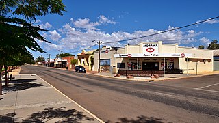
Morawa is a town in the Mid West region of Western Australia. It is located within the Shire of Morawa, approximately 370 kilometres (230 mi) north of the state capital Perth, on the railway line between Wongan Hills and Mullewa.
Koolyanobbing is located 54 km (34 mi) north-northeast of the town of Southern Cross, Western Australia. A subsidiary of Cleveland-Cliffs of Cleveland, Ohio mines Iron ore here. The ore is railed to the port at Esperance for export. Current operations commenced in 1993. The current owner and operator of the lease is Mineral Resources who took over from Cleveland-Cliffs in July 2018. MRL currently mine the ore and transport it to the port of Esperance

The Mid-Western Regional Council is a local government area in the Central West region of New South Wales, Australia. The area is located adjacent to the Castlereagh Highway that passes through the middle of the area in an approximate southeast–northwest direction.

Rylstone is a small town in New South Wales, Australia, in the Central Tablelands region within the Mid-Western Regional Council local government area. It is located on the Bylong Valley Way road route. At the 2021 census, Rylstone had a population of 904.
Kandos is a small town in the Central Tablelands of New South Wales, Australia, within Mid-Western Regional Council. The area is the traditional home of the Dabee tribe, of the Wiradjuri people. The town sits beneath Cumber Melon Mountain, in a district formerly known as Coomber. Kandos shares its locality, employment and infrastructure with the neighbouring town Rylstone, 6 kilometres away. At the 2021 census, Kandos had a population of 1263.

Baerami is a locality in the Muswellbrook Shire in the Upper Hunter region of New South Wales, Australia.

The Gwabegar railway line is a railway line in the Central West and North West Slopes of New South Wales, Australia, which passes through the towns of Mudgee, Gulgong, Dunedoo, Coonabarabran and terminates at Gwabegar.

Leadville is a town in New South Wales, Australia. The town is located in the Warrumbungle Shire local government area, 376 kilometres (234 mi) north west of the state capital, Sydney. At the 2016 census, Leadville and the surrounding area had a population of 169.
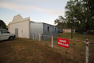
Wollar is a village in New South Wales, Australia. The town is located 316 kilometres (196 mi) north west of the state capital Sydney and 48 kilometres (30 mi) north-east of the regional centre of Mudgee, near the Goulburn River National Park. At the 2006 census, Wollar and the surrounding region had a population of 304. By the 2016 census the village of Wollar and district was reduced to 69 persons living in 50 private dwellings.

William Chandos Wall was an Australian politician. He was also a prospector, geologist, minerals surveyor, commission / mining agent, inventor and a quarry and mine operator before and after entering politics. In June 1886 he was elected to the New South Wales Legislative Assembly to succeed the former NSW premier Sir John Robertson KCMG as one of the members for Mudgee. In 1894 Wall transferred to Rylstone and in July 1895 he lost the Rylstone seat.
Burraga is located in the Central Tablelands of New South Wales, 47 kilometres south west of Oberon and about 67 kilometres (42 mi) south of Bathurst. It is within Oberon Shire. At the 2016 census, Burraga had a population of 91.

Merricumbene is a locality in the Eurobodalla Shire, New South Wales, Australia. It is located about 43 km south of Braidwood and 40 km northwest of Moruya in the valley of the Deua River. At the 2016 census, it had a population of 19.
Cadia is a locality in the Cabonne Council of New South Wales, Australia. It was formerly a private township established c. 1860s by the Cadiangullong Consolidated Copper company. It is now part of the Cadia-Ridgeway Mine lease, operated by Newcrest. It had a population of zero as of the 2016 census.

Charles Henry Hoskins (1851-1926) was an Australian industrialist, who was significant in the development of the iron and steel industry in Australia.
Mount Drysdale is a ghost town in the Orana region of New South Wales, Australia. It was once a village associated with gold mining. It lies within the locality of Tindarey, named after the original pastoral holding from which the village site was excised.
Caloola is a locality in the Central West region of New South Wales. There once was a small village of the same name but it is a ghost town today. At the 2016 census, the locality had a population of 88.
Torbane was a privately-owned village lying within the area now known as Capertee, in the Local Government Area of the City of Lithgow, within the Central West region of New South Wales, Australia. There was also another village, Airly, nearby. Both villages were associated with the mining of oil shale. The mine associated with Torbane was known as the New Hartley Mine. and that associated with Airly was known as the Genowlan Mine. There were retorts that produced crude shale oil at Torbane. Both Torbane and Airly are now ghost towns.
