
Fort Worth is the fifth-largest city in the U.S. state of Texas and the 13th-largest city in the United States. It is the county seat of Tarrant County, covering nearly 350 square miles (910 km2) into four other counties: Denton, Parker, Wise, and Johnson. According to the 2020 U.S. census, Fort Worth's population was 918,915. Fort Worth is the second-largest city in the Dallas–Fort Worth–Arlington metropolitan area, which is the fourth-most populous metropolitan area in the United States.

Bellaire is a city in southwest Harris County, Texas, United States, within the Houston–Sugar Land–Baytown metropolitan area. As of the 2010 U.S. census, the city population was 16,855. In 2019, its population increased to 18,971. It is surrounded by the cities of Houston and West University Place. Bellaire is known as the "City of Homes," owing to its mostly residential character; however, there are offices along the 610 Loop within the city limits.

Cinco Ranch is a census-designated place and master-planned community located in the extraterritorial jurisdiction of the city of Houston within Fort Bend and Harris counties in the U.S. state of Texas. The population was 18,274 at the 2010 census. It lies about 25 miles (40 km) west of the Harris County seat of Houston and 10 miles (16 km) north of the Fort Bend County seat of Richmond. Cinco Ranch is considered to be part of the Greater Katy area and is roughly 10 miles southeast of the city of Katy.

Chinatown is a community in Southwest Houston, Texas, United States.

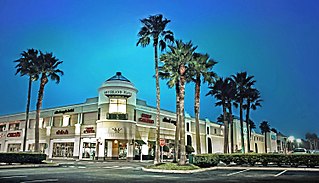
Sharpstown is a master-planned community in the Southwest Management District, Southwest Houston, Texas It was one of the first communities to be built as a master-planned, automobile centered community and the first in Houston. Frank Sharp (1906–1993), the developer of the subdivision, made provisions not only for homes but also for schools, shopping and recreation areas. While this model has been duplicated countless times in the past fifty years, at the time it was quite revolutionary, attracting national media attention. The development was dedicated on March 13, 1955.

Westbury is a neighborhood in the Brays Oaks district of Southwest Houston, Texas, United States. It is located east of Bob White Road, north of U.S. Highway 90 Alternate, and west of South Post Oak Road, adjacent to the Fondren Southwest and Meyerland neighborhoods, just west of the southwest corner of the 610 Loop.
Wedgwood is a neighborhood in Fort Worth, Texas (USA), located on the southwest part of the city. It is bounded by Granbury Rd on the northwest, Altamesa Blvd on the south, McCart Ave & Westcreek Dr on the east, and Interstate 20 on the north.

The Memorial area of Houston, Texas is located west of Downtown, northwest of Uptown, and south of Spring Branch. The Memorial Super Neighborhood, as defined by the City of Houston, is bounded by Buffalo Bayou to the south, Barker Reservoir to the west, the Katy Freeway to the north, and the Memorial Villages, a contiguous group of independent municipalities, to the east.

Alief is a working-class suburb in Southwest Harris County, Texas, United States. Most of Alief is within the city limits of Houston, while a portion of the community is in unincorporated Harris County.
Meyerland is a 6,000-acre (9 sq mi) community in southwest Houston, Texas, outside of the 610 Loop and inside Beltway 8. The neighborhood is named after the Meyer family, who bought and owned 6,000 acres (24 km²) of land in southwest Houston.
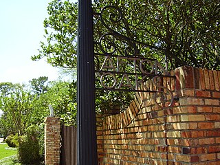
Afton Oaks is a deed-restricted "Inner Loop" upscale residential community of approximately 525 homes in Houston, Texas, United States. Afton Oaks is located inside Interstate 610 near the Galleria and Highland Village. The neighborhood is bounded on the north by Westheimer Road, on the east by Union Pacific railroad tracks, on the south by Interstate 69/U.S. Highway 59, and on the west by Interstate 610.

Tanglewood is a neighborhood in western Houston, Texas, located off of San Felipe Road.

Willow Meadows is a subdivision in Houston, Texas, United States.
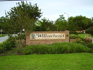
Willowbend is a neighborhood in Houston, Texas.

Maplewood is a community in Houston, Texas located outside the 610 Loop, southwest of Downtown Houston. It consists of 524 houses. They are one-story and two-story houses, as two stories is the limit allowed by the subdivision. The oldest houses were built in the early 1950s. Maplewood is located along Beechnut, Hillcroft, and Renwick.

Northeast El Paso is part of the city of El Paso, Texas and is located north of Central El Paso, and east of the Franklin Mountains. Its southern boundary is variously given as Fred Wilson Boulevard or Cassidy Road and Van Buren Avenue, and it extends northward to the New Mexico state line; some portions of this region lie outside the city limits, including parts of Franklin Mountains State Park and areas of Fort Bliss: the Logan area of Fort Bliss around Chapin High School and Castner Range, an old firing range northwest of Hondo Pass Avenue and Gateway South Boulevard. Development of Northeast El Paso, which had begun before the Second World War around the Logan area, started in earnest during the 1950s, when many homes were demolished in the process of the construction of Interstate 10. It is one of the more ethnically diverse areas of town due to a high concentration of enlisted military families. Northeast El Paso has historically not developed at a rate comparable to East El Paso and Northwest El Paso, but in recent years, it has seen an increase in development. It is expected that the population in Northeast El Paso will grow more rapidly as a result of the troop increase for Fort Bliss in the coming years. Northeast El Paso has gained recognition throughout the city for schools like Parkland, Irvin, Andress and Chapin because of their outstanding athletic programs.

Athmar Park is a residential neighborhood in southwest Denver, Colorado. It consists mostly of all-brick ranches and bungalow-style homes built in the 1940s and 1950s.

Washington, D.C., is administratively divided into four geographical quadrants of unequal size, each delineated by their ordinal directions from the medallion located in the Crypt under the Rotunda of the Capitol. Street and number addressing, centered on the Capitol, radiates out into each of the quadrants, producing a number of intersections of identically named cross-streets in each quadrant. Originally, the District of Columbia was a near-perfect square. However, even then the Capitol was never located at the geographic center of the territory. As a result, the quadrants are of greatly varying size. Northwest is quite large, encompassing over a third of the city's geographical area, while Southwest is little more than a neighborhood and military base.

Rosedale Park is a historic district located in Detroit, Michigan. It is roughly bounded by Lyndon, Outer Drive, Grand River Avenue, Southfield Freeway, Glastonbury Avenue, Lyndon Street and Westwood Drive. It was listed on the National Register of Historic Places in 2006. The Rosedale Park district has the largest number of individual properties of any district nominated to the National Register of Historic Places in Michigan, with 1533.