Ur was an important Sumerian city-state in ancient Mesopotamia, located at the site of modern Tell el-Muqayyar in south Iraq's Dhi Qar Governorate. Although Ur was once a coastal city near the mouth of the Euphrates on the Persian Gulf, the coastline has shifted and the city is now well inland, on the south bank of the Euphrates, 16 km (10 mi) from Nasiriyah in modern-day Iraq. The city dates from the Ubaid period circa 3800 BC, and is recorded in written history as a city-state from the 26th century BC, its first recorded king being King Tuttues.
Kish is an important archaeological site in Babil Governorate (Iraq), located 80 km (50 mi) south of Baghdad and 12 km (7.5 mi) east of the ancient city of Babylon. The Ubaid period site of Ras al-Amiyah is 8 km (5.0 mi) away. It was occupied from the Ubaid period to the Hellenistic period. In Early Dynastic times the city's patron deity was Ishtar with her consort Ea. Her temple, at Tell Ingharra, was (E)-hursag-kalama. By Old Babylonian times the patron deities had become Zababa, along with his consort, the goddess Bau and Istar. His temple Emeteursag was at Uhaimir.

The Ubaid period is a prehistoric period of Mesopotamia. The name derives from Tell al-'Ubaid where the earliest large excavation of Ubaid period material was conducted initially in 1919 by Henry Hall and later by Leonard Woolley.

Tepe Gawra is an ancient Mesopotamian settlement 15 miles NNE of Mosul in northwest Iraq that was occupied between 5000 and 1500 BC. It is roughly a mile from the site of Nineveh and 2 miles E of the site of Khorsabad. It contains remains from the Halaf period, the Ubaid period, and the Uruk period. Tepe Gawra contains material relating to the Halaf-Ubaid Transitional period c. 5,500–5,000 BC.
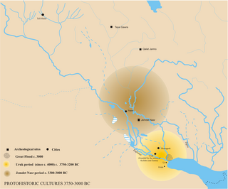
The Jemdet Nasr Period is an archaeological culture in southern Mesopotamia. It is generally dated from 3100 to 2900 BC. It is named after the type site Tell Jemdet Nasr, where the assemblage typical for this period was first recognized. Its geographical distribution is limited to south-central Iraq. The culture of the proto-historical Jemdet Nasr period is a local development out of the preceding Uruk period and continues into the Early Dynastic I period.

The Halaf culture is a prehistoric period which lasted between about 6100 BC and 5100 BC. The period is a continuous development out of the earlier Pottery Neolithic and is located primarily in the fertile valley of the Khabur River, of south-eastern Turkey, Syria, and northern Iraq, although Halaf-influenced material is found throughout Greater Mesopotamia.
Lake Hamrin, is a man-made lake approximately 50 km (31 mi) north-east of Baqubah, in Iraq's Diyala Governorate. The town of Hamrin sits on the western shore of the lake, both of which are at the southern tip of the Hamrin mountains. The Hemrin Dam, which creates Lake Hamrin, was established in 1981 as an artificial dam to hold over two billion cubic metres of water. It is a source of fish and also provides water for nearby date palm orchards and other farms. In June 2008, it was reported that due to Iranian damming of the Alwand River, the lake had lost nearly 80% of its capacity.
Tell Arpachiyah is a prehistoric archaeological site in Nineveh Province (Iraq). It takes its name from a more recent village located about 4 miles (6.4 km) from Nineveh. The local name of the mound on which the site is located is Tepe Reshwa.
Telul eth-Thalathat is an archaeological site located 40 miles (64 km) west of Mosul and just east of Tal Afar in Nineveh Province (Iraq).
Tell es-Sawwan is an important Samarran period archaeological site in Saladin Province, Iraq. It is located 110 kilometres (68 mi) north of Baghdad, and south of Samarra. It lies on a 12 meter high cliff overlooking the Tigris River.
Choga Mami is a Samarran settlement site in Diyala province in Eastern Iraq in the Mandali region. It shows the first canal irrigation in operation at about 6000 BCE.
Tell al-Fakhar is a tell, or archaeological settlement mound, 45 kilometers southwest of the modern city of Kirkuk in Kirkuk Governorate, northeastern Iraq. Excavations were carried out at the site between 1967 and 1969 by the Directorate-General of Antiquities of Iraq. The site measures 200 by 135 metres and is 4.5 metres (15 ft) high. Excavations revealed two occupation phases that were dated to the Mitanni/Kassite and Neo-Assyrian periods, or mid-second and early-first millennia BCE. The mid-second millennium phase consisted of a large building, dubbed the "Green Palace", where an archive of circa 800 clay tablets was found. It has been suggested that the site's name was Kurruḫanni but later researchers have called this into question.
The Halaf-Ubaid Transitional period or HUT is a prehistoric period of Mesopotamia. It lies chronologically between the Halaf period and the Ubaid period. It is still a complex and rather poorly understood period. At the same time, recent efforts were made to study the gradual change from Halaf style pottery to Ubaid style pottery in various parts of North Mesopotamia.

Yarim Tepe is an archaeological site of an early farming settlement that goes back to about 6000 BC. It is located in the Sinjar valley some 7km southwest from the town of Tal Afar in northern Iraq. The site consists of several hills reflecting the development of the Hassuna culture, and then of the Halaf and Ubaid cultures.
Tell Khaiber is a tell, or archaeological settlement mound, in southern Mesopotamia. It is located thirteen kilometers west of the modern city of Nasiriyah, about 19 kilometers northwest of the ancient city of Ur in Dhiq Qar Province and 25 kilometers south of the ancient city of Larsa. In 2012, the site was visited by members of the Ur Region Archaeology Project (URAP), a cooperation between the British Institute for the Study of Iraq, the University of Manchester and the Iraqi State Board for Antiquities and Heritage. They found that the site had escaped looting, and applied for an excavation permit.
Tell Saadiya is a tell, or archaeological settlement mound, in Diyala Governorate (Iraq).
Tell Rashid is a tell, or archaeological settlement mound, in Diyala Governorate, Iraq. The site lies in the foothills of the Zagros Mountains, some 12 km (7.5 mi) south of Tell Abada, another Ubaid period site. It measures 54 by 30 m and extends 2.5 m above the surrounding plain. Tell Rashid was excavated for a single season in 1978 under the direction of Sabah Abboud Jasim as part of the archaeological salvage work being done for the construction of the Hemrin Dam. The excavation trench reached a depth of 5 m, at which point virgin soil was reached. Four different occupation levels were recognised, all dating to the Ubaid period.
Tell Abada is a tell, or archaeological settlement mound, in Diyala Governorate (Iraq). Abada was excavated as part of the archaeological salvage operation to excavate sites that would be flooded by the reservoir of the Hamrin Dam. Excavations revealed occupation levels dating to the Ubaid 1-3 periods. The site is important because it was one of the few where an Ubaid period settlement could be excavated in its entirety.
Tell Zurghul, also spelled Tell Surghul, is an archaeological site in Dhi Qar Governorate (Iraq). It lies on an ancient canal leading from Lagash of which is lies 10 km to the south-east. Its ancient name was the cuneiform read as Niĝin. The city god was Nanshe (Nanše), who had temples there (E-sirara) and at nearby Girsu. She was the daughter of Enki and sister of Ningirsu and Nisaba. Niĝin, along with the cities of Girsu and Lagash, was part of the State of Lagash in the later part of the 3rd Millennium BC.
Tell Yelkhi, is an ancient Near East archaeological site in Diyala Governorate (Iraq). It was examined as part of the Hamrin Dam salvage excavation before it flooded. Other sites a part of that rescue excavation included, Me-Turan, Tell Gubah, Tell Songor, Tellul Hamediyat, Tell Rubeidheh, Tell Madhur, Tell Imlihiye, Tell Rashid, Tell Saadiya and Tell Abada. Some of these sites, including Tell Yelkhi, periodically emerge from the water. The site of Tell Yelhi was settled in the early 3rd millennium BC and occupation continued through the Kassite period late in the 2nd millennium BC. It's name in ancient times is not yet known though Awalki has been suggested.

