
Interstate 40 (I-40) is a major east–west transcontinental Interstate Highway in the southeastern and southwestern portions of the United States. At a length of 2,556.61 miles (4,114.46 km), it is the third-longest Interstate Highway in the country, after I-90 and I-80. From west to east, it passes through California, Arizona, New Mexico, Texas, Oklahoma, Arkansas, Tennessee, and North Carolina. Its western end is at I-15 in Barstow, California, while its eastern end is at a concurrency with U.S. Route 117 (US 117) and North Carolina Highway 132 (NC 132) in Wilmington, North Carolina. Major cities served by the interstate include Flagstaff, Arizona; Albuquerque, New Mexico; Amarillo, Texas; Oklahoma City, Oklahoma; Little Rock, Arkansas; Memphis, Nashville, and Knoxville in Tennessee; and Asheville, Winston-Salem, Greensboro, Durham, Raleigh, and Wilmington in North Carolina.

U.S. Route 11 or U.S. Highway 11 (US 11) is a major north–south United States Numbered Highway extending 1,645 miles (2,647 km) across the eastern U.S. The southern terminus of the route is at US 90 in Bayou Sauvage National Wildlife Refuge in eastern New Orleans, Louisiana. The northern terminus is at the Rouses Point–Lacolle 223 Border Crossing in Rouses Point, New York. The route continues across the border into Canada as Route 223. US 11, created in 1926, maintains most of its original route. The route north of Knoxville, Tennessee, follows a route similar to Interstate 81 (I-81). While it is signed as a north-south route, it physically travels in a northeast-southwest direction.

U.S. Route 70 or U.S. Highway 70 is an east–west United States highway that runs for 2,381 miles (3,832 km) from eastern North Carolina to east-central Arizona. It is a major east–west highway of the Southeastern, Southern and Southwestern United States. Established as one of the original highways of 1926, it originally ran only to Holbrook, Arizona, then was extended in 1934 as a coast to coast route, with the current Eastern terminus near the Atlantic Ocean in Atlantic, North Carolina, and the former Western terminus near the Pacific Ocean in Los Angeles, California. The current Western terminus was then truncated to US 60 / SR 77 in Globe, Arizona. Before the completion of the Interstate system, U.S. Highway 70 was sometimes referred to as the "Broadway of America", due to its status as one of the main east–west thoroughfares in the nation. It was also promoted as the "Treasure Trail" by the U.S. Highway 70 Association as of 1951.

Interstate 275 (I-275) is an Interstate Highway in Tennessee that serves Knoxville by connecting the downtown with I-75/I-640/US Route 25W (US 25W). Measuring 2.98 miles (4.80 km) in length, it runs from a northern terminus at the junction with I-75/I-640/US 25W to a southern terminus at I-40.

Interstate 640 (I-640) is an east–west auxiliary Interstate Highway in Knoxville, Tennessee. It serves as a bypass for I-40 around Downtown Knoxville and is also an alternative route for traffic passing between I-40 and I-75. All trucks carrying hazardous cargo through Knoxville are required to use I-640. It has a total length of 10.80 miles (17.38 km) and runs approximately three miles (4.8 km) north of downtown through the northern neighborhoods of Knoxville.

State Route 168 is a state highway in Knox County, Tennessee, that is 18.1 miles long. Its western terminus is with US 129/SR 115, and its eastern terminus is with US 11/US 11E/US 11W/US 70/SR 1.

State Route 1, known as the Memphis to Bristol Highway, is a 538.8-mile-long (867.1 km) mostly-unsigned state highway in the U.S. state of Tennessee. It stretches all the way from the Arkansas state line at Memphis in the southwest corner of the state to Bristol in the northeast part. Most of the route travels concurrently with U.S. Route 70 and US 11W. It is the longest highway of any kind in the state of Tennessee. The route is signed as both in the state of Tennessee, a Primary and Secondary Highway
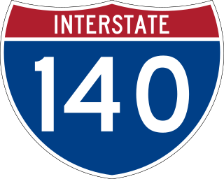
The Pellissippi Parkway is a major highway in Knox and Blount counties in the Knoxville metropolitan area in Tennessee that extends 19.75 miles (31.78 km) from State Route 62 at Solway to SR 33 in Alcoa. It provides access to the cities of Oak Ridge and Maryville from Interstates 40 and 75 in the western part of Knoxville, and also serves a major corridor that includes Oak Ridge National Laboratory, Y-12 National Security Complex, and a number of science and technology firms. The central portion of the Pellissippi Parkway is included in the Interstate Highway System and is designated Interstate 140 (I-140), while the remainder is designated as State Route 162. The entire highway is part of the National Highway System, a national network of roads identified as important to the national economy, defense, and mobility. It takes its name from an older name for the Clinch River of Native American origin.

U.S. Route 11W (US 11W) is the western branch of US 11 from the twin cities of Bristol, Tennessee/Bristol, Virginia, where US 11 splits into US 11E and US 11W, to Knoxville, Tennessee, where the two highways rejoin. The highway serves the Appalachia region's Ridge-and-Valley section of East Tennessee, bounded by the Clinch Mountain ridge to the north and the Holston River to the south. US 11W from Bristol to Bean Station and Blaine to Knoxville are designated as part of the National Highway System.

State Route 331 is a mostly west–east, signed north–south, secondary highway in Knox County in the U.S. state of Tennessee.
Concord is an unincorporated community in Knox County, Tennessee, United States and is listed on the National Register of Historic Places as a historic district, the Concord Village Historic District. The United States Geographic Names Information System classifies Concord as a populated place. It is located in western Knox County, east of Farragut and west of Knoxville. Mail destined for Concord is now addressed to Concord, Knoxville, or Farragut.

Interstate 475 (I-475)/State Route 475, officially known as the Knoxville Parkway and commonly known as the Orange Route, was a proposed Interstate highway and state route in Loudon, Knox, Anderson, Grainger, Jefferson and Sevier counties within the eastern part of the U.S. state of Tennessee. The proposed route would have allowed through traffic on I-75 to bypass the Knoxville-Knox County urbanized area. If constructed, SR 475 was to begin at the I-40/I-75 junction near Farragut, and travel northeast through the communities of Hardin Valley, Solway and Claxton, then join I-75 again northwest of Heiskell. It was also considered to be extended to I-40 at exit 407, serving as a northern semi-beltway of the Knoxville area. Driven by opposition spearheaded by state representative H.E. Bittle of Hardin Valley and Knoxville mayor Victor Ashe, the project was scrapped by the Tennessee Department of Transportation (TDOT) in 2010.

Interstate 81 (I-81) is part of the Interstate Highway System that runs 855.02 miles (1,376.02 km) northward from Dandridge, Tennessee, to the Thousand Islands Bridge at the Canadian border near Fishers Landing, New York. In Tennessee, I-81 serves the northeastern part of the state, running 75.66 miles (121.76 km) from its southern terminus with I-40 in Dandridge to the Virginia state line in Bristol. The route serves the Tri-Cities region of the state and the eastern parts of the Knoxville metropolitan area, terminating about 35 miles (56 km) east of Knoxville. I-81 bypasses most cities that it serves, instead providing access via interchanges with state and federal routes. It remains in the Ridge-and-Valley topographic region of the Appalachian Mountains for its entire length in Tennessee, and runs in a northeast to southwest direction.

Kingston Pike is a highway in Knox County, Tennessee, United States, that connects Downtown Knoxville with West Knoxville, Farragut, and other communities in the western part of the county. The road follows a merged stretch of U.S. Route 11 (US 11) and US 70. From its initial construction in the 1790s until the development of the Interstate Highway System in the 1960s, Kingston Pike was the main traffic artery in western Knox County, and an important section of several cross-country highways. The road is now a major commercial corridor, containing hundreds of stores, restaurants, and other retail establishments.

State Route 169 , also known as Middlebrook Pike, is a west-to-east secondary highway in Knox County in the U.S. state of Tennessee.

State Route 131 is a south-to-north highway in the U.S. state of Tennessee that is 68.8-mile (110.7 km) long. It is designated as a secondary route.
Interstate 40 (I-40) is part of the Interstate Highway System that spans 2,556.61 miles (4,114.46 km) from Barstow, California, to Wilmington, North Carolina. In Tennessee, I-40 traverses the state from west to east, from the Mississippi River at the Arkansas border to the northern base of the Great Smoky Mountains at the North Carolina border. At 455.28 miles (732.70 km), the Tennessee segment of I-40 is the longest of the eight states through which it passes, and the longest Interstate Highway in Tennessee.

Interstate 75 (I-75) in the US state of Tennessee runs from Chattanooga to Jellico by way of Knoxville. I-75 enters the East Tennessee region from Georgia, following the Tennessee Valley all the way through Knoxville to near Rocky Top, then climbs into the Cumberland Mountains before crossing over into Kentucky at Jellico.

U.S. Route 129 is a north–south United States highway that runs for 52.8 miles (85.0 km) in East Tennessee, from the North Carolina state line, near Tapoco, to Knoxville. In Tennessee, the highway is completely overlapped by unsigned State Route 115. In the Greater Knoxville area, US 129 serves as a six-lane controlled-access highway known as Alcoa Highway.
U.S. Route 11 (US 11) in the U.S. state of Tennessee travels from the Georgia state line in Chattanooga to Knoxville, where it then splits into US 11E and US 11W. These two highways then travel to the Virginia state line near Kingsport and Bristol. During its length, it shares concurrencies with State Route 2 (SR 2) and SR 38.

