Terre Hill, Pennsylvania

Last updated
Terre Hill, Pennsylvania
Terre Hill, Pennsylvania.jpg
Watermelons on their way to a farmers market, near the intersection of Sweigart Street and Pennsylvania Route 897
Lancaster County Pennsylvania Incorporated and Unincorporated areas Terre Hill Highlighted.svg
Location in Lancaster County, Pennsylvania
USA Pennsylvania location map.svg
Red pog.svg
Terre Hill
Location in Pennsylvania
Usa edcp location map.svg
Red pog.svg
Terre Hill
Location in the United States
Coordinates: 40°09′27″N76°03′01″W / 40.15750°N 76.05028°W / 40.15750; -76.05028
CountryUnited States
StatePennsylvania
County Lancaster
Government
  MayorRobert R. Rissler
Area
[1]
  Total0.46 sq mi (1.18 km2)
  Land0.46 sq mi (1.18 km2)
  Water0.00 sq mi (0.00 km2)
Elevation
531 ft (162 m)
Population
 (2020) [2]
  Total1,357
  Density2,982.42/sq mi (1,152.72/km2)
Time zone UTC-5 (EST)
  Summer (DST) UTC-4 (EDT)
ZIP code
17581
Area code 717
FIPS code 42-76400
Website www.terrehillboro.com

Terre Hill is a borough in Lancaster County, Pennsylvania, United States. The population was 1,363 at the 2020 census. [3]

Contents

History

Terre Hill was formerly known as "Fairville". [4] It was incorporated as a borough in 1907 after a successful court battle to separate from East Earl Township. [4]

The borough was once considered to be the hub of cigar-making in Lancaster County. [4] One of its most recognizable landmarks is the 19th-century clock at the borough hall. [4]

Terre Hill has the second fewest residents of any incorporated borough in Lancaster County, with the exception of Christiana. [4] Terre Hill has no traffic lights as of 2022. [4] The first four-way stop in Terre Hill was created at the intersection of East Main Street and Earl Street in spring 2023. To create the four-way stop, two stop signs were added to East Main Street at the approaches to the already installed stop signs at Earl Street. The four-way stop was created during the closure of a section of PA Route 625 for underground pipe work.

Geography

Terre Hill is located in northeastern Lancaster County at 40°9′27″N76°3′1″W / 40.15750°N 76.05028°W / 40.15750; -76.05028 (40.157565, -76.050410). [5] Pennsylvania Route 897 is the borough's Main Street, leading north 6 miles (10 km) to Swartzville and south 4 miles (6 km) to East Earl. Terre Hill is 18 miles (29 km) northeast of Lancaster, the county seat, and 16 miles (26 km) southwest of Reading.

According to the United States Census Bureau, the borough has a total area of 0.46 square miles (1.2 km2), of which 0.3 acres (1,046 m2), or 0.09%, are water. [6] The community is on high ground overlooking the Weaverland Valley of eastern Lancaster County [4] and is part of the watershed of the Conestoga River, a southwest-flowing tributary of the Susquehanna River.

Demographics

Historical population
CensusPop.Note
1890 891
1910 882
1920 840−4.8%
1930 812−3.3%
1940 90711.7%
1950 1,00010.3%
1960 1,12912.9%
1970 1,1290.0%
1980 1,2177.8%
1990 1,2825.3%
2000 1,237−3.5%
2010 1,2954.7%
2020 1,3574.8%
2021 (est.)1,355 [3] −0.1%
U.S. Decennial Census [7]

As of the census [8] of 2000, there were 1,237 people, 440 households, and 349 families residing in the borough. The population density was 2,710.3 inhabitants per square mile (1,046.5/km2). There were 454 housing units at an average density of 994.7 per square mile (384.1/km2). The racial makeup of the borough was 98.63% White, 0.16% African American, 0.08% Native American, 0.73% from other races, and 0.40% from two or more races. Hispanic or Latino of any race were 1.86% of the population.

There were 440 households, out of which 40.9% had children under the age of 18 living with them, 67.7% were married couples living together, 7.0% had a female householder with no husband present, and 20.5% were non-families. 17.3% of all households were made up of individuals, and 5.5% had someone living alone who was 65 years of age or older. The average household size was 2.81 and the average family size was 3.17.

In the borough the population was spread out, with 29.7% under the age of 18, 8.2% from 18 to 24, 30.1% from 25 to 44, 20.0% from 45 to 64, and 12.1% who were 65 years of age or older. The median age was 34 years. For every 100 females there were 101.8 males. For every 100 females age 18 and over, there were 97.3 males.

The median income for a household in the borough was $47,083, and the median income for a family was $47,891. Males had a median income of $36,815 versus $21,442 for females. The per capita income for the borough was $19,128. About 3.2% of families and 4.8% of the population were below the poverty line, including 7.0% of those under age 18 and 4.0% of those age 65 or over.

Annual events

The borough has numerous public events throughout the year for residents and community members. These special events are sponsored by the fundraising group Terre Hill Days Committee. The committee donates all of its proceeds to maintenance and upkeep of the Terre Hill Park. Some events include Breakfast & Yard Sales in the Park, Lunch in the Park, Ice Cream Social, Terre Hill Community Auction, Christmas Decorating Contest, Santa's Workshop, and a Community Egg Hunt. Terre Hill's main event is Terre Hill Days. In 2007, the borough celebrated its centennial year with a special Terre Hill Days festival.

Starting in 2018, a Christmas in the Park event has been held as a fundraiser for the Terre Hill Park and has become a holiday-time staple for the community. During this festive event, the entire Park is converted into a Christmas wonderland- lights, live music, food, entertainment, and more.

In 1980, Calvin Trillin wrote a humorous article in The New Yorker about a dispute between the fire company of Terre Hill and its ladies' auxiliary. [9]

Related Research Articles

<span class="mw-page-title-main">Akron, Pennsylvania</span> Borough in Pennsylvania, United States

Akron is a borough in Lancaster County, Pennsylvania, United States. As of the 2020 census, it had a population of 4,169,

<span class="mw-page-title-main">Elizabethtown, Pennsylvania</span> Borough in Pennsylvania, United States

Elizabethtown is a borough in Lancaster County, Pennsylvania, United States. It is located 18 miles (29 km) southeast of Harrisburg, the state capital. Small factories existed at the turn of the 20th century when the population in 1900 was 1,861. As of the 2020 census, the population of the borough was 11,639. Elizabethtown is commonly referred to in south-central Pennsylvania as "E-Town." This nickname is also used for the local college and high school.

<span class="mw-page-title-main">Lititz, Pennsylvania</span> Borough in Pennsylvania, United States

Lititz is a borough in Lancaster County, Pennsylvania, United States, 9 miles (14 km) north of the city of Lancaster. As of the 2020 census, it had a population of 9,370.

<span class="mw-page-title-main">Manheim, Pennsylvania</span> Borough in Pennsylvania, United States

Manheim is a borough in Lancaster County, Pennsylvania, United States. The population was 5,064 at the 2020 census. The borough was named after Kerpen-Manheim, Germany.

<span class="mw-page-title-main">Marietta, Pennsylvania</span> Borough in Pennsylvania, United States

Marietta is a borough in Lancaster County, Pennsylvania, United States. The population was 2,633 at the 2020 census. It is located on the east bank of the Susquehanna River, northwest of Columbia.

<span class="mw-page-title-main">Millersville, Pennsylvania</span> Borough in Pennsylvania, United States

Millersville is a borough in Lancaster County, Pennsylvania. At the 2020 census, the population was 7,629 and in 2021 it was estimated at 7,593. Millersville is home to Millersville University of Pennsylvania.

<span class="mw-page-title-main">Christiana, Pennsylvania</span> Borough in Pennsylvania, United States

Christiana is a borough in Lancaster County, Pennsylvania, United States. The population was 1,100 at the time of the 2020 census.

<span class="mw-page-title-main">East Earl Township, Lancaster County, Pennsylvania</span> Township in Pennsylvania, United States

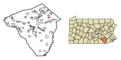
East Earl Township is a township in northeastern Lancaster County, Pennsylvania, United States. At the 2020 census, the population was 6,721.

<span class="mw-page-title-main">Sewickley Hills, Pennsylvania</span> Borough in Pennsylvania, United States

Sewickley Hills is a borough in Allegheny County, Pennsylvania, United States. The population was 689 at the 2020 census. It is a residential suburb of the Pittsburgh metropolitan area.

<span class="mw-page-title-main">Valencia, Pennsylvania</span> Borough in Pennsylvania, United States

Valencia is a borough in Butler County, Pennsylvania, United States. The population was 551 at the 2010 census.

<span class="mw-page-title-main">Earl Township, Lancaster County, Pennsylvania</span> Township in Pennsylvania, United States

Earl Township is a township in northeastern Lancaster County, Pennsylvania, United States. The population was 7,149 at the 2020 census.

<span class="mw-page-title-main">Ephrata Township, Lancaster County, Pennsylvania</span> Township in Pennsylvania, United States

Ephrata Township is a township in northeastern Lancaster County, Pennsylvania, United States. The population was 10,391 at the 2020 census.

<span class="mw-page-title-main">Mountville, Pennsylvania</span> Borough in Pennsylvania, United States

Mountville is a borough in Lancaster County, Pennsylvania, United States. The population was 3,022 at the 2020 census, an increase over the figure of 2,802 tabulated in 2010. The original Charles Chips potato chip factory was located here.

<span class="mw-page-title-main">Warwick Township, Lancaster County, Pennsylvania</span> Township in Pennsylvania, United States

Warwick Township is a township in north-central Lancaster County, Pennsylvania, United States. The population was 19,068 at the 2020 census. It completely surrounds the borough of Lititz and contains the unincorporated villages of Brunnerville, Disston, Kissel Hill, Lexington, Millway, and Rothsville.

<span class="mw-page-title-main">West Cocalico Township, Lancaster County, Pennsylvania</span> Township in Pennsylvania, United States

West Cocalico Township is a township that is located in northeastern Lancaster County, Pennsylvania, United States. The population was 7,491 at the time of the 2020 census.

<span class="mw-page-title-main">West Earl Township, Lancaster County, Pennsylvania</span> Township in Pennsylvania, United States

West Earl Township is a township in northeastern Lancaster County, Pennsylvania, United States. The population was 8,565 at the 2020 census. The township was founded by its first settler, Hans Conrad Groff (1661-1746) in 1717.

<span class="mw-page-title-main">West Hempfield Township, Lancaster County, Pennsylvania</span> Township in Pennsylvania, United States

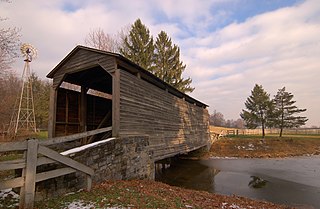
West Hempfield Township is a township in west central Lancaster County, Pennsylvania, United States. The population was 17,061 at the 2020 census.

<span class="mw-page-title-main">Hempfield Township, Westmoreland County, Pennsylvania</span> Township in Pennsylvania, United States

Hempfield Township is a township in Westmoreland County, Pennsylvania, United States. The population was 41,585 at the 2020 census, making it the largest suburb in the Pittsburgh Metropolitan Area by population. Its name is derived from Hempfield in Lancaster County, which was formed in 1729 and is named after the hemp fields in the area.

<span class="mw-page-title-main">Wellsville, Pennsylvania</span> Historic district in Pennsylvania, United States

Wellsville is a borough in York County, Pennsylvania, United States. The population was 299 at the 2020 census.

<span class="mw-page-title-main">Adamstown, Pennsylvania</span> Place in Pennsylvania, United States

Adamstown is a borough that is located in Lancaster County and Berks County in the U.S. state of Pennsylvania.

References

  1. "ArcGIS REST Services Directory". United States Census Bureau. Retrieved October 16, 2022.
  2. "Census Population API". United States Census Bureau. Retrieved Oct 12, 2022.
  3. 1 2 Bureau, US Census. "City and Town Population Totals: 2020-2021". Census.gov. US Census Bureau. Retrieved 9 July 2022.
  4. 1 2 3 4 5 6 7 Wolf, Paula (2010-03-28). "Terre Hill tops early Census returns". Intelligencer Journal . Archived from the original on 2013-01-03. Retrieved 2010-04-07.
  5. "US Gazetteer files: 2010, 2000, and 1990". United States Census Bureau. 2011-02-12. Retrieved 2011-04-23.
  6. "2019 U.S. Gazetteer Files". United States Census Bureau. Retrieved July 28, 2020.
  7. "Census of Population and Housing". Census.gov. Retrieved June 4, 2016.
  8. "U.S. Census website". United States Census Bureau . Retrieved 2008-01-31.
  9. Trillin, Calvin (November 10, 1980). "U.S. Journal: Terre Hill, PA. The Men and the Women". The New Yorker: 192–200.