Lesotho, formally the Kingdom of Lesotho, is a landlocked country in Southern Africa. As an enclave of South Africa, with which it shares a 1,106 km border, it is the only sovereign enclave in the world outside of the Italian Peninsula. It is situated in the Maloti Mountains and contains the highest peak in Southern Africa. It has an area of over 30,000 km2 (11,600 sq mi) and has a population of about 2 million. Its capital and largest city is Maseru.

Lesotho is a mountainous, landlocked country located in Southern Africa. It is an enclave, surrounded by South Africa. The total length of the country's borders is 909 kilometres (565 mi). Lesotho covers an area of around 30,355 square kilometres (11,720 sq mi), of which a negligible percentage is covered with water.
This article concerns systems of transport in Lesotho. As a landlocked country, Lesotho has no seaports or harbours, but does have road, air transport, and limited rail infrastructure.
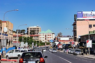
Maseru is the capital and largest city of Lesotho. It is also the capital of the Maseru District. Located on the Caledon River, Maseru lies directly on the Lesotho–South Africa border. Maseru had a population of 330,760 in the 2016 census. The city was established as a police camp and assigned as the capital after the country became a British protectorate in 1869. When the country achieved independence in 1966, Maseru retained its status as capital. The name of the city is a Sesotho word meaning "red sandstones".

Basutoland was a British Crown colony that existed from 1884 to 1966 in present-day Lesotho, bordered with the Cape Colony, Natal Colony and Orange River Colony until 1910 and completely surrounded by South Africa from 1910. Though the Basotho and their territory had been under British control starting in 1868, the Cape Colony was unpopular and unable to control the territory. As a result, Basutoland was brought under direct authority of Queen Victoria, via the High Commissioner, and run by an Executive Council presided over by a series of British Resident Commissioners.

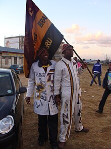
The Sotho, also known as the Basotho, are a prominent Sotho-Tswana ethnic group with roots in Southern Africa. They primarily inhabit the regions of Lesotho and South Africa.
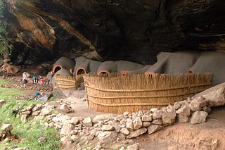
Berea is a district of Lesotho. In the west, Berea borders on the Free State Province of South Africa. Domestically, it borders on the following districts: Leribe District in the north, Thaba-Tseka District in southeast and Maseru District in the south. Teyateyaneng is the capital of the district. It is also home to the Kome Cave Dwellings. It is also the only district in Lesotho which is not named after its capital.

Mafeteng is a city in Lesotho, and the Camptown of the district of Mafeteng. It is located about 76 kilometres south of the country's capital, Maseru and has a population of approximately 61,000. The South African border town to Mafeteng is Wepener.

Maseru is a district of Lesotho. Maseru is also the name of the district's capital, and is the only city in the district and also the capital of the country. It is the largest urban area in the country, and therefore the only city. The city of Maseru is located on Lesotho's western border with the Free State Province of South Africa, the frontier being the Caledon River. Maseru borders on Berea District in north, Thaba-Tseka District in the east, Mohale's Hoek District in south, and Mafeteng District in southwest.

Smithfield is a small town in the Free State province of South Africa. Founded in 1848 in the Orange River Sovereignty, the town is situated in a rural farming district and is the third oldest town in present-day Free State, after Philippolis and Winburg.

The Caledon River is a major river located in central South Africa. Its total length is 642 km (399 mi), rising in the Drakensberg Mountains on the Lesotho border, flowing southwestward and then westward before joining the Orange River near Bethulie in the southern Free State.
The Lesotho Premier League, also known as Econet Premier League for sponsorship reasons, is the top football division in Lesotho and was created in 1970. Econet Telecom Lesotho are the current league sponsor, since 2017/2018 season. Vodacom Lesotho were the previous league sponsor and were also the sponsor of the now cancelled Vodacom Soccer Spectacular knockout competition, which was the Lesotho's annual national cup tournament.
The following outline is provided as an overview of and topical guide to Lesotho:

Thaba Bosiu is a constituency and sandstone plateau with an area of approximately 2 km2 (0.77 sq mi) and a height of 1,804 meters above sea level. It is located between the Orange and Caledon Rivers in the Maseru District of Lesotho, 24 km east of the country's capital Maseru. It was once the capital of Lesotho, having been King Moshoeshoe's stronghold.
The sport of football in the country of Lesotho is run by the Lesotho Football Association. The association administers the national football team, as well as the Premier League. Football is the most popular sport in the country.

The border between Lesotho and South Africa is 909 kilometres (565 mi) long and forms a complete loop, as Lesotho is an enclave entirely surrounded by South Africa. The border follows the Caledon River, the drainage divide of the Drakensberg mountains, the Orange River, the Makhaleng River, and a series of hills joining the Makhaleng back to the Caledon.

The history of rail transport in Lesotho began in 1905, when the landlocked nation of Lesotho was connected with the railway network of South Africa. The two nations have remained connected by a single railway line ever since.
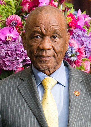
On 30 August 2014, Lesotho's Prime Minister Tom Thabane alleged that a coup d'état had been launched against him. This followed a previous allegation which caused him to suspend parliament over possible extra-constitutional manoeuvres. It also followed pressure from South Africa to maintain the democratic process. The next day, Deputy Prime Minister Mothetjoa Metsing assumed responsibility for running the government. An early election was held in February 2015 as a result of South African-led Southern African Development Community (SADC) mediation, giving power to the opposition.
Lehlohonolo Moses Maliehe is a South African former professional soccer player who was most recently manager of Lesotho.

'Mantsopa Anna Makhetha (1793–1908), often referred to as 'Mantsopa, was a Basotho prophetess, rainmaker, and storyteller. She advised King Moshoeshoe I and predicted the outcomes of several battles, including the Battle of Viervoet in 1851 and the Battle of Berea in 1852. She was exiled to Modderpoort in the late 1860s, where she converted to Christianity and was baptised in 1870. She fused Christianity with her own traditional Basotho customs.