Wayanad is a district in the north-east of the Indian state of Kerala, with administrative headquarters at the municipality of Kalpetta. It is the only plateau in Kerala. The Wayanad Plateau forms a continuation of the Mysore Plateau, the southern portion of Deccan Plateau which links the Western Ghats with the Eastern Ghats. It is set high in the Western Ghats with altitudes ranging from 700 to 2,100 meters. Vellari Mala, a 2,240 m (7,349 ft) high peak situated on the trijunction of Wayanad, Malappuram, and Kozhikode districts, is the highest point in Wayanad district. The district was formed on 1 November 1980 as the 12th district in Kerala, by carving out areas from Kozhikode and Kannur districts. An area of 885.92 km2 in the district is forested. Wayanad has three municipal towns—Kalpetta, Mananthavady and Sulthan Bathery. There are many indigenous tribes in this area. The Kabini River, a tributary of Kaveri River, originates at Wayanad. Wayanad district, along with the Chaliyar valley in the neighbouring Nilambur in Malappuram district, is known for natural gold fields, which are also seen in other parts of the Nilgiri Biosphere Reserve. Chaliyar river, which is the fourth longest river of Kerala, originates on the Wayanad plateau. The historically important Edakkal Caves are located in Wayanad district.
Nilambur is a major town, a municipality and a Taluk in the Malappuram district of the Indian state of Kerala. It is located close to the Nilgiris range of the Western Ghats on the banks of the Chaliyar River. This place is also known as 'Teak Town' because of the abundance of Nilambur teaks in this area; Which is a variety of a large, deciduous tree that occurs in mixed hardwood forests. Unlike many Municipalities of India; Nilambur is covered with large amounts of vegetation making it close to nature and hence make it very scenic and inspiring.

Kalpetta is a major City, Town and municipality in the Wayanad district of the Indian state of Kerala. Kalpetta is the headquarters, Capital of Wayanad district, as well as the headquarters of Vythiri taluk. It is a bustling city, town surrounded by dense coffee and tea plantations and mountains. It lies on the Kozhikode-Mysore National Highway NH 766 at an altitude of about 780 m above sea level. Kalpetta is 72 km from Kozhikode and 140 km from Mysore.
Sultan Bathery is a town and municipality in the Wayanad district of Kerala, India, near its borders with Tamil Nadu and Karnataka. Once known as a strategic location in the Malabar region, Sultan Bathery is now the largest town in Wayanad, and is the headquarters of the Sultan Bathery taluk.

Ghat Roads are access routes into the mountainous Western and Eastern Ghats, mountain ranges of the Indian subcontinent. These roads are remarkable feats of engineering, and most were constructed during the British Raj. Ghat Roads were built to connect to the hill stations established in the mountains for residents to avoid summer heat. They generally served to connect coastal areas with the upper Deccan Plateau.

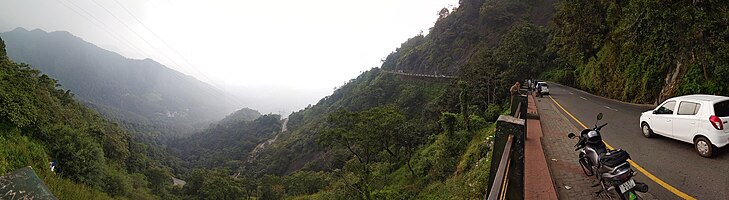
Lakkidi is a rain forest located in a gateway of the Wayanad district of the Indian state of Kerala. During British Raj, a horse track in Wayanad attracted European investors and traders. They cultivated Malabar pepper, spices, tea, and coffee. National Highway 766 connects Kozhikode in Kerala with Kollegal in Karnataka via Mysore, creating business opportunities in tourism and agriculture. Lakkidi is surrounded by a biodiverse environment and unspoiled nature which attracts visitors interested in bird-watching, trekking, and off-roading. Jawahar Navodaya Vidyalaya is situated there.
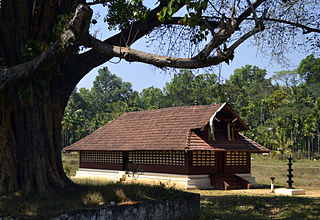
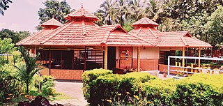
Valliyoorkkavu is an ancient Bhagavathy temple located near Mananthavady in the Wayanad district. The temple is for Goddess Durga as its presiding deity in three forms namely: Vana Durga, Bhadrakali, and Jala Durga.
Kodanchery is a town in Kozhikode district in the state of Kerala, India.

Puthuppadi is a village and Panchayath located in Kozhikode district of Kerala, India. Puthuppadi Grama Panchayat covers an area of 64.75 km2 and is spread over the villages of Engapuzha and Puthuppadi. The panchayat is bounded on the north by Thamarassery, Kattippara, Kodenchery, Vythiri (Wayanad) panchayats, on the east by Vythiri (Wayanad) and Kodancheri panchayats, on the south by Thamarassery and Kodancheri panchayats and on the west by Kattippara panchayat. Famous Wayandan Churam or Wayandan Pass, which has nine hairpins between Adivaram of Puthuppady Panchayath and Lakkidi of Vythri Panchayath, is in Puthuppadi Panchayat.

Kottathara or Venniyode is a gram panchayat of Wayanad district, Kerala State, India.

Panamaram is a town,village in Wayanad district in the state of Kerala, India.

Thamarassery, formerly known as Thazhmalachery, is one of the taluks and a major hill town in the Kozhikode district of Kerala, India, 30 km north-east of Kozhikode (Calicut) city and 29 km east of Koyilandy. The town lies on National highway 766.

Banasura Hill is one of the tallest mountains in the Western Ghats of the Wayanad district, Kerala, India. The hill is named after Banasura, a mythical character of Indian legends. It is one of the highest peaks exceeding 2,000m between Nilgiris and Himalayas after Chembra Peak.
Kuttiady is a Major town situated in the north-eastern part of Kozhikode district of Kerala, India. It is located 24 km (15 mi) from Vadakara and 50 km (31 mi) from Kozhikode. Kuttiady is situated in the slopes of the Western Ghats.

Vythiri is a small village, town and tourist destination located in the Wayanad district in the Indian state of Kerala. It is one of the three Taluks in the district with the other two being Mananthavady and Sulthan Bathery.

National Highway 766 is a National Highway in Southern India. NH 766 connects Kozhikode in Kerala with Kollegal in Karnataka via Mysore. Of the total distance of 272 km, 117 km is in Kerala and 155 is in Karnataka. At Kollegal, it joins National Highway 948, which connects Bengaluru and Coimbatore. The highway passes through dense forests of Western ghats of India. The NH-766 passes through 19.7 km Bandipur National Park and Wayanad wild life sanctuary.

The district capital of Wayanad is Kalpetta town. Kalpetta has very good road connectivity with the rest of Kerala and neighboring South Indian cities. National Highway 766 (India) NH766 connects Kalpetta with Kozhikode and Mysore. State Highways connect Kalpetta with Ooty in Tamil Nadu and Madikeri in Karnataka.

Kayakkunnu is a village near Nadavayal, Mananthavady in the Wayanad District of Kerala, India. The village is part of the Panamaram Panchayath, and the assembly constituency is Mananthavady. It is an agricultural area and its main crops include rice, coffee, pepper, ginger, cardamom, vanilla, rubber, areca nut, and coconut. The nearest towns are Nadavayal and Panamaram. Kayakkunn is situated midway along the Mananthavady–Gudalur interstate road.

Karinthandan is a legendary figure in the history of Wayanad, a district in the Indian state of Kerala. He is revered as a tribal chieftain who sacrificed his life to protect his people and their land. tris.
Kozhikode–Wayanad Tunnel Road is a proposed twin-tube tunnel road project in the South Indian state of Kerala. The proposed tunnel, which is being described as the third longest underpass in India would run through the sensitive hills and forests of the Western Ghats. It would provide an alternate route between Kozhikode and Wayanad and will reduce the distance between Anakkampoil and Meppady from 42 kilometres to less than 20 kilometres. The tunnel road is also expected to lead to a better economic growth and development in the region. Once the construction is completed, the distance between Kochi and Bengaluru would be shortened, and the districts of Wayanad and Kozhikode will be linked without crossing the Thamarassery Churam. The construction of the tunnel is expected to begin in 2024 at an estimated cost of ₹2100 crores.