The Bentway

Last updated

The Bentway
The Bentway near Garrison Common 2023.jpg
A section of The Bentway near Garrison Common in 2023
Length1.75 km (1.09 mi)
Location Toronto, Ontario, Canada
Website TheBentway.ca
Trail map

Contents

BSicon lhSTRa@g(r).svg
BSicon MFADEfq.svg
BSicon RP4.svg
BSicon fCONTg.svg
BSicon lhSTRa@g(l).svg
BSicon MFADEgq.svg
BSicon RP4.svg
BSicon lhSTR(r).svg
BSicon MFADEfq.svg
BSicon RP4.svg
BSicon RP2oq.svg
BSicon fSTR.svg
BSicon lhSTR(l).svg
BSicon MFADEgq.svg
BSicon RP4.svg
Strachan
BSicon lhSTR(r).svg
BSicon MFADEfq.svg
BSicon RP4.svg
BSicon RP2oq.svg
BSicon fSTR.svg
BSicon lhSTR(l).svg
BSicon MFADEgq.svg
BSicon RP4.svg
Garrison
BSicon lhSTR(r).svg
BSicon MFADEfq.svg
BSicon RP4.svg
BSicon BUILDINGr.svg
BSicon fSTR.svg
BSicon lhSTR(l).svg
BSicon MFADEgq.svg
BSicon RP4.svg
BSicon lhSTR(r).svg
BSicon MFADEfq.svg
BSicon RP4.svg
BSicon fSTR.svg
BSicon SKRZ-G2o.svg
BSicon lhSTR(l).svg
BSicon MFADEgq.svg
BSicon RP4.svg
Fort York Blvd
BSicon lhSTR(r).svg
BSicon MFADEfq.svg
BSicon RP4.svg
BSicon fSTR.svg
BSicon RP2q.svg
BSicon lhSTR(l).svg
BSicon MFADEgq.svg
BSicon RP4.svg
Iannuzzi
BSicon lhSTR(r).svg
BSicon MFADEfq.svg
BSicon RP4.svg
BSicon fSTR.svg
BSicon RP4q.svg
BSicon RP4sRP2.svg
BSicon lhSTR(l).svg
BSicon MFADEgq.svg
BSicon RP4.svg
Bathurst BSicon CLRV.svg
BSicon lhSTR(r).svg
BSicon MFADEfq.svg
BSicon RP4.svg
BSicon fSTR.svg
BSicon RP1q.svg
BSicon RP2wRP1.svg
BSicon lhSTR(l).svg
BSicon MFADEgq.svg
BSicon RP4.svg
Housey
BSicon lhSTR(r).svg
BSicon MFADEfq.svg
BSicon RP4.svg
BSicon fSTR.svg
BSicon RP2q.svg
BSicon RP2nRP2.svg
BSicon lhSTR(l).svg
BSicon MFADEgq.svg
BSicon RP4.svg
Dan Leckie
BSicon lhSTR(r).svg
BSicon MFADEfq.svg
BSicon RP4.svg
BSicon fTEEl.svg
BSicon fCONTfq.svg
BSicon lhSTR(l).svg
BSicon MFADEgq.svg
BSicon RP4.svg
Canoe Landing
BSicon lhSTR(r).svg
BSicon MFADEfq.svg
BSicon RP4.svg
BSicon fTEEl.svg
BSicon RP2w.svg
BSicon lhSTR(l).svg
BSicon MFADEgq.svg
BSicon RP4.svg
Brunel
BSicon lhSTRe@f(r).svg
BSicon MFADEfq.svg
BSicon RP4.svg
BSicon fCONTf.svg
BSicon lhSTRe@f(l).svg
BSicon MFADEgq.svg
BSicon RP4.svg

The Bentway, formerly Project: Under Gardiner, [1] is a public trail and corridor space underneath the Gardiner Expressway in Toronto, Ontario, Canada. It is repurposed land that was in sections vacant, [2] rail lines, parking lots and outdoor storage.

History

A section underneath the Gardiner Expressway near Fort York in 2007, nearly a decade before work on The Bentway began Gardiner (497280174).jpg
A section underneath the Gardiner Expressway near Fort York in 2007, nearly a decade before work on The Bentway began

The initial idea to transform the underside of the Gardiner Expressway into a public space came from Judy Matthews, a local Toronto urban planner and activist. On November 17, 2015, after the city's mayor approved the park initiative, Matthews donated CA$25 million for the park to the City of Toronto government through the Judy and Wilmot Matthews Foundation. The donation represented one of the most significant gifts in Toronto's history, and it was hoped that it would inspire other Torontonians to make similar philanthropic contributions to city-building initiatives. Waterfront Toronto, a revitalization agency representing the governments of Toronto, Ontario and Canada, was brought on board to collaborate with the city, along with Ken Greenberg Consultants Incorporated and Public Work to manage project planning and design. [3] [4] [5]

The project was given the working name "Project: Under Gardiner". A public naming contest was launched in March 2016, and the public submitted 884 different name suggestions. A panel of 12 artists, policy experts and community leaders took the suggestions and whittled them down to a shortlist of four names: "The Artery," "The Bentway," "The Canopy," and "Gathering Place." The public voting between these four options occurred between April 28 and May 8, 2016. The Bentway remained a firm leader throughout the vote with The Artery behind in second place by 10 percentage points, but in the last hours before voting closed, Waterfront Toronto observed a surge in votes for The Artery. The legitimacy of the votes was questioned, and a second runoff vote was held between The Bentway and The Artery. On June 6, 2016, The Bentway was revealed as the new official winner of the naming contest. [1] [6] [7]

Construction of the Bentway was completed in phases, with the first phase opened on January 6, 2018, including a winter skating trail. [8] [9]

Layout

Bentway Staging Grounds near Canoe Landing Park The Bentway near Canoe Landing Park 2023.jpg
Bentway Staging Grounds near Canoe Landing Park

The conceptual vision of The Bentway consists of a 1.75 kilometres (1.09 mi) long multi-use trail between Exhibition GO Station to Spadina Avenue. It hosts activities such as farmer's markets, gardens, performances, ice skating and festivals, spanning three main sections. [10] The Bentway spans six Toronto neighbourhoods with a total of 77,000 residents: Liberty Village, Niagara, Fort York, Fashion District, CityPlace, and Harbourfront. [10]

Staging Grounds

Bentway Staging Grounds, located at Dan Leckie Way and Lake Shore Boulevard, opened in September 2023. [11] To the south of Canoe Landing Park, Bentway Staging Grounds includes a network of ramps and elevated walkways for pedestrians and cyclists. [12] This public infrastructure blends art, public space, experimentation, education and environmental regeneration. [13] Designed by Agency—Agency (New York City) and SHEEEP (Toronto), [14] Bentway Staging Grounds collects and leverages runoff water from the highway into oversized planters in the space below. [15] These planters support the growth of diverse, native plant species. Water filtration and retention helps to reduce the risk of flooding. [16]

Winter Skating

In the winter, part of The Bentway is converted into a public ice skating trail and exhibits public art by local artists. [17] During the 2022-2023 season, Shellie Zhang's installation Beacons was on display. [18] [17] During the 2023-2024 season, Canadian artistic duo Yi Zhou and Carlos Portillo’s installation The Gateway is on display. [19]

Related Research Articles

The Frederick G. Gardiner Expressway, commonly known as the Gardiner Expressway or simply the Gardiner, is a partially at grade and elevated municipal expressway in Toronto, Ontario, Canada. Running close to the shore of Lake Ontario, it extends from the foot of the Don Valley Parkway (DVP) in the east, just past the mouth of the Don River, to the junction of Highway 427 and the Queen Elizabeth Way (QEW) in the west, for a total length of 18.0 kilometres (11.2 mi). East of Dufferin Street to just east of the Don River, the roadway is elevated for a length of 6.8 kilometres (4.2 mi), unofficially making it the longest bridge in Ontario, as it runs above Lake Shore Boulevard east of Spadina Avenue. The Gardiner Expressway is wholly owned and operated by the Province of Ontario.

The Don Valley Parkway (DVP) is a municipal freeway in Toronto, Ontario, Canada, which connects the Gardiner Expressway in downtown Toronto with Highway 401. North of Highway 401, it continues as Highway 404. The parkway runs through the parklands of the Don River valley, after which it is named. It has a maximum speed limit of 90 km/h (56 mph) for its entire length of 15.0 km (9.3 mi). It is six lanes for most of its length, with eight lanes north of York Mills Road and four lanes south of Eastern Avenue. As a municipal road, it is patrolled by the Toronto Police Service.

<span class="mw-page-title-main">Harbourfront, Toronto</span> Neighbourhood in Toronto, Ontario, Canada

Harbourfront is a neighbourhood on the northern shore of Lake Ontario within the downtown core of the city of Toronto, Ontario, Canada. Part of the Toronto waterfront, Harbourfront extends from Bathurst Street in the west, along Queens Quay, with its ill-defined eastern boundary being either Yonge Street or York Street. Its northern boundary is the Gardiner Expressway. Much of the district was former water lots filled in during the early 1900s to create a larger harbour district. After shipping patterns changed and the use of the Toronto harbour declined, the area was converted from industrial uses to a mixed-use district that is mostly residential and leisure.

<span class="mw-page-title-main">David Crombie</span> Canadian politician; mayor of Toronto

David Edward Crombie is a former Canadian academic and politician who served as the 56th mayor of Toronto from 1972 to 1978. Crombie was elected to Parliament following his tenure as mayor. A member of the Progressive Conservative (PC) Party, he served as minister of national health and welfare from 1979 to 1980, minister of Indian affairs and northern development from 1984 to 1986, and secretary of state for Canada from 1986 to 1988.

<span class="mw-page-title-main">John Tory</span> Mayor of Toronto from 2014 to 2023

John Howard Tory is a Canadian broadcaster, businessman, and former politician who served as the 65th mayor of Toronto from 2014 to 2023. He served as leader of the Official Opposition in Ontario from 2005 to 2007 while he was leader of the Progressive Conservative Party of Ontario from 2004 to 2009.

<span class="mw-page-title-main">Toronto waterfront</span> Shore of Lake Ontario in Toronto, Canada

The Toronto waterfront is the lakeshore of Lake Ontario in the city of Toronto, Ontario, Canada. It spans 46 kilometres between the mouth of Etobicoke Creek in the west and the Rouge River in the east.

<span class="mw-page-title-main">Parkdale—High Park (federal electoral district)</span> Federal electoral district in Ontario, Canada

Parkdale—High Park is a federal electoral district in Ontario, Canada, that has been represented in the House of Commons of Canada since 1979. It was created during the 1976 electoral boundaries redistribution from parts of Parkdale, High Park—Humber Valley, Davenport and Spadina districts. As of the October 19, 2015, Canadian general election, the current Member of Parliament (MP) is Liberal member Arif Virani. According to the 2016 census, Parkdale—High Park has the lowest percentage of visible minorities (26.2%) among all City of Toronto ridings; it also has the highest percentage of people of Irish (20.0%), German (9.8%), and French (8.9%) ethnic origin of all City of Toronto ridings.

<span class="mw-page-title-main">Spadina Avenue</span> Thoroughfare in Toronto, Ontario

Spadina Avenue is one of the most prominent streets in Toronto, Ontario, Canada. Running through the western section of downtown, the road has a very different character in different neighbourhoods.

<span class="mw-page-title-main">Cancelled expressways in Toronto</span> Unbuilt freeways in Toronto, Canada

The cancelled expressways in Toronto were a planned series of expressways in Toronto, Ontario, Canada that were only partially built or cancelled due to public opposition. The system of expressways was intended to spur or handle growth in the suburbs of Toronto, but were opposed by citizens within the city of Toronto proper, citing the demolition of homes and park lands, air pollution, noise and the high cost of construction. The Spadina Expressway, planned since the 1940s, was cancelled in 1971 after being only partially constructed. After the Spadina cancellation, other expressway plans, intended to create a 'ring' around the central core, were abandoned.

<span class="mw-page-title-main">Waterfront Trail</span> Pedestrian and bicycle trail system in Ontario, Canada

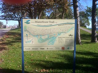
Stretching over 3600 km from Prince Township, west of Sault Ste. Marie, to the Quebec border, the Great Lakes Waterfront Trail is a signed route of interconnecting roads and off-road trails joining over 150 communities and First Nations along the Canadian shores of the Great Lakes and St. Lawrence River. A celebration of nature and culture, the Great Lakes Waterfront Trail is part of a strategy to protect and connect people to the largest group of freshwater lakes on earth. It is a legacy project of the Waterfront Regeneration Trust, a charity, and its community partners. Through Toronto, the trail is called the Martin Goodman Trail. The Waterfront Trail is also used by commuters in parts of Southern Ontario.

Transportation in the Canadian city of Toronto forms the hub of the road, rail and air networks in the Greater Toronto Area and much of southern Ontario. There are many forms of transport in the city, including railways, highways, and public transit. Toronto also has an extensive network of bicycle lanes and multi-use trails and paths.

<span class="mw-page-title-main">Transit City</span> Proposed Toronto public transit plan

Transit City was a plan for developing public transport in Toronto, Ontario, Canada. It was first proposed and announced on 16 March 2007 by Toronto mayor David Miller and Toronto Transit Commission (TTC) chair Adam Giambrone. The plan called for the construction of seven new light rail lines along the streets of seven priority transit corridors, which would have eventually been integrated with existing rapid transit, streetcar, and bus routes. Other transit improvements outlined in the plan included upgrading and extending the Scarborough RT line, implementing new bus rapid transit lines, and improving frequency and timing of 21 key bus routes. The plan integrated public transportation objectives outlined in the City of Toronto Official Plan, the TTC Ridership Growth Strategy and Miller's 2006 election platform.

<span class="mw-page-title-main">West Don Lands</span> Neighbourhood in Toronto, Ontario, Canada

The West Don Lands are the site of a neighbourhood under construction in Toronto, Ontario, Canada. The area is bordered by the Don River, King Street, Parliament Street and the rail line adjacent to the Gardiner Expressway. It is 80 hectares in size. A former industrial area, the area is being rebuilt as a mixed-use neighbourhood.

<span class="mw-page-title-main">Waterfront Toronto</span> Organization that oversees revitalization projects along the Toronto waterfront

Waterfront Toronto is an organization that oversees revitalization projects along the Toronto waterfront. Established in 2001 as a public–public partnership between the City of Toronto, Province of Ontario and Government of Canada, the organization is administering several blocks of land redevelopment projects surrounding Toronto Harbour and various other initiatives to promote the revitalization of the area, including public transit, housing developments, brownfield rehabilitation, possible removal of the Gardiner Expressway in the area, the Martin Goodman Trail and lakeshore improvements, and naturalization of the Don River. Actual development of the projects is done by other entities, primarily private corporations. The projects include a series of wavedeck walkways and gathering places designed by West 8 and DTAH.

<span class="mw-page-title-main">Fort York (neighbourhood)</span> Neighbourhood in Toronto, Ontario, Canada

Fort York, also known as Garrison, is a neighbourhood in Toronto, Ontario, Canada, located west of Downtown Toronto, north of Billy Bishop Toronto City Airport, and east of Exhibition Place along the shores of Lake Ontario. While it is home to Fort York, a National Historic Site, it also contains several mid and high-rise condominium buildings built during the 21st century.

<span class="mw-page-title-main">Railway Lands</span> Redevelopment district in Toronto, Ontario, Canada

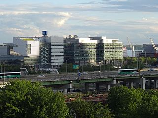
Railway Lands is an area in Downtown Toronto, Ontario, Canada. Originally a large railway switching yard near the Toronto waterfront, including the CNR Spadina Roundhouse and the CPR John Roundhouse, it has since been redeveloped and today is home to mostly mixed-used development, including the CN Tower and the Rogers Centre. The lands were owned and maintained by the Canadian National Railway and later transferred to the federal crown corporation Canada Lands Company. The area is bounded by Front Street, Yonge Street, Gardiner Expressway and Bathurst Street. The western portion of the Railway Lands is now part of the CityPlace neighbourhood and the eastern portion is now called South Core.

<span class="mw-page-title-main">East Bayfront</span> Neighbourhood in Toronto, Ontario, Canada

East Bayfront, or the East Bayfront Precinct, is an emerging neighbourhood in Toronto, Ontario, Canada. It is currently undergoing a transformation from industrial use to mixed-use as part of Waterfront Toronto's plans to create a residential and commercial district urban core near the lake.

<span class="mw-page-title-main">Jennifer Keesmaat</span> Canadian politician and urban planner (born 1970)

Jennifer Keesmaat is a Canadian real estate developer and urban planner who served as Chief City Planner of Toronto from 2012 to 2017 and the runner-up in the 2018 Toronto mayoral election to Mayor John Tory, where she won 23.6% of the vote and lost to Tory in each of Toronto's 25 wards.

<span class="mw-page-title-main">South Core, Toronto</span> Neighbourhood in Toronto, Ontario, Canada

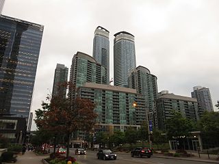
South Core is a neighbourhood located in downtown Toronto, Ontario, Canada. The South Core occupies the eastern portions of the Railway Lands. The remodeling and restoration of Union Station and the construction of a new wave of business and condominium towers is central to this area's forecast growth.

Forecasters expect the downtown population to grow 80 per cent to 130,000 by 2031. With the financial district just to the north and the new high-rise South Core on the other side, Union is right at the centre.

Shellie Zhang is a Chinese multidisciplinary artist based in Toronto, Ontario.

References

  1. 1 2 "Waterfront Toronto renames Under Gardiner project as the Bentway". Parkdale Villager. InsideToronto. June 6, 2016. Retrieved June 10, 2016.
  2. "Grand Opening: Experimental Gardens under the Gardiner Expressway". The Bentway. September 18, 2023. Retrieved November 30, 2023.
  3. Keenan, Edward (November 16, 2015). "Matthews generous with ideas, energy — and cash — for Toronto". Toronto Star. Retrieved November 25, 2016.
  4. "FAQ - Learn More About The Bentway". The Bentway. Retrieved November 25, 2016.
  5. "EX10.7 - Staff Report - Private Donation to Animate the F.G. Gardiner Expressway from Approximately Strachan Avenue to Spadina Avenue" (PDF). City of Toronto. Retrieved November 25, 2016.
  6. Fraser, Laura (May 9, 2016). "Vote-rigging suspected in naming of future Gardiner Expressway park". CBC. Retrieved December 2, 2016.
  7. Goffin, Peter (April 28, 2016). "Help choose a name for new-look land under Gardiner Expressway". Toronto Star. Retrieved December 2, 2016.
  8. Bozikovic, Alex (July 5, 2017). "Highway art: The Bentway defines the next wave of urban public spaces". The Globe and Mail .
  9. "'It's very Canadian': The Bentway skating trail under Gardiner opens this weekend". cbc.ca. January 5, 2018.
  10. 1 2 "WHAT IS THIS PROJECT?". Project: Under Gardiner. Archived from the original on June 17, 2016. Retrieved June 10, 2016.
  11. "New Bentway installation uses rainwater runoff from Gardiner Expressway to nurture plants". CBC News. September 18, 2023. Retrieved January 8, 2024.
  12. "Bentway Staging Grounds introduced under Gardiner Expressway". toronto.citynews.ca. Retrieved January 8, 2024.
  13. "Bentway Staging Grounds Brings Plant Life to Gardiner | Designlines". Designlines Magazine. September 22, 2023. Retrieved January 8, 2024.
  14. Novakovic, Stefan (September 29, 2023). "Infrastructure/Ecology: Staging Grounds Extends The Bentway". Azure Magazine. Retrieved January 8, 2024.
  15. Klein, Kristine (September 22, 2023). "Staging Grounds repurposes infrastructure as an educational garden". The Architect’s Newspaper. Retrieved January 8, 2024.
  16. "Staging Grounds — SHEEEP". sheeep.studio. Retrieved January 8, 2024.
  17. 1 2 "Attention, Toronto artists. Local landmarks are looking to exhibit your work". CBC News. January 25, 2023. Retrieved July 7, 2023.
  18. ""First Winter" Programming at The Bentway". The Bentway. Retrieved July 7, 2023.
  19. Fujio, Tim (December 5, 2023). "Northern Lights in the City: The Gateway at The Bentway". Setting Mind. Retrieved December 29, 2023.