Related Research Articles

Brazoria County is a county in the U.S. state of Texas. As of the 2020 census, the population of the county was 372,031. The county seat is Angleton.
Montgomery County is a county in the U.S. state of Texas. As of the 2020 U.S. census, the county had a population of 620,443. The county seat is Conroe. The county was created by an act of the Congress of the Republic of Texas on December 14, 1837, and is named for the town of Montgomery. Between 2000 and 2010, its population grew by 55%, the 24th-fastest rate of growth of any county in the United States. Between 2010 and 2020, its population grew by 36%. According to the U.S. Census Bureau, the estimated population is 711,354 as of July 1, 2023.

Waller County is a county in the U.S. state of Texas. As of the 2020 census, its population was 56,794. Its county seat is Hempstead. The county was named for Edwin Waller, a signer of the Texas Declaration of Independence and first mayor of Austin.

Walker County is a county located in the east central section of the U.S. state of Texas. As of the 2020 census, its population was 76,400. Its county seat is Huntsville. Initially, Walker County was named for Robert J. Walker, a legislator from Mississippi who introduced into the United States Congress the resolution to annex Texas. Walker later supported the U.S. during its Civil War and earned some enmity for it. In order to keep the county's name, the state renamed it for Samuel H. Walker, a Texas Ranger and soldier in the United States Army.

Liberty is a city in the U.S. state of Texas, within Liberty County. The population was 8,279 at the 2020 census. It serves as the seat of Liberty County.

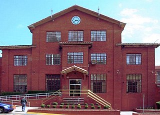
Huntsville is a city in and the county seat of Walker County, Texas, United States. The population was 45,941 as of the 2020 census. It is the center of the Huntsville micropolitan area. Huntsville is in the East Texas Piney Woods on Interstate 45 and home to Sam Houston State University, Texas State Prison, the Texas Department of Criminal Justice, Huntsville State Park, and HEARTS Veterans Museum of Texas.

Prairie View is a city in Waller County, Texas, United States, situated on the northwestern edge of the Houston–The Woodlands–Sugar Land metropolitan area. The population was 8,184 at the 2020 census.

East Texas is a broadly defined cultural, geographic, and ecological region in the eastern part of the U.S. state of Texas that comprises most of 41 counties. It is primarily divided into Northeast and Southeast Texas. Most of the region consists of the Piney Woods ecoregion. East Texas can sometimes be defined only as the Piney Woods. At the fringes, towards Central Texas, the forests expand outward toward sparser trees and eventually into open plains.

The Holocaust Museum Houston is located in Houston's Museum District, in Texas. It is the fourth largest holocaust museum in the U.S. It was opened in 1996.

Sunnyside is a community in southern Houston, Texas, United States, south of Downtown Houston.

Third Ward is an area of Houston, Texas, United States, that evolved from one of the six historic wards of the same name. It is located in the southeast Houston management district.
Texas State Penitentiary at Huntsville or Huntsville Unit (HV), nicknamed "Walls Unit", is a Texas state prison located in Huntsville, Texas, United States. The approximately 54.36-acre (22.00 ha) facility, near downtown Huntsville, is operated by the Correctional Institutions Division of the Texas Department of Criminal Justice. The facility, the oldest Texas state prison, opened in 1849.

Hockley is an unincorporated community located in Harris County, Texas, United States, on Texas State Highway 6 and U.S. Highway 290, approximately five miles southeast of the city hall of Waller, and 36 mi (57.9 km) northwest of downtown Houston.

Fourth Ward is one of the historic six wards of Houston, Texas, United States. The Fourth Ward is located inside the 610 Loop directly west of and adjacent to Downtown Houston. The Fourth Ward is the site of Freedmen's Town, which was a post-U.S. Civil War community of African-Americans.
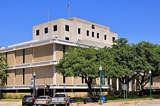
Huntsville Independent School District is a public school district based in the Hawkins Administration Building in Huntsville, Texas, United States.
Samuel Walker Houston was an American pioneer in the field of education.
Gulf Coast Trades Center / Raven School (GCTC) is a charter boarding school located in unincorporated Walker County, Texas, near New Waverly. The school, operated by the nonprofit agency Gulf Coast Trades Center Inc., is in proximity to Houston.

Project Row Houses is a development in the Third Ward area of Houston, Texas. Project Row Houses includes a group of shotgun houses restored in the 1990s. Eight houses serve as studios for visiting artists. Those houses are art studios for art related to African-American themes. A row behind the art studio houses single mothers.

Jesse Lott was an American visual artist known for his wire and wood sculptures, papier mâché figures, and collages made from found materials within a style he called "urban frontier art".

The Community Artists' Collective is a non-profit exhibition space based in Houston, Texas, USA, focused on exhibiting work by African American artists and creating more opportunities for children and adults to explore the arts.
References
- Allan Turner (1995-02-05). "A Wall of Hope: Sculpture puts human faces on legacy of black school". The Houston Chronicle, State section. p. 1.