
Nolita, sometimes written as NoLIta and deriving from "North of Little Italy", is a neighborhood in the borough of Manhattan in New York City. Nolita is situated in Lower Manhattan, bounded on the north by Houston Street, on the east by the Bowery, on the south roughly by Broome Street, and on the west by Lafayette Street. It lies east of SoHo, south of NoHo, west of the Lower East Side, and north of Little Italy and Chinatown.

Little Italy is a neighborhood in Lower Manhattan in New York City, known for its Italian population. It is bounded on the west by Tribeca and Soho, on the south by Chinatown, on the east by the Bowery and Lower East Side, and on the north by Nolita.

Greenpoint is the northernmost neighborhood in the New York City borough of Brooklyn, in the U.S. state of New York. It is bordered on the southwest by Williamsburg at Bushwick Inlet Park and McCarren Park; on the southeast by the Brooklyn–Queens Expressway and East Williamsburg; on the north by Newtown Creek and the neighborhood of Long Island City in Queens; and on the west by the East River. The neighborhood has a large Polish immigrant and Polish-American community, containing many Polish restaurants, markets, and businesses, and it is often referred to as Little Poland.

East Williamsburg is a name for the area in the northwestern portion of Brooklyn, New York City, United States. East Williamsburg consists roughly of what was the 3rd District of the Village of Williamsburgh and what is now called the East Williamsburg In-Place Industrial Park (EWIPIP), bounded by the neighborhoods of Northside and Southside Williamsburg to the west, Greenpoint to the north, Bushwick to the south and southeast, and both Maspeth and Ridgewood in Queens to the east. Much of this area is still referred to as either Bushwick, Williamsburg, or Greenpoint with the term East Williamsburg falling out of use since the 1990s.

Williamsburg is a neighborhood in the New York City borough of Brooklyn, bordered by Greenpoint to the north; Bedford–Stuyvesant to the south; Bushwick and East Williamsburg to the east; and the East River to the west. It was an independent city until 1855, when it was annexed by Brooklyn; around that time, the spelling was changed from Williamsburgh to Williamsburg.

Bushwick is a neighborhood in the northern part of the New York City borough of Brooklyn. It is bounded by the neighborhood of Ridgewood, Queens, to the northeast; Williamsburg to the northwest; East New York and the cemeteries of Highland Park to the southeast; Brownsville to the south; and Bedford–Stuyvesant to the southwest.

Bedford–Stuyvesant, colloquially known as Bed–Stuy, is a neighborhood in the northern section of the New York City borough of Brooklyn. Bedford–Stuyvesant is bordered by Flushing Avenue to the north, Classon Avenue to the west, Broadway to the east, and Atlantic Avenue to the south. The main shopping street, Fulton Street, runs east–west the length of the neighborhood and intersects high-traffic north–south streets including Bedford Avenue, Nostrand Avenue, and Stuyvesant Avenue. Bedford–Stuyvesant contains four smaller neighborhoods: Bedford, Stuyvesant Heights, Ocean Hill, and Weeksville. Part of Clinton Hill was once considered part of Bedford–Stuyvesant.

The B44 is a public transit line in Brooklyn, New York City, running mostly along Nostrand Avenue, as well as northbound on Rogers Avenue or New York Avenue and Bedford Avenue, between Sheepshead Bay and Williamsburg. Originally a streetcar line, it is now the B44 bus route, operated by the New York City Transit Authority.
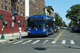
The Sumner Avenue Line and New Lots Avenue Line were two streetcar lines in Brooklyn, New York City, running mainly along Marcus Garvey Boulevard, East 98th Street, and New Lots Avenue between northern Bedford–Stuyvesant and New Lots. Originally streetcar lines, the two lines were combined as a bus route in 1947. That bus route became the present B15 Marcus Garvey Boulevard / New Lots Avenue service, operated by MTA New York City Bus' East New York Depot in East New York. The B15 continues east from New Lots to John F. Kennedy International Airport in Queens.
Bedford Avenue is the longest street in Brooklyn, New York City, stretching 10.2 miles (16.4 km) and 132 blocks, from Manhattan Avenue in Greenpoint south to Emmons Avenue in Sheepshead Bay, and passing through the neighborhoods of Williamsburg, Bedford-Stuyvesant, Crown Heights, Flatbush, Midwood, Marine Park, and Sheepshead Bay.

Duff's Brooklyn is a heavy metal bar located at 168 Marcy Avenue in Williamsburg, Brooklyn, New York City.
Moore Street Market, often referred to as La Marqueta de Williamsburg, is one of four surviving public markets built by mayor Fiorello La Guardia in New York City in 1941 to get pushcarts off crowded and unclean streets. It is located at 110 Moore Street in the Williamsburg neighborhood of northern Brooklyn.

McNally Jackson Books is an independent bookstore based in Manhattan, New York, owned and operated since 2004 by Sarah McNally, a former editor at Basic Books and the child of Holly and Paul McNally, the founders of the Canadian McNally Robinson Booksellers chain. McNally Jackson's publishing arm is McNally Editions, devoted to rediscovering unduly neglected books. McNally Jackson also operates two Goods for the Study stationery stores on Mulberry Street and West 8th Street.

Broadway is an avenue in the New York City borough of Brooklyn that extends from the East River in the neighborhood of Williamsburg in a southeasterly direction to East New York for a length of 4.32 miles (6.95 km). It was named for the Broadway in Manhattan. The East New York terminus is a complicated intersection with East New York Avenue, Fulton Street, Jamaica Avenue, and Alabama Avenue. The BMT Jamaica Line of the New York City Subway runs on elevated tracks over Broadway from the Williamsburg Bridge to East New York on its way to Queens. Broadway forms the boundary between the neighborhoods of Bushwick, which lies above Broadway to the northeast, and Bedford–Stuyvesant, which is to the southwest.

Elizabeth Street is a street in Manhattan, New York City, which runs north-south parallel to and west of the Bowery. The street is a popular shopping strip in Manhattan's Nolita neighborhood.

Taïm is a Mediterranean fast casual restaurant chain. Its oldest location is at 45 Spring Street, in NoLita in Manhattan, New York City.

There are over 50 farmer's markets in New York City in all boroughs, which operate under GrowNYC under the "Greenmarket" name. GrowNYC's food hub, "Greenmarket", includes Greenmarket Co., Youthmarket, Fresh Food Box, and the Wholesale Greenmarket under its programming. Greenmarket farmers market aims to encourage regional agriculture by allowing small family farms to sell their locally grown fruits, vegetables, flowers, dairy and other products, so that people in New York of all incomes and in all parts, have access to the fresh, nutritious, provincial, affordable and sustainable goods.

Macri Triangle is a 0.57 acres park located at the intersection of Meeker Avenue, Union Avenue, and Metropolitan Avenue in Williamsburg, Brooklyn, New York City. The property was designated as a park in 1946 during the construction of the Brooklyn-Queens Expressway, which resulted in the demolition of buildings along its route and the extension of Meeker Avenue from Richardson Street south to Metropolitan Avenue, serving as the expressway's service road. As the highway ran through the street grid, triangular parcels that were too small to be developed were designated as public plazas, including this one.
Williamsburg General Hospital was the final name of a Brooklyn hospital that opened in the late 19th century and both moved and changed names more than once. One of these names is associated with "Brooklyn's first woman ambulance surgeon," Mary Crawford. Today that location houses an apartment building and an earlier one became a playground.
