Bryce Canyon National Park is an American national park located in southwestern Utah. The major feature of the park is Bryce Canyon, which despite its name, is not a canyon, but a collection of giant natural amphitheaters along the eastern side of the Paunsaugunt Plateau. Bryce is distinctive due to geological structures called hoodoos, formed by frost weathering and stream erosion of the river and lake bed sedimentary rock. The red, orange, and white colors of the rocks provide spectacular views for park visitors. Bryce Canyon National Park is much smaller and sits at a much higher elevation than nearby Zion National Park. The rim at Bryce varies from 8,000 to 9,000 feet.
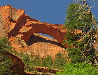
Kolob Arch is a natural arch in Zion National Park, Utah, United States. According to the Natural Arch and Bridge Society (NABS), it is the sixth-longest natural arch in the world. In 2006, the Society measured the span at 287.4 ± 2 feet, which is slightly shorter than Landscape Arch in Arches National Park. Differences in measuring technique or definitions could produce slightly different results and change this ranking.

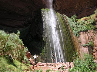
The Narrows is the narrowest section of Zion Canyon in Zion National Park, Utah, United States. Situated on the North Fork of the Virgin River and upstream of the main canyon, The Narrows is one of the premier hikes in the park and on the Colorado Plateau. The Narrows refers to both the 3.6-mile (5.8 km) bottom-up hike from the Temple of Sinawava to Big Springs, as well as the 16-mile (26 km) top-down hike from Chamberlain's Ranch back to the Temple of Sinawava.

The geology of the Zion and Kolob canyons area includes nine known exposed formations, all visible in Zion National Park in the U.S. state of Utah. Together, these formations represent about 150 million years of mostly Mesozoic-aged sedimentation in that part of North America. Part of a super-sequence of rock units called the Grand Staircase, the formations exposed in the Zion and Kolob area were deposited in several different environments that range from the warm shallow seas of the Kaibab and Moenkopi formations, streams and lakes of the Chinle, Moenave, and Kayenta formations to the large deserts of the Navajo and Temple Cap formations and dry near shore environments of the Carmel Formation.
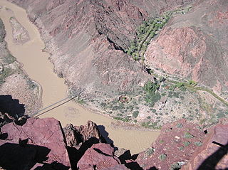
The South Kaibab Trail is a hiking trail in Grand Canyon National Park, located in the U.S. state of Arizona. Unlike the Bright Angel Trail which also begins at the south rim of the Grand Canyon and leads to the Colorado River, the South Kaibab Trail follows a ridge out to Skeleton Point allowing for 360-degree views of the canyon.
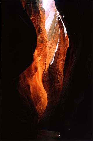
Buckskin Gulch is a gulch and canyon located in southern Kane County, Utah, near the Arizona border in the Paria Canyon-Vermilion Cliffs Wilderness. With a length of over 13 mi, it is one of the main tributaries of the Paria River, a tributary of the Colorado River.

The Wave is a sandstone rock formation located in Arizona, US, near its northern border with Utah. The formation is situated on the slopes of the Coyote Buttes in the Paria Canyon-Vermilion Cliffs Wilderness of the Colorado Plateau. The area is administered by the Bureau of Land Management (BLM) at the Grand Staircase–Escalante National Monument visitor center in Kanab, Utah.

Zion Canyon is a deep and narrow gorge in southwestern Utah, United States, carved by the North Fork of the Virgin River. Nearly the entire canyon is located within the western half of Zion National Park.

State Route 9 (SR-9) is a 57.075-mile-long (91.853 km) state highway in southern Utah, serving Zion National Park. It starts at the western terminus at exit 16 on Interstate 15 (I-15), passing through Zion National Park, and ending at the eastern junction with U.S. Route 89 (US-89). The entire length of the highway has been designated the Zion Park Scenic Byway. There is a fee to travel through Zion National Park, but the Zion-Mt. Carmel Highway is open to private vehicles year-round. A separate fee is required for vehicles 7'10" wide and/or 11'4" tall or larger. This fee pays for a park employee to stop traffic from the other side of the Zion - Mt. Carmel Tunnel to allow the larger vehicles to pass through. There is a smaller tunnel in Zion National Park that does not require an escort. Commercial vehicles are prohibited from using SR-9 and are directed to use SR-20 instead.
The North Kaibab Trail is a hiking trail in the North Rim side of the Grand Canyon, in Grand Canyon National Park, located in the U.S. state of Arizona.

Horseshoe Canyon, formerly known as Barrier Canyon, is in a remote area west of the Green River and north of the Canyonlands National Park Maze District in Utah, United States. It is known for its collection of Barrier Canyon Style (BCS) rock art, including both pictographs and petroglyphs, which was first recognized as a unique style here. A portion of Horseshoe Canyon containing The Great Gallery is part of a detached unit of Canyonlands National Park. The Horseshoe Canyon Unit was added to the park in 1971 in an attempt to preserve and protect the rock art found along much of its length.
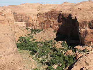
Coyote Gulch is a tributary of the Escalante River, located in Garfield and Kane Counties in southern Utah, in the western United States. Over 25 mi (40 km) long, Coyote Gulch exhibits many of the geologic features found in the Canyons of the Escalante, including high vertical canyon walls, narrow slot canyons, domes, arches, and natural bridges. The upper sections of Coyote Gulch are located within the Grand Staircase–Escalante National Monument, while its lower sections are located in the Glen Canyon National Recreation Area.
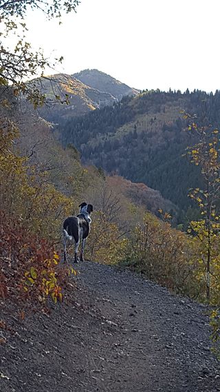
Millcreek Canyon is a canyon in the Wasatch Mountains and part of Millcreek City on the east side of the Salt Lake Valley, Utah. It is a popular recreation area both in the summer and in the winter. It was named by Brigham Young on August 22, 1847, before all of the mills that were built in and below the densely forested canyon. It is home to two restaurants and six Boy Scout Day Camps.
Zion National Park is an American national park located in southwestern Utah near the town of Springdale. Located at the junction of the Colorado Plateau, Great Basin, and Mojave Desert regions, the park has a unique geography and a variety of life zones that allow for unusual plant and animal diversity. Numerous plant species as well as 289 species of birds, 75 mammals, and 32 reptiles inhabit the park's four life zones: desert, riparian, woodland, and coniferous forest. Zion National Park includes mountains, canyons, buttes, mesas, monoliths, rivers, slot canyons, and natural arches. The lowest point in the park is 3,666 ft (1,117 m) at Coalpits Wash and the highest peak is 8,726 ft (2,660 m) at Horse Ranch Mountain. A prominent feature of the 229-square-mile (590 km2) park is Zion Canyon, which is 15 miles (24 km) long and up to 2,640 ft (800 m) deep. The canyon walls are reddish and tan-colored Navajo Sandstone eroded by the North Fork of the Virgin River. The park attracted 5 million visitors in 2023.

The Court of the Patriarchs is a sandstone cliff on the south face of the Three Patriarchs in Zion Canyon in Zion National Park in Washington County, Utah, United States.
Kolob Creek Dam is a dam in Washington County, Utah.

Tucupit Point is a prominent sandstone pinnacle in the Kolob Canyons area of Zion National Park in Washington County, Utah, United States.

Observation Point is a 6,507-foot (1,983 m) elevation Navajo Sandstone feature located in Zion National Park, in Washington County of southwest Utah, United States. Observation Point is situated at the north end of Zion Canyon, towering 2,100 feet above the canyon floor and the North Fork of the Virgin River which drains precipitation runoff from this viewpoint. A popular 8-mile round-trip trail climbs from the Weeping Rock trailhead along Zion Canyon Road to reach the top. Neighbors visible from the point include The Great White Throne, Cathedral Mountain, Angels Landing, and Cable Mountain. This geographical feature's name was officially adopted in 1934 by the U.S. Board on Geographic Names.

Mountain of the Sun is a 6,722-foot (2,049 m) elevation Navajo Sandstone summit located in Zion National Park, in Washington County of southwest Utah, United States. Mountain of the Sun is situated immediately east of Court of the Patriarchs, and south of Zion Lodge, towering 2,500 feet above the lodge and the floor of Zion Canyon. It is set on the east side of the North Fork of the Virgin River which drains precipitation runoff from this mountain. Its neighbors include The Sentinel, Mount Spry, The East Temple, and Mount Moroni. This feature's name was officially adopted in 1934 by the U.S. Board on Geographic Names.

The Towers of the Virgin is a series of several lofty sandstone monoliths on the west side of Zion Canyon in Zion National Park in Washington County, Utah, United States.