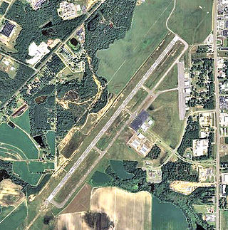
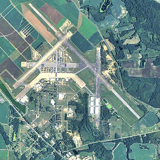
Southwest Georgia Regional Airport is an airport four miles southwest of Albany, in Dougherty County, Georgia, in the United States. The National Plan of Integrated Airport Systems for 2011–2015 categorized it as a primary commercial service airport. Federal Aviation Administration records say the airport had 39,200 passenger boardings (enplanements) in calendar year 2008, 33,044 in 2009 and 35,494 in 2010.

Tuskegee Airmen National Historic Site, at Moton Field in Tuskegee, Alabama, commemorates the contributions of African-American airmen in World War II. Moton Field was the site of primary flight training for the pioneering pilots known as the Tuskegee Airmen, and is now operated by the National Park Service to interpret their history and achievements. It was constructed in 1941 as a new training base. The field was named after former Tuskegee Institute principal Robert Russa Moton, who died the previous year.
Gardner Army Airfield is a former United States Army Air Force World War II Field located 9 miles southeast of Taft, California. It was named for Major John H. Gardner, a World War I aviator hero.
Douglas Municipal Airport is a public airport located two miles (3 km) south of the central business district of Douglas, a city in Coffee County, Georgia, United States. It is owned by the City of Douglas.

Sharpe Field is a closed private use airport located six nautical miles northwest of the central business district of Tuskegee, a city in Macon County, Alabama, United States. This airport is privately owned by the Bradbury Family Partnership.
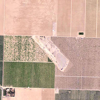
Hereford Army Airfield is an abandoned military airfield located about 2 miles west-southwest of Hereford, Arizona, United States.
Yucca Army Airfield is a former military airfield located about 1 mile (1.6 km) west of Yucca, in Mohave County, Arizona, United States. It is on the east side of Interstate 40, 25 miles (40 km) south of Kingman. It is now used as a private facility owned by Fiat Chrysler Automobiles named Chrysler Arizona Proving Grounds.

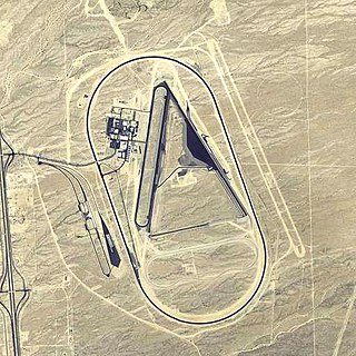
Grand Central Airport is a former airport in Glendale, California. Also known as Grand Central Air Terminal (GCAT), the airport was an important facility for the growing Los Angeles suburb of Glendale in the 1920s and a key element in the development of United States aviation. The terminal, located at 1310 Air Way, was built in 1928 and still exists, owned since 1997 by The Walt Disney Company as a part of its Grand Central Creative Campus (GC3). Three hangars also remain standing. The location of the single concrete 3,800-foot (1,200 m) runway has been preserved, but is now a public street as the runway was dug up and converted into Grand Central Avenue.

Dalhart Army Air Base is a former World War II military airfield complex near the city of Dalhart, Texas. It operated three training sites for the United States Army Air Forces from 1943 until 1945.
Spence Air Base was a United States Air Force base that operated from 1941 to 1961. It was later reopened as Spence Airport.

Anniston Air Force Base is a former United States Air Force airfield located approximately 10 miles north-northeast of Talladega, Alabama. It was active from 1942 to 1945 and 1949 to 1952. It is currently the site of the Talladega Superspeedway and Talladega Municipal Airport.

Fort Sumner Municipal Airport is a village owned, public use airport located two nautical miles (4 km) northeast of the central business district of Fort Sumner, a village in De Baca County, New Mexico, United States. It is included in the National Plan of Integrated Airport Systems for 2011–2015, which categorized it as a general aviation airport.

Curtis Field is a city-owned airport three miles northeast of Brady, in McCulloch County, Texas. The airport is named for Mayor Harry L. Curtis of Brady, who proposed the site as an auxiliary field for the United States Army Air Forces (USAAF). The FAA's National Plan of Integrated Airport Systems for 2009–2013 calls it a general aviation facility.
W. R. Byron Airport is a privately owned, private use airport in Riverside County, California, United States. It is located four nautical miles northwest of the central business district of Blythe, California, within the city limits.

Rankin Field is a former airport and military airfield located approximately 7 miles (11 km) southeast of Tulare, California. It was a United States Army Air Forces basic flying training facility during World War II. It is now an agricultural and light industrial site.

Helm Field also called Lemoore Auxiliary Army Airfield A-7 is a former US Army Airfield use for training during World War II. Helm Field was location in the town of Coalinga, California, 70 miles south of Fresno. Helm Field had two 3,000 foot runways, one oriented east/west and one oriented northwest/southeast. The Airfield was on a 773 acres site of form farm land. The US Army purchased the land on January 11, 1943 for training pilots. The Airfield was used by the Lemoore Basic Flying School, based at the Lemoore Army Air Field. Helm Field was 15 miles northwest of Lemoore Army Air Field. The Army built at Helm Field to support training stage house, control tower, motor pool building, crash truck shelter and latrines. Helm Field was used by Air Corps Basic Flying School, the AAF Basic Flying School, the AAF Pilot School, the 88th Air Base Squadron, the 3023rd Army Air Force Pilot School and the 461st Army Air Force Base Unit. The army closed Helm Field on October 15, 1844 and the Airfield was sold by the War Assets Administration. Helm Field was used as a farm labor camp in the 1950s. The east/west runway was returned to farmland. The northwest/southeast runway was still intact and was used as a civilian airfield till 1971.

Minter Army Airfield auxiliary fields were a number of airfields used during World War II to support the Minter Army Airfield near Shafter, California. Minter Army Airfield was also called Lerdo Field, after the nearby road. Minter Army Airfield also housed the Shafter Gap Filler Annex P-59A and Shafter Army Aviation Test Activity and opened in June 1941. An Army depot open on the base in October 1941, the Minter Sub-Depot, a division of the Sacramento Air Depot. Minter Army Airfield had 7,000 troops and civilians working at the base.
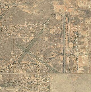
Victorville Army Airfield auxiliary fields were four airfields used during World War II to support the Victorville Army Airfield pilot training near Victorville, California, and Adelanto, California. After the war the Victorville Army Airfield was renamed George Air Force Base on January 13, 1948. The airfields were built in 1941 by the United States Army Air Corps just before the war. Victorville Army Airfield covered 2,200-acre in the Mojave Desert. The US Army held a groundbreaking ceremony on 12 July 1941. The base, called Victorville Army Flying School, was ready to use before the attack on Pearl Harbor on December 7, 1941. The Army built four runways in a triangle configuration, with one runway down the middle of the triangle. Seven hangars were built to support operation. On April 23, 1943, the base was renamed Victorville Army Airfield.

Merced Army Air Field auxiliary fields were built to support pilot training at the Merced Army Air Field. In 1940 the US Army wanted to build near Merced, California a 30,000 per year basic pilot training base. The former city of Cuba, Merced County, California near the Atchison, Topeka and Santa Fe Railway rail line was chosen at 37°22′50″N120°34′05″W at an elevation of 181 feet (55 m) for the main base, in Atwater, California. United States Army Air Corps leased the land from the City of Merced on 16 June 1941. Building the airbase school started on 8 July 1941 and opened on 20 September 1941 as a sub base of Army Air Forces Western Flying Training Command at Moffett Field. First called Air Corps Basic Flying School, Merced. The US Army moved part of the: 98th Bombardment Group, 539th School Squadrons, 540th School Squadrons, 541st School Squadrons, the 90th Air Base Squadron, and the 340th Material Squadron at Moffett Field to the new base in November 1941. The Air Corps Basic Flying School was renamed the Merced Army Flying School on 7 April 1942. To support the training auxiliary fields near the Merced Army Flying School were to be built for the flight training program. Merced Army Flying School was renamed the Merced Army Air Field in May 1943 and became part of the Western Flying Training Command.


 Thunderbird Pilots Memorial dedicated to the pilots who trained there during WW II
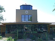 The historic Thunderbird Control Tower was built in 1941 and served as the Air Control Tower and Officers' quarters during the operation of the Thunderbird 1 Army Air Field, in Glendale. There American, British, Canadian and Chinese pilots trained during World War II. The air field was deactivated in 1945 and is now occupied by Arizona Christian University which is located southeast of the intersection of West Greenway Road & North 59th Avenue in Glendale, Arizona (GAHS).
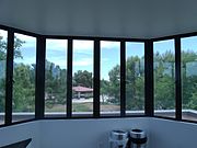 View from the inside of the historic Thunderbird Control Tower station
 Different view of the historic Thunderbird Control Tower. The tower and officer quarters were built in 1941 and served the Thunderbird 1 Army Air Field, in Glendale during WW II (GAHS).
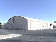 The historic Thunderbird 1 Army Air Field Airplane Hangar was built in 1941 (GAHS).
 Thunderbird Army Air Field barracks used during World War II by the pilots
 Thunderbird Army Air Field barracks