
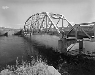
Bighorn Canyon National Recreation Area is a national recreation area established by an act of Congress on October 15, 1966, following the construction of the Yellowtail Dam by the Bureau of Reclamation. It is one of over 420 sites managed by the U.S. National Park Service. The recreation area spans 120,296.22 acres, straddling the border between Wyoming and Montana. It is divided into two distinct areas, the North District accessed via Fort Smith, Montana and the South District accessed through Lovell, Wyoming. There is no thru road inside the recreation area connecting the two districts. The Yellowtail Dam is located in the North District. It is named after the famous Crow leader Robert Yellowtail, harnesses the waters of the Bighorn River by turning that variable watercourse into Bighorn Lake. The lake extends 71 miles (114 km) through Wyoming and Montana, 55 miles (89 km) of which lie within the national recreation area. The lake provides recreational boating, fishing, water skiing, kayaking, and birding opportunities to visitors. About one third of the park unit is located on the Crow Indian Reservation. Nearly one-quarter of the Pryor Mountains Wild Horse Range lies within the Bighorn Canyon National Recreation Area.

The Tongue River is a tributary of the Yellowstone River, approximately 265 mi (426 km) long, in the U.S. states of Wyoming and Montana. The Tongue rises in Wyoming in the Big Horn Mountains, flows generally northeast through northern Wyoming and southeastern Montana, and empties into the Yellowstone River at Miles City, Montana. Most of the course of the river is through the beautiful and varied landscapes of eastern Montana, including the Tongue River Canyon, the Tongue River breaks, the pine hills of southern Montana, and the buttes and grasslands that were formerly the home of vast migratory herds of American bison.
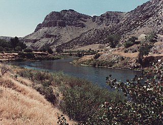
The Bighorn River is a tributary of the Yellowstone, approximately 461 miles (742 km) long, in the states of Wyoming and Montana in the western United States. The river was named in 1805 by fur trader François Larocque for the bighorn sheep he saw along its banks as he explored the Yellowstone.

The Little Bighorn River is a 138-mile-long (222 km) tributary of the Bighorn River in the United States in the states of Montana and Wyoming. The Battle of the Little Bighorn, also known as the Battle of the Greasy Grass, was fought on its banks on June 25–26, 1876, as well as the Battle of Crow Agency in 1887.

The Bighorn Mountains are a mountain range in northern Wyoming and southern Montana in the United States, forming a northwest-trending spur from the Rocky Mountains extending approximately 200 mi (320 km) northward on the Great Plains. They are separated from the Absaroka Range, which lie on the main branch of the Rockies to the west, by the Bighorn Basin. Much of the land is contained within the Bighorn National Forest.
The Wind River is the name applied to the upper reaches of the Bighorn River in Wyoming in the United States. The Wind River is 185 miles (298 km) long. The two rivers are sometimes referred to as the Wind/Bighorn.
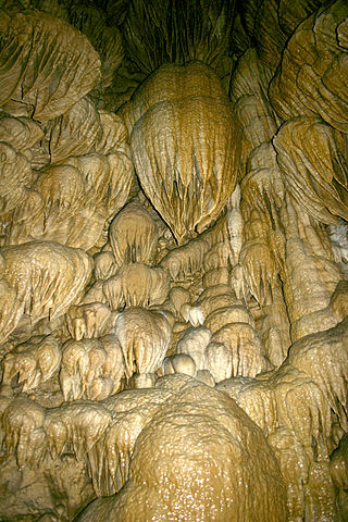
Oregon Caves National Monument and Preserve is a protected area in the northern Siskiyou Mountains of southwestern Oregon in the United States. The 4,554-acre (1,843 ha) park, including the marble cave, is 20 miles (32 km) east of Cave Junction, on Oregon Route 46. The protected area, managed by the National Park Service (NPS), is in southwestern Josephine County, near the Oregon–California border.

Greer is an unincorporated community and census-designated place in Apache County, Arizona, United States. Located within the White Mountains of Arizona and surrounded by the Apache-Sitgreaves National Forest, Greer is the highest town in the state at an elevation of approximately 8,400 feet. As of the 2020 census it had a population of 58. Greer was founded circa 1879 by Mormon settlers from Utah. The Greer post office has the ZIP code of 85927.
The Bighorn National Forest is a U.S. National Forest located in northern Wyoming, United States and consists of over 1.1 million acres (4,500 km2). Created as a US Forest Reserve in 1897, it is one of the oldest government-protected forest lands in the U.S. The forest is well east of the continental divide and extends from the Montana border for a distance of 80 miles (130 km) along the spine of the Bighorn Mountains, an outlying mountain range separated from the rest of the Rocky Mountains by Bighorn Basin. Elevations range from 5,000 feet (1,500 m) along the sagebrush and grass-covered lowlands at the foot of the mountains, to 13,189 feet (4,020 m) on top of Cloud Peak, the highest point in the Bighorn Mountains. Around 99% of the land is above 1,500 metres (4,900 ft). The forest is named after the Bighorn River, which is partially fed by streams found in the forest. Streams in the range are fed primarily by snowmelt and snowmelt mixed with driving rainfall.
Little Goose Creek is a creek originating on the east slope of the Big Horn Mountains in north-central Wyoming.

Germany Valley is a scenic upland valley high in the Allegheny Mountains of eastern West Virginia originally settled by German farmers in the mid-18th century. It is today a part of the Spruce Knob–Seneca Rocks National Recreation Area of the Monongahela National Forest, although much ownership of the Valley remains in private hands.

The Bridger Trail, also known as the Bridger Road and Bridger Immigrant Road, was an overland route connecting the Oregon Trail to the gold fields of Montana. Gold was discovered in Virginia City, Montana in 1863, prompting settlers and prospectors to find a trail to travel from central Wyoming to Montana. In 1863, John Bozeman and John Jacobs scouted the Bozeman Trail, which was a direct route to the Montana gold fields through the Powder River Country. At the time the region was controlled by the Sioux, Cheyenne and Arapaho, who stepped up their raids in response to the stream of settlers along the trail.

The Blue Mountains ecoregion is a Level III ecoregion designated by the United States Environmental Protection Agency (EPA) in the Pacific Northwest, mainly in the state of Oregon, with small areas over the state border in Idaho and southeastern Washington. It is also contiguous with the World Wildlife Fund's Blue Mountain forests ecoregion.

Big Lake is a reservoir in Arizona's White Mountains', with attractive size, recreational activities, and visitor amenities. As with most trout waters in Arizona, catch rates are best in spring, during late April and May after the winter ice thaws. Fishing gets even better later in the summer and into fall until the lake freezes over again in late November. Big Lake is in Apache County and is managed by the Apache-Sitgreaves National Forests.

Škocjan Caves is a cave system located in Slovenia. Recognized for its exceptional significance, Škocjan Caves was included on UNESCO’s list of natural and cultural World Heritage Sites in 1986. The international scientific community has acknowledged the caves as one of the planet Earth's natural treasures. Renowned as one of the most important caves in the world, Škocjan Caves is a significant underground phenomenon on the Karst Plateau and in Slovenia. After gaining independence from Yugoslavia in 1991, Slovenia made a commitment to actively protect the Škocjan Caves area. To fulfill this commitment, Škocjan Caves Regional Park was established, along with its managing authority, the Škocjan Caves Park Public Service Agency.

The Pryor Mountains are a mountain range in Carbon and Big Horn counties of Montana, and Big Horn County, Wyoming. They are located on the Crow Indian Reservation and the Custer National Forest, and portions of them are on private land. They lie south of Billings, Montana, and north of Lovell, Wyoming.

The White Mountain Wilderness is a 46,963 acre designated wilderness area managed by the United States Forest Service. Located in the Smokey Bear Ranger District of the Lincoln National Forest, the White Mountain Wilderness lies in the Sierra Blanca mountains of south central New Mexico, approximately 15 miles (24 km) north northwest of the town of Ruidoso.
There are eighteen indigenous species of bats in Canada, which are found in many parts of the country. They are insectivores, and are prey to falcons, hawks, owls, snakes, cats, and raccoons.
