
The Tower of London, officially His Majesty's Royal Palace and Fortress of the Tower of London, is a historic castle on the north bank of the River Thames in central London, England. It lies within the London Borough of Tower Hamlets, which is separated from the eastern edge of the square mile of the City of London by the open space known as Tower Hill. It was founded toward the end of 1066 as part of the Norman Conquest. The White Tower, which gives the entire castle its name, was built by William the Conqueror in 1078 and was a resented symbol of oppression, inflicted upon London by the new Norman ruling class. The castle was also used as a prison from 1100 until 1952, although that was not its primary purpose. A grand palace early in its history, it served as a royal residence. As a whole, the Tower is a complex of several buildings set within two concentric rings of defensive walls and a moat. There were several phases of expansion, mainly under kings Richard I, Henry III, and Edward I in the 12th and 13th centuries. The general layout established by the late 13th century remains despite later activity on the site.

Wapping is a district in East London in the London Borough of Tower Hamlets. Wapping's position, on the north bank of the River Thames, has given it a strong maritime character, which it retains through its riverside public houses and steps, such as the Prospect of Whitby and Wapping Stairs. It also has a Royal Navy shore establishment base on the riverfront called HMS President and home to Tobacco Dock and King Edward Memorial Park.

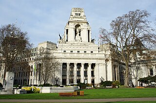
The London Borough of Tower Hamlets is a borough of London, England. Situated on the north bank of the River Thames and immediately east of the City of London, the borough spans much of the traditional East End of London and includes much of the regenerated London Docklands area. The 2019 mid-year population for the borough is estimated at 324,745.

Middlesex is a historic county in southeast England. Its area is almost entirely within the wider urbanised area of London and mostly within the ceremonial county of Greater London, with small sections in neighbouring ceremonial counties. Three rivers provide most of the county's boundaries; the Thames in the south, the Lea to the east and the Colne to the west. A line of hills forms the northern boundary with Hertfordshire.

St Katharine Docks is a former dock and now a mixed-used district in Central London, in the London Borough of Tower Hamlets and within the East End. It lies on the north bank of the River Thames, immediately downstream of the Tower of London and Tower Bridge. From 1828 to 1968, it was one of the commercial docks that made up the Port of London. It is in the redevelopment zone known as Docklands and is now a popular housing and leisure complex.

Bromley, commonly known as Bromley-by-Bow, is a district in the London Borough of Tower Hamlets in East London, located on the western banks of the River Lea, in the Lower Lea Valley in East London.

The London Wall was a defensive wall first built by the Romans around the strategically important port town of Londinium in c. AD 200, and is now the name of a modern street in the City of London, England.

Shadwell is a district of East London, England, in the London Borough of Tower Hamlets, 3 miles (4.8 km) east of Charing Cross. It lies on the north bank of the Thames between Wapping and Ratcliff. This riverside location has meant the area's history and character have been shaped by the maritime trades.

Blackwall is an area of Poplar, in the London Borough of Tower Hamlets, East London. The neighbourhood includes Leamouth and the Coldharbour conservation area.

The London Docks were one of several sets of docks in the historic Port of London.
This article lists the islands in the River Thames, or at the mouth of a tributary, in England. It excludes human-made islands built as part of the building of forty-five two-gate locks which each accompany a weir, and islets subordinate to and forming part of the overall shape of another. The suffix -ey is common across England and Scotland and cognate with ait and meaning island, a term – as ait or eyot – unusually well-preserved on the Thames. A small minority of list entries are referred to as Island, Ait or Eyot and are vestiges, separated by a depression in the land or high-water-level gully.
Tower Hill is the area surrounding the Tower of London in the London Borough of Tower Hamlets. It is infamous for the public execution of high status prisoners from the late 14th to the mid 18th century. The execution site on the higher ground north-west of the Tower of London moat is now occupied by Trinity Square Gardens.

East London is the northeastern part of London, England, east of the ancient City of London and north of the River Thames as it begins to widen. East London developed as London's docklands and the primary industrial centre. The expansion of railways in the 19th century encouraged the eastward expansion of the East End of London and a proliferation of new suburbs. The industrial lands of East London are today an area of regeneration, which are well advanced in places such as Canary Wharf and ongoing elsewhere.

The Liberties of the Tower, or the Tower Liberty is a small neighbourhood in the London Borough of Tower Hamlets, East London, which includes both Tower Hill and the Tower of London. The area was defined sometime after 1200 to provide an open area around the Tower to ensure its defensibility. The liberty was an independent administrative unit from then until it was formally abolished on 25 June 1894. The district maintains a ceremonial existence, with its custom of beating the bounds being a particularly well known example of the tradition.

East Smithfield is a small locality in the London Borough of Tower Hamlets, east London, and also a short street, a part of the A1203 road. Once broader in scope, the name came to apply to the part of the ancient parish of St Botolph without Aldgate that was outside of the City of London.
The Lines of Communication were English Civil War fortifications commissioned by Parliament and built around London between 1642 and 1643 to protect the capital from attack by the Royalist armies of Charles I. It acted to supplement the inner defences provided by Roman and medieval wall in the City of London which underwent repairs and maintenance at this time.

The East End of London, often referred to within the London area simply as the East End, is the historic core of wider East London, east of the Roman and medieval walls of the City of London and north of the River Thames. It does not have universally accepted boundaries to the north and east, though the River Lea is sometimes seen as the eastern boundary. Parts of it may be regarded as lying within Central London. The term "East of Aldgate Pump" is sometimes used as a synonym for the area.

St George in the East, historically known as Wapping-Stepney, was an ancient parish, in the London Borough of Tower Hamlets, England. The place name is no longer widely used.
St George was a parliamentary constituency in what is now the London Borough of Tower Hamlets. It was part of the Parliamentary borough of Tower Hamlets and returned one Member of Parliament (MP) to the House of Commons of the Parliament of the United Kingdom.

