
Goochland County is a county located in the Piedmont of the Commonwealth of Virginia. Its southern border is formed by the James River. As of the 2020 census, the population was 24,727. Its county seat is Goochland.

The Appomattox Court House National Historical Park is a preserved 19th-century village in Appomattox County, Virginia. The village is famous for the site of the Battle of Appomattox Court House, and contains the house of Wilmer McLean, where the surrender of the Army of Northern Virginia under Robert E. Lee to Union commander Ulysses S. Grant took place on April 9, 1865, effectively ending the American Civil War. The McLean House was the site of the surrender conference, but the village itself is named for the presence nearby of what is now preserved as the Old Appomattox Court House.

Westover Plantation is a historic colonial tidewater plantation located on the north bank of the James River in Charles City County, Virginia. Established in c. 1730–1750, it is the homestead of the Byrd family of Virginia. State Route 5, a scenic byway, runs east–west to the north of the plantation, connecting the independent cities of Richmond and Williamsburg.

St. John's Church is an Episcopal church located at 2401 East Broad Street in Richmond, Virginia, United States. Formed from several earlier parishes, St. John's is the oldest church in the city of Richmond, Virginia. It was built in 1741 by William Randolph's son, Colonel Richard Randolph; the Church Hill district was named for it. It was the site of two important conventions in the period leading to the American Revolutionary War, and is famous as the location where American Founding Father Patrick Henry gave his memorable speech at the Second Virginia Convention, closing with the often-quoted demand, "Give me liberty, or give me death!" The church is designated as a National Historic Landmark.

Varina is a former unincorporated community and current magisterial district in the easternmost portion of Henrico County, Virginia, United States.
Varina Farms, also known as Varina Plantation or Varina Farms Plantation or Varina on the James, is a plantation established in the 17th century on the James River about 10 miles (16 km) south of Richmond, Virginia. An 820-acre (330 ha) property was listed on the National Register of Historic Places in 1977 as "Varina Plantation". At that time it included two contributing buildings and one other contributing site.

The Southside of Richmond is an area of the Metropolitan Statistical Area surrounding Richmond, Virginia. It generally includes all portions of the City of Richmond which lie south of the James River, and includes all of the former city of Manchester. Depending on context, the term "Southside of Richmond" can include some northern areas of adjacent Chesterfield County, Virginia in the Richmond-Petersburg region. With minor exceptions near Bon Air, VA, the Chippenham Parkway forms the border between Chesterfield County and the City of Richmond portions of Southside, with some news agencies using the term "South Richmond" to refer to the locations in Southside located in the city proper.

Transportation in Richmond, Virginia and its immediate surroundings include land, sea and air modes. This article includes the independent city and portions of the contiguous counties of Henrico and Chesterfield. While almost all of Henrico County would be considered part of the Richmond area, southern and eastern portions of Chesterfield adjoin the three smaller independent cities of Petersburg, Hopewell, and Colonial Heights, collectively commonly called the Tri-Cities area. A largely rural section of southwestern Chesterfield may be considered not a portion of either suburban area.
Malvern Hill stands on the north bank of the James River in Henrico County, Virginia, USA, about eighteen miles southeast of Richmond. On 1 July 1862, it was the scene of the Battle of Malvern Hill, one of the Seven Days Battles of the American Civil War.
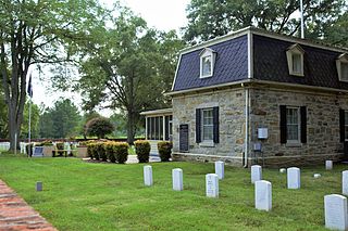
Fort Harrison National Cemetery is a United States National Cemetery located seven miles (11 km) south of the city of Richmond, in Henrico County, Virginia. Administered by the United States Department of Veterans Affairs, It encompasses 1.5 acres (0.61 ha), and as of the end of 2005, had 1,570 interments.

Glendale National Cemetery is a United States National Cemetery located near the city of Richmond, in Henrico County, Virginia. Administered by the United States Department of Veterans Affairs, it encompasses 2.1 acres (0.85 ha), and as of the end of 2005 had 2,064 interments. It is closed to new interments.

Richmond National Cemetery is a United States National Cemetery three miles (4.8 km) east of Richmond in Henrico County, Virginia. Administered by the United States Department of Veterans Affairs, it encompasses 9.7 acres (3.9 ha), and as of 2021 had more than 11,000 interments. It is closed to new interments. Richmond National Cemetery was listed on the National Register of Historic Places in 1995.

John Minor Botts was a nineteenth-century politician, planter and lawyer from Virginia. He was a prominent Unionist in Richmond, Virginia during the American Civil War.
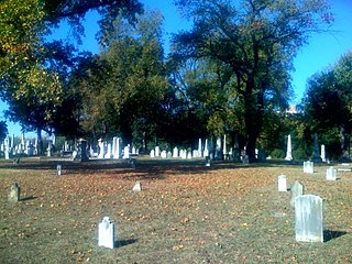
The Shockoe Hill Cemetery is a historic cemetery located on Shockoe Hill in Richmond, Virginia.

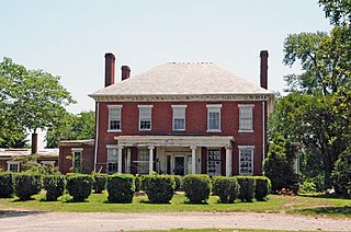
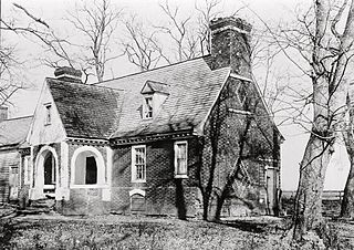
This is a list of the National Register of Historic Places listings in Henrico County, Virginia.

The Emmanuel Church at Brook Hill, in the historic community of Brook Hill in Henrico County, Virginia, is a historic Episcopal church.

Farley, previously named Sans Souci, is a historic home located near Brandy Station, Culpeper County, Virginia. It was built before 1800, purchased from Robert Beverly in 1801 by William Champe Carter and renamed Farley in honour of his wife, Maria Byrd Farley. It is a two-story, frame dwelling, nine bays across with two bay projecting pavilions at either end and a single-bay pavilion in the center. The house measures 96 feet long and 46 feet deep.

Franklin Stearns, was an American businessman who moved to Richmond, Virginia, and became one of the city's leading Unionists, for which he was imprisoned several times during the American Civil War. When Union forces captured the Confederate capital in April, 1865, Richmond's mayor delivered the city's note of surrender to Union forces at Stearns' farm, Tree Hill which may become a park after development is completed. After the war, Stearns worked to restore Richmond, and three of his properties remain today, and are on the National Register of Historic Places.
Joseph Carrington Mayo was a Virginia lawyer and politician. He served in the Virginia House of Delegates, as attorney for the City of Richmond and as the city's mayor from 1852 through the American Civil War. Mayo surrendered the city to the Union Army on April 3, 1865, and was twice deposed by Union generals during the military occupation and Congressional Reconstruction.


