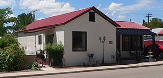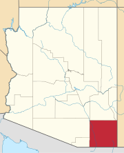
Sierra Vista is a city in Cochise County, Arizona, United States. According to the 2020 Census, the population of the city is 45,308, and is the 27th most populous city in Arizona. The city is part of the Sierra Vista-Douglas Metropolitan Area, with a 2010 population of 131,346. Fort Huachuca, a U.S. Army post, has been incorporated and is located in the northwest part of the city. Sierra Vista is bordered by the cities of Huachuca City and Whetstone to the north and Sierra Vista Southeast to the South.

Oro Valley, incorporated in 1974, is a suburban town located 6 miles (9.7 km) north of Tucson, Arizona, United States, in Pima County. According to the 2020 census, the population of the town is 47,070, an increase from 29,700 in 2000. Dubbed the "Upscale Tech Mecca" of Southern Arizona by the Arizona Daily Star newspaper, Oro Valley is home to over 10 high tech firms and has a median household income nearly 50% higher than the U.S. median. The town is located approximately 110 miles (180 km) southeast of the state capital of Phoenix.

Tanque Verde is a suburban unincorporated community in Pima County, Arizona, United States, northeast of Tucson. The population was 16,195 at the 2000 census. For statistical purposes, the United States Census Bureau has defined Tanque Verde as a census-designated place (CDP).

Vail is a census-designated place (CDP) in Pima County, Arizona, United States. It is 24 miles (39 km) southeast of Tucson. The population was 10,208 at the 2010 census, up from 2484 in the 2000 census. The area is known for the nearby Colossal Cave, a large cave system, and the Rincon Mountains District of Saguaro National Park, a top tourism spot within Arizona.

The Rincon Mountains are a significant mountain range east of Tucson, Pima County, Arizona, in the United States. The Rincon Mountains are one of five mountain ranges surrounding the Tucson valley. The other ranges include the most prominent, the Santa Catalina Mountains to the north, the Santa Rita Mountains to the south, the Tucson Mountains to the west, and the Tortolita Mountains to the northwest. Redington Pass separates the Rincon Mountains from the Santa Catalina Mountains. The Rincon Mountains are generally less rugged than the Santa Catalina Mountains and Santa Rita Mountains. The Rincon Mountains are also included in the Madrean sky island mountain ranges of southeast Arizona, extreme southwest New Mexico, and northern Sonora Mexico.
Redington Pass is a high mountain pass between the Santa Catalina Mountains and the Rincons in northeast Pima County, Arizona. It is located just east of Tucson. Historically, it was the connection between the farming and ranching areas of Redington along the San Pedro River on the east side of the pass and Tucson on the west side.
Tanque Verde Falls are a series of waterfalls in Tanque Verde Canyon east of Tanque Verde, Arizona and Tucson, Arizona. Tanque Verde Ridge of the Rincon Mountains lies to the south and Agua Caleinte Hill to the north. The falls lie south of Redington Road which connects the Tucson Valley to the southwest with the San Pedro River valley to the east.

Mission San Cayetano de Calabazas, also known as Calabasas, is a Spanish Mission in the Sonoran Desert, located near present-day Tumacacori, Arizona, United States.
Redington is a populated place in Pima County, Arizona, United States.
Cascabel is a rural community in Cochise County, Arizona, United States.

Colossal Cave is a large cave system in southeastern Arizona, United States, near the community of Vail, about 22 miles (35 km) southeast of Tucson. It contains about 3.5 miles (5.6 km) of mapped passageways. Temperatures inside average 70 °F (21 °C) year-round. Previous names include 'Mountain Springs Cave' and 'Five–Mile Cave'.

Presidio San Agustín del Tucsón was a presidio located within Tucson, Arizona, United States. The original fortress was built by Spanish soldiers during the 18th century and was the founding structure of what became the city of Tucson. After the American arrival in 1846, the original walls were dismantled, with the last section torn down in 1918. A reconstruction of the northeast corner of the fort was completed in 2007 following an archaeological excavation that located the fort's northeast tower.
The Little Rincon Mountains are a small range of mountains, lying to the east of the Rincon Mountains, at Tucson, of eastern Pima County, Arizona. The range is located in northwest Cochise County and is part of the western border of the San Pedro River and Valley, the major valley and river of western Cochise County. The river is northward flowing to meet the Gila River; its headwaters are south of the US-Mexico border in northern Sonora. A small part of the Little Rincon range's southwest lies in Pima County.

Southern Emigrant Trail, also known as the Gila Trail, the Kearny Trail, Southern Trail and the Butterfield Stage Trail, was a major land route for immigration into California from the eastern United States that followed the Santa Fe Trail to New Mexico during the California Gold Rush. Unlike the more northern routes, pioneer wagons could travel year round, mountain passes not being blocked by snows; however, it had the disadvantage of summer heat and lack of water in the desert regions through which it passed in New Mexico Territory and the Colorado Desert of California. Subsequently, it was a route of travel and commerce between the eastern United States and California. Many herds of cattle and sheep were driven along this route and it was followed by the San Antonio-San Diego Mail Line in 1857–1858 and then the Butterfield Overland Mail from 1858 to 1861.
Stein's Pass, is a gap or mountain pass through the Peloncillo Mountains of Hidalgo County, New Mexico. The pass was named after United States Army Major Enoch Steen, who camped nearby in 1856, as he explored the recently acquired Gadsden Purchase. The pass is in the form of a canyon cut through the mountains through which Steins Creek flows to the west just west of the apex of the pass to the canyon mouth at 32°13′19″N109°01′48″W.
The Tucson Cutoff was a significant change in the route of the Southern Emigrant Trail. It became generally known after a party of Forty-Niners led by Colonel John Coffee Hays followed a route suggested to him by a Mexican Army officer as a shorter route than Cooke's Wagon Road which passed farther south to cross the mountains to the San Pedro River at Guadalupe Pass.
Tres Alamos Wash, an ephemeral stream tributary to the San Pedro River, in Cochise County, Arizona. It runs southwesterly to meet the San Pedro River, across the river from the former settlement of Tres Alamos, Arizona. Tres Alamos Wash passes east and northeastward between the Little Dragoon Mountains and Johnny Lyon Hills to where it arises in a valley east of those heights and west of Allen Flat and the Steele Hills. It has its source at 32°07′45″N110°02′59″W.

Calabasas is a former populated place or ghost town, within the census-designated place of Rio Rico, a suburb of Nogales in Santa Cruz County, Arizona, United States.

The Benson Historic Barrio is a small neighborhood in Benson, Arizona. It began to develop between 1898 and 1901, settled primarily with people of Mexican descent. It is located on the east side of the original townsite, just south of the business district, and comprises three blocks along both sides of East Fifth Street, encompassing blocks, 19, 20, 21, 23, 24, and 25. It includes houses, lots, other buildings, and Our Lady of Lourdes Catholic Church.


