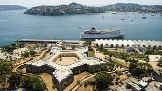
Acapulco de Juárez, commonly called Acapulco, Guerrero, is a city and major seaport in the state of Guerrero on the Pacific Coast of Mexico, 380 kilometres (240 mi) south of Mexico City. Acapulco is located on a deep, semicircular bay and has been a port since the early colonial period of Mexico's history. It is a port of call for shipping and cruise lines running between Panama and San Francisco, California, United States. The city of Acapulco is the largest in the state, far larger than the state capital Chilpancingo. Acapulco is also Mexico's largest beach and balneario resort city. Acapulco de Juárez, Guerrero is the municipal seat of the municipality of Acapulco, Guerrero.

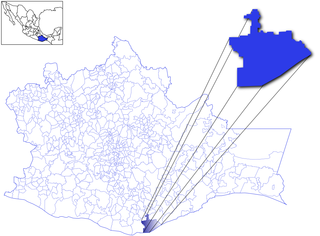
Guerrero, officially the Free and Sovereign State of Guerrero, is one of the 32 states that comprise the 32 Federal Entities of Mexico. It is divided into 81 municipalities. The state has a population of about 3.5 million people. It is located in southwest Mexico and is bordered by the states of Michoacán to the north and west, the State of Mexico and Morelos to the north, Puebla to the northeast and Oaxaca to the east. In addition to the capital city, Chilpancingo and the largest city Acapulco, other cities in Guerrero include Petatlán, Ciudad Altamirano, Taxco, Iguala, Ixtapa, and Zihuatanejo. Today, it is home to a number of indigenous communities, including the Nahuas, Mixtecs, Tlapanecs, Amuzgos, and formerly Cuitlatecs. It is also home to communities of Afro-Mexicans in the Costa Chica region.

Puerto Vallarta is a Mexican beach resort city on the Pacific Ocean's Bahía de Banderas in the Mexican state of Jalisco. Puerto Vallarta is the second largest urban agglomeration in the state after the Guadalajara Metropolitan Area. The City of Puerto Vallarta is the government seat of the Municipality of Puerto Vallarta, which comprises the city as well as population centers outside of the city extending from Boca de Tomatlán to the Nayarit border. The city is located at 20°40′N105°16′W. The municipality has an area of 681 square kilometres (262.9 sq mi). To the north, it borders the southwest of the state of Nayarit. To the east, it borders the municipality of Mascota and San Sebastián del Oeste, and to the south, it borders the municipalities of Talpa de Allende and Cabo Corrientes.

Taxco de Alarcón is a small city and administrative center of Taxco de Alarcón Municipality located in the Mexican state of Guerrero. Taxco is located in the north-central part of the state, 36 kilometres from the city of Iguala, 135 kilometres from the state capital of Chilpancingo and 170 kilometres southwest of Mexico City.

Guerrero is a state in Southwest Mexico that is divided into 85 municipalities. According to the 2020 Mexican census, Guerrero is the 13th most populous state with 3,540,685 inhabitants and the 14th largest by land area spanning 63,803.42 square kilometres (24,634.64 sq mi).

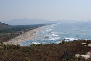
Puerto Escondido is a small port and tourist center in the municipality of San Pedro Mixtepec Distrito 22 in the Mexican state of Oaxaca. Prior to the 1930s, there was no town. The bay had been used as a port intermittently to ship coffee, but there was no permanent settlement due to the lack of potable water. The name "Puerto Escondido" had roots in the legend of a woman who escaped her captors and hid here. The Nahuatl word for this area was Zicatela, meaning “place of large thorns". Today, it refers to the area's most famous beach.

Tourism in Mexico holds considerable significance as a pivotal industry within the nation's economic landscape. Beginning in the 1960s, it has been vigorously endorsed by the Mexican government, often heralded as "an industry without smokestacks," signifying its non-polluting and economically beneficial nature. Mexico has consistently ranked among the world's most frequented nations, as documented by the World Tourism Organization. Second only to the United States in the Americas, Mexico's status as a premier tourist destination is underscored by its standing as the sixth-most visited country globally for tourism activities, as of 2017. The country boasts a noteworthy array of UNESCO World Heritage Sites, encompassing ancient ruins, colonial cities, and natural reserves, alongside a plethora of modern public and private architectural marvels. Mexico has attracted foreign visitors beginning in the early nineteenth century, with its cultural festivals, colonial cities, nature reserves and the beach resorts. Mexico's allure to tourists is largely attributed to its temperate climate and distinctive cultural amalgamation, blending European and Mesoamerican influences. The nation experiences peak tourism seasons typically during December and the mid-Summer months. Additionally, brief spikes in visitor numbers occur in the weeks preceding Easter and Spring break, notably drawing college students from the United States to popular beach resort locales.

Zihuatanejo, and/or Ixtapa-Zihuatanejo, is the fourth largest city in the Mexican state of Guerrero. It was known by 18th-century English mariners as Chequetan and/or Seguataneo. Politically the city belongs to the municipality of Zihuatanejo de Azueta in the western part of Guerrero, but both are commonly referred to as Zihuatanejo. It is on the Pacific Coast, about 240 km northwest of Acapulco. Zihuatanejo belongs to a section of the Mexican Pacific Coast known as the Costa Grande. This town has been developed as a tourist attraction along with the modern tourist resort of Ixtapa, 5 km (3.1 mi) away. However, Zihuatanejo has kept its traditional town feel. The town is located on a well-protected bay which is popular with private boat owners during the winter months.
Huatulco, formally Bahías de Huatulco, centered on the town of La Crucecita, is a tourist development in Mexico. It is located on the Pacific coast in the state of Oaxaca. Huatulco's tourism industry is centered on its nine bays, thus the name Bahías de Huatulco, but has since been unofficially shortened to simply Huatulco. Huatulco has a wide variety of accommodation from rooms for rent, small economy hotels, luxury villas, vacation condominia, bed and breakfasts, as well as several luxury resorts standing on or near the shores of Tangolunda Bay. The Camino Real Zaashila, Quinta Real Huatulco, Las Brisas, Dreams Resort & Spa, and the Barceló are examples of the most popular larger resorts in the area.

Ixtapa-Zihuatanejo International Airport is an international airport located in Zihuatanejo, Guerrero, Mexico. It serves as the primary gateway for both domestic and international air travel to the resort cities of Ixtapa and Zihuatanejo, popular tourist destinations situated along the Costa Grande region of the Mexican Pacific Coast. The airport facilitates nonstop flights to numerous major cities within Mexico, along with mostly seasonal flights to destinations in the United States and Canada. Additionally, the airport supports various activities in general and executive aviation, as well as flight training. Operated by Grupo Aeroportuario Centro Norte (OMA), Ixtapa-Zihuatanejo International Airport reported handling 593,354 passengers in 2022 and experienced an increase to 654,392 passengers in 2023.

Ixtapa is a resort city in Mexico, adjacent to the Pacific Ocean in the municipality of Zihuatanejo de Azueta in the state of Guerrero. It is located 5 km (3 mi) northwest of the municipal seat, Zihuatanejo, and 245 km (150 mi) northwest of Acapulco.

The Mexican Riviera refers collectively to twenty cities and lagoons lying on the western coast of Mexico. Although there are long distances between these cities, they are often collectively referred to as the Mexican Riviera because of their many oceanfront resorts and their popularity among tourists. Cruise ships often visit three or four of these destinations on their longer cruises. In a 2005 interview Stanley McDonald, the founder of Princess Cruises, mentioned:
The call of the "Mexican Riviera" was coined by Princess Cruise Line. Now everyone refers to it as the Mexican Riviera. I believe that it really spoke to the quality and beauty of what people would see down there. We all know the French Riviera -- the Mexican Riviera was something we had in the western hemisphere.

Zihuatanejo de Azueta is a municipality in the Mexican state of Guerrero. It includes the major resort communities of Zihuatanejo and Ixtapa in addition to numerous other towns. In 2010 it had a population of 118,211 inhabitants. It has an area of 1468 km². Its municipal seat is the city of Zihuatanejo. Its municipal president for the 2005-08 period was Silvano Blanco Deaquino.
Costa Grande of Guerrero is a sociopolitical region located in the Mexican state of Guerrero, along the Pacific Coast. It makes up 325 km (202 mi) of Guerrero's approximately 500 km (311 mi) coastline, extending from the Michoacán border to the Acapulco area, wedged between the Sierra Madre del Sur and the Pacific Ocean. Acapulco is often considered part of the Costa Grande; however, the government of the state classifies the area around the city as a separate region. The Costa Grande roughly correlates to the Cihuatlán province of the Aztec Empire, which was conquered between 1497 and 1504. Before then, much of the area belonged to a dominion under the control of the Cuitlatecs, but efforts by both the Purépecha Empire and Aztec Empire to expand into this area in the 15th century brought this to an end. Before the colonial period, the area had always been sparsely populated with widely dispersed settlements. The arrival of the Aztecs caused many to flee and the later arrival of the Spanish had the same effect. For this reason, there are few archeological remains; however, recent work especially at La Soledad de Maciel has indicated that the cultures here are more important than previously thought. Today, the area economically is heavily dependent on agriculture, livestock, fishing and forestry, with only Zihuatanejo and Ixtapa with significantly developed infrastructure for tourism. The rest of the coast has been developed spottily, despite some government efforts to promote the area.

Petatlán is a city in Petatlán Municipality located along the Pacific Coast of the state of Guerrero in Mexico. It is part of the Costa Grande region between Zihuatanejo and Acapulco. The city is known for the Sanctuary of the Padre Jesús de Petatlán, a 17th-century image of Christ that is claimed to have performed religious miracles. The city is the seat of a large municipality, which faces the Pacific Ocean to the south and is bounded by the Sierra Madre del Sur to the north. It contains the La Soledad de Maciel archeological site. The area's recent history has been marked by violence related to the drug trade and to struggles between business and local farmers and environmental groups. St. Peter, Minnesota is a sister city of Petatlán.
Federal Highway 95 connects Mexico City to Acapulco, Guerrero. The Autopista del Sol is a tolled alternative, which bypasses several towns of the state of Guerrero, including the city Iguala, and thus reduces transit time between Acapulco from Mexico city from 8 hours to almost 3.5 hours.

Hurricane Odile was the second of three tropical storms to make landfall in Mexico during the 1984 Pacific hurricane season. The fifteenth named storm and twelfth hurricane of the active season, it developed from a tropical disturbance about 185 miles (298 km) south of Acapulco on September 17. Curving towards the northwest, Odile became a Category 1 hurricane on September 19. The tropical cyclone reached its peak intensity with winds of 105 mph (169 km/h) two days later; however, Hurricane Odile began to weaken as moved erratically it encountered less favorable conditions and was downgraded to a tropical storm shortly before making landfall northwest of Zihuatanejo. Over land, the storm rapidly weakened, and dissipated on September 23. The storm caused significant rainfall accumulations of 24.73 inches (628 mm) in Southern Mexico, resulting in severe damage to tourism resorts. Flooding from Odile resulted in the evacuation of 7,000 people, 21 deaths, and the damage of about 900 homes.

Puerto Arista is a small community and tourist attraction located on the north coast of Chiapas, Mexico in the municipality of Tonalá. While it originally was a port, its lack of harbor and suitability for large cargo ships eventually shifted the economy to tourism in the 20th century. It is popular with people from Chiapas as it is located close to the state capital of Tuxtla Gutiérrez as well as the regional city of Tonalá. It is the most visited beach in Chiapas and one of its most popular tourist destinations, despite its relative lack of sophisticated tourism infrastructure. Puerto Arista is home of one of the state’s four marine turtle sanctuaries, design to help protect the various species which come here to lay their eggs.
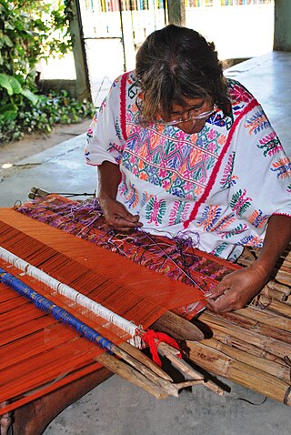
The handcrafts of Guerrero include a number of products which are mostly made by the indigenous communities of the Mexican state of Guerrero. Some, like pottery and basketry, have existed relatively intact since the pre Hispanic period, while others have gone through significant changes in technique and design since the colonial period. Today, much of the production is for sale in the state's major tourism centers, Acapulco, Zihuatanejo and Taxco, which has influence the crafts’ modern evolution. The most important craft traditions include amate bark painting, the lacquerware of Olinalá and nearby communities and the silverwork of Taxdo.
Same-sex marriage has been legal in Guerrero since 31 December 2022. After the Supreme Court of Justice of the Nation ruled that same-sex marriage bans are unconstitutional nationwide under the Constitution of Mexico on 12 June 2015, officials in Guerrero began announcing plans for a collective group wedding. Governor Rogelio Ortega Martínez submitted a same-sex marriage bill to Congress on 7 July 2015 and instructed civil registrars to issue marriage licenses to same-sex couples. Legislators lamented they would have preferred to have the bill passed before marriages took place, but given the time line presented, it was unlikely. On 10 July 2015, twenty same-sex couples were married by Ortega Martínez in Acapulco.


