
Merritt Island is a peninsula, commonly referred to as an island, in Brevard County, Florida, United States, located on the eastern Florida coast, along the Atlantic Ocean. It is also the name of an unincorporated town in the central and southern parts of the island and a census-designated place (CDP).

South Patrick Shores is a census-designated place (CDP) in Brevard County, Florida, United States. The population was 6,496 at the 2020 census, up from 5,875 at the 2010 census. It is part of the Palm Bay–Melbourne–Titusville, Florida Metropolitan Statistical Area.

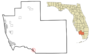
Goodland is a census-designated place (CDP) in Collier County, Florida, United States. The population was 312 at the 2020 census, up from 267 at the 2010 census. It is part of the Naples–Marco Island Metropolitan Statistical Area. Located on the southeast portion of Marco Island, it is the closest community to Cape Romano, the southern tip of a nearby island that was the official site of the Florida landfall of Hurricane Wilma.
Plantation Island is a census-designated place (CDP) in Collier County, Florida, United States. The population was 119 at the 2020 census, down from 163 at the 2010 census. It is part of the Naples–Marco Island Metropolitan Statistical Area.

Jensen Beach is an unincorporated community and census-designated place (CDP) in Martin County, Florida, United States. The population was 12,652 at the 2020 census. It is part of the Port St. Lucie, Florida Metropolitan Statistical Area.

Kendall is an unincorporated area and census-designated place in Miami-Dade County, Florida. It is part of the Miami metropolitan area of South Florida. At the 2020 census, the area had a population of 80,241.

Westchester is a census-designated place (CDP) and neighborhood in Miami-Dade County, Florida. It is part of the Miami metropolitan area of South Florida. Prior to the 2020 U.S. Census, the neighboring University Park CDP was merged into Westchester CDP, effectively doubling its geography and population. Per the 2020 census, the population was 56,384.

Big Pine Key is a census-designated place and unincorporated community in Monroe County, Florida, United States, on an island of the same name in the Florida Keys. As of the 2020 census, the town had a total population of 4,521.

Cudjoe Key is a census-designated place and unincorporated community in Monroe County, Florida, United States, on an island of the same name in the lower Florida Keys. As of the 2020 census, the CDP had a population of 2,019, up from 1,763 in 2010.
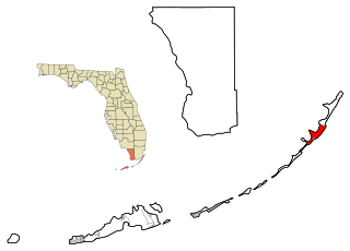
Key Largo is an unincorporated area and census-designated place in Monroe County, Florida, United States, located on the island of Key Largo in the upper Florida Keys. The population was 12,447 at the 2020 census, up from 10,433 in 2010. The name comes from the Spanish Cayo Largo, or "long key". It is both the first island and town of the Florida Keys to be reached from the Overseas Highway to Key West. It was also the location of one of the stations of the Overseas Railroad.
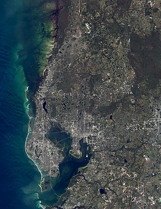
The Tampa Bay area is a major metropolitan area surrounding Tampa Bay on the Gulf Coast of Florida in the United States. It includes the main cities of Tampa, St. Petersburg, and Clearwater. It is the 17th-largest metropolitan area in the United States, with a population of 3,175,275 as of the 2020 U.S. Census.
Perrine, Florida was an unincorporated community in Miami-Dade County, Florida, United States, about midway between Miami and Homestead. It is at 25°36′18″N80°21′13″W The community was named after Henry Perrine, who in 1839 had been granted a survey township of land in the area by the United States Congress in recognition of his service as United States Consul in Campeche, Mexico, and to support his plans to introduce new plants from tropical countries into cultivation in the United States.
University is a census-designated place (CDP) and unincorporated community in Orange County, Florida, United States, east of Orlando. The community is centered around the University of Central Florida and includes a location on its south side known as University Park. It is part of the Orlando–Kissimmee–Sanford, Florida Metropolitan Statistical Area. As of 2020, the CDP had a population of 45,284.

The Sarasota metropolitan area is a metropolitan area located in Southwest Florida. The metropolitan area is defined by the Office of Management and Budget (OMB) as the North Port–Bradenton–Sarasota Metropolitan Statistical Area, a metropolitan statistical area (MSA) consisting of Manatee County and Sarasota County. The principal cities listed by the OMB for the MSA are North Port, Bradenton, Sarasota, Lakewood Ranch, and Venice. At the 2020 census, the MSA had a population of 833,716. The Census Bureau estimates that its population was 891,411 in 2022.
Fleming Island is an unincorporated community and census-designated place (CDP) in Clay County, Florida, United States. It is located 21 miles (34 km) southwest of downtown Jacksonville, on the western side of the St. Johns River, off US 17. As of the 2010 census the Fleming Island CDP had a population of 27,126. Fleming Island's ZIP code became 32003 in 2004, giving it a different code from Orange Park, the incorporated town to the north.
Lake Mary is a census-designated place and unincorporated area in Orange County, Florida, United States. The population was 1,575 at the 2010 census. It is part of the Orlando–Kissimmee Metropolitan Statistical Area.

Merritt Park is a census-designated place (CDP) in the town of Fishkill in Dutchess County, New York, United States. As of the 2020 census it had a population of 1,647.
North Merritt Island is a census-designated place (CDP) in Brevard County, Florida, United States. It occupies a portion of the physical Merritt Island, north of the CDP of Merritt Island and south of Merritt Island National Wildlife Refuge. Florida State Road 3 is the main highway through the community, leading north to Florida State Road 405 and south to Florida State Road 528. Situated on an Atlantic coast peninsula, North Merritt Island is a portion of the larger Merritt Island area in Brevard County, Florida. The area is well-known for its close vicinity to the Cape Canaveral Space Force Station and the Kennedy Space Center, which contribute to its rich aerospace culture and heritage.
Pelican Marsh is a census-designated place (CDP) in northwestern Collier County, Florida, United States. It is bordered to the west by Naples Park and to the south by Pine Ridge, and it is 8 miles (13 km) north of Naples. U.S. Route 41 forms the western edge of the community.


