
In physical geography, a steppe is an ecoregion characterized by grassland plains without closed forests except near rivers and lakes. Steppe biomes may include:

A wetland is a distinct ecosystem that is flooded or saturated by water, either permanently for years or decades or seasonally for a shorter periods. Flooding results in oxygen-free anoxic processes prevailing, especially in the soils. The primary factor that distinguishes wetlands from terrestrial land forms or water bodies is the characteristic vegetation of aquatic plants, adapted to the unique anoxic hydric soils. Wetlands are considered among the most biologically diverse of all ecosystems, serving as home to a wide range of plant and animal species. Methods for assessing wetland functions, wetland ecological health, and general wetland condition have been developed for many regions of the world. These methods have contributed to wetland conservation partly by raising public awareness of the functions some wetlands provide. Constructed wetlands are designed and built to treat municipal and industrial wastewater as well as to divert stormwater runoff. Constructed wetlands may also play a role in water-sensitive urban design.

A marsh is — according to ecological definitions — a wetland that is dominated by herbaceous rather than woody plant species. More in general, the word can be used for any low-lying and seasonally waterlogged terrain. In Europe and in agricultural literature low-lying meadows that require draining and embanked polderlands are also referred to as marshes or marshland.

The Tian Shan(Chinese: 天山), also known as the Tengri Tagh or Tengir-Too, meaning the "Mountains of God/Heaven", is a large system of mountain ranges in Central Asia. The highest peak is Jengish Chokusu at 7,439 metres (24,406 ft) high. Its lowest point is the Turpan Depression, which is 154 m (505 ft) below sea level.

The Great Basin Desert is part of the Great Basin between the Sierra Nevada and the Wasatch Range. The desert is a geographical region that largely overlaps the Great Basin shrub steppe defined by the World Wildlife Fund, and the Central Basin and Range ecoregion defined by the U.S. Environmental Protection Agency and United States Geological Survey. It is a temperate desert with hot, dry summers and snowy winters. The desert spans large portions of Nevada and Utah, and extends into eastern California. The desert is one of the four biologically defined deserts in North America, in addition to the Mojave, Sonoran, and Chihuahuan Deserts.

The Tarim River, known in Sanskrit as the Śītā, is an endorheic river in Xinjiang, China. It is the principal river of the Tarim Basin, a desert region of Central Asia between the Tian Shan and Kunlun Mountains. The river historically terminated at Lop Nur, but today reaches no further than Taitema Lake before drying out.

A semi-arid climate, semi-desert climate, or steppe climate is a dry climate sub-type. It is located on regions that receive precipitation below potential evapotranspiration, but not as low as a desert climate. There are different kinds of semi-arid climates, depending on variables such as temperature, and they give rise to different biomes.

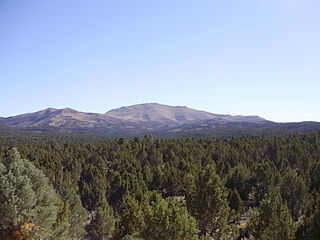
The Santa Ana River is the largest river entirely within Southern California in the United States. It rises in the San Bernardino Mountains and flows for most of its length through San Bernardino and Riverside counties, before cutting through the northern Santa Ana Mountains via Santa Ana Canyon and flowing southwest through urban Orange County to drain into the Pacific Ocean. The Santa Ana River is 96 miles (154 km) long, and its drainage basin is 2,650 square miles (6,900 km2) in size.

Colorado Desert is a part of the larger Sonoran Desert located in California, United States and Baja California, Mexico. It encompasses approximately 7 million acres, including the heavily irrigated Coachella, Imperial and Mexicali valleys. It is home to many unique flora and fauna.

A bosque is a type of gallery forest habitat found along the riparian flood plains of streams, river banks, and lakes. It derives its name from the Spanish word for 'forest', pronounced.

The Eastern Desert is the part of the Sahara desert that is located east of the Nile river. It spans 223,000 square kilometres (86,000 sq mi) of northeastern Africa and is bordered by the Nile river to the west and the Red Sea and Gulf of Suez to the east. It extends through Egypt, Eritrea, Sudan and Ethiopia. The Eastern Desert consists of a mountain range which runs parallel to the coast, wide sedimentary plateaus extending from either side of the mountains and the Red Sea coast. The rainfall, climate, vegetation and animal life sustained in the desert varies between these different regions. The Eastern Desert has been a mining site for building materials, as well as precious and semi-precious metals, throughout history. It has historically contained many trade routes leading to and from the Red Sea, including the Suez Canal.

The Tarim Basin deciduous forests and steppe is a temperate broadleaf and mixed forests ecoregion in the Xinjiang Uyghur Autonomous Region of western China. The ecoregion includes deciduous riparian forests and steppes sustained by the region's rivers in an otherwise arid region.
The Yarkand deer, also known as the Theenivs deer, Tarim deer, or Lop Nor stag, is a subspecies of the Central Asian red deer that is native to the province of Xinjiang, China. It is similar in ecology to the related Bactrian deer in occupying lowland riparian corridors surrounded by deserts. Both populations are isolated from one another by the Tian Shan Mountains and probably form a primordial subgroup of the Central Asian red deer.

A gallery forest is one formed as a corridor along rivers or wetlands, projecting into landscapes that are otherwise only sparsely treed such as savannas, grasslands, or deserts. The gallery forest maintains a more temperate microclimate above the river. Defined as long and narrow forest vegetation associated with rivers, gallery forests are structurally and floristically heterogeneous.

Tamarix ramosissima, commonly known as saltcedarsalt cedar, or tamarisk, is a deciduous arching shrub with reddish stems, feathery, pale green foliage, and characteristic small pink flowers.

The Paroo-Darling National Park is a protected national park that is located in the Far West region of New South Wales, in eastern Australia. The 178,053-hectare (439,980-acre) national park spans two distinct regions in the outback area. This region covers the arid catchments of the Paroo River and the Paroo-Darling confluence to the south.
Pinyon–juniper woodland, also spelled piñon–juniper woodland, is a biome found mid-elevations in arid regions of the Western United States, characterized by being an open forest dominated by low, bushy, evergreen junipers, pinyon pines, and their associates. At lower elevations, junipers often predominate and trees are spaced widely, bordering on and mingling with grassland or shrubland, but as elevation increases, pinyon pines become common and trees grow closer, forming denser canopies. Historically, pinyon-juniper woodland has provided a vital source of fuel and food for peoples of the American Southwest.

Riparian-zone restoration is the ecological restoration of riparian-zonehabitats of streams, rivers, springs, lakes, floodplains, and other hydrologic ecologies. A riparian zone or riparian area is the interface between land and a river or stream. Riparian is also the proper nomenclature for one of the fifteen terrestrial biomes of the earth; the habitats of plant and animal communities along the margins and river banks are called riparian vegetation, characterized by aquatic plants and animals that favor them. Riparian zones are significant in ecology, environmental management, and civil engineering because of their role in soil conservation, their habitat biodiversity, and the influence they have on fauna and aquatic ecosystems, including grassland, woodland, wetland or sub-surface features such as water tables. In some regions the terms riparian woodland, riparian forest, riparian buffer zone, or riparian strip are used to characterize a riparian zone.

Populus euphratica, commonly known as the Euphrates poplar, desert poplar, diversiform-leaved poplar, or poplar diversifolia, is a species of poplar tree in the willow family.

The Central Asian riparian woodlands ecoregion is spread out across the deserts and plains of central Asia between the Aral Sea and the mountains 2,000 kilometres (1,200 mi) to the east. The long narrow components of the ecoregion follow the large rivers fed by snowmelt, and provide critical habitat for migratory birds as they travel through the arid region. The vegetation is referred to as tugai, characterized by low tangles of trees and brush along the edges of the rivers and associated wetlands, and fed by groundwater instead of precipitation.


