Twin City, Georgia

Last updated

Twin City, Georgia
Emanuel County Georgia Incorporated and Unincorporated areas Twin City Highlighted.svg
Location in Emanuel County and the state of Georgia
Coordinates: 32°34′50″N82°9′28″W / 32.58056°N 82.15778°W / 32.58056; -82.15778
Country United States
State Georgia
County Emanuel
Area
[1]
  Total3.61 sq mi (9.36 km2)
  Land3.57 sq mi (9.26 km2)
  Water0.04 sq mi (0.10 km2)
Elevation
308 ft (94 m)
Population
 (2020)
  Total1,642
  Density459.43/sq mi (177.40/km2)
Time zone UTC-5 (Eastern (EST))
  Summer (DST) UTC-4 (EDT)
ZIP code
30471
Area code 478
FIPS code 13-77988 [2]
GNIS feature ID0356602 [3]
Website https://www.twincityga.com

Twin City is a city in Emanuel County, Georgia, United States. As of the 2020 census, the city had a population of 1,642.

Contents

History

Twin City gets its name from the combining of two adjacent towns, Graymont and Summit. The two rival towns were merged in 1924 as Twin City. [4]

Of Twin City's 3.6 square miles (9.3 km2) area, 255 acres (1.03 km2) is included in the Twin City Historic District, listed on the National Register of Historic Places. This includes the historic jail and former city hall building [5]

Geography

Twin City is located in eastern Emanuel County at 32°34′50″N82°9′28″W / 32.58056°N 82.15778°W / 32.58056; -82.15778 (32.580420, -82.157776). [6] U.S. Route 80 passes through the city, leading west 11 miles (18 km) to Swainsboro, the county seat, and east 25 miles (40 km) to Statesboro.

According to the United States Census Bureau, Twin City has a total area of 3.6 square miles (9.4 km2), of which 0.04 square miles (0.1 km2), or 1.12%, is water. [7]

Demographics

Historical population
CensusPop.Note
1930 901
1940 1,01913.1%
1950 1,018−0.1%
1960 1,0957.6%
1970 1,1192.2%
1980 1,40225.3%
1990 1,4664.6%
2000 1,75219.5%
2010 1,742−0.6%
2020 1,642−5.7%
U.S. Decennial Census [8]
Twin City racial composition as of 2020 [9]
RaceNum.Perc.
White (non-Hispanic)81149.39%
Black or African American (non-Hispanic)76546.59%
Native American 10.06%
Asian 20.12%
Other/Mixed 231.4%
Hispanic or Latino 402.44%

As of the 2020 United States census, there were 1,642 people, 559 households, and 333 families residing in the city.

Attractions

George L. Smith State Park is located in Emanuel County, and is known for its Parrish Mill and Pond, a combination grist mill, saw mill, covered bridge and dam built in 1880 and now open for tours. [10] Anglers and canoeists can explore the mill pond dotted with Spanish moss-draped trees and home to blue heron and white ibis.[ citation needed ] Hikers can walk seven miles of trails while searching for gopher tortoises, Georgia's state reptile.[ citation needed ]

Notable people

Related Research Articles

<span class="mw-page-title-main">Montgomery County, Georgia</span> County in Georgia, United States

Montgomery County is a county located in the central portion of the U.S. state of Georgia. As of the 2020 census, the population was 8,610. The county seat is Mount Vernon. Montgomery County is part of the Vidalia, GA micropolitan statistical area.

<span class="mw-page-title-main">Treutlen County, Georgia</span> County in Georgia, United States

Treutlen County is a county located in the east central portion of the U.S. state of Georgia. As of the 2020 census, the population was 6,406. The county seat is Soperton. It is host to the Million Pines Arts and Crafts Festival which occurs during the first weekend in November.

<span class="mw-page-title-main">Toombs County, Georgia</span> County in Georgia, United States

Toombs County is a county located in the east central portion of the U.S. state of Georgia. As of the 2020 census, the population was 27,030. The county seat is Lyons and the largest city is Vidalia. The county was created on August 18, 1905.

<span class="mw-page-title-main">Tattnall County, Georgia</span> County in Georgia, United States

Tattnall County is a county located in the southeast portion of the U.S. state of Georgia, located within the Magnolia Midlands, a part of the Historic South region. As of the 2020 census, the population was 22,842. The county seat is Reidsville. Tattnall County was created on December 5, 1801, from part of Montgomery County, Georgia by the Georgia General Assembly.

<span class="mw-page-title-main">Laurens County, Georgia</span> County in Georgia, United States

Laurens County is a county located in the central part of the U.S. state of Georgia. As of the 2020 census, the population was 49,570, up from 48,434 in 2010. The county seat is Dublin. The county was founded on December 10, 1807, and named after Lieutenant Colonel John Laurens, an American soldier and statesman from South Carolina during the American Revolutionary War.

<span class="mw-page-title-main">Johnson County, Georgia</span> County in Georgia, United States

Johnson County is a county located in the U.S. state of Georgia. As of the 2020 census, the population was 9,189. The county seat is Wrightsville. Johnson County is part of the Dublin, Georgia, micropolitan statistical area.

<span class="mw-page-title-main">Emanuel County, Georgia</span> County in Georgia, United States

Emanuel County is a county located in the U.S. state of Georgia. As of the 2020 census, the population was 22,768. The county seat is Swainsboro.

<span class="mw-page-title-main">Candler County, Georgia</span> County in Georgia, United States

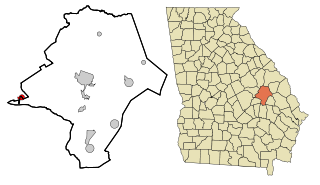
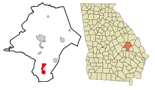
Candler County is a county located in the southeastern part of the U.S. state of Georgia. As of the 2020 census, the population was 10,981. The county seat is Metter. The county was founded in 1914 and named for Allen D. Candler, the 56th governor of Georgia.

<span class="mw-page-title-main">Ray City, Georgia</span> City in Georgia, United States

Ray City is a city in Berrien County and Lanier County, Georgia, United States. The population was 956 in 2020.

<span class="mw-page-title-main">Metter, Georgia</span> City in Georgia, United States

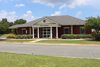
Metter is a city and the county seat of Candler County, Georgia, United States. The population was 4,130 at the 2010 census. In 2020, its population was 4,004.

<span class="mw-page-title-main">Douglas, Georgia</span> City in Georgia, United States

Douglas is a city in Coffee County, Georgia, United States. As of the 2020 census, the city had a population of 11,722. Douglas is the county seat of Coffee County and the core city of the Douglas micropolitan statistical area, which had a population of 50,731 as of the 2010 census.

<span class="mw-page-title-main">Adrian, Georgia</span> City in Georgia, United States

Adrian is a city in Emanuel and Johnson County, Georgia, United States. As of the 2020 census, the city had a population of 552.

<span class="mw-page-title-main">Garfield, Georgia</span> City in Georgia, United States

Garfield is a city in Emanuel County, Georgia, United States. The population was 257 in 2020.

<span class="mw-page-title-main">Nunez, Georgia</span> City in Georgia, United States

Nunez is a city in Emanuel County, Georgia, United States. The population was 134 in 2020.

<span class="mw-page-title-main">Oak Park, Georgia</span> City in Georgia, United States

Oak Park is a city in Emanuel County, Georgia, United States. The population was 484 at the 2010 census, up from 366 in 2000. By 2020, its population was 512.

<span class="mw-page-title-main">Stillmore, Georgia</span> City in Georgia, United States

Stillmore is a city in Emanuel County, Georgia, United States. The population was 439 in 2020.

<span class="mw-page-title-main">Summertown, Georgia</span> City in Georgia, United States

Summertown is a city in Emanuel County, Georgia, United States. The population was 121 in 2020.

<span class="mw-page-title-main">Swainsboro, Georgia</span> City in Georgia, United States

Swainsboro is a city in Emanuel County, Georgia, United States. As of the 2020 census, the city had a population of 7,425. The city is the county seat of Emanuel County.

<span class="mw-page-title-main">East Dublin, Georgia</span> City in Georgia, United States

East Dublin is a city in Laurens County, Georgia, United States. The population was 2,492 in 2020.

<span class="mw-page-title-main">Crawfordville, Georgia</span> Town in Georgia, United States

Crawfordville is a town in Taliaferro County, Georgia, United States. The population was 534 at the 2010 census. The city is the county seat of Taliaferro County.

References

  1. "2020 U.S. Gazetteer Files". United States Census Bureau. Retrieved December 18, 2021.
  2. "U.S. Census website". United States Census Bureau . Retrieved January 31, 2008.
  3. "US Board on Geographic Names". United States Geological Survey. October 25, 2007. Retrieved January 31, 2008.
  4. Krakow, Kenneth K. (1975). Georgia Place-Names: Their History and Origins (PDF). Macon, GA: Winship Press. p. 215. ISBN   0-915430-00-2.
  5. Lynn Speno (December 2013). "National Register of Historic Places Registration: Twin City Historic District / Summit; Graymont" (PDF). National Park Service . Retrieved April 12, 2017. Includes 42 photos from 2012.
  6. "US Gazetteer files: 2010, 2000, and 1990". United States Census Bureau. February 12, 2011. Retrieved April 23, 2011.
  7. "Geographic Identifiers: 2010 Demographic Profile Data (G001): Twin City city, Georgia". American Factfinder. U.S. Census Bureau. Archived from the original on February 13, 2020. Retrieved January 27, 2016.
  8. "Census of Population and Housing". Census.gov. Retrieved June 4, 2015.
  9. "Explore Census Data". data.census.gov. Retrieved December 18, 2021.
  10. "George L. Smith State Park | Department of Natural Resources Division".