
Portage Des Sioux is a city in St. Charles County, Missouri, United States. The town sits on the Mississippi River roughly opposite Elsah, Illinois, and is the home of the riverside shrine of Our Lady of the Rivers. The population was 328 at the 2010 census. The city was founded in 1799 by Spanish Lt. Gov. Zenon Trudeau and François Saucier in reaction to American plans to build a military post about twelve miles (19 km) downstream. The French name derives from the overland escape route between the Missouri River and Mississippi River used by a band of Sioux, fleeing enemies; they used this area as a portage for their canoes, outdistancing their rivals who instead paddled all of the way to the confluence of the rivers.

Kennett is a city in, and the county seat of, Dunklin County, Missouri, United States. The city is located in the southeast corner of Missouri, 4 miles (6.4 km) east of Arkansas and 20 miles (32 km) from the Mississippi River. It has a population of 10,932 according to the 2010 Census. Kennett is the largest city in the Bootheel, a mostly agricultural area.
Sulphur Springs is an unincorporated community in eastern Jefferson County, Missouri, United States. It is located near Barnhart, bordering the banks of Glaize Creek and the Mississippi River.
St. Albans is an unincorporated community in northeastern Franklin County, Missouri, United States. It lies approximately three miles north of Route 100 and about seven miles west of Wildwood. St. Albans is near the Missouri River and features high bluffs overlooking the river. The community is on the border of St.Louis County. The town also borders a small section of St. Charles County which, unlike the rest of the county, is on the south side of the Missouri River.

Matson is an unincorporated community in southern St. Charles County, Missouri, United States. It is located approximately three miles south of Defiance on Route 94 and is near the Missouri River.

St. Louis is located at 38°38′53″N90°12′44″W.

Chouteau Island, situated approximately eight miles (13 km) due north of the Gateway Arch in St. Louis, Missouri, and approximately one mile (1.6 km) south of the confluence of the Missouri River and Mississippi River, is one of a cluster of three islands: Chouteau Island, Gabaret Island, and Mosenthein Island. The three, with a combined area of approximately 5,500 acres (20 km2), are located in Madison County, Illinois. The three-island complex is also referred to as "Chouteau Island". The island is manmade, having been created during the construction of the Chain of Rocks Canal between 1946 and 1953. Most of Chouteau Island lies in Chouteau Township, but its southern quarter lies in Venice Township, both in Madison County. Gabaret Island and Mosenthein Island both lie entirely in Venice Township.
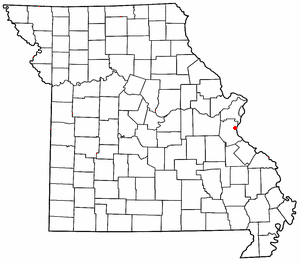
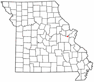
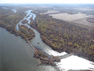
The Cuivre River is a 41.6-mile-long (66.9 km) river in the east central part of the state of Missouri, north of the Missouri River terminus. A good part of its course marks the borders between Lincoln and St. Charles counties before emptying into the Mississippi River north of St. Louis. The Cuivre River State Park near Troy has its southwestern borders on the river. The river is declared not to be a navigable stream.

Kosciusko is a mostly non-residential neighborhood located in St. Louis, Missouri. It begins at the Mississippi River front in the east and goes up to 7th Boulevard and 8th Street in the west. Interstate 55 is a northern border, and St. George and Dorcas Streets border the south of this neighborhood. Kosciusko is named in honor of Tadeusz Kościuszko, an American Revolutionary war general of Polish descent.
Joachim Creek is a stream in Jefferson and St. Francois counties in the U.S. state of Missouri. It is a tributary to the Mississippi River.
Plattin Creek is a stream in northeastern St. Francois and Jefferson counties in the U.S. state of Missouri. It is a tributary of the Mississippi River.
Riverside is an unincorporated community in Jefferson County, in the U.S. state of Missouri.
Apple Island is an island in the Mississippi River. The island is entirely within St. Charles County, Missouri.
Dresser Island is an island in the Mississippi River.The island is entirely within St. Charles County, Missouri.
Ellis Island is an island in the Mississippi River. The island is entirely within St. Charles County, Missouri.
Enon is an unincorporated community in northwest St. Charles County, in the U.S. state of Missouri.
Klondike is an unincorporated community in southern St. Charles County, in the U.S. state of Missouri.
Peruque is an unincorporated community in St. Charles County, in the U.S. state of Missouri. The community is adjacent to the Mississippi River, approximately five miles north of St. Peters on Missouri Route C. McCann Landing is just to the southeast along the river.

Maline Creek is a stream in St. Louis County in the U.S. state of Missouri. It is a tributary of the Mississippi River
Sugar Creek is a stream in St. Louis County in the U.S. state of Missouri. It is a tributary of the Mississippi River.


