St. Charles County, Missouri

Last updated

St. Charles County
St. Charles County Missouri Courthouse 20141018 A.jpg
St. Charles County Courthouse in St. Charles
Flag of St. Charles County, Missouri.gif
Map of Missouri highlighting St. Charles County.svg
Location within the U.S. state of Missouri
Missouri in United States.svg
Missouri's location within the U.S.
Coordinates: 38°45′36″N90°37′00″W / 38.76°N 90.6167°W / 38.76; -90.6167
CountryFlag of the United States.svg United States
StateFlag of Missouri.svg  Missouri
FoundedOctober 1, 1812
Named for Charles Borromeo
Seat St. Charles
Largest city O'Fallon
Government
   County executive Steve Ehlmann (R)
Area
  Total593 sq mi (1,540 km2)
  Land560 sq mi (1,500 km2)
  Water32 sq mi (80 km2)  5.4%
Population
 (2020)
  Total405,262
  Density680/sq mi (260/km2)
Time zone UTC−6 (Central)
  Summer (DST) UTC−5 (CDT)
Congressional districts 2nd, 3rd
Website www.sccmo.org

St. Charles County is in the central eastern part of the U.S. state of Missouri. As of the 2020 census, the population was 405,262, [1] making it Missouri's third-most populous county. Its county seat is St. Charles. [2] The county was organized October 1, 1812, and named for Saint Charles Borromeo, an Italian cardinal.

Contents

St. Charles County is part of the St. Louis, MO-IL Metropolitan Statistical Area and contains many of the city's northwestern suburbs. The wealthiest county in Missouri, [3] St. Charles County is one of the nation's fastest-growing counties.

St. Charles County includes a part of the Augusta AVA, an area of vineyards and wineries designated by the federal government in 1980 as the first American Viticultural Area. [4] The county's rural outer edge along the south-facing bluffs above the Missouri River, is also part of the broader Missouri Rhineland.

History

The County of St. Charles was originally called the District of St. Charles and had no definite limits until 1816 to 1818 when neighboring counties were formed. [5] The borders of St. Charles are the same today as they were in 1818. [6]

Geography

St. Charles County is the only known habitat of the threatened decurrent false aster in Missouri. Boltonia decurrens millar.jpg
St. Charles County is the only known habitat of the threatened decurrent false aster in Missouri.

According to the U.S. Census Bureau, the county has a total area of 593 square miles (1,540 km2), of which 560 square miles (1,500 km2) is land and 32 square miles (83 km2) (5.4%) is water. [8]

The highest elevation is 901 feet (275 m) northwest of Augusta near Femme Osage Creek headwaters. [9]

Adjacent counties

Major highways

National protected area

Climate

Saint Charles County
Climate chart (explanation)
J
F
M
A
M
J
J
A
S
O
N
D
 
 
2.6
 
 
36
25
 
 
3.2
 
 
45
30
 
 
3.7
 
 
55
36
 
 
8.5
 
 
75
50
 
 
4.4
 
 
77
57
 
 
4.9
 
 
90
66
 
 
1.9
 
 
88
70
 
 
4.2
 
 
86
68
 
 
4
 
 
82
57
 
 
3.6
 
 
72
45
 
 
1.8
 
 
57
41
 
 
3
 
 
39
25
Average max. and min. temperatures in °F
Precipitation totals in inches
Source: [10]
Metric conversion
J
F
M
A
M
J
J
A
S
O
N
D
 
 
66
 
 
2
−4
 
 
81
 
 
7
−1
 
 
94
 
 
13
2
 
 
216
 
 
24
10
 
 
112
 
 
25
14
 
 
124
 
 
32
19
 
 
48
 
 
31
21
 
 
107
 
 
30
20
 
 
102
 
 
28
14
 
 
91
 
 
22
7
 
 
46
 
 
14
5
 
 
76
 
 
4
−4
Average max. and min. temperatures in °C
Precipitation totals in mm

Demographics

Historical population
CensusPop.Note
1810 3,505
1820 3,97013.3%
1830 4,3208.8%
1840 7,91183.1%
1850 11,45444.8%
1860 16,52344.3%
1870 21,30428.9%
1880 23,0658.3%
1890 22,977−0.4%
1900 24,4746.5%
1910 24,6950.9%
1920 22,828−7.6%
1930 24,3546.7%
1940 25,5625.0%
1950 29,83416.7%
1960 52,97077.5%
1970 92,95475.5%
1980 144,10755.0%
1990 212,90747.7%
2000 283,88333.3%
2010 360,48527.0%
2020 405,26212.4%
U.S. Decennial Census [11]
1790–1960 [12] 1900–1990 [13]
1990–2000 [14] 2010–2020 [15]

As of 2020, there were 405,262 people and 150,668 households residing in the county. The population density was 643 inhabitants per square mile (248/km2). There were 161,144 housing units. The racial makeup of the county was 83.8% White, 5.2% African American, 0.1% Native American, 2.8% Asian, 0.1% Pacific Islander, and 6.5% from two or more races. Hispanic or Latino made up 4.0% of the population. [16]

There were 101,663 households, out of which 40.50% had children under the age of 18 living with them, 63.20% were married couples living together, 9.20% have a woman whose husband does not live with her, and 24.20% were non-families. 19.40% of all households were made up of individuals, and 5.90% had someone living alone who was 65 years of age or older. The average household size was 2.76 and the average family size was 3.18.

In the county, the population was spread out in age, with 29.00% under the age of 18, 8.20% from 18 to 24, 32.60% from 25 to 44, 21.60% from 45 to 64, and 8.80% who were 65 years of age or older. The median age was 34 years. For every 100 females there were 97.10 males. For every 100 females age 18 and over, there were 94.10 males.

The median income for a household in the county was $71,458, and the median income for a family was $64,415. Males had a median income of $44,528 versus $29,405 for females. The per capita income for the county was $23,592. 4.00% of the population and 2.80% of families were below the poverty line. Out of the total people living in poverty, 4.90% are under the age of 18 and 5.10% are 65 or older.

St. Charles County has had one of the fastest-growing populations in the state for many decades, with 55% growth in the 1970s, 48% in the 1980s, 33% in the 1990s, and another 27% in the 2000s. The county sits at a cross-section of industry, as well as extensive retail and some agriculture. With the Missouri River on the south and east and the Mississippi River on the north, the county is bisected east to west by Interstate 70. After St. Charles Airport closed in 2010, the county has one remaining small airport, St. Charles County Smartt Airport. Two ferries cross the Mississippi River from St. Charles County.

Racial composition2010 [17] 2018 [18]
White 91.3%89.9%
—Non-Hispanic89.1%86.9%
Black or African American 4.4%5.1%
Hispanic or Latino (of any race)2.9%3.4%
Asian 2.3%2.7%
Two or More Races1.6%2.0%

2020 Census

St. Charles County Racial Composition [19]
RaceNum.Perc.
White (NH)335,87982.9%
Black or African American (NH)20,6725.1%
Native American (NH)6230.15%
Asian (NH)11,0682.73%
Pacific Islander (NH)1990.05%
Other/Mixed (NH)20,8105.13%
Hispanic or Latino 16,0114%

Education

Public schools

School districts include: [20]

High schools (all grades 9–12):

Private schools

  • Academy of the Sacred Heart – St. Charles – (PK-08) Roman Catholic
  • All Saints School – St. Peters – (K-08) – Roman Catholic
  • Assumption Catholic Grade School – O'Fallon – (K-08) – Roman Catholic
  • Christian High School– O'Fallon and St. Peters– (PK-12) – Non-denominational Christian
  • Duchesne High School– St. Charles– (09-12)– Roman Catholic
  • First Baptist Christian Academy – O'Fallon – (PK-07) – Non-denominational Christian
  • Foristell Baptist Academy Foristell  – (K-09) Baptist
  • Hope Montessori Academy Lake St. Louis  – (PK-K) – Nonsectarian
  • Immaculate Conception Catholic School – Dardenne Prairie – (K-08) – Roman Catholic
  • Immanuel Lutheran School – St. Charles – (PK-08) Lutheran
  • Immanuel Lutheran School – Wentzville – (PK-08) – Lutheran
  • Liberty Classical School – O'Fallon – (07-12) – Non-denominational Christian
  • Lutheran High School of St. Charles County – St. Peters – (09-12) – Lutheran
  • Messiah Lutheran School – Weldon Spring – (PK-08) – Lutheran
  • Mid Rivers Seventh-day Adventist School – St. Peters – (03-08) Seventh-day Adventist
  • St. Charles Borromeo – St. Charles – (K-08) – Roman Catholic
  • St. Cletus School – St. Charles – (K-08) – Roman Catholic
  • St. Dominic High School  – O'Fallon – (09-12) – Roman Catholic
  • St. Elizabeth St. Robert Regional School – St. Charles – (PK-08) – Roman Catholic
  • St. Joseph School Cottleville  – (K-08) – Roman Catholic
  • St. Joseph School – Wentzville – (PK-08) – Roman Catholic
  • St. Patrick Elementary School – Wentzville – (K-08) – Roman Catholic
  • St. Paul Elementary School – St. Paul – (PK-08) – Roman Catholic
  • St. Peter Catholic School – St. Charles – (PK-08) – Roman Catholic
  • St. Theodore School – Wentzville – (K-08) – Roman Catholic
  • Sts. Joachim & Ann School – St. Charles – (PK-08) – Roman Catholic
  • Trinity Lutheran School – St. Charles – (01-08) – Lutheran
  • Willott Road Christian Academy – St. Peters – (NS-09) – Baptist
  • Zion Lutheran School – St. Charles – (PK-08) – Lutheran

Alternative schools

Higher education

Public libraries

Government

St. Charles County is governed by a county executive and a county council. The county council consists of seven members, each elected from various districts in the county. The county executive is elected by the entire county. The current executive is Steve Ehlmann. He was preceded by Joe Ortwerth, who was preceded by Gene Schwendemann, the first county executive of St. Charles County under the new form of government. The executive under the old form of county government was termed a "judge." The county had 258,525 registered voters as of March 2016. [22]

St. Charles County Ambulance District (SCCAD) is the largest such district in Missouri, serving all of St. Charles County and its population of nearly 370,000.

Law enforcement

The St. Charles County Sheriff's Department (SCCSD) is responsible for court services and security, prisoner transport, civil process, and bailiffs. Until the end of 2014, SCCSD was the primary law enforcement agency serving unincorporated areas of St. Charles County. On January 1, 2015, the St. Charles County Police Department was established and assumed that responsibility. [23] It should not be confused with the St. Charles City Police Department. The St. Charles County Regional SWAT Team is made up of officers from each county law enforcement agency.

The SCCSD Aviation Unit is part of a multi-jurisdictional unit known as the Metro Air Support Unit, with the Metropolitan Police Department, City of St. Louis, St. Louis County Police Department, and St. Charles County Sheriff's Department. In 2007, the fleet included six helicopters, one fixed-wing airplane, six pilots, and eight crew chiefs. [24]

In May 2022, Ryan Keuhner, who was then an SCCSD deputy, shot and killed his neighbor's 3-year-old rescue dog with a pellet gun. The shooting was reportedly unprovoked and Keuhner was off duty at the time. Video of the dog's owner confronting Keuhner was uploaded online, and later gained national coverage. Keuhner resigned in June 2022 and was charged with a class A misdemeanor for animal abuse. [25] [26]

Library resolution

In 2023, the county council issued a resolution aimed at library policies and staff online activities. The resolution followed protests and comments at council meetings from residents who complained about a staff member wearing gender non-conforming clothes. Within the resolution, the council asked the library CEO to remove an article they shared on their personal LinkedIn profile related to conservative campaigns targeting public libraries and freedom of speech. [27]

Politics

Local

The Republican Party predominantly controls politics at the local level in St. Charles County. Republicans hold all the elected positions in the county. [28] [29] [30]

PositionIncumbentParty
AssessorTravis Welge [31] Republican
CollectorMichelle McBride Republican
Council Member – District 1Matt Swanson Republican
Council Member – District 2Joseph Brazil Republican
Council Member – District 3Michael Elam Republican
Council Member – District 4David Hammond Republican
Council Member – District 5Terry Hollander Republican
Council Member – District 6Nancy Schneider Republican
Council Member – District 7Tim Baker Republican
County Executive Steve Ehlmann Republican
Director of Elections Kurt Bahr Republican
Prosecuting AttorneyJoe McCulloch Republican [32] [33]
RecorderMary Dempsey Republican
SheriffScott Lewis Republican

State

Past Gubernatorial Elections Results
Year Republican Democratic Third Parties
2020 58.12%128,23039.84% 87,8882.04% 4,496
2016 54.52%103,94642.58% 85,7042.90% 5,836
2012 48.58% 89,14448.97%89,8602.45% 4,486
2008 44.51% 82,44053.84%99,7051.65% 3,058
2004 55.90%91,32342.96% 70,1841.14% 1,865
2000 58.24%74,35739.49% 50,4152.27% 2,907
1996 49.48%47,88648.01% 46,4622.50% 2,424

St. Charles County is divided among eleven legislative districts in the Missouri State House of Representatives, all of which are held by Republicans.

St. Charles County is divided into three districts in the Missouri State Senate, each of which are represented by Republicans.

Federal

Missouri is represented in the U.S. Senate by Josh Hawley and Eric Schmitt, whose most recent election results from the county are included here.

U.S. Senate — Missouri — (2022) [34]
PartyCandidateVotes%
Republican Eric Schmitt 83,559 55.35%
Democratic Trudy Busch Valentine64,55242.76%
Libertarian Jonathan Dine2,1581.43%
Constitution Paul Venable7090.47%
Total votes150,978 100.00%
U.S. Senate — Missouri — (2018) [35]
PartyCandidateVotes%
Republican Josh Hawley93,17252.90%
Democratic Claire McCaskill 77,97344.30%
Independent Craig O'Dear2,3931.40%
Libertarian Japheth Campbell1,8361.0%
Green Jo Crain7310.4%
Total votes176,105 100%
U.S. Senate — Missouri — (2016)
PartyCandidateVotes%±%
Republican Roy Blunt103,94651.78%+6.87
Democratic Jason Kander88,23843.95%-5.18
Libertarian Jonathan Dine5,2382.61%-3.35
Green Johnathan McFarland1,9700.98%+0.98
Constitution Fred Ryman1,3550.67%+0.67
U.S. Senate — Missouri — (2012) [36]
PartyCandidateVotes%
Democratic Claire McCaskill 89,99349.10%
Republican Todd Akin82,27844.90%
Libertarian Jonathan Dine10,9246.0%
U.S. Senate — Missouri — (2010) [37]
PartyCandidateVotes%
Republican Roy Blunt 73,69559.09%
Democratic Robin Carnahan43,95535.24%
Libertarian Jonathan Dine10,9246.0%

Part of St. Charles County is included in Missouri's 2nd Congressional District and is currently represented by Ann Wagner in the U.S. House of Representatives.

U.S. House of Representatives — Missouri's 2nd Congressional District — St. Charles County (2020)
PartyCandidateVotes%±%
Republican Ann Wagner45,94157.38%
Democratic Jill Schupp31,23939.02%
Libertarian Martin Schulte2,8213.52%
U.S. House of Representatives — Missouri's 2nd Congressional District — St. Charles County (2018) [35]
PartyCandidateVotes%±%
Republican Ann Wagner 37,875 57.5%
Democratic Cort VanOstran26,78240.6%
Libertarian Tony Kirk9561.5%
Green David Arnold3040.5%
Independent Ken Newhouse (write-in)00.0%
Total votes65,917 100.0%
Republican hold

Most of St. Charles County is included in Missouri's 3rd Congressional District and is currently represented by Blaine Luetkemeyer (R-St. Elizabeth) in the U.S. House of Representatives.

U.S. House of Representatives — Missouri's 3rd Congressional District — St. Charles County (2020)
PartyCandidateVotes%±%
Republican Blaine Luetkemeyer84,07161.74%
Democratic Megan Rezabek49,31536.22%
Libertarian Leonard J Steinman II2,6311.93%
U.S. House of Representatives — Missouri's 3rd Congressional District — St. Charles County (2018) [35]
PartyCandidateVotes%±%
Republican Blaine Luetkemeyer 61,751 57.77%
Democratic Katy Geppert43,07040.30%
Libertarian Donald V. Stolle2,0621.93%
Total votes106,883 100.0%
Republican hold
United States presidential election results for St. Charles County, Missouri [38]
Year Republican Democratic Third party
No.%No.%No.%
2020 128,38957.69%89,53040.23%4,6472.09%
2016 121,65059.87%68,62633.78%12,9086.35%
2012 110,78459.44%71,83838.55%3,7442.01%
2008 102,55054.27%84,18344.55%2,2241.18%
2004 95,82658.61%66,85540.89%8070.49%
2000 72,11456.04%53,80641.81%2,7662.15%
1996 47,70546.66%41,36940.46%13,17212.88%
1992 38,67336.29%37,26334.97%30,62728.74%
1988 50,00562.90%29,28636.84%2090.26%
1984 47,78473.06%17,61726.94%00.00%
1980 36,05060.32%20,66834.58%3,0505.10%
1976 26,10553.60%22,06345.30%5361.10%
1972 25,67769.94%11,03430.06%00.00%
1968 13,53345.63%10,37434.98%5,75219.39%
1964 9,02038.30%14,53061.70%00.00%
1960 10,88847.80%11,89052.20%00.00%
1956 9,46255.40%7,61844.60%00.00%
1952 8,45156.48%6,49343.39%200.13%
1948 5,97649.54%6,04950.14%390.32%
1944 7,05058.92%4,88040.78%360.30%
1940 7,79259.14%5,33440.48%500.38%
1936 5,15642.72%5,90348.91%1,0098.36%
1932 3,66434.12%6,91164.37%1621.51%
1928 5,40451.43%5,08148.36%220.21%
1924 4,66859.11%2,36429.94%86510.95%
1920 6,64572.13%2,47226.83%961.04%
1916 3,51864.16%1,91434.91%510.93%
1912 2,35049.00%1,79237.36%65413.64%
1908 3,48062.84%1,97935.73%791.43%
1904 3,20362.91%1,78835.12%1001.96%
1900 3,32458.10%2,34340.95%540.94%
1896 3,17356.15%2,44843.32%300.53%
1892 2,52250.00%2,48549.27%370.73%
1888 2,66852.65%2,38146.99%180.36%

2016 Missouri presidential primary results

Republican

Donald Trump won the most votes in St. Charles County, with 41.50 percent. U.S. Senator Ted Cruz (R-Texas) came in second with 38.87 percent, Governor John Kasich (R-Ohio) placed third with 10.70 percent, and U.S. Senator Marco Rubio (R-Florida) was fourth with 7.10 percent.

Democratic

U.S. Senator Bernie Sanders (I-Vermont) won the primary with 54.32 percent to former Secretary of State Hillary Clinton's 44.80 percent.

2012 Missouri presidential primary results

Republican

Former U.S. Senator Rick Santorum (R-Pennsylvania) won the most votes in St. Charles County, with 56.29 percent. Former Governor Mitt Romney (R-Massachusetts) came in second with 25.43 percent, and former U.S. Representative Ron Paul (R-Texas) was third with 12.69 percent.

Democratic

With incumbent President Barack Obama facing no serious opposition, few St. Charles County voters voted in the Democratic primary; Obama won 87.83 percent.

2008 Missouri presidential primary results

Republican

Former Governor Mitt Romney (R-Massachusetts) won the most votes in St. Charles County, with 37.72 percent. U.S. Senator John McCain (R-Arizona) came in second with 34.95 percent, former Governor Mike Huckabee (R-Arkansas) placed third with 21.83 percent, and U.S. Representative Ron Paul (R-Texas) was fourth with 3.83 percent.

Democratic

Former U.S. Senator Hillary Clinton (D-New York) received a total of 23,611 votes, more than any candidate from either party in St. Charles County during the 2008 presidential primary.

Communities

Cities

Villages

Census-designated place

Other unincorporated places

Islands

Subregions

Westplex

Westplex is an area within St. Charles County in east-central Missouri to the west of St. Louis County. [39]

The Westplex is part of St. Charles County that used to be called "The Golden Triangle". The "triangle" was formed by I-70 to the north, Missouri Route 94 to the southeast, and I-64 to the southwest. Since almost all of the growth in St. Charles County was within this triangle it was dubbed the "Golden" area of St. Charles county, hence, Golden Triangle. Today the Westplex is made up of St. Charles, St. Peters, Weldon Spring, Cottleville, Dardenne Prairie, O'Fallon, Lake St. Louis, and Wentzville.

See also

Related Research Articles

<span class="mw-page-title-main">Warren County, Missouri</span> County in Missouri, United States

Warren County is a county located in the eastern portion of the U.S. state of Missouri. As of the 2020 census, the population was 35,532. The county is located on the north side of the Missouri River. Its county seat is Warrenton. The county was established on January 5, 1833, and was named for General Joseph Warren, who died in the Battle of Bunker Hill during the American Revolutionary War.

<span class="mw-page-title-main">Scott County, Missouri</span> County in Missouri, United States

Scott County is located in the southeastern portion of the U.S. state of Missouri. As of the 2020 census, the population was 38,059. Its county seat is Benton. The county was organized in 1821 and named for U.S. Representative John Scott, the first federal representative from Missouri. Scott County comprises the Sikeston, MO Micropolitan Statistical Area, which is also included in the Cape Girardeau-Sikeston, MO-IL Combined Statistical Area. The county is home to Scott County Central High School, which has won 18 state championships in boys basketball—the most of any high school in the state.

<span class="mw-page-title-main">Jefferson County, Missouri</span> County in Missouri, United States

Jefferson County is located in the eastern portion of the U.S. state of Missouri. It is a part of the St. Louis Metropolitan Area. As of the 2020 census, the population was 226,739, making it the sixth-most populous county in Missouri. Its county seat is Hillsboro. The county was organized in 1818 and named in honor of former president Thomas Jefferson.

<span class="mw-page-title-main">Greene County, Missouri</span> County in Missouri, United States

Greene County is located in the southwest part of the U.S. state of Missouri. As of the 2020 census, its population was 298,915. making it the fourth most-populous county in Missouri.

<span class="mw-page-title-main">Franklin County, Missouri</span> County in Missouri, United States

Franklin County is located in the U.S. state of Missouri. At the 2020 census, the population was 104,682. Its county seat is Union. The county was organized in 1818 and is named after Founding Father Benjamin Franklin.

<span class="mw-page-title-main">Cole County, Missouri</span> County in Missouri, United States

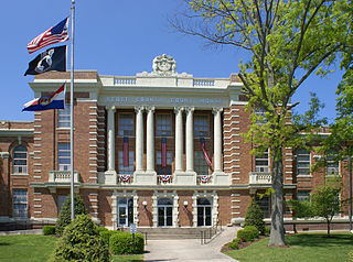
Cole County is located in the central part of the U.S. state of Missouri. As of the 2020 census, its population was 77,279. Its county seat and largest city is Jefferson City, the state capital. The county was organized November 16, 1820, and named after pioneer William Temple Cole who built Cole's Fort in Boonville.

<span class="mw-page-title-main">Buchanan County, Missouri</span> County in Missouri, United States

Buchanan County is located in the U.S. state of Missouri. As of the 2020 United States Census, the population was 84,793. Its county seat is St. Joseph. When originally formed in 1838, the county was named Roberts County, after settler Hiram Roberts. It was renamed in 1839 for James Buchanan, then a U.S. Senator and later President of the United States. The county was formed from land annexed to Missouri, as were five other counties.

<span class="mw-page-title-main">Wentzville, Missouri</span> City in Missouri, United States

Wentzville is an exurb of St. Louis that is located in western St. Charles County, Missouri, United States. As of the 2022 U.S. Census Bureau estimates, the city had a total population of 47,197, making it the 15th largest city in Missouri. Wentzville has been the fastest growing city in Missouri, by percentage population increase, for two consecutive decades from 2000 to 2020. As the site of Rotary Park, Wentzville is host to the St. Charles County Fair and the St. Louis Renaissance Festival.

<span class="mw-page-title-main">St. Peters, Missouri</span> City in east central Missouri, U.S.

St. Peters is a city in St. Charles County, Missouri, United States. The population was 57,732 at the 2020 census, making it the eleventh-largest city in Missouri. It is a northwestern suburb of St. Louis.

<span class="mw-page-title-main">Greater St. Louis</span> Metropolitan Statistical Area in the United States

Greater St. Louis is the 21st-largest metropolitan statistical area (MSA) in the United States, the largest in Missouri, and the second-largest in Illinois. Its core city—St. Louis, Missouri—sits in the geographic center of the metro area, on the west bank of the Mississippi River. The river bisects the metro area geographically between Illinois and Missouri, although the latter portion is much more populous. The MSA includes St. Louis County, which is independent of the City of St. Louis; their two populations are generally tabulated separately.

Francis Howell High School is a four-year public high school located in St. Charles, Missouri. Approximately 1800 students from Defiance, Foristell, New Melle, O'Fallon, Saint Peters, Saint Charles, Weldon Spring, and Wentzville attend school at Howell. It is in the Francis Howell School District. The school's mascot is Victor the Viking.

<span class="mw-page-title-main">Fort Zumwalt Park</span> Park in OFallon, Missouri, U.S.

Fort Zumwalt Park is a park in O'Fallon, Missouri, that features the rebuilt homestead fort of Jacob Zumwalt.

Zumwalt may refer to:

<span class="mw-page-title-main">Fort Zumwalt North High School</span> Public secondary school in OFallon, Missouri, U.S.

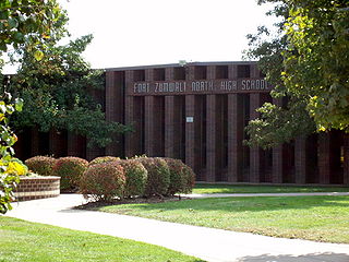
Fort Zumwalt North High School, the first high school established in its Fort Zumwalt School District, is located in O'Fallon, Missouri. Established in 1960 as Fort Zumwalt High School, the school moved to its current location in 1976. "North" was added to the school's name when the district's second high school opened in 1987.

<span class="mw-page-title-main">O'Fallon, Missouri</span> City in Missouri, United States

O'Fallon is a city in St. Charles County, Missouri, United States. It is part of the St. Louis metropolitan statistical area, located along Interstates 64 and 70 between Lake St. Louis and St. Peters. As of the 2020 census, O'Fallon had a population of 91,316, making it the most populous suburb of St. Louis, as well as the most populous municipality in St. Charles County and the 7th most populous in Missouri. O'Fallon's namesake in St. Clair County, Illinois, is also part of the St. Louis region. The two cities are one of the few pairs of same-named municipalities to be part of the same metro area.

<span class="mw-page-title-main">Dardenne Prairie, Missouri</span> Town in Missouri, United States

Dardenne Prairie is a city in St. Charles County, Missouri, United States. The population was 12,743 at the 2020 census.

<span class="mw-page-title-main">Fort Zumwalt School District</span> U.S. public school district in St. Charles County, Missouri

Fort Zumwalt School District is headquartered in O'Fallon, Missouri, United States.

Wentzville R-IV School District is a school district headquartered in Wentzville, Missouri, United States. In addition to almost all of Wentzville, the district serves all of Lake St. Louis, the St. Charles County portion of Foristell; and portions of Dardenne Prairie, Flint Hill, Josephville, and O'Fallon.

The Francis Howell R-III School District, also known as the Francis Howell School District (FHSD) is a school district in Missouri, headquartered in O'Fallon in the St. Louis metropolitan area.

References

  1. "2020 U.S. Census". United States Census Bureau.
  2. "Find a County". National Association of Counties. Retrieved June 7, 2011.
  3. "County-Level Unemployment and Median Household Income for Missouri". www.ers.usda.gov. USDA Economic Research Service. Retrieved March 30, 2009.
  4. Pingelton, Tim (December 8, 2005). "The Soul of Augusta". Appellation American. Archived from the original on July 24, 2008.
  5. Bryan, William S. (1993). St. Charles Co., Missouri: biographical sketches from pioneer families of Missouri by Bryan and Rose. Baltimore, Maryland: Genealogical Publishing Company. p. 1.
  6. "MO: Individual County Chronology". Newberry. Retrieved October 8, 2020.
  7. "Decurrent False Aster". Field Guide. Missouri Dept. of Conservation. Retrieved September 2, 2015.
  8. "2010 Census Gazetteer Files". United States Census Bureau. August 22, 2012. Archived from the original on October 21, 2013. Retrieved November 20, 2014.
  9. USGS 1/3 Arc Second NED
  10. "NASA Earth Observations Data Set Index". NASA. Archived from the original on May 11, 2020. Retrieved January 30, 2016.
  11. "U.S. Decennial Census". United States Census Bureau. Retrieved November 20, 2014.
  12. "Historical Census Browser". University of Virginia Library. Retrieved November 20, 2014.
  13. "Population of Counties by Decennial Census: 1900 to 1990". United States Census Bureau. Retrieved November 20, 2014.
  14. "Census 2000 PHC-T-4. Ranking Tables for Counties: 1990 and 2000" (PDF). United States Census Bureau. Retrieved November 20, 2014.
  15. "2020 Population and Housing State Data". U.S. Census Bureau. Retrieved August 28, 2021.
  16. "St. Charles County, Missouri". United States Census Bureau. Retrieved January 9, 2022.
  17. "American Fact Finder". U.S. Census.[ dead link ]
  18. "QuickFacts. St. Charles County, Missouri". United States Census Bureau. Retrieved August 9, 2019.
  19. "P2 Hispanic or Latino, and Not Hispanic or Lationo by Race – 2020: DEC Redistricting Data (PL 94-171) – St. Charles County, Missouri".
  20. "2020 Census - School District Reference Map: St. Charles County, MO" (PDF). U.S. Census Bureau . Retrieved July 22, 2022. - Text list
  21. Breeding, Marshall. "Saint Charles City – County Public Library". Libraries.org. Retrieved May 8, 2017.
  22. "Presidential Preference Primary, March 15, 2016, St. Charles County Missouri". St. Charles County Election Authority. March 22, 2016. Retrieved March 30, 2016.
  23. Schlinkmann, Mark (December 30, 2014). "New St. Charles County police department begins operations Thursday". STLtoday.com. Retrieved June 28, 2017.
  24. "Metro Airborne Law Enforcement of St. Louis, Mo".
  25. Byers, Christine (June 27, 2022). "St. Charles County Sheriff's Deputy charged after pellet gun death of neighbor's dog". KSDK . Retrieved April 30, 2023.
  26. Harris, Taylor Tiamoyo (July 3, 2022). "Ex-St. Charles County sheriff's deputy faces misdemeanor charge in dog's death". St. Louis Post-Dispatch. Retrieved May 1, 2023.
  27. Hanshaw, Annelise (August 15, 2023). "Community uproar leads St. Charles County to admonish library to be 'non-political'". Missouri Independent. Retrieved August 16, 2023.
  28. "November 2018 General Election".
  29. "November 3, 2020 General Election".
  30. "County Council". St. Charles County, Missouri. Retrieved March 9, 2022.
  31. "Assessor". St. Charles County, Missouri. Retrieved May 15, 2024.
  32. Korando, Russell (November 23, 2012). "St. Charles County judge nominated for prosecutor". St. Charles County Suburban Journal. Retrieved December 3, 2013. Ehlmann was required to appoint someone from the same political party as Banas, a Republican, to serve until the office comes up for election in November 2014.
  33. https://sccmo.org/414/Prosecuting-Attorney
  34. "Official Final Election Results". St. Charles County Election Authority. Retrieved August 19, 2023.
  35. 1 2 3 "County Results". Election Night Reporting. Missouri Secretary of State. Retrieved March 4, 2019.
  36. "2012 Missouri Senate Results". POLITICO.
  37. "St. Charles County 2010 Election Results".
  38. Leip, David. "Dave Leip's Atlas of U.S. Presidential Elections". uselectionatlas.org. Retrieved March 26, 2018.
  39. "About Westplex". westplex.com. Retrieved October 20, 2017.