Arnold, Missouri

Last updated

Arnold, Missouri
Arnold Water Tower from I-55 North.JPG
Arnold Water Tower from I-55 North
(color is sky blue since Nov 2015)
Jefferson County Missouri Incorporated and Unincorporated areas Arnold Highlighted.svg
Location within Jefferson County and Missouri
Arnold, Missouri
Interactive map of Arnold
Coordinates: 38°25′47″N90°22′24″W / 38.42972°N 90.37333°W / 38.42972; -90.37333
Country United States
State Missouri
County Jefferson
Government
  MayorRon Counts [1]
  Mayor Pro-TemTim Seidenstricker [2]
Area
[3]
  Total11.53 sq mi (29.86 km2)
  Land11.53 sq mi (29.85 km2)
  Water0.00 sq mi (0.01 km2)
Elevation
[4]
522 ft (159 m)
Population
 (2020)
  Total20,858
  Density1,809.80/sq mi (698.79/km2)
Time zone UTC-6 (Central (CST))
  Summer (DST) UTC-5 (CDT)
ZIP code
63010
Area code 636
FIPS code 29-01972 [5]
GNIS ID 2393991 [4]
Website arnoldmo.org

Arnold is a city in Jefferson County, Missouri, United States, and a suburb of St. Louis. The population was 20,858 at the 2020 United States census.

Contents

History

The Osage peoples were the first people that lived in what today is Arnold, many artifacts have been found in the area that show there was an ancient Osage village near where the Meramec River meets the Mississippi River. In the area where 2 salt licks used to be, human bones have been found, along with pottery shards and many other artifacts. The first European settler in Arnold, was John Hildebrand an immigrant from Germany, that lived in Monongahela County, Pennsylvania. He was the first white settler in the area that is today Jefferson county, he established a settlement near saline creek, with a fort for protection. In 1776 Jean Baptiste Gamache, who operated a ferry boat across the Meramec River was granted 1050 arpents of land by king Charles III of Spain. This ferry was on the King's Trace or El Camino Real, from St. Louis to Ste. Genevieve, Missouri.[1] [2]

Eminent domain

Arnold was a focal point over the eminent domain issue in Missouri. [6] In January 2004, the City of Arnold announced that THF Realty had approached them regarding developing a section of Arnold known as the Triangle, [7] an area bordered by Route 141, Interstate 55 and Church Road in the city limits. The city voted in favor of the Triangle Development project proceeding on September 16, 2005.

According to an agreement with THF, Arnold would acquire the properties in the triangle and would be reimbursed its costs by THF. Arnold offered the property owners a buy-out, and most accepted. Some businesses were promised relocation [7] either in the new development or elsewhere in the city. Others were not given this option. Some refused the offer, and the city moved to condemn the dissenting properties. One such hold out was Homer R. Tourkakis, the owner of a dental practice on the corner of the triangle formed by Route 141 and Interstate 55.

Tourkakis claims that THF never made a fair-market offer. THF claims they offered to rebuild his practice elsewhere and purchase his property for $600,000. Tourkakis's property was declared blighted, and Arnold sought to seize it under eminent domain. Tourkakis fought these proceedings in the Jefferson County courts. Arnold and THF argued that although incorporated cities are not explicitly granted the use of eminent domain does not imply they are denied it. The judge ruled that because Arnold is a third-class city, under Missouri law, it cannot use eminent domain to seize properties. [6] In appeal to the Missouri Supreme Court, the decision was reversed, ruling that through the TIF act and the City of Arnold being an incorporated municipality, had the right to use eminent domain. [8]

Red light cameras

In 2005, Arnold became the first city in Missouri to install red light cameras. [9] A 2009 lawsuit against the cameras was dismissed on procedural grounds. [10] In 2013 the Missouri Court of Appeals Eastern District ruled the Arnold red-light camera ordinance to be unconstitutional. [11]

Notable events

On October 24, 1988 Republican vice-presidential candidate Dan Quayle addressed the students at Fox High School, listening to questions and discussing the fight on drugs.

On July 17, 1993 President Bill Clinton with several members of his cabinet held a "flood summit" at Fox High School during the Great Flood of 1993. During the summit, Clinton promised the governors of flood-damaged states that his administration would not abandon them once the water recedes. [12]

On April 29, 2009, United States President Barack Obama held a town hall meeting commemorating his 100th day in office at Fox High School in Arnold. Several members of the presidents cabinet and staff attended the event including senior White House advisers Valerie Jarrett and David Axelrod and National Security Adviser James L. Jones.

Meramec River flooding

The Meramec River crested at a record level of 47.26 feet on December 31, 2015, after a weekend of heavy rain, affecting over 300 homes and breaking the previous record crest from 1993. [13] The floodwaters closed Interstate 55 at the Meramec just north of Arnold. [14]

Flooding struck again in 2017 after heavy rains, with the Meramec cresting at 45.62 feet on May 3. Only the southbound lanes of I-55 were closed by floodwater. [15] Approximately 20 homes were affected. [16]

Geography

According to the United States Census Bureau, the city has a total area of 11.94 square miles (30.92 km2), of which 11.58 square miles (29.99 km2) is land and 0.36 square miles (0.93 km2) is water. [17]

The city is located at the confluence of the Meramec and Mississippi rivers, [18] just south of St. Louis County.

Demographics

Historical population
CensusPop.Note
1980 19,141
1990 18,828−1.6%
2000 19,9656.0%
2010 20,8084.2%
2020 20,8580.2%
U.S. Decennial Census [19]

2020 census

The 2020 United States census [20] counted 20,858 people, 8,518 households, and 5,607 families in Arnold. The population density was 1,809.0 per square mile (698.8/km2). There were 8,961 housing units at an average density of 777.2 per square mile (300.2/km2). The racial makeup was 89.55% (18,678) white, 0.94% (196) black or African-American, 0.21% (43) Native American, 1.11% (232) Asian, 0.06% (13) Pacific Islander, 0.81% (169) from other races, and 7.32% (1,527) from two or more races. Hispanic or Latino of any race wash 1.7% (363) of the population. The foreign born population also saw an increase in Arnold, particularly in it’s Bosnian community. [21]

Of the 8,518 households, 31.6% had children under the age of 18; 49.8% were married couples living together; 27.0% had a female householder with no husband present. Of all households, 25.7% consisted of individuals and 12.9% had someone living alone who was 65 years of age or older. The average household size was 2.5 and the average family size was 3.0.

23.2% of the population was under the age of 18, 5.7% from 18 to 24, 27.4% from 25 to 44, 27.1% from 45 to 64, and 18.0% who were 65 years of age or older. The median age was 40.3 years. For every 100 females, the population had 97.1 males. For every 100 females ages 18 and older, there were 93.2 males.

The 2016-2020 5-year American Community Survey [22] estimates show that the median household income was $64,678 (with a margin of error of +/- $6,401) and the median family income $76,738 (+/- $8,404). Males had a median income of $47,707 (+/- $5,963) versus $32,198 (+/- $4,524) for females. The median income for those above 16 years old was $38,896 (+/- $2,588). Approximately, 6.5% of families and 8.6% of the population were below the poverty line, including 13.4% of those under the age of 18 and 6.5% of those ages 65 or over.

2010 census

As of the census [23] of 2010, there were 20,808 people, 8,090 households, and 5,695 families living in the city. The population density was 1,796.9 inhabitants per square mile (693.8/km2). There were 8,547 housing units at an average density of 738.1 per square mile (285.0/km2). The racial makeup of the city was 96.3% White, 0.6% African American, 0.2% Native American, 0.9% Asian, 0.6% from other races, and 1.4% from two or more races. Hispanic or Latino of any race were 2.2% of the population.

There were 8,090 households, of which 34.1% had children under the age of 18 living with them, 52.3% were married couples living together, 12.9% had a female householder with no husband present, 5.2% had a male householder with no wife present, and 29.6% were non-families. 23.9% of all households were made up of individuals, and 9.7% had someone living alone who was 65 years of age or older. The average household size was 2.55 and the average family size was 3.02.

The median age in the city was 39.2 years. 23.3% of residents were under the age of 18; 8.6% were between the ages of 18 and 24; 26.3% were from 25 to 44; 27.4% were from 45 to 64; and 14.4% were 65 years of age or older. The gender makeup of the city was 48.7% male and 51.3% female.

2000 census

As of the census [5] of 2000, there were 19,965 people, 7,550 households, and 5,564 families living in the city. The population density was 1,775.0 inhabitants per square mile (685.3/km2). There were 7,913 housing units at an average density of 703.5 per square mile (271.6/km2). The racial makeup of the city was 97.91% White, 0.30% African American, 0.21% Native American, 0.38% Asian, 0.02% Pacific Islander, 0.27% from other races, and 0.92% from two or more races. Hispanic or Latino of any race were 1.04% of the population.

There were 7,550 households, out of which 34.3% had children under the age of 18 living with them, 58.2% were married couples living together, 11.1% had a female householder with no husband present, and 26.3% were non-families. 22.0% of all households were made up of individuals, and 7.7% had someone living alone who was 65 years of age or older. The average household size was 2.61 and the average family size was 3.05.

In the city, the population was spread out, with 25.5% under the age of 18, 8.4% from 18 to 24, 30.4% from 25 to 44, 23.6% from 45 to 64, and 12.1% who were 65 years of age or older. The median age was 37 years. For every 100 females, there were 94.7 males. For every 100 females age 18 and over, there were 90.3 males.

The median income for a household in the city was $47,188, and the median income for a family was $53,664. Males had a median income of $37,972 versus $27,222 for females. The per capita income for the city was $20,378. About 3.0% of families and 4.4% of the population were below the poverty line, including 6.1% of those under age 18 and 3.6% of those age 65 or over.

Economy

In 2014, Anheuser-Busch InBev's subsidiary Metal Container Corp, made the decision to expand their aluminum can and bottle manufacturing plant in Arnold, [24] making the city home to the largest can manufacturing facility in the country.

Arnold is home to one of two offices of the National Geospatial Intelligence Agency in the St Louis area [25] employing at least 900 workers. [26]

According to Money Magazine, Arnold was ranked the 12th best and most affordable city to live in the United States in 2008. [27]

Parks and recreation

Arnold City Park is located off Jeffco Blvd. at #1 Bradley Beach Road. The 68-acre park has an 8-acre fishing lake and 4 pavilions, each with electricity and a BBQ pit. The park also offers a playground, paved 1/2-mile walking/hiking trail, 2 dirt multipurpose fields, 2 horseshoe pits, volleyball poles, Paw (dog) park, and fishing.

Ferd B. Lang Park is a 25-acre multi-use park located at 1820 Old Lemay Ferry Road. The park has 5 pavilions with electrical outlets and BBQ pits at each site. Other amenities include a playground, hiking trails, 2 grass multipurpose fields, 5 horseshoe pits, 3 sand volleyball courts, Arnold Jaycees Skate Park, half basketball court, Paw Park for Dogs, and restrooms (closed Nov 5, 2018 – Apr 8, 2019)

The City of Arnold offers a full service recreation center including workout center, walking track and swimming pool for a monthly fee. [28] First Baptist Church of Arnold offers a free NCAA caliber gymnasium, weight rooms, cardio center, arts & craft center, indoor walking track. An orientation is required prior to use. [29]

Education

The Fox C-6 School District operates public schools. Three elementary schools are in the city limits: Fox Elementary School, Rockport Heights Elementary School, and Sherwood Elementary School. Fox Middle School and Fox High School are in Arnold.

The Fox district was originally a K-8 school district, with high school students having a choice of Crystal City High School and Herculaneum High School. The district became K-12 when Fox High School was established in 1955. [30]

Arnold has a public library, a branch of the Jefferson County Library. [31]

The Jefferson College (Missouri) Arnold campus was opened in 2007 to expand educational services to those in northern Jefferson County. The 40,000 square feet (3,700 m2) facility is located at 1687 Missouri State Road behind the Arnold Library and Recreation Center.

Notable people

Locations

Related Research Articles

<span class="mw-page-title-main">Eureka, Missouri</span> A city in St. Louis County and Jefferson County, Missouri

Eureka is a city in St. Louis County and Jefferson County, Missouri, adjacent to Wildwood and Pacific. It is in the extreme southwest of the Greater St. Louis metro area. As of the 2020 census, the city had a population of 11,646. Since 1971, Eureka has been known as the home of the amusement park Six Flags St. Louis.

<span class="mw-page-title-main">Jefferson County, Missouri</span> County in Missouri, United States

Jefferson County is located in the eastern portion of the U.S. state of Missouri. It is a part of the St. Louis Metropolitan Area. As of the 2020 census, the population was 226,739, making it the sixth-most populous county in Missouri. Its county seat is Hillsboro. The county was organized in 1818 and named in honor of former president Thomas Jefferson.

<span class="mw-page-title-main">Harrisonville, Missouri</span> City in Missouri, United States

Harrisonville is a city in Cass County, Missouri, United States. The population was 10,121 at the 2020 census. It is the county seat of Cass County. It is part of the Kansas City metropolitan area.

<span class="mw-page-title-main">Saint Clair, Missouri</span> City in Missouri, United States

St. Clair is a city in Franklin County, Missouri, United States. The population was 4,791 at the 2020 census.

<span class="mw-page-title-main">Barnhart, Missouri</span> CDP in Missouri, United States

Barnhart is a census-designated place (CDP) in Jefferson County, Missouri, United States. Barnhart is also a suburb of St. Louis.

<span class="mw-page-title-main">Cedar Hill, Missouri</span> Census-designated place in Missouri, United States

Cedar Hill is an unincorporated community and census-designated place (CDP) in northwest Jefferson County, Missouri, United States. The population was 1,721 at the 2010 census.

<span class="mw-page-title-main">High Ridge, Missouri</span> Census-designated place in Missouri, United States

High Ridge is an unincorporated community and census-designated place (CDP) in Jefferson County, Missouri, United States. The population was 4,305 at the 2010 census. At 927 feet (283 m) above sea level, High Ridge is the second-highest point in Jefferson County, second only to Sun Ridge, north of Hillsboro, according to data from the House Springs/Hillsboro 7.5 minute topographic quadrangles. The Beaumont Scout Reservation, a property of the Greater St. Louis Area Council, Boy Scouts of America, is 4 miles (6 km) north of High Ridge.

<span class="mw-page-title-main">Hillsboro, Missouri</span> City in Missouri, United States

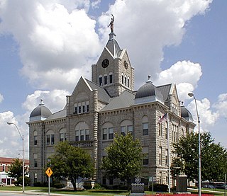
Hillsboro is a city and county seat of Jefferson County, Missouri, United States. The population was 3,473 at the 2020 census, up from 2,821 in 2010.

<span class="mw-page-title-main">Imperial, Missouri</span> Census-designated place in Missouri, United States

Imperial is a census-designated place (CDP) in Jefferson County, Missouri, United States, and is a suburb of St. Louis. The population was 4,947 at the 2020 census. Imperial was originally known as West Kimmswick, the historic Catholic church of St. John’s in Imperial, became an independent parish in 1869.

<span class="mw-page-title-main">Kimmswick, Missouri</span> City in Missouri, United States

Kimmswick is a city in Jefferson County, Missouri, United States. The population was 157 at the 2010 census.

<span class="mw-page-title-main">Bolivar, Missouri</span> City in Missouri, United States

Bolivar is a city and county seat of Polk County, Missouri, United States.

<span class="mw-page-title-main">Fenton, Missouri</span> City in Missouri, United States

Fenton is a city in St. Louis County, Missouri, United States, and a suburb of St. Louis County. The population was 3,989 at the 2020 census.

<span class="mw-page-title-main">Lemay, Missouri</span> CDP in Missouri, United States

Lemay is a census-designated place (CDP) in south St. Louis County, Missouri, United States. The population was 16,645 at the 2010 census.

<span class="mw-page-title-main">Oakville, Missouri</span> CDP in Missouri, United States

Oakville is a census-designated place (CDP) in south St. Louis County, Missouri, United States. The population was 36,301 at the 2020 census. Oakville is 18 miles south of the city of St. Louis and borders the Mississippi and Meramec rivers; the area is part of "South County".

<span class="mw-page-title-main">Valley Park, Missouri</span> City in Missouri, United States

Valley Park is a city in St. Louis County, Missouri, United States. The population was 6,885 at the 2020 census.

<span class="mw-page-title-main">Bourbon, Missouri</span> City in Missouri, United States

Bourbon is a city in Crawford County, Missouri, United States. At the time of the 2010 census, it had a population of 1,632.

<span class="mw-page-title-main">Sunset Hills, Missouri</span> City in Missouri, United States

Sunset Hills is a city in south St. Louis County, Missouri, United States. As of the 2020 United States Census, the city's population was 9,198.

<span class="mw-page-title-main">Sullivan, Missouri</span> City in Missouri, United States

Sullivan is a city that straddles the border of Franklin and Crawford counties in the U.S. state of Missouri. The population was 6,906 at the 2020 census.

<span class="mw-page-title-main">Pacific, Missouri</span> City in Missouri, United States of America

Pacific is a city in the U.S. state of Missouri in eastern Franklin County and extending to the east into southwest St. Louis County. The population was 7,414 at the 2020 census.

<span class="mw-page-title-main">Belle, Missouri</span> City in Missouri, United States

Belle is a city in northeast Maries County and extending north into southeast Osage County in the U.S. state of Missouri. The population was 1,381 at the 2020 census, down from 1,545 in 2010.

References

  1. "Mayor of Arnold" . Retrieved April 20, 2023.
  2. "Mayor Pro Tem" . Retrieved April 20, 2023.
  3. "ArcGIS REST Services Directory". United States Census Bureau. Retrieved August 28, 2022.
  4. 1 2 U.S. Geological Survey Geographic Names Information System: Arnold, Missouri
  5. 1 2 "U.S. Census website". United States Census Bureau . Retrieved January 31, 2008.
  6. 1 2 Case Summary for January 17, 2008
  7. 1 2 "Show-Me Institute - Homer Tourkakis: Victim of Eminent Domain Abuse". Archived from the original on July 6, 2008. Retrieved July 22, 2008. Homer Tourkakis: Victim of Eminent Domain Abuse
  8. "FindLaw's Supreme Court of Missouri case and opinions". Findlaw.
  9. Lynn Horsley, Caught Red Handed? Although Red-Light Cameras Haven't Gotten an OK in Kansas, Some Missouri Cities Are Installing Them, THE KANSAS CITY STAR, Apr. 1, 2006, p. A1
  10. Hoekstra v. City of Arnold, No. 4:08CV0267, 2009 WL 259857 (E.D. Mo. Feb. 3, 2009)
  11. Thorsen, Leah (February 8, 2014). "No need to pay red-light ticket in Arnold". St. Louis Post-Dispatch. Retrieved June 27, 2017.
  12. "25 years ago: The president - and the world - get a stunning view of flood damage".
  13. "Flooding cleanup continues in Arnold," St. Louis Post-Dispatch, Jan. 11 2016, http://www.stltoday.com/news/local/metro/flooding-cleanup-continues-in-arnold/article_d0ae7567-0be2-560a-8f9b-53c56680b3e9.html, Accessed 6-27-17
  14. Tim O'Neill, "Surging Meramec River swamps flood records and major highways," St. Louis Post-Dispatch, Dec. 31, 2015, http://www.stltoday.com/news/local/illinois/surging-meramec-river-swamps-flood-records-and-major-highways/article_41b2d24a-5df9-5a77-a7b5-57b8005fd0f9.html, Accessed 6-27-17
  15. Doug Moore, "Cleanup begins along Meramec as floodwater recedes, but sandbags remain with new crests coming," St. Louis Post-Dispatch, May 4, 2017, http://www.stltoday.com/news/local/metro/cleanup-begins-along-meramec-as-floodwater-recedes-but-sandbags-remain/article_6737a1cd-5509-57c8-a512-688de23cfc8f.html, Accessed 6-27-17
  16. Jacob Long, "Flood recovery begins for Arnold residents," KDSK, May 6, 2017, http://www.ksdk.com/news/local/flood-recovery-begins-for-arnold-residents/437338996, Accessed 6-27-17
  17. "US Gazetteer files 2010". United States Census Bureau. Archived from the original on January 25, 2012. Retrieved July 8, 2012.
  18. Bolstad, Erika (May 15, 2017). "Trump country is flooding, and climate ideas are shifting". E&E News. Retrieved May 16, 2017.
  19. "Census of Population and Housing". Census.gov. Retrieved June 4, 2015.
  20. "Explore Census Data". data.census.gov. Retrieved December 17, 2023.
  21. "Arnold, MO | Data USA". datausa.io. Retrieved March 6, 2024.
  22. "Explore Census Data". data.census.gov. Retrieved December 17, 2023.
  23. "U.S. Census website". United States Census Bureau . Retrieved July 8, 2012.
  24. "Anheuser-Busch to invest $150million in Arnold Metal Container Corporation Facility". newsroom.anheuser-busch.com. Archived from the original on June 14, 2015. Retrieved June 12, 2015.
  25. "NGA Arnold Facility". www.nga.mil. Retrieved July 26, 2019.
  26. Mike Fitzgerald (March 31, 2016). "Q-and-A: What's the NGA? Why Is It Moving? Why All the Fuss? Can I Get A Job There?". Belleville News-Democrat. Archived from the original on April 3, 2016. Retrieved July 26, 2019.
  27. "Where homes are affordable - Arnold, MO (12) - Money Magazine". Archived from the original on September 23, 2008. Retrieved September 29, 2008.
  28. Leinicke, Connie. "Fitness". The City of Arnold, Missouri. Retrieved March 14, 2019.
  29. "Family Life Center". fbcarnold.org. Archived from the original on October 16, 2018. Retrieved March 14, 2019.
  30. "History of the District" (Archive). Fox C-6 School District. Retrieved on June 13, 2014.
  31. "Our Branches". Jefferson County Library. Retrieved March 17, 2018.
  32. "Wickes" . Retrieved May 20, 2018.