Parks in Greater St. Louis

Last updated

Parks in Greater St. Louis are administered by a variety of state, county, and municipal authorities. The region also is home to Gateway Arch National Park, site of the Gateway Arch, the only National Memorial in the state of Missouri. Among the largest municipal parks is Forest Park, which is 1,293 acres (5.2 km2) and is located in the city of St. Louis, although both Greensfelder County Park and Creve Coeur Park in St. Louis County are larger, at 1,646 and 2,114 acres (6.7 and 8.6 km2) respectively. St. Louis County is also the location of two large state parks, Babler State Park with 3.8 square miles (9.8 km2) and Castlewood State Park with 2.8 square miles (7.3 km2). The largest state park in the region is Meramec State Park, located near Sullivan, Missouri, with 10.8 square miles (28 km2) of parkland.

Contents

Parks in the city of St. Louis

The city of St. Louis owns and maintains more than one hundred parks, ranging in size from the 1,371 acres (5.5 km2) of Forest Park to less the than 1-acre (4,000 m2) of Aboussie Park. Parks are administered by the city of St. Louis Department of Parks, Recreation and Forestry, the National Park Service, or a separate private board, such as Tower Grove Park, which is maintained by a Board of Commissioners but remains city property. Compton Hill Reservoir Park is owned by the city but maintained by the St. Louis Water Division.

Parks owned by the city of St. Louis [1]
North CityCreated †Central CorridorCreated †South CityCreated †
Amherst Park1970 Aloe Plaza 1931 Aboussie Park 1981
Barrett Brothers Park1947Aloe Plaza West1969Alaska Park1995
Beckett Playground1959 Citygarden ‡‡2009Amberg Park1963
Busche Park1913 Forest Park 1876Bellerive Park1908
Chambers Park1966Franz Park1915Benton Park1866
Columbus Square Park1980Gateway Mall Plaza1970Berra Park1945
DeSoto Park1908Greg Freeman Park1980Buder Playground1912
Dickman Park1938Kaufmann Park1932Carnegie Park1899
Eugene "Tink" Bradley Park1958 Kiener Plaza 1962Carondelet Lions Park1929
Fairground Park 1908Kingsbury Square Park1980 Carondelet Park 1929
Father Filipiak Park1980Lucas Gardens Park1857Cherokee Park1924
Fountain Park1889 Memorial Plaza 1932Chouteau Park2008
Fourteenth Street Mall1976Phillip Lucier Park1980 Christy Park 1910
Frank Williamson Sr. Park (Parkland Park)1968Poelker Park1986Clifton Heights Park1912
Gregory J. Carter Park1951Samuel Kennedy Park2007 Compton Hill Reservoir Park1867
Gwen Giles Park1959Serra Sculpture Park1981Eads Square Park1979
Hamilton Heights Park2002Taylor Park2008Fanetti Plaza1979
Hickey Park1947Washington Square Park1840Fox Park1917
Hyde Park1947 Francis Park 1916
Ivory Perry Park1961Francis R Slay Park1926
Jackson Place Park1816Fremont Park1963
Jet Banks Park1963Gravois Park1812
Loretta Hall Park1842Joe Leisure Park2000
Marie Fowler Park1981Laclede Park1812
Murphy Park1962 Lafayette Park 1838
Norman Seay Park1936Lindenwood Park1947
North Riverfront Park1980Lyon Park1868
O'Fallon Park 1908Marquette Park1915
Penrose Park1910McDonald Park1928
Rumbold Park1945Mestres Park1937
Russell Park1950Minnesota and Hill Park1924
Ruth Porter Mall1975Minnie Wood Memorial Square1925
Sherman Park1917Mount Pleasant Park1812
St. Louis Place Park 1850Pontiac Square Park1908
Strodtman Park1924Ray Leisure Park1958
Tandy Park1918River Des Peres Extension1954
Turner Playground1937 River Des Peres Park 1926
Unity Park2004Sister Marie Charles Park1982
Vivian Astra Park1921Soulard Market Park1908
W. C. Handy Park1941St. Louis Square Park1882
Walnut Park1974St. Marcus Commemorative Park1977
Windsor Park1947Sublette Park1915
Yeatman Square Park1906Terry Park1945
  • † Dates based on city ordinance date establishing park. [1]
  • ‡ Parks owned by the city and maintained by the St. Louis Water Division.
  • ‡‡ Citygarden is owned by the city and maintained by the Gateway Foundation.
  • ± Tower Grove Park is owned by the city and maintained by a Tower Grove Park Board of Commissioners.
Tiffany Park1980
Tilles Park1957
Tower Grove Park ±1868
Willmore Park1947

Non-municipally owned parks

The city of St. Louis is also home to several public parks that are owned by other entities. Among these is Baer Plaza, owned and maintained by CVC/Sports Authority, Gateway Arch National Park, owned and maintained by the National Park Service, Kiel Triangle Park, owned by the Bi-State Development Agency, and Luther Ely Smith Park, owned and maintained by the National Park Service.

Parks in St. Louis County

St. Louis County owns and maintains more than forty parks, including playgrounds and nature preserves. It also operates several recreation centers, the National Museum of Transportation, and the Affton Community Center. In addition to parks owned by St. Louis County, several municipalities in the county also own and maintain their own park systems.

Parks in St. Charles County

St. Charles County Blueways

The Dardenne Creek Blueway is the first in a planned series of kayaking and canoeing routes connecting St. Charles area parks and recreation facilities. The blueway’s first 3.5-mile stretch links Riverside Landing County Park on the Mississippi River to St. Peters’ 370 Lakeside Park and takes up to two hours for a round trip. The next stage opens in the fall of 2022 and will link to St. Peters’ Lone Wolff Park 5.2-miles to the southwest. [2] Three future phases will connect Jack Gettemeyer Park, O’Fallon Sports Park, and Bluebird Meadow Park for a total of 19-miles (30.6 km) of access along Dardenne Creek. [3] A future route is the Big Creek Blueway, which will connect Indian Camp Creek and Flatwoods parks through Big Creek and the Cuivre River, or about 12.3-miles (19.8 km). [3]

State parks

Eleven Missouri state parks are in Greater St. Louis, and the Missouri Department of Natural Resources also operates several state historic sites in the region. [4]

Related Research Articles

<span class="mw-page-title-main">St. Louis</span> Independent city in Missouri, United States

St. Louis is an independent city in the U.S. state of Missouri. It is located near the confluence of the Mississippi and the Missouri rivers. In 2020, the city proper had a population of 301,578, while its bi-state metropolitan area, which extends into Illinois, had an estimated population of over 2.8 million. It is the largest metropolitan area in Missouri and the second largest in Illinois. The city's combined statistical area (CSA) is the 21st largest in the United States.

<span class="mw-page-title-main">Gateway Arch National Park</span> National park in St. Louis, Missouri, U.S.

Gateway Arch National Park is an American national park located in St. Louis, Missouri, near the starting point of the Lewis and Clark Expedition.

<span class="mw-page-title-main">St. Louis County, Missouri</span> County in Missouri, United States

St. Louis County is located in the eastern-central portion of Missouri. It is bounded by the City of St. Louis and the Mississippi River to the east, the Missouri River to the north, and the Meramec River to the south. At the 2020 census, the total population was 1,004,125, making it the most populous county in Missouri. Its county seat is Clayton. The county is included in the St. Louis, MO–IL metropolitan statistical area.

<span class="mw-page-title-main">Lake St. Louis, Missouri</span> City in Missouri, United States

The City of Lake St. Louis is a planned community situated around two lakes between Interstate 70 and Interstate 64 in western St. Charles County, Missouri, United States. The population was 16,707 as of the 2020 US Census.

<span class="mw-page-title-main">Fenton, Missouri</span> City in Missouri, United States

Fenton is a city in St. Louis County, Missouri, United States, and a suburb of St. Louis County. The population was 3,989 at the 2020 census.

<span class="mw-page-title-main">Shrewsbury, Missouri</span> City in Missouri, United States

Shrewsbury is an inner-ring suburb of St. Louis, located in St. Louis County, Missouri, United States. The population was 6,254 at the 2010 census.

<span class="mw-page-title-main">Chesterfield, Missouri</span> City in Missouri, United States

Chesterfield is a city in St. Louis County, Missouri, United States. It is a western suburb of St. Louis. As of the 2020 census, the population was 49,999, making it the state's 14th most populous city. The broader valley of Chesterfield was originally referred to as "Gumbo Flats", derived from its soil, which though very rich and silty, resembled gumbo when wet.

<span class="mw-page-title-main">St. Ann, Missouri</span> City in Missouri, United States

St. Ann or Saint Ann is a city in northwest St. Louis County, Missouri, United States. The population was 13,019 at the 2020 census.

<span class="mw-page-title-main">Yankton, South Dakota</span> City in South Dakota, United States

Yankton is a city in and the county seat of Yankton County, South Dakota, United States.

<span class="mw-page-title-main">St. Charles County, Missouri</span> County in Missouri, United States

St. Charles County is in the central eastern part of the U.S. state of Missouri. As of the 2020 census, the population was 405,262, making it Missouri's third-most populous county. Its county seat is St. Charles. The county was organized October 1, 1812, and named for Saint Charles Borromeo, an Italian cardinal.

<span class="mw-page-title-main">St. Peters, Missouri</span> City in east central Missouri, U.S.

St. Peters is a city in St. Charles County, Missouri, United States. The population was 57,732 at the 2020 census, making it the eleventh-largest city in Missouri. It is a northwestern suburb of St. Louis.

<span class="mw-page-title-main">Sturgeon Bay, Wisconsin</span> City in Wisconsin, United States

Sturgeon Bay is a city in and the county seat of Door County, Wisconsin, United States. The population was 9,646 at the 2020 Census. The city is well-known regionally for being the largest city of the Door Peninsula, after which the county is named.

<span class="mw-page-title-main">Malcolm W. Martin Memorial Park</span> Gateway Geyser venue

Malcolm W. Martin Memorial Park is a park on the east side of the Mississippi River in East St. Louis, Illinois, directly across from the Gateway Arch and the city of St. Louis, Missouri. Its major feature is the Gateway Geyser, a fountain that lifts water up to 630 feet (192 m). The Gateway Geyser is a counterpart to the equally tall Gateway Arch, and is visible from the west side of the river to the right of the prominent Cargill grain elevator. Four smaller fountains around the Geyser represent the four rivers which converge near the two cities: The Mississippi, Missouri, Illinois, and Meramec. The park also includes an elevated viewing point overlooking the river.

<span class="mw-page-title-main">Three Rivers Park District</span> Park district in the Twin Cities

Three Rivers Park District is a special park district serving the suburban areas of the Twin Cities including suburban Hennepin, Carver, Dakota, Scott, and Ramsey counties. Three Rivers's mission is "To promote environmental stewardship through recreation and education in a natural resources-based park system." Three Rivers operates twenty parks and ten regional trails, with at least two more regional trails planned. Nearly seven million people visit Three Rivers facilities each year. It has over 27,000 acres (11,000 ha) of parks and trails.
<span class="mw-page-title-main">Transportation in St. Louis</span>

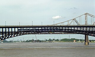
Transportation in Greater St. Louis, Missouri includes road, rail, ship, and air transportation modes connecting the bi-state St. Louis metropolitan area with surrounding communities throughout the Midwest, national transportation networks, and international locations. The Greater St. Louis region also supports a multi-modal transportation network that includes bus, paratransit, and light rail service in addition to shared-use paths, bike lanes and greenways.

Frank Holten State Recreation Area is an urban Illinois state park on 1,080 acres (437 ha) in unincorporated Centreville Township, St. Clair County, Illinois, United States. It is located less than five miles southeast of the Gateway Arch in Greater St. Louis. The park is bisected by Interstate 255.
<span class="mw-page-title-main">The Great Rivers Greenway District</span> Government agency for creating a greenway network in metro St. Louis, USA

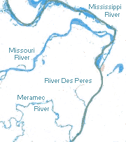
The Great Rivers Greenway District is a public agency created in 2000 to develop a regional network of greenways. Great Rivers Greenway engages citizens and community partners to plan, build and care for the greenways. In its first 20 years the agency built more than 128 miles of greenways connecting parks, rivers, schools, neighborhoods, business districts and transit.

<span class="mw-page-title-main">O'Fallon, Missouri</span> City in Missouri, United States

O'Fallon is a city in St. Charles County, Missouri, United States. It is part of the St. Louis metropolitan statistical area, located along Interstates 64 and 70 between Lake St. Louis and St. Peters. As of the 2020 census, O'Fallon had a population of 91,316, making it the most populous suburb of St. Louis, as well as the most populous municipality in St. Charles County and the 7th most populous in Missouri. O'Fallon's namesake in St. Clair County, Illinois, is also part of the St. Louis region. The two cities are one of the few pairs of same-named municipalities to be part of the same metro area.

<span class="mw-page-title-main">Dardenne Prairie, Missouri</span> Town in Missouri, United States

Dardenne Prairie is a city in St. Charles County, Missouri, United States. The population was 12,743 at the 2020 census.

References

  1. 1 2 "Browse St. Louis City Parks". stlouis-mo.gov. Retrieved 2022-11-07.
  2. Schlinkmann, Mark (22 September 2022). "Second stretch of St. Charles County's 'blueway' to open this fall". STLtoday.com. Retrieved 2022-11-01.
  3. 1 2 "Blueways | St Charles County, MO - Official Website". www.sccmo.org. Retrieved 2022-11-01.
  4. "Missouri State Parks". Archived from the original on 2014-12-31.