
The Central West End is a neighborhood in St. Louis, Missouri, stretching from Midtown's western edge to Union Boulevard and bordering on Forest Park with its array of free cultural institutions. It includes the Cathedral Basilica of Saint Louis on Lindell Boulevard at Newstead Avenue, which houses the second-largest collection of mosaics in the world. The Central West End sits entirely within the 9th Ward.
Soulard is a historic neighborhood in St. Louis, Missouri. It is the home of Soulard Farmers Market, the oldest farmers' market west of the Mississippi River. Soulard is one of ten certified local historic districts in the city of St. Louis.
Wydown/Skinker is a neighborhood in St. Louis, Missouri. Washington University in St. Louis is located just north of this neighborhood. The neighborhood is bounded by the city limits on the west, Forsyth Boulevard on the north, Forest Park on the east and Clayton Avenue on the south. The Missouri Historical Society Library & Research Center is located in the Wydown/Skinker neighborhood.

Boulevard Heights is a neighborhood of St. Louis, Missouri. The neighborhood is bounded by Gravois Avenue on the west, Holly Hills Boulevard and Carondelet Park on the north, South Grand Avenue and I-55 on the east, and the city limits on the south.

Dutchtown is a neighborhood of St. Louis, Missouri. It is called "Dutch" from Deutsch, i.e., "German", as it was the southern center of German-American settlement in St. Louis in the early 19th century. It was the original site of Concordia Seminary, Concordia Publishing House, Lutheran Hospital, and other German community organizations. The German Cultural Society still has its headquarters there. St Anthony of Padua Catholic Church towers over the neighborhood and is a symbol of the neighborhood.

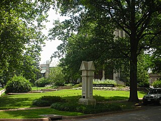
Fountain Park is a neighborhood of St. Louis, Missouri, United States. Originally the Aubert Place subdivision, it was laid out by John Lay in 1857. The Fountain Park neighborhood is located in north St. Louis with Martin Luther King Drive on the north, Delmar Boulevard on the south, Walton Avenue on the east, and Kingshighway Boulevard on the west. It is just two blocks north of the Central West End (CWE) of the city. The Fountain Park neighborhood is named after Fountain Park, a small oval-shaped city park near its center. A Martin Luther King Jr. statue sculpted by Rudolph Edward Torrini is situated on the west side of the park.

Hyde Park is a neighborhood of St. Louis, Missouri. A historic North St. Louis neighborhood, Hyde Park is bound by Ferry to the North, I-70 to the East, Palm Street and Natural Bridge Avenue to the South, and Glasgow to the West.

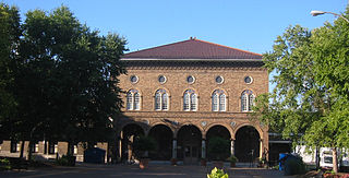
Skinker DeBaliviere is a neighborhood of St. Louis, Missouri, located directly north of Forest Park. In addition to the park, its boundaries are Delmar Boulevard to the north, DeBaliviere Avenue to the east, and the western city limits near Skinker Boulevard. It is home to The Pageant, Pin-up Bowl, and all the other establishments of the Delmar Loop east of University City. It also includes the west end of the Forest Park – DeBaliviere and the entire Skinker MetroLink stations. The Delmar Loop station is just outside of its north boundary. In 1978, the neighborhood was designated a Local Historic District by the City of St. Louis, and the private subdivision of Parkview is listed in the National Register of Historic Places.

Botanical Heights is a neighborhood of St. Louis, Missouri. Its former name was McRee Town. The Botanical Heights neighborhood is defined by Chouteau Avenue on the North, Interstate 44 on the South, 39th Street on the East and Vandeventer Avenue on the West. This near Southside neighborhood is located just north of the Shaw neighborhood.

Southwest Garden is a neighborhood of St. Louis, Missouri, located south of The Hill and Forest Park Southeast, west of the Missouri Botanical Garden and Tower Grove Park, east of Lindenwood Park and Clifton Heights, and north of North Hampton.

Penrose is a primarily residential neighborhood of St. Louis, Missouri. The neighborhood is located on the north side of the city just south of Interstate 70 and west of O’Fallon Park. It is bounded by Florissant Avenue and I-70 on the north, Natural Bridge Avenue on the south, North Newstead and Pope Avenues on the east, and Kingshighway Boulevard on the west.

Tiffany is a neighborhood of St. Louis, Missouri. It is located on the western side of Grand Boulevard along the section containing St. Louis University's Medical Complex. The neighborhood is defined by Chouteau Avenue on the North, Interstate 44 on the South, Grand Boulevard on the East, and 39th Street on the West.

Tower Grove South is a neighborhood of south St. Louis, Missouri. Formerly known as Oak Hill, Tower Grove South is bounded by Arsenal Street on the north, Chippewa Street on the south, Kingshighway Boulevard on the west, and Grand Boulevard on the east. The majority of the neighborhood was built following the extension of streetcar lines from downtown St. Louis. Commercial development in the neighborhood is concentrated on Grand Boulevard in the east and Morganford Road in the west of the neighborhood. There are also scatterings of commercial and mixed use buildings on interior intersections.

North Riverfront Park is a municipal park in St. Louis, Missouri.

Aboussie Park is a municipal park in St. Louis. It is the city's smallest park, with less than 1-acre (4,000 m2). Aboussie Park was established in 1981.
Grand Boulevard is a major, seven to five-lane wide, north-south thoroughfare that runs through the center of St. Louis, Missouri. It runs north through Carondelet Park in the south portion of the city to the Mississippi River north of the McKinley Bridge, about midway between Forest Park and the Mississippi River. Neighborhoods that it runs through include Dutchtown, Tower Grove East, Tower Grove South, Compton Heights, Tiffany, Midtown, Jef-Vander-Lou, Fairground, and College Hill.

Clayton–Tamm is a historic St Louis neighborhood and once an Irish-American enclave located near the western border of St. Louis, Missouri, USA, just south of Forest Park.

St. Louis City Hall was designed by architects Eckel & Mann, the winners of a national competition. Construction began in July 1890 and completed in 1904. Its profile and stylistic characteristics evoke the French Renaissance Hôtel de Ville, Paris, with an elaborate interior decorated with marble and gold trim.

Francis Park is an urban park located in the St. Louis Hills neighborhood of St. Louis, Missouri, United States. Francis Park is located between Eichelberger Street, Nottingham Avenue, Donovan Avenue and Tamm Avenue.

