Metro East

Last updated
St. Louis Metro East
Metro East
Interactive Map of St. Louis–St. Charles–
Farmington, MO–IL CSA
Country Flag of United States.svg United States
State Flag of Illinois.svg Illinois
Largest city Belleville, IL
Other cities
Elevation
142–390 m (466–1,280 ft)
Population
 (2020)
  Total681,678
Time zone UTC−6 (CST)
  Summer (DST) UTC−5 (CDT)
Area code(s) 217, 314, 447, 557, 573, 618, 636, 730

The Metro East is an urban area in Southern Illinois, United States that contains the eastern and northern suburbs and exurbs of St. Louis, Missouri. It encompasses five counties in the Greater St. Louis area and constitutes the second-most populous urban area in Illinois. The region's most populated city is Belleville, with 42,404 residents. [1]

Contents

Geography

City Hall of Granite City Granite City - City Hall.JPG
City Hall of Granite City
O'Fallon Public Library OFallon Public Library.jpg
O'Fallon Public Library

The Metro East is a loose collection of small and mid-sized cities sitting along the American Bottom and the bluffs of the Mississippi River. According to the U.S. Census Bureau, the five counties of the region have a total area of 6,974 km2 (2,692 mi2). 6,787 km2 (2,620 mi2) of it is land and 186 km2 (71 mi2) of it (2.74%) is water.

As of the 2020 census, the most populated cities in the region included the following [2]

Principal cities

City populations [3]

  • 42,404
  • 32,289
  • 27,549
  • 26,808
  • 25,676
  • 24,366

Demographics

As of the 2010 census, there had been a major shift in population from the older rust belt industrial cities in the Mississippi River bottom, such as East St. Louis and Alton, to the more suburban satellite cities, such as, Belleville, Edwardsville, and O'Fallon sitting on the bluffs. This is mainly due to continued white flight. [4]

As of the census [5] of 2000, there were 599,845 people, 229,888 households, and 160,260 families residing in the five Metro East counties.

The most common language is English, although various other languages are spoken. German speakers exist in southeastern Madison, and Clinton, and southern and eastern St. Clair Counties. Spanish is spoken in the Fairmont City area, and in parts of Clinton County. The largest concentration of African-Americans is in Madison, Venice, western Granite City, East St. Louis, Washington Park, Belleville, Cahokia, Alorton and Alton.

List of counties

List of cities, towns, and villages

Notes:

Clinton County

Jersey County

Madison County

St. Clair County

Colleges and universities

Transportation

State routes

U.S. routes

Interstate freeways

Public transit

MetroLink in Belleville Illinois Belleville, IL Metro East.jpg
MetroLink in Belleville Illinois

Public transit service in St. Clair County is provided by Metro Transit in partnership with the St. Clair County Transit District. Service includes local bus lines and the MetroLink light rail system. MetroLink has 11 stations in Illinois between the East St. Louis Riverfront and Scott Air Force Base. It links the suburban Metro East to St. Louis Lambert International Airport on the Red Line and Shrewsbury, Missouri on the Blue Line. Intermediate stops include downtown St. Louis, area universities and hospitals, and downtown Clayton.

In 2019, the St. Clair County Transit District was awarded $96 million in Illinois infrastructure funding to build a 5.2-mile (8.4 km) extension of the Red Line from Shiloh-Scott to MidAmerica St. Louis Airport in Mascoutah. [6] This extension will include two 2.6-mile (4.2 km) segments, a double-track and a single-track segment, along with a station at the airport. [7] Construction on the extension began in 2023 with Metro expecting to begin operations in early 2026. [8] [9] [10]

Additionally, Madison County Transit operates local bus service in that county with routes that serve downtown St. Louis transit centers. [11]

Major employers

Notable attractions

Residents, historic figures, and contributors

Media in the Metro East

St. Louis area TV stations

Champaign-Urbana/Decatur/Springfield area TV stations

Paducah/Cape Girardeau/Harrisburg area TV stations

Daily newspapers

Radio stations

  • WSIE 88.7 FM (Edwardsville), jazz/public radio
  • WLCA 89.9 FM (Godfrey), alternative/college radio
  • WRXX 95.3 FM (Centralia), pop
  • KXBS 95.5 FM (Bethalto), hip-hop
  • WDLJ 97.5 FM (Carlyle), classic rock
  • KATZ-FM 100.3 FM (Alton), urban
  • WJAF 103.7 FM (Centralia)
  • WNSV 104.7 FM (Nashville), Hot AC
  • WAOX 105.3 FM (Staunton), Hot AC
  • WSMI 106.1 FM (Litchfield). country
  • WILY 1210 AM (Centralia), oldies
  • WJBM 1480 AM (Jerseyville), talk
  • KFTK 1490 AM (East St. Louis), talk
  • WQQW 1510 AM (Highland, Belleville), classic hits
  • WBGZ 1570 AM (Alton), news/talk
  • WSDZ 1260 AM (Belleville), urban gospel

See also: Radio stations in Illinois

The Metro East in film

"Uncredited" means a Metro East location was not credited within the database, but was clearly shot on Metro East soil upon watching the film itself.

Metro East in fiction

Laurell K. Hamilton has used the Metro East as a setting in several books from the Anita Blake and Merry Gentry series. In the Merry Gentry series, fairies of the Unseelie Court have made their home in Monk's Mound.

Robert J. Randisi set one of his Joe Keough mysteries, East of the Arch (2002), in the Metro East communities of East St. Louis and Fairview Heights. [12]

Awards

The 2010 issue of Family Circle magazine named Edwardsville third in their "Top 10 Best Towns for Families". [13]

Area codes

Related Research Articles

<span class="mw-page-title-main">St. Clair County, Illinois</span> County in Illinois, United States

St. Clair County is the ninth most populous county in Illinois. Located directly east of St. Louis, the county is part of the Metro East region of the Greater St. Louis metropolitan area in southern Illinois. As of the 2020 United States census, St. Clair County had a population of 257,400, making it the third most populous county in Illinois outside the Chicago metropolitan area. Belleville is the county’s seat and largest city.

<span class="mw-page-title-main">Madison County, Illinois</span> County in Illinois, United States

Madison County is a county in the U.S. state of Illinois. It is a part of the Metro East in southern Illinois. According to the 2020 census, it had a population of 264,776, making it the eighth-most populous county in Illinois and the most populous in the southern portion of the state. The county seat is Edwardsville, and the largest city is Granite City.

<span class="mw-page-title-main">Bethalto, Illinois</span> Village in the metropolitan area of St. Louis, Missouri

Bethalto is a village in Madison County, Illinois, United States. Bethalto, like the rest of Madison County, is part of the Illinois Metro East portion of the Greater St. Louis metropolitan area.

<span class="mw-page-title-main">Wood River, Illinois</span> City in Illinois, United States

Wood River is a city in Madison County, Illinois. The population was 10,464 as of the 2020 census.

<span class="mw-page-title-main">Belleville, Illinois</span> City in Illinois, United States

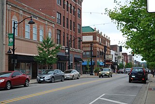
Belleville is a city and the county seat of St. Clair County, Illinois, United States. The population was 42,404 at the 2020 census, making it the most populated city in the Metro East region of Greater St. Louis, and in all of Southern Illinois. Due to its proximity to Scott Air Force Base, the city has a significant population of military and federal civilian personnel. It is the seat of the Roman Catholic Diocese of Belleville and home to the National Shrine of Our Lady of the Snows.

<span class="mw-page-title-main">Southern Illinois</span> Region of Illinois in the United States

Southern Illinois is a region of the U.S. state of Illinois comprising the southern third of the state, principally south of Interstate 70. Part of downstate Illinois, it is bordered by the two most voluminous rivers in the United States: the Mississippi below its connection with the Missouri River to the west and the Ohio River to the east and south, with the Wabash as a tributary. Some areas of Southern Illinois are known historically as Little Egypt.

<span class="mw-page-title-main">Greater St. Louis</span> Metropolitan Statistical Area in the United States

Greater St. Louis is the 21st-largest metropolitan statistical area (MSA) in the United States, the largest in Missouri, and the second-largest in Illinois. Its core city—St. Louis, Missouri—sits in the geographic center of the metro area, on the west bank of the Mississippi River. The river bisects the metro area geographically between Illinois and Missouri, although the latter portion is much more populous. The MSA includes St. Louis County, which is independent of the City of St. Louis; their two populations are generally tabulated separately.

<span class="mw-page-title-main">MetroLink (St. Louis)</span> Light rail system in Missouri, US

MetroLink is a light rail system that serves the Greater St. Louis area. Operated by Metro Transit in a shared fare system with MetroBus, the two-line, 38-station system runs from St. Louis Lambert International Airport and Shrewsbury in Missouri to Scott Air Force Base in Illinois. Intermediate destinations include downtown Clayton, Forest Park, and downtown St. Louis. It is the only U.S. light rail system to cross state lines.

<span class="mw-page-title-main">Metro Transit (St. Louis)</span> Public transit operator in the St. Louis metropolitan area

Metro Transit is an enterprise of the Bi-State Development Agency and operates public transportation services in the St. Louis region. In 2023, the system had an annual ridership of 19,528,200, or about 59,800 per weekday as of the fourth quarter of 2023.

<span class="mw-page-title-main">MidAmerica St. Louis Airport</span> Commercial airport serving St. Louis, Missouri, United States; located in Belleville, Illinois

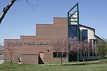
MidAmerica St. Louis Airport is a public use airport next to Scott Air Force Base. It is located 18 nautical miles [nmi] east of downtown St. Louis and 14 nmi east of the central business district of Belleville in St. Clair County, Illinois, United States. Opened in 1997, MidAmerica is the secondary domestic passenger airport for the Greater St. Louis metropolitan area, after the larger St. Louis Lambert International Airport. It is a joint-use airport and is currently served by one scheduled commercial airline, Allegiant Air.

<span class="mw-page-title-main">Southwestern Illinois College</span> Public community college in Illinois, US

Southwestern Illinois College is a public community college in Illinois with campuses in Belleville, Granite City, and Red Bud. It also has off-campus sites throughout the district, including Scott Air Force Base and the East St. Louis Community College Center.

<span class="mw-page-title-main">Transportation in St. Louis</span>

Transportation in Greater St. Louis, Missouri includes road, rail, ship, and air transportation modes connecting the bi-state St. Louis metropolitan area with surrounding communities throughout the Midwest, national transportation networks, and international locations. The Greater St. Louis region also supports a multi-modal transportation network that includes bus, paratransit, and light rail service in addition to shared-use paths, bike lanes and greenways.

<span class="mw-page-title-main">Area codes 618 and 730</span> Telephone area code for southern Illinois

Area codes 618 and 730 are telephone area codes in the North American Numbering Plan (NANP) for southern Illinois. The numbering plan area (NPA) comprises one hundred and twenty-six municipalities, such as Carbondale, Cairo, Belleville, East St. Louis, Edwardsville, Marion, O'Fallon, Alton, Mt. Vernon, Centralia, Herrin, Salem, Metropolis, Fairview Heights, Collinsville, and Granite City. Area code 618 was one of the original North American area codes created in 1947, and 730 was added to the plan area to form an overlay complex to satisfy the need for more telephone numbers in the region. The current population of the 618/730 area code is 1,288,816 people. It encompasses approximately 15,458 square mile ; and has a population density of 83.38 people per square mile.

<span class="mw-page-title-main">East St. Louis and Suburban Railway</span>

The East St. Louis and Suburban Railway was an interurban railroad that operated in Illinois.

<span class="mw-page-title-main">Belleville station (MetroLink)</span> Station in St. Louis MetroLink light rail system, Illinois, USA

Belleville station is a light rail station on the Red Line of the St. Louis MetroLink system. This at-grade station bisects Scheel Street in the northern section of Belleville, Illinois approximately one-mile (1.6 km) from the center of town. It features a MetroBus transfer and 321 park and ride spaces.

<span class="mw-page-title-main">Madison County Transit</span> Public transit and bike trail system in Madison County, Illinois, U.S.

Madison County Transit, or MCT for short, is a bus and bike trail transportation system that serves the citizens of Madison County, which is located in Illinois approximately 20 miles (32 km) northeast of St. Louis. It was created in 1980 by the Madison County Board to improve transportation in Madison County, and is a completely separate transit system from the St. Louis Metro Transit system which includes MetroLink, which doesn't operate into Madison County, though the buses connect with many MetroBus routes and even serve MetroLink stations in East St. Louis, Belleville and Downtown St. Louis.

<i>Suburban Journals</i>

Suburban Journals of Greater St. Louis was a group of publications in the St. Louis region owned by Lee Enterprises. The chain served St. Louis and St. Charles counties in Missouri and Madison, Monroe and St. Clair counties in Illinois.

<span class="mw-page-title-main">Red Line (St. Louis MetroLink)</span> Light rail line in the Greater St. Louis area

The Red Line is the older and longer line of the MetroLink light rail system in Greater St. Louis. It serves 29 stations across three counties and two states.

<span class="mw-page-title-main">Education in Greater St. Louis</span>

Education in Greater St. Louis is provided by 132 public school districts, independent private schools, parochial schools, and several public library systems. Greater St. Louis also is home to more than thirty colleges and universities.

References

  1. "U.S. Census Bureau QuickFacts: Belleville city, Illinois". www.census.gov. Retrieved 2024-02-17.
  2. Staff (2012). "Main". United States Census Bureau . Retrieved 27 May 2012.
  3. 2010census
  4. DOUG MOORE; JEREMY KOHLER; NICHOLAS J.C. PISTOR (20 February 2011). "Metro East growing more diverse, census data show". STL Today. Retrieved 27 May 2012.
  5. "U.S. Census website". United States Census Bureau . Retrieved 2008-01-31.
  6. Schlinkmann, Mark (June 14, 2019). "Illinois to pay for long-sought MetroLink extension to MidAmerica Airport". STLtoday.com. Archived from the original on November 2, 2021. Retrieved September 20, 2022.
  7. "Trajectory for Transit in 2022 Points to Need for Continued Collaboration". January 19, 2022. Archived from the original on February 3, 2022. Retrieved February 2, 2022.
  8. "When will MetroLink extension to MidAmerica Airport be complete? How much will it cost? - MidAmerica St. Louis Airport (BLV) | Mascoutah, IL". flymidamerica.com. July 14, 2021. Archived from the original on September 20, 2022. Retrieved September 20, 2022.
  9. Cella, Kim (November 1, 2023). "Construction Underway on MetroLink Extension Project in St. Clair County". St. Clair County Transit District. Archived from the original on November 7, 2023. Retrieved November 7, 2023.
  10. "Construction underway on 5-mile MetroLink extension from Scott AFB to MidAmerica Airport". STLPR. 2023-12-28. Archived from the original on February 4, 2024. Retrieved 2024-02-05.
  11. Madison County Transit Overview
  12. East of the Arch: A Joe Keough Mystery: Robert J. Randisi: 9780312283988: Amazon.com: Books
  13. "10 Best Towns for Families: 2010" Archived 2017-11-21 at the Wayback Machine , Family Circle , Retrieved on 2010-08-07.

38°40′N90°0′W / 38.667°N 90.000°W / 38.667; -90.000