Scott County, Illinois

Last updated

Scott County
Scott County Courthouse, Winchester.jpg
Map of Illinois highlighting Scott County.svg
Location within the U.S. state of Illinois
Illinois in United States.svg
Illinois's location within the U.S.
Coordinates: 39°39′N90°29′W / 39.65°N 90.48°W / 39.65; -90.48
CountryFlag of the United States.svg United States
StateFlag of Illinois.svg  Illinois
Founded1839
Named for Scott County, Kentucky
Seat Winchester
Largest cityWinchester
Area
  Total253 sq mi (660 km2)
  Land251 sq mi (650 km2)
  Water1.9 sq mi (5 km2)  0.7%
Population
 (2020)
  Total4,949
  Density20/sq mi (7.6/km2)
Time zone UTC−6 (Central)
  Summer (DST) UTC−5 (CDT)
Congressional district 15th

Scott County is a county located in the U.S. state of Illinois. According to the 2020 census, it had a population of 4,949, [1] making it the fourth-least populous county in Illinois. Its county seat is Winchester. [2]

Contents

Scott County is part of the Jacksonville, IL Micropolitan Statistical Area, which is also included in the Springfield-Jacksonville-Lincoln, IL Combined Statistical Area.

History

Scott County was formed in 1839 out of Morgan County. It was named for Scott County, Kentucky.

Geography

According to the U.S. Census Bureau, the county has a total area of 253 square miles (660 km2), of which 251 square miles (650 km2) is land and 1.9 square miles (4.9 km2) (0.7%) is water. [3] The county's western boundary is formed by the Illinois River.

Climate and weather

Winchester, Illinois
Climate chart (explanation)
J
F
M
A
M
J
J
A
S
O
N
D
 
 
1.6
 
 
34
16
 
 
1.8
 
 
40
20
 
 
3.3
 
 
52
30
 
 
3.6
 
 
64
42
 
 
4.3
 
 
74
52
 
 
3.6
 
 
83
61
 
 
3.4
 
 
87
65
 
 
2.8
 
 
85
63
 
 
3
 
 
78
54
 
 
2.6
 
 
67
43
 
 
3.3
 
 
52
32
 
 
2.6
 
 
39
21
Average max. and min. temperatures in °F
Precipitation totals in inches
Source: The Weather Channel [4]
Metric conversion
J
F
M
A
M
J
J
A
S
O
N
D
 
 
41
 
 
1
−9
 
 
44
 
 
4
−7
 
 
83
 
 
11
−1
 
 
90
 
 
18
6
 
 
110
 
 
23
11
 
 
90
 
 
28
16
 
 
86
 
 
31
18
 
 
72
 
 
29
17
 
 
75
 
 
26
12
 
 
67
 
 
19
6
 
 
83
 
 
11
0
 
 
65
 
 
4
−6
Average max. and min. temperatures in °C
Precipitation totals in mm

In recent years, average temperatures in the county seat of Winchester have ranged from a low of 16 °F (−9 °C) in January to a high of 87 °F (31 °C) in July, although a record low of −26 °F (−32 °C) was recorded in January 1912 and a record high of 113 °F (45 °C) was recorded in July 1934. Average monthly precipitation ranged from 1.60 inches (41 mm) in January to 4.34 inches (110 mm) in May. [4]

Major highways

Adjacent counties

Demographics

Historical population
CensusPop.Note
1840 6,215
1850 7,91427.3%
1860 9,06914.6%
1870 10,53016.1%
1880 10,7412.0%
1890 10,304−4.1%
1900 10,4551.5%
1910 10,067−3.7%
1920 9,489−5.7%
1930 8,539−10.0%
1940 8,176−4.3%
1950 7,245−11.4%
1960 6,377−12.0%
1970 6,096−4.4%
1980 6,1420.8%
1990 5,644−8.1%
2000 5,537−1.9%
2010 5,355−3.3%
2020 4,949−7.6%
2023 (est.)4,710 [5] −4.8%
U.S. Decennial Census [6]
1790-1960 [7] 1900-1990 [8]
1990-2000 [9] 2010 [10]

As of the 2010 census, there were 5,355 people, 2,214 households, and 1,516 families living in the county. [11] The population density was 21.3 inhabitants per square mile (8.2/km2). There were 2,459 housing units at an average density of 9.8 per square mile (3.8/km2). [3] The racial makeup of the county was 98.6% white, 0.2% Asian, 0.2% American Indian, 0.2% black or African American, 0.1% from other races, and 0.7% from two or more races. Those of Hispanic or Latino origin made up 0.8% of the population. [11] In terms of ancestry, 26.3% were German, 24.3% were American, 18.0% were English, and 16.2% were Irish. [12]

Of the 2,214 households, 32.0% had children under the age of 18 living with them, 54.7% were married couples living together, 9.1% had a female householder with no husband present, 31.5% were non-families, and 27.3% of all households were made up of individuals. The average household size was 2.40 and the average family size was 2.89. The median age was 42.7 years. [11]

The median income for a household in the county was $49,462 and the median income for a family was $64,412. Males had a median income of $40,781 versus $32,011 for females. The per capita income for the county was $27,530. About 6.5% of families and 9.1% of the population were below the poverty line, including 9.5% of those under age 18 and 10.2% of those age 65 or over. [13]

Communities

City

Town

Villages

Unincorporated communities

Population ranking

The population ranking of the following table is based on the 2020 census of Scott County.

county seat

RankPlaceMunicipal typePopulation (2020 Census)
1 Winchester City1,574
2 Bluffs Village618
3 Manchester Village265
4 Alsey Village195
5 Glasgow Village119
6 Naples Town100
7 Exeter Town87

Politics

United States presidential election results for Scott County, Illinois [14]
Year Republican Democratic Third party
No.%No.%No.%
2020 2,11477.07%57220.85%572.08%
2016 1,96675.38%53520.51%1074.10%
2012 1,58761.80%91035.44%712.76%
2008 1,45555.81%1,09041.81%622.38%
2004 1,69664.34%92735.17%130.49%
2000 1,45859.05%95438.64%572.31%
1996 1,11243.81%1,01239.87%41416.31%
1992 1,13240.68%1,05737.98%59421.34%
1988 1,53555.02%1,24344.55%120.43%
1984 1,97667.33%94332.13%160.55%
1980 1,99065.42%94130.93%1113.65%
1976 1,78955.35%1,42444.06%190.59%
1972 2,22866.00%1,14533.92%30.09%
1968 1,97155.55%1,25235.29%3259.16%
1964 1,62745.46%1,95254.54%00.00%
1960 2,26759.44%1,54340.46%40.10%
1956 2,30360.91%1,47839.09%00.00%
1952 2,29860.36%1,50639.56%30.08%
1948 1,84051.28%1,73548.36%130.36%
1944 2,18553.84%1,86445.93%90.22%
1940 2,58550.70%2,49248.87%220.43%
1936 2,16542.14%2,94557.32%280.54%
1932 1,74036.22%3,01262.70%521.08%
1928 2,60159.96%1,73039.88%70.16%
1924 2,22750.49%1,99445.21%1904.31%
1920 2,07552.25%1,78644.98%1102.77%
1916 2,12645.72%2,45752.84%671.44%
1912 37915.41%1,34154.53%73930.05%
1908 1,10142.76%1,37653.44%983.81%
1904 1,16345.47%1,23648.32%1596.22%
1900 1,20442.59%1,58556.07%381.34%
1896 1,26143.63%1,59855.29%311.07%
1892 1,00639.73%1,28250.63%2449.64%

See also

Related Research Articles

<span class="mw-page-title-main">Putnam County, Illinois</span> County in Illinois, United States

Putnam County is the least extensive county in the U.S. state of Illinois. According to the 2020 census, it had a population of 5,637. The county seat is Hennepin. The county was formed in 1825 out of Fulton County and named after Israel Putnam, who was a general in the American Revolution. Putnam County is part of the Ottawa, IL Micropolitan Statistical Area.

<span class="mw-page-title-main">Wayne County, Illinois</span> County in Illinois, United States

Wayne County is a county located in the U.S. state of Illinois. According to the 2020 census, it had a population of 16,179. Its county seat is Fairfield. It is located in the southern portion of Illinois known locally as "Little Egypt".

<span class="mw-page-title-main">Shelby County, Illinois</span> County in Illinois, United States

Shelby County is a county located in the U.S. state of Illinois. According to the 2020 census, it had a population of 20,990. Its county seat is Shelbyville.

<span class="mw-page-title-main">Richland County, Illinois</span> County in Illinois, United States

Richland County is a county located in the U.S. state of Illinois. According to the 2020 United States census, it had a population of 15,813. Its county seat is Olney.

<span class="mw-page-title-main">Pulaski County, Illinois</span> County in Illinois, United States

Pulaski County is a county located in the U.S. state of Illinois. According to the 2020 census, it had a population of 5,193. Its county seat is Mound City. Its largest city is Mounds. It is located along the Ohio River in the southwestern portion of the state, known locally as "Little Egypt".

<span class="mw-page-title-main">Piatt County, Illinois</span> County in Illinois, United States

Piatt County is a county in Illinois. According to the 2020 United States Census, it had a population of 16,673. Its county seat is Monticello.

<span class="mw-page-title-main">Morgan County, Illinois</span> County in Illinois, United States

Morgan County is a county located in the U.S. state of Illinois. According to the 2020 census, it had a population of 32,915. Its county seat is Jacksonville.

<span class="mw-page-title-main">Lawrence County, Illinois</span> County in Illinois, United States

Lawrence County is the easternmost county in the U.S. state of Illinois. At the 2020 census, the population was 15,280. Its county seat is Lawrenceville.

<span class="mw-page-title-main">Greene County, Illinois</span> County in Illinois, United States

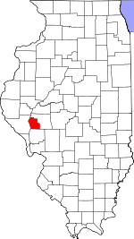
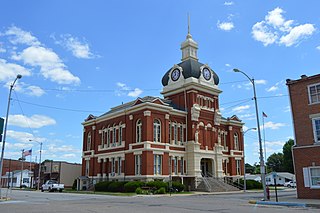
Greene County is a county located in the U.S. state of Illinois. According to the 2020 United States Census, it has a population of 11,843. Its county seat is Carrollton.

<span class="mw-page-title-main">Douglas County, Illinois</span> County in Illinois, United States

Douglas County is a county located in the U.S. state of Illinois. As of the 2020 United States Census, the population was 19,740. The county seat is Tuscola.

<span class="mw-page-title-main">Roodhouse, Illinois</span> City in Illinois, United States

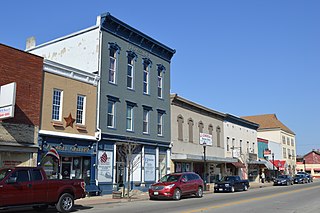
Roodhouse is a city in Greene County, Illinois, United States. The population was 1,814 at the 2010 census, down from 2,214 at the 2000 census.

<span class="mw-page-title-main">McLeansboro, Illinois</span> City in Illinois, United States

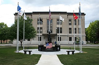
McLeansboro is a city in Hamilton County, Illinois, United States. The population was 2,675 at the 2020 census. The estimated population as of 2018 was 2,773. It is the county seat of Hamilton County.

<span class="mw-page-title-main">Winchester, Illinois</span> City in Illinois, United States

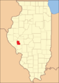
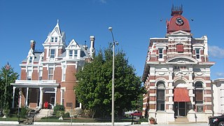
Winchester is a city in and the county seat of Scott County, Illinois, United States. The population was 1,593 at the 2010 census. Winchester is part of the Jacksonville Micropolitan Statistical Area.

<span class="mw-page-title-main">Winchester, Indiana</span> City in Indiana, United States

Winchester is a city in White River Township, Randolph County, in the U.S. state of Indiana. The city is the county seat of Randolph County. The population was 4,935 at the 2010 census. It is the home of Winchester Speedway.

<span class="mw-page-title-main">Winchester, Kansas</span> City in Kansas, United States

Winchester is a city in Jefferson County, Kansas, United States. As of the 2020 census, the population of the city was 461.

<span class="mw-page-title-main">Winchester, Missouri</span> City in Missouri, United States

Winchester is a city in St. Louis County, Missouri, United States. The population was 1,447 at the 2020 census.

<span class="mw-page-title-main">New Carlisle, Ohio</span> City in Ohio, United States

New Carlisle is a city in Bethel Township, Clark County, Ohio, United States. The population was 5,559 at the 2020 census. It is part of the Springfield, Ohio Metropolitan Statistical Area.

<span class="mw-page-title-main">Northgate, Ohio</span> Census-designated place in Ohio, United States

Northgate is a census-designated place (CDP) in Colerain Township, Hamilton County, Ohio, United States. The population was 7,277 at the 2020 census.

<span class="mw-page-title-main">Capon Bridge, West Virginia</span> Town in West Virginia, United States

Capon Bridge is a town in eastern Hampshire County, West Virginia, United States, along the Northwestern Turnpike, approximately 20 miles (32 km) west of Winchester, Virginia. The population was 418 at the 2020 census. Originally known as "Glencoe", Capon Bridge was incorporated in 1902 by the Hampshire County Circuit Court. It is named because of the construction of the bridge over the Cacapon River at that place, the name of the river being derived from the Shawnee Cape-cape-de-hon, meaning "river of medicine water".

<span class="mw-page-title-main">Winchester, Adams County, Ohio</span> Village in Ohio, United States

Winchester is a village in Adams County, Ohio, United States. The population was 987 at the 2020 census. The name of the surrounding township is also named Winchester.

References

  1. "Scott County, Illinois". United States Census Bureau . Retrieved June 10, 2023.
  2. "Find a County". National Association of Counties. Retrieved June 7, 2011.
  3. 1 2 "Population, Housing Units, Area, and Density: 2010 - County". United States Census Bureau. Archived from the original on February 13, 2020. Retrieved July 12, 2015.
  4. 1 2 "Monthly Averages for Winchester, Illinois". The Weather Channel. Retrieved January 27, 2011.
  5. "Annual Estimates of the Resident Population for Counties: April 1, 2020 to July 1, 2023". United States Census Bureau. Retrieved April 2, 2024.
  6. "U.S. Decennial Census". United States Census Bureau. Retrieved July 8, 2014.
  7. "Historical Census Browser". University of Virginia Library. Retrieved July 8, 2014.
  8. "Population of Counties by Decennial Census: 1900 to 1990". United States Census Bureau. Retrieved July 8, 2014.
  9. "Census 2000 PHC-T-4. Ranking Tables for Counties: 1990 and 2000" (PDF). United States Census Bureau. Retrieved July 8, 2014.
  10. "State & County QuickFacts". United States Census Bureau. Archived from the original on June 7, 2011. Retrieved July 8, 2014.
  11. 1 2 3 "DP-1 Profile of General Population and Housing Characteristics: 2010 Demographic Profile Data". United States Census Bureau. Archived from the original on February 13, 2020. Retrieved July 12, 2015.
  12. "DP02 SELECTED SOCIAL CHARACTERISTICS IN THE UNITED STATES – 2006-2010 American Community Survey 5-Year Estimates". United States Census Bureau. Archived from the original on February 13, 2020. Retrieved July 12, 2015.
  13. "DP03 SELECTED ECONOMIC CHARACTERISTICS – 2006-2010 American Community Survey 5-Year Estimates". United States Census Bureau. Archived from the original on February 13, 2020. Retrieved July 12, 2015.
  14. Leip, David. "Dave Leip's Atlas of U.S. Presidential Elections". uselectionatlas.org. Retrieved April 1, 2018.

39°39′N90°29′W / 39.65°N 90.48°W / 39.65; -90.48