Effingham County, Illinois

Last updated

Effingham County
Effingham County Building and Jail.jpg
Effingham County Government Center and Jail in Effingham
Effingham County Illinois seal.png
Map of Illinois highlighting Effingham County.svg
Location within the U.S. state of Illinois
Illinois in United States.svg
Illinois's location within the U.S.
Coordinates: 39°04′N88°35′W / 39.06°N 88.59°W / 39.06; -88.59
CountryFlag of the United States.svg United States
StateFlag of Illinois.svg  Illinois
Founded1831
Named for Thomas Howard, 3rd Earl of Effingham
Seat Effingham
Largest cityEffingham
Area
  Total480 sq mi (1,200 km2)
  Land479 sq mi (1,240 km2)
  Water1.2 sq mi (3 km2)  0.3%
Population
 (2020)
  Total34,668
  Density72/sq mi (28/km2)
Time zone UTC−6 (Central)
  Summer (DST) UTC−5 (CDT)
Congressional district 12th
Website www.effinghamcountyil.gov

Effingham County is located in the south central part of the U.S. state Illinois. As of the 2020 census, the population was 34,668. [1] Its county seat and largest city is Effingham. Some other cities in Effingham County, Illinois include Altamont, Teutopolis, Beecher City, Montrose, Dieterich, Shumway, Watson, Mason, and Edgewood. Effingham County comprises the Effingham, IL Micropolitan Statistical Area. [2]

Contents

History

Effingham County at the time of its creation in 1831 Effingham County Illinois 1831.png
Effingham County at the time of its creation in 1831

Effingham County was formed in 1831 out of Fayette and Crawford counties. It may have been named after Thomas Howard, 3rd Earl of Effingham, who resigned his commission as general in the British army in 1775, refusing to serve in the war against the Colonies. The name is Anglo-Saxon for "Effa's house". New information suggests that the county was named after a surveyor who surveyed the area whose last name was Effingham. There is no written proof that the county was named after Lord Effingham.

Government

Effingham County Courthouse in Effingham Effingham County Courthouse, Effingham, IL.jpg
Effingham County Courthouse in Effingham

Effingham County is governed by a board of elected representatives. [3] The current Effingham County Board Chairman is Joshua Douthit (Republican) elected in 2022 from District B.

Geography

According to the U.S. Census Bureau, the county has a total area of 480 square miles (1,200 km2), of which 479 square miles (1,240 km2) is land and 1.2 square miles (3.1 km2) (0.3%) is water. [4]

Just west of Effingham on Interstate 70 there is a 198-foot (60 m) white cross; 35,000 vehicles are estimated to pass the site each day. It is one of the world's tallest crosses, and took over 200 short tons (180 t) of steel to erect.

Climate and weather

Effingham, Illinois
Climate chart (explanation)
J
F
M
A
M
J
J
A
S
O
N
D
 
 
2.4
 
 
35
18
 
 
2.5
 
 
41
22
 
 
3.6
 
 
52
32
 
 
4.1
 
 
64
42
 
 
4.5
 
 
74
52
 
 
4.3
 
 
83
62
 
 
4.5
 
 
87
66
 
 
2.9
 
 
85
63
 
 
3
 
 
78
55
 
 
3
 
 
67
43
 
 
4.1
 
 
52
34
 
 
3.3
 
 
40
23
Average max. and min. temperatures in °F
Precipitation totals in inches
Source: The Weather Channel [5]
Metric conversion
J
F
M
A
M
J
J
A
S
O
N
D
 
 
60
 
 
2
−8
 
 
64
 
 
5
−6
 
 
92
 
 
11
0
 
 
104
 
 
18
6
 
 
113
 
 
23
11
 
 
108
 
 
28
17
 
 
115
 
 
31
19
 
 
74
 
 
29
17
 
 
77
 
 
26
13
 
 
75
 
 
19
6
 
 
103
 
 
11
1
 
 
83
 
 
4
−5
Average max. and min. temperatures in °C
Precipitation totals in mm

In recent years, average temperatures in the county seat of Effingham have ranged from a low of 18 °F (−8 °C) in January to a high of 87 °F (31 °C) in July, although a record low of −29 °F (−34 °C) was recorded in January 1915 and a record high of 111 °F (44 °C) was recorded in July 1954. Average monthly precipitation ranged from 2.38 inches (60 mm) in January to 4.51 inches (115 mm) in July. [5]

Adjacent counties

Major highways

Transit

Demographics

Historical population
CensusPop.Note
1840 1,675
1850 3,799126.8%
1860 7,816105.7%
1870 15,653100.3%
1880 18,92020.9%
1890 19,3582.3%
1900 20,4655.7%
1910 20,055−2.0%
1920 19,556−2.5%
1930 19,013−2.8%
1940 22,03415.9%
1950 21,675−1.6%
1960 23,1076.6%
1970 24,6086.5%
1980 30,94425.7%
1990 31,7042.5%
2000 34,2648.1%
2010 34,242−0.1%
2020 34,6681.2%
2023 (est.)34,331 [6] −1.0%
U.S. Decennial Census [7]
1790-1960 [8] 1900-1990 [9]
1990-2000 [10] 2010-2013 [1]
2000 census age pyramid for Effingham County USA Effingham County, Illinois age pyramid.svg
2000 census age pyramid for Effingham County

As of the 2010 United States Census, there were 34,242 people, 13,515 households, and 9,302 families residing in the county. [11] The population density was 71.5 inhabitants per square mile (27.6/km2). There were 14,570 housing units at an average density of 30.4 per square mile (11.7/km2). [4] The racial makeup of the county was 97.6% white, 0.4% Asian, 0.2% black or African American, 0.1% American Indian, 0.8% from other races, and 0.8% from two or more races. Those of Hispanic or Latino origin made up 1.7% of the population. [11] In terms of ancestry, 41.6% were German, 10.0% were Irish, 9.3% were American, and 8.8% were English. [12]

Of the 13,515 households, 32.7% had children under the age of 18 living with them, 54.9% were married couples living together, 9.5% had a female householder with no husband present, 31.2% were non-families, and 26.9% of all households were made up of individuals. The average household size was 2.50 and the average family size was 3.03. The median age was 39.2 years. [11]

The median income for a household in the county was $49,509 and the median income for a family was $61,373. Males had a median income of $40,951 versus $28,209 for females. The per capita income for the county was $24,843. About 7.8% of families and 10.5% of the population were below the poverty line, including 14.1% of those under age 18 and 7.4% of those age 65 or over. [13]

Communities

Cities

Town

Villages

Townships

Effingham County is divided into fifteen townships:

Politics

In its early years Effingham County was owing to its anti-Civil War German-American population powerfully Democratic. Until Woodrow Wilson’s harsh policies towards Germany following World War I drove many voters to the GOP’s Warren G. Harding, it had voted an absolute majority to the Democratic presidential candidate in every election since the county’s formation. Opposition to the New Deal caused a considerable swing away from Franklin D. Roosevelt in 1936, and combined with local opposition to Roosevelt’s war policies in 1940 to cause FDR to only win the county by forty-seven votes from Wendell Willkie.

Since that election, the county has voted Republican in every election except 1948 and 1964, and no Democrat since Jimmy Carter in 1976 has reached 35 percent of the county’s vote. Currently Effingham County is one of Illinois’ most Republican counties, rivalled by a number of southern counties like Edwards. In the 2008 U.S. presidential election, John McCain carried the county by a 36% margin over Barack Obama, making it McCain's strongest county in the state, with Obama carrying his home state by a 25.1% margin over McCain. [14]

Currently all elected officials holding major offices in Effingham County are Republican with 8 of 9 elected County Board Representatives being Republican.

United States presidential election results for Effingham County, Illinois [15]
Year Republican Democratic Third party
No.%No.%No.%
2020 15,00678.64%3,71619.47%3611.89%
2016 13,63577.43%3,08317.51%8915.06%
2012 12,50175.25%3,86123.24%2511.51%
2008 11,32367.08%5,26231.17%2951.75%
2004 11,77472.33%4,38826.96%1160.71%
2000 9,85568.04%4,22529.17%4052.80%
1996 7,69654.18%4,82533.97%1,68311.85%
1992 6,32942.25%5,22134.85%3,43122.90%
1988 8,43164.53%4,55334.85%820.63%
1984 9,61771.22%3,84128.44%460.34%
1980 9,10465.93%4,22930.63%4753.44%
1976 7,19453.72%5,95244.45%2451.83%
1972 8,75266.34%4,43133.59%100.08%
1968 6,69855.95%4,49637.55%7786.50%
1964 5,04442.65%6,78257.35%00.00%
1960 6,41053.01%5,67646.94%60.05%
1956 6,90460.67%4,45539.15%210.18%
1952 6,53057.79%4,74541.99%250.22%
1948 4,82348.92%4,94050.11%960.97%
1944 5,44153.77%4,58745.33%910.90%
1940 5,94149.48%5,98849.88%770.64%
1936 4,29340.57%6,03056.98%2602.46%
1932 2,93330.65%6,50367.96%1331.39%
1928 3,88247.26%4,23951.61%931.13%
1924 3,15939.18%3,81447.30%1,09013.52%
1920 4,17657.47%2,98541.08%1061.46%
1916 3,20740.36%4,52957.00%2102.64%
1912 1,00223.25%2,57559.76%73216.99%
1908 1,87738.86%2,82658.51%1272.63%
1904 1,86342.68%2,30352.76%1994.56%
1900 1,85337.95%2,97961.01%511.04%
1896 1,89538.57%2,95360.11%651.32%
1892 1,47232.92%2,74461.37%2555.70%

See also

Related Research Articles

<span class="mw-page-title-main">Clay County, Illinois</span> County in Illinois, United States

Clay County is a county in the southeastern portion of the U.S. state of Illinois. As of the 2020 United States Census, the population was 13,288. Since 1842, its county seat has been Louisville, in the center of the county's area.

<span class="mw-page-title-main">Pulaski County, Illinois</span> County in Illinois, United States

Pulaski County is a county located in the U.S. state of Illinois. According to the 2020 census, it had a population of 5,193. Its county seat is Mound City. Its largest city is Mounds. It is located along the Ohio River in the southwestern portion of the state, known locally as "Little Egypt".

<span class="mw-page-title-main">Marion County, Illinois</span> County in Illinois, United States

Marion County is a county located in the U.S. state of Illinois. According to the 2020 census, it had a population of 37,729. Its county seat is Salem.

<span class="mw-page-title-main">Henry County, Illinois</span> County in Illinois, United States

Henry County is a county located in the U.S. state of Illinois. The 2020 United States Census, listed its population at 49,284. Its county seat is Cambridge.

<span class="mw-page-title-main">Ford County, Illinois</span> County in Illinois, United States

Ford County is a county located in the U.S. state of Illinois. According to the 2020 United States Census, it had a population of 13,534. Its county seat is Paxton. Ford County was part of the Champaign–Urbana, IL Metropolitan Statistical Area until 2018, when the Office of Management and Budget removed the county from the area.

<span class="mw-page-title-main">Fayette County, Illinois</span> County in Illinois, United States

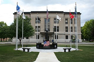
Fayette County is a county located in the U.S. state of Illinois. As of the 2020 census, the population was 21,488. Its county seat is Vandalia, the site of the Vandalia State House State Historic Site. Ramsey Lake State Recreation Area is located in the northwestern part of this county.

<span class="mw-page-title-main">Douglas County, Illinois</span> County in Illinois, United States

Douglas County is a county located in the U.S. state of Illinois. As of the 2020 United States Census, the population was 19,740. The county seat is Tuscola.

<span class="mw-page-title-main">Cumberland County, Illinois</span> County in Illinois, United States

Cumberland County is a county located in the U.S. state of Illinois. As of the 2020 census, the population was 10,450. Its county seat is Toledo.

<span class="mw-page-title-main">Crawford County, Illinois</span> County in Illinois, United States

Crawford County is a county located in the U.S. state of Illinois. As of the 2020 census, the population was 18,679. Its county seat is Robinson.

<span class="mw-page-title-main">Carroll County, Illinois</span> County in Illinois, United States

Carroll County is a county located in the U.S. state of Illinois. As of the 2020 census, the population was 15,702. Its county seat is Mount Carroll.

<span class="mw-page-title-main">Dieterich, Illinois</span> Village in Illinois, United States

Dieterich is a village in Effingham County, Illinois, United States. The population was 890 at the 2020 census. Dieterich is part of the Effingham, IL Micropolitan Statistical Area.

Teutopolis is a village in Effingham County, Illinois. As of the 2020 census it had a population of 1,618.

<span class="mw-page-title-main">Watson, Illinois</span> Village in Illinois, United States

Watson is a village in Effingham County, Illinois, United States. The population was 668 at the 2020 census. Watson is part of the Effingham, IL Micropolitan Statistical Area.

<span class="mw-page-title-main">Summit Township, Effingham County, Illinois</span> Township in Illinois, United States

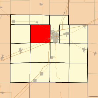
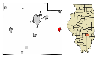
Summit Township is one of fifteen townships in Effingham County, Illinois, USA. As of the 2020 census, its population was 3,760 and it contained 1,774 housing units.

<span class="mw-page-title-main">Bishop Township, Effingham County, Illinois</span> Township in Illinois, United States

Bishop Township is one of fifteen townships in Effingham County, Illinois, USA. As of the 2020 census, its population was 1,702 and it contained 629 housing units.

<span class="mw-page-title-main">Douglas Township, Effingham County, Illinois</span> Township in Illinois, United States

Douglas Township is one of fifteen townships in Effingham County, Illinois, USA. As of the 2020 census, its population was 12,556 and it contained 5,947 housing units.

<span class="mw-page-title-main">St. Francis Township, Effingham County, Illinois</span> Township in Illinois, United States

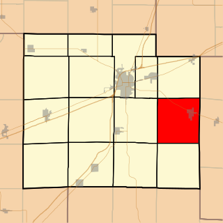
Saint Francis Township is one of fifteen townships in Effingham County, Illinois, USA. As of the 2020 census, its population was 1,194 and it contained 479 housing units.

<span class="mw-page-title-main">Teutopolis Township, Effingham County, Illinois</span> Township in Illinois, United States

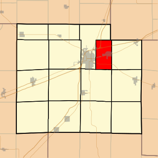
Teutopolis Township is one of fifteen townships in Effingham County, Illinois, USA. As of the 2020 census, its population was 2,782 and it contained 1,050 housing units. It was formed from Douglas Township.

<span class="mw-page-title-main">Watson Township, Effingham County, Illinois</span> Township in Illinois, United States

Watson Township is one of fifteen townships in Effingham County, Illinois, USA. As of the 2020 census, its population was 3,188 and it contained 1,298 housing units.

<span class="mw-page-title-main">West Township, Effingham County, Illinois</span> Township in Illinois, United States

West Township is one of fifteen townships in Effingham County, Illinois, USA. As of the 2020 census, its population was 444 and it contained 181 housing units.

References

Specific
  1. 1 2 "State & County QuickFacts". United States Census Bureau. Archived from the original on June 6, 2011. Retrieved July 4, 2014.
  2. "Find a County". National Association of Counties. Archived from the original on July 12, 2012. Retrieved June 7, 2011.
  3. "Board | Effingham County, Illinois (IL)". www.co.effingham.il.us. Retrieved December 13, 2023.
  4. 1 2 "Population, Housing Units, Area, and Density: 2010 - County". United States Census Bureau. Archived from the original on February 12, 2020. Retrieved July 11, 2015.
  5. 1 2 "Monthly Averages for Effingham, Illinois". The Weather Channel. Retrieved January 27, 2011.
  6. "Annual Estimates of the Resident Population for Counties: April 1, 2020 to July 1, 2023". United States Census Bureau. Retrieved April 2, 2024.
  7. "U.S. Decennial Census". United States Census Bureau. Retrieved July 4, 2014.
  8. "Historical Census Browser". University of Virginia Library. Retrieved July 4, 2014.
  9. "Population of Counties by Decennial Census: 1900 to 1990". United States Census Bureau. Retrieved July 4, 2014.
  10. "Census 2000 PHC-T-4. Ranking Tables for Counties: 1990 and 2000" (PDF). United States Census Bureau. Archived (PDF) from the original on March 27, 2010. Retrieved July 4, 2014.
  11. 1 2 3 "DP-1 Profile of General Population and Housing Characteristics: 2010 Demographic Profile Data". United States Census Bureau. Archived from the original on February 13, 2020. Retrieved July 11, 2015.
  12. "DP02 SELECTED SOCIAL CHARACTERISTICS IN THE UNITED STATES – 2006-2010 American Community Survey 5-Year Estimates". United States Census Bureau. Archived from the original on February 13, 2020. Retrieved July 11, 2015.
  13. "DP03 SELECTED ECONOMIC CHARACTERISTICS – 2006-2010 American Community Survey 5-Year Estimates". United States Census Bureau. Archived from the original on February 13, 2020. Retrieved July 11, 2015.
  14. U.S. Election Atlas
  15. Leip, David. "Dave Leip's Atlas of U.S. Presidential Elections". uselectionatlas.org. Retrieved November 1, 2018.
General

39°04′N88°35′W / 39.06°N 88.59°W / 39.06; -88.59