Winnebago County, Illinois

Last updated

Winnebago County
Rockford, IL Winnebago County Justice Center 01.JPG
Winnebago County Justice Center
Winnebago County il seal.png
Map of Illinois highlighting Winnebago County.svg
Location within the U.S. state of Illinois
Illinois in United States.svg
Illinois's location within the U.S.
Coordinates: 42°20′N89°10′W / 42.33°N 89.16°W / 42.33; -89.16
CountryFlag of the United States.svg United States
StateFlag of Illinois.svg  Illinois
FoundedJanuary 16, 1836
Named for Winnebago people
Seat Rockford
Largest cityRockford
Area
  Total519 sq mi (1,340 km2)
  Land513 sq mi (1,330 km2)
  Water5.9 sq mi (15 km2)  1.1%
Population
 (2020)
  Total285,350 Decrease2.svg
  Density550/sq mi (210/km2)
Time zone UTC−6 (Central)
  Summer (DST) UTC−5 (CDT)
Congressional districts 16th, 17th
Website www.wincoil.us

Winnebago County is a county located in the U.S. state of Illinois. According to the 2020 census, it had a population of 285,350 making it the seventh most populous county in Illinois behind Cook County and its five surrounding collar counties. Its county seat is Rockford. [1] Winnebago County is the central county of the Rockford metropolitan area.

Contents

History

Winnebago County was formed on January 16, 1836, out of Jo Daviess and LaSalle counties. It was named for the Winnebago Tribe of American Indians. At the time the county was founded its inhabitants consisted almost entirely of New Englanders and New England transplants from upstate New York. [2] These were "Yankee" settlers, meaning they were descended from the English Puritans who settled New England during the early 1600s. They made up virtually all of Winnebago County's inhabitants during the first several decades of its history. In this regard the county was similar to most of the northern portion of the state of Illinois, and almost all of the neighboring state of Wisconsin. After the conclusion of the Black Hawk War there was an additional surge of immigration from New England. As a result of this heritage the inhabitants of Winnebago County considered themselves, and functioned as, a cultural expansion of early New England culture. [3] In the presidential election of 1860, Abraham Lincoln won 3,985 votes in Winnebago County, whereas Stephen A. Douglas only won 817 votes. [4]

Geography

According to the U.S. Census Bureau, the county has a total area of 519 square miles (1,340 km2), of which 513 square miles (1,330 km2) is land and 5.9 square miles (15 km2) (1.1%) is water. [5]

Climate and weather

Rockford, Illinois
Climate chart (explanation)
J
F
M
A
M
J
J
A
S
O
N
D
 
 
1.4
 
 
27
11
 
 
1.3
 
 
33
16
 
 
2.4
 
 
46
27
 
 
3.6
 
 
59
37
 
 
4
 
 
71
48
 
 
4.8
 
 
80
58
 
 
4.1
 
 
83
63
 
 
4.2
 
 
81
61
 
 
3.5
 
 
74
52
 
 
2.6
 
 
62
40
 
 
2.6
 
 
46
29
 
 
2.1
 
 
32
17
Average max. and min. temperatures in °F
Precipitation totals in inches
Source: The Weather Channel [6]
Metric conversion
J
F
M
A
M
J
J
A
S
O
N
D
 
 
36
 
 
−3
−12
 
 
34
 
 
1
−9
 
 
61
 
 
8
−3
 
 
92
 
 
15
3
 
 
102
 
 
22
9
 
 
122
 
 
27
14
 
 
104
 
 
28
17
 
 
107
 
 
27
16
 
 
88
 
 
23
11
 
 
65
 
 
17
4
 
 
67
 
 
8
−2
 
 
52
 
 
0
−8
Average max. and min. temperatures in °C
Precipitation totals in mm

In recent years, average temperatures in the county seat of Rockford have ranged from a low of 11 °F (−12 °C) in January to a high of 83 °F (28 °C) in July, although a record low of −27 °F (−33 °C) was recorded in January 1982 and a record high of 112 °F (44 °C) was recorded in July 1936. Average monthly precipitation ranged from 1.34 inches (34 mm) in February to 4.80 inches (122 mm) in June. [6]

Major highways

Transit

Adjacent counties

Demographics

Historical population
CensusPop.Note
1840 4,609
1850 11,773155.4%
1860 24,491108.0%
1870 29,30119.6%
1880 30,5054.1%
1890 39,93830.9%
1900 47,84519.8%
1910 63,15332.0%
1920 90,92944.0%
1930 117,37329.1%
1940 121,1783.2%
1950 152,38525.8%
1960 209,76537.7%
1970 246,62317.6%
1980 250,8841.7%
1990 252,9130.8%
2000 278,41810.1%
2010 295,2666.1%
2020 285,350−3.4%
2023 (est.)280,922 [7] −1.6%
U.S. Decennial Census [8]
1790–1960 [9] 1900–1990 [10]
1990–2000 [11] 2010–2019 [12]

As of the 2010 census, there were 295,266 people, 115,501 households, and 76,854 families residing in the county. [13] The population density was 575.2 inhabitants per square mile (222.1/km2). There were 125,965 housing units at an average density of 245.4 per square mile (94.7/km2). [5] The racial makeup of the county was 77.4% white, 12.2% black or African American, 2.3% Asian, 0.3% American Indian, 4.9% from other races, and 2.8% from two or more races. Those of Hispanic or Latino origin made up 10.9% of the population. [13] In terms of ancestry, 25.6% were German, 13.5% were Irish, 9.4% were American, 8.7% were Swedish, 8.3% were English, and 7.4% were Italian. [14]

Of the 115,501 households, 33.1% had children under the age of 18 living with them, 47.3% were married couples living together, 14.0% had a female householder with no husband present, 33.5% were non-families, and 27.7% of all households were made up of individuals. The average household size was 2.52 and the average family size was 3.07. The median age was 38.3 years. [13]

The median income for a household in the county was $47,198 and the median income for a family was $59,814. Males had a median income of $48,358 versus $32,103 for females. The per capita income for the county was $24,008. About 11.5% of families and 15.9% of the population were below the poverty line, including 25.0% of those under age 18 and 7.5% of those age 65 or over. [15]

Communities

Cities

Villages

Census-designated place

Unincorporated communities

Townships

Winnebago County is divided into these townships:

Politics

Prior to 1992, Winnebago County was a Republican Party stronghold in presidential elections, only backing the Democratic Party candidates in the national landslides of 1936 & 1964. Since then, it became a swing county, backing the national winner in every presidential election from 1980 to 2012. In 2016, Hillary Clinton won the county by only 89 votes over Donald Trump, affected by the relatively large third-party vote that year.

United States presidential election results for Winnebago County, Illinois [16]
Year Republican Democratic Third party
No.%No.%No.%
2020 60,86147.49%64,05649.98%3,2432.53%
2016 55,62446.33%55,71346.41%8,7187.26%
2012 55,13846.18%61,73251.70%2,5272.12%
2008 53,88642.53%70,03455.27%2,7842.20%
2004 60,78250.06%59,74049.20%9030.74%
2000 53,81649.24%51,98147.56%3,5003.20%
1996 44,47944.52%46,26446.31%9,1679.18%
1992 42,22137.63%48,29843.04%21,69619.33%
1988 55,69954.85%45,28044.59%5710.56%
1984 64,20358.66%44,62940.78%6190.57%
1980 48,82546.46%32,38430.82%23,88022.72%
1976 52,73654.15%42,39943.54%2,2522.31%
1972 57,68261.46%35,93738.29%2310.25%
1968 47,64652.51%36,70240.45%6,3917.04%
1964 39,92044.98%48,83455.02%00.00%
1960 49,54155.20%40,09044.67%1100.12%
1956 48,33262.38%29,06337.51%890.11%
1952 43,46857.95%31,40941.88%1270.17%
1948 29,53751.54%27,14547.36%6311.10%
1944 30,83752.31%27,83147.22%2770.47%
1940 30,68351.89%28,06147.46%3830.65%
1936 24,99746.30%27,20050.38%1,7923.32%
1932 26,63257.12%17,70737.98%2,2864.90%
1928 33,25880.39%7,68418.57%4301.04%
1924 21,97871.32%2,2287.23%6,60821.44%
1920 19,91379.23%3,35513.35%1,8667.42%
1916 14,89365.04%6,19827.07%1,8067.89%
1912 2,53721.32%2,27619.12%7,08959.56%
1908 8,91971.54%2,16317.35%1,38511.11%
1904 8,14374.80%1,17710.81%1,56714.39%
1900 8,10372.69%2,49822.41%5464.90%
1896 8,24275.10%2,44722.30%2862.61%
1892 5,85462.50%2,63428.12%8789.37%

See also

Related Research Articles

<span class="mw-page-title-main">Stephenson County, Illinois</span> County in Illinois, United States

Stephenson County is a county located in the U.S. state of Illinois. According to the 2020 United States Census, it had a population of 44,630. Its county seat is Freeport.

<span class="mw-page-title-main">Scott County, Illinois</span> County in Illinois, United States

Scott County is a county located in the U.S. state of Illinois. According to the 2020 census, it had a population of 4,949, making it the fourth-least populous county in Illinois. Its county seat is Winchester.

<span class="mw-page-title-main">Ogle County, Illinois</span> County in Illinois, United States

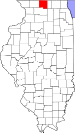
Ogle County is a county in the northern part of the U.S. state of Illinois. According to the 2020 United States Census, it had a population of 51,788. Its county seat is Oregon, and its largest city is Rochelle. Ogle County comprises Rochelle, IL Micropolitan Statistical Area, which is also included in the Rockford-Freeport-Rochelle, IL Combined Statistical Area.

<span class="mw-page-title-main">Boone County, Illinois</span> County in Illinois, United States

Boone County is a county located in the U.S. state of Illinois. As of the 2020 census, the population was 53,448. Its county seat is Belvidere.

<span class="mw-page-title-main">Loves Park, Illinois</span> City in Illinois, United States

Loves Park is a city in Boone and Winnebago counties in the U.S. state of Illinois. Most of the city is in Winnebago County, with a tiny sliver in the east located in Boone County. The population was 23,397 at the 2020 census.

<span class="mw-page-title-main">Huntley, Illinois</span> Village in Illinois, United States

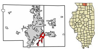
Huntley is a village in McHenry and Kane counties, Illinois, United States. As of the 2021 census it had a population of 28,008. It is a part of the Chicago metropolitan area.

<span class="mw-page-title-main">Davis Junction, Illinois</span> Village in Illinois, United States

Davis Junction is a village in Ogle County, Illinois, United States. The population was 2,512 at the 2020 census. Named for Jeremiah Davis, it is located where the Illinois Railway Rockford Line and the Canadian Pacific Railway Chicago Subdivision intersect along Illinois Route 72. It is the site of the Orchard Hills Landfill - one of the largest in the United States.

<span class="mw-page-title-main">Cherry Valley, Illinois</span> Village in Illinois, United States

Cherry Valley is a village of 8.72 square miles (22.6 km2) that lies primarily in Winnebago County. Approximately ten percent of the village is within Boone County. The village is within the Rockford, Illinois Metropolitan Statistical Area, and borders the southeast side of Rockford. It is also within the Kishwaukee River valley. The population is 2905 at the 2020 census, down from 3,162 as of the 2010 census.

<span class="mw-page-title-main">Durand, Illinois</span> Village in Illinois, United States

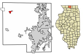
Durand is a village in Winnebago County, Illinois, United States. It is part of the Rockford, Illinois Metropolitan Statistical Area The population was 1,443 at the 2010 census, up from 1,081 in 2000.

<span class="mw-page-title-main">Machesney Park, Illinois</span> Village in Illinois, United States

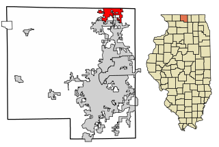
Machesney Park is a village located in Winnebago County, Illinois, United States. The population was 23,499 at the 2010 census, up from 20,759 in 2000. Machesney Park is part of the Rockford, Illinois Metropolitan Statistical Area.

<span class="mw-page-title-main">New Milford, Illinois</span> Village in Illinois, United States

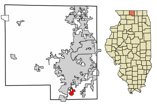
New Milford is a village in Winnebago County, Illinois, United States on the south bank of the Kishwaukee River overlooking the south side of Rockford. It is part of the Rockford, Illinois Metropolitan Statistical Area. The population was 697 at the 2010 census, up from 541 in 2000.

<span class="mw-page-title-main">Pecatonica, Illinois</span> Village in Illinois, United States

Pecatonica is a village in Winnebago County, Illinois, United States. It is part of the Rockford, Illinois Metropolitan Statistical Area. The population was 2,195 at the 2010 census, up from 1,997 in 2000.

<span class="mw-page-title-main">Rockton, Illinois</span> Village in Illinois, United States

Rockton is a village in Winnebago County, Illinois. It is located in the Rock River Valley and is part of the Rockford metropolitan area. The population was 7,685 at the time of the 2010 census, up from 5,296 at the time of the 2000 census.

<span class="mw-page-title-main">Roscoe, Illinois</span> Village in Illinois, United States

Roscoe is a village in Winnebago County, Illinois, along the Rock River. It is in a suburban area of the Rockford, Illinois Metropolitan Statistical Area. As of the 2010 census, the village population was 10,785, up from 6,244 at the 2000 census. The area has been undergoing a period of rapid growth. There have been numerous border disputes with its neighbor to the west, Rockton, Illinois, and development and annexations continue by both villages. Recent growth has included the Promontory Ridge and Hidden Creek custom home subdivisions east of the Illinois Tollway, I-39/I-90.

<span class="mw-page-title-main">South Beloit, Illinois</span> City in Illinois, United States

South Beloit, is a city located in Winnebago County, Illinois, USA. It is part of the Rockford Metropolitan Area, but it is also a suburban extension of Beloit, Wisconsin. South Beloit, is directly along the border of smaller cities and towns north of Rockfords border. At the 2010 census, the city's population was 7,892, up from 5,297 in 2000.

<span class="mw-page-title-main">Winnebago, Illinois</span> Village in Illinois, United States

Winnebago is a village in Winnebago County, Illinois. It is part of the Rockford-Winnebago Metropolitan Statistical Area. The population was 3,101 at the 2010 census, up from 2,958 in 2000.

<span class="mw-page-title-main">Rockford, Iowa</span> City in Iowa, United States

Rockford is a city in Floyd County, Iowa, United States, at the confluence of the Shell Rock and Winnebago rivers. The population was 758 at the time of the 2020 census.

<span class="mw-page-title-main">Winnebago, Minnesota</span> City in Minnesota, United States

Winnebago is a city in Faribault County, Minnesota, United States. The population was 1,391 at the 2020 census.

<span class="mw-page-title-main">Pecatonica River</span> River

The Pecatonica River is a tributary of the Rock River, 194 miles (312 km) long, in southern Wisconsin and northern Illinois in the United States.

The Rockford Metropolitan Statistical Area, as defined by the United States Census Bureau, is an area consisting of four counties in north-central Illinois, anchored by the city of Rockford. As of the 2010 census, the MSA had a population of 349,431. The Rockford MSA abuts the southern portions of the Janesville-Beloit MSA and the Chicago MSA. It forms the main part of the larger Rockford–Freeport–Rochelle Combined Statistical Area.

References

Specific
  1. "Find a County". National Association of Counties. Retrieved June 7, 2011.
  2. History of Rockford and Winnebago County, Illinois: From the First Settlement in 1834 to the Civil War pg. 253
  3. The Expansion of New England: The Spread of New England Settlement and Institutions to the Mississippi River, 1620-1865 by Lois imball Mathews pg. 210-212
  4. History of Rockford and Winnebago County, Illinois: From the First Settlement in 1834 to the Civil War, pg. 379
  5. 1 2 "Population, Housing Units, Area, and Density: 2010 - County". United States Census Bureau. Archived from the original on February 12, 2020. Retrieved July 12, 2015.
  6. 1 2 "Monthly Averages for Rockford, Illinois". The Weather Channel. Retrieved January 27, 2011.
  7. "Annual Estimates of the Resident Population for Counties: April 1, 2020 to July 1, 2023". United States Census Bureau. Retrieved April 2, 2024.
  8. "U.S. Decennial Census". United States Census Bureau. Retrieved July 9, 2014.
  9. "Historical Census Browser". University of Virginia Library. Retrieved July 9, 2014.
  10. "Population of Counties by Decennial Census: 1900 to 1990". United States Census Bureau. Retrieved July 9, 2014.
  11. "Census 2000 PHC-T-4. Ranking Tables for Counties: 1990 and 2000" (PDF). United States Census Bureau. Retrieved July 9, 2014.
  12. "State & County QuickFacts". United States Census Bureau. Archived from the original on June 7, 2011. Retrieved July 9, 2014.
  13. 1 2 3 "DP-1 Profile of General Population and Housing Characteristics: 2010 Demographic Profile Data". United States Census Bureau. Archived from the original on February 13, 2020. Retrieved July 12, 2015.
  14. "DP02 SELECTED SOCIAL CHARACTERISTICS IN THE UNITED STATES – 2006-2010 American Community Survey 5-Year Estimates". United States Census Bureau. Archived from the original on February 13, 2020. Retrieved July 12, 2015.
  15. "DP03 SELECTED ECONOMIC CHARACTERISTICS – 2006-2010 American Community Survey 5-Year Estimates". United States Census Bureau. Archived from the original on February 13, 2020. Retrieved July 12, 2015.
  16. Leip, David. "Dave Leip's Atlas of U.S. Presidential Elections". uselectionatlas.org. Retrieved March 19, 2018.
General

Further reading

42°20′11″N89°09′39″W / 42.33639°N 89.16083°W / 42.33639; -89.16083