Pecatonica, Illinois

Last updated

Pecatonica
Pecatonica, IL Sign 02.JPG
Sign leading into the south side of Pecatonica
Motto(s): 
Small Town, Bright Future
Winnebago County Illinois incorporated and unincorporated areas Pecatonica highlighted.svg
Coordinates: 42°18′36″N89°21′31″W / 42.31000°N 89.35861°W / 42.31000; -89.35861
CountryUnited States
StateIllinois
County Winnebago
Township Pecatonica
Government
  Village PresidentBill Smull [1]
Area
[2]
  Total1.31 sq mi (3.39 km2)
  Land1.28 sq mi (3.32 km2)
  Water0.03 sq mi (0.07 km2)
Elevation
[3]
771 ft (235 m)
Population
 (2020)
  Total2,090
  Density1,628.99/sq mi (628.77/km2)
Time zone UTC-6 (CST)
  Summer (DST) UTC-5 (CDT)
ZIP code(s)
61063
Area code 815
FIPS code 17-58408
Wikimedia CommonsPecatonica, Illinois
Website http://www.villageofpecatonica.com/

Pecatonica is a village in Winnebago County, Illinois, United States. It is part of the Rockford, Illinois Metropolitan Statistical Area. The population was 2,195 at the 2010 census, up from 1,997 in 2000.

Contents

History

The village was named after the Pecatonica River, which forms its northern border. [4] The word Pecatonica is an anglicization of two Algonquian language words; Bekaa (or Pekaa in certain dialects), which means slow and niba, which means water; forming the conjunction Bekaaniba or Slow Water. Civil War records from the state of Illinois [5] include soldiers from "Lysander", the area's common name before incorporation by rail speculators.

The Galena and Chicago Union Railroad, later the Chicago & North Western Railroad, came through in 1853 from Chicago and continued to Freeport, Illinois. That sparked the town to be the center of commerce for western Winnebago County. The Village of Pecatonica was incorporated in 1869, built on territory rightfully owned by Indians and previously deeded to the Reed family by US President James K. Polk. C.W. Knowlton opened his first bank here in 1882 and built a Queen Anne Victorian house on Main Street, [6] on the hill overlooking the business district. This house still stands, after having been restored starting in the mid-1980s.

An electric interurban line known as the Rockford & Interurban ran from Rockford through Winnebago, Illinois and Pecatonica to Ridott, Illinois and on to Freeport, starting in 1902, until the line's eventual abandonment in 1930. [7] A small depot building [7] remains standing near the 300 block of Main Street. For the portion of the rail line between Pecatonica and Winnebago, the line often parallels the Pecatonica River.

This route has since been reclaimed as a nature trail known as the Prairie Path, called in 2021 the Pecatonica Prairie Trail, for walking and biking (non-motorized), with maps shown online. [8] [9] [10] The village of Winnebago has also published a brochure of the trail which can be viewed online. [11]

Prior to rail traffic, this region of Northern Illinois received stagecoach traffic. A limestone house on Comly Road dates to this period, and there are permanent wagon wheel scars near a utility building for the 12 Mile Grove Cemetery, which is just hundreds of feet from the current corridor used by U.S. Route 20, a major east–west route through Northern Illinois. Further west, Route 20 parallels more roads which sometime bear the phrase "Stagecoach Trail".

Geography

Pecatonica is located at 42°18′36″N89°21′31″W / 42.31000°N 89.35861°W / 42.31000; -89.35861 (42.309955, −89.358647). [12]

According to the 2010 census, Pecatonica has a total area of 1.295 square miles (3.35 km2), of which 1.28 square miles (3.32 km2) (or 98.84%) is land and 0.015 square miles (0.04 km2) (or 1.16%) is water. [13]

Education

Education in Pecatonica is provided by the Pecatonica Community Unit School District #321, which operates three school buildings. The Elementary School, originally constructed in 1938, was used as a high school for many years. Two additions to that structure were built in 1962 and 1970 respectively. The Middle School, also a former high school building, was built in 1958 and also accommodated two additions to the original structure in 1967 and 1970.

The current high school building opened in 2003. This state-of-the-art facility is approximately 107,000 square feet. Along with the new high school building a football field and eight lane track were constructed. The high school complex also includes a baseball diamond and play field space for physical education classes. The building was built as a flexible multi-purpose facility that will allow for both school-based and community-based activities.

Parks and recreation

North of downtown Pecatonica, on West 1st Street is Sumner Park, which has three baseball diamonds, four tennis courts, two basketball courts, horseshoe pits and children's playgrounds. The park connects with the recently acquired Pecatonica Wetlands Forest Preserve, both to the west and across the river to the north. Pecatonica Wetlands is made up of 1048 acres of flood plain forest, oxbow pond marshes and upland forest along the Pecatonica River. The site features spring flora and birdlife. Site development is still in progress but when complete will include fishing access, hiking and equestrian trails, picnic areas and wildlife areas.

The Seward Bluffs Forest Preserve is also located nearby. The combined Public Parks and the Recreation Bike and Prairie Path offer a wide variety of recreation. It is a favored fishing spot along the Pecatonica River.

Winnebago County Fair Grounds

The fairgrounds have over 108 acres of indoor and outdoor activities including music festivals, motor sports, auto and trade shows, conventions, antique markets, social events, and the Winnebago County Fair.

Demographics

Historical population
CensusPop.Note
1880 1,029
1890 1,0592.9%
1900 1,045−1.3%
1910 1,022−2.2%
1920 1,0886.5%
1930 1,1525.9%
1940 1,30213.0%
1950 1,43810.4%
1960 1,65915.4%
1970 1,7817.4%
1980 1,732−2.8%
1990 1,7601.6%
2000 1,99713.5%
2010 2,1959.9%
2020 2,090−4.8%
U.S. Decennial Census [14]

As of the census [15] of 2000, there were 1,997 people, 791 households, and 579 families residing in the village. The population density was 1,607.2 inhabitants per square mile (620.5/km2). There were 827 housing units at an average density of 665.6 per square mile (257.0/km2). The racial makeup of the village was 98.35% White, 0.25% African American, 0.15% Native American, 0.10% Asian, 0.25% from other races, and 0.90% from two or more races. Hispanic or Latino of any race were 0.60% of the population.

There were 791 households, out of which 38.8% had children under the age of 18 living with them, 60.7% were married couples living together, 8.8% had a female householder with no husband present, and 26.7% were non-families. 23.4% of all households were made up of individuals, and 11.9% had someone living alone who was 65 years of age or older. The average household size was 2.52 and the average family size was 2.97.

In the village, the population was spread out, with 27.2% under the age of 18, 6.1% from 18 to 24, 30.8% from 25 to 44, 21.0% from 45 to 64, and 14.9% who were 65 years of age or older. The median age was 37 years. For every 100 females, there were 91.5 males. For every 100 females age 18 and over, there were 89.9 males.

The median income for a household in the village was $47,361, and the median income for a family was $55,086. Males had a median income of $40,900 versus $27,143 for females. The per capita income for the village was $20,420. About 3.6% of families and 4.7% of the population were below the poverty line, including 5.7% of those under age 18 and 8.2% of those age 65 or over.

Famous residents

See also

Related Research Articles

<span class="mw-page-title-main">Winnebago County, Illinois</span> County in Illinois, United States

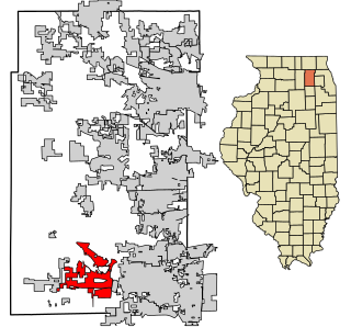
Winnebago County is a county located in the U.S. state of Illinois. According to the 2020 census, it had a population of 285,350 making it the seventh most populous county in Illinois behind Cook County and its five surrounding collar counties. Its county seat is Rockford. Winnebago County is the central county of the Rockford metropolitan area.

<span class="mw-page-title-main">Stephenson County, Illinois</span> County in Illinois, United States

Stephenson County is a county located in the U.S. state of Illinois. According to the 2020 United States Census, it had a population of 44,630. Its county seat is Freeport.

<span class="mw-page-title-main">Boone County, Illinois</span> County in Illinois, United States

Boone County is a county located in the U.S. state of Illinois. As of the 2020 census, the population was 53,448. Its county seat is Belvidere.

<span class="mw-page-title-main">Elmhurst, Illinois</span> City in Illinois, United States

Elmhurst is a city mostly in DuPage County and overlapping into Cook County in the U.S. state of Illinois, and a western suburb of Chicago.

<span class="mw-page-title-main">Glendale Heights, Illinois</span> Village in Illinois, United States

Glendale Heights is a village in DuPage County, Illinois, United States. Per the 2020 census, the population was 33,176. The village is almost entirely residential, and is a far west suburb of Chicago.

<span class="mw-page-title-main">Villa Park, Illinois</span> Village in Illinois, United States

Villa Park is a village in DuPage County, Illinois, United States, within the Chicago metropolitan area. The population as of the 2020 Census is 21,113. Villa Park is a western suburb of Chicago.

<span class="mw-page-title-main">West Chicago, Illinois</span> City in Illinois, United States

West Chicago is a city in DuPage County, Illinois, United States. The population was 25,614 at the 2020 census. It was formerly named Junction and later Turner, after its founder, John B. Turner, president of the Galena and Chicago Union Railroad (G&CU) in 1855. The city was initially established around the first junction of railroad lines in Illinois, and today is still served by the Union Pacific West Metra service via West Chicago station.

<span class="mw-page-title-main">Sugar Grove, Illinois</span> Village in Illinois, United States

Sugar Grove is a village in Kane County, Illinois, United States. The population at the 2010 census was 8,997, and in 2018 the estimated population was 9,803.

<span class="mw-page-title-main">Freeport, Illinois</span> City in Illinois, United States

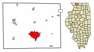
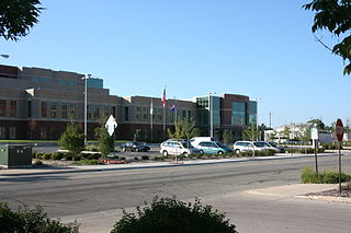
Freeport is the county seat and largest city of Stephenson County, Illinois, United States. The population was 23,973 at the 2020 census, and the mayor of Freeport is Jodi Miller, elected in 2017. Freeport is known for hosting the second Lincoln-Douglas debate of 1858, and as "Pretzel City, USA", due to a popular local German bakery that became well known for its prolific pretzel production after it opened in 1869. Freeport High School's mascot is the Pretzel to honor its heritage.

<span class="mw-page-title-main">Cherry Valley, Illinois</span> Village in Illinois, United States

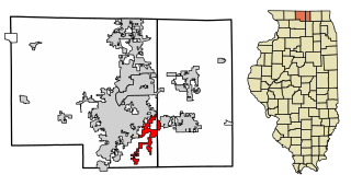
Cherry Valley is a village of 8.72 square miles (22.6 km2) that lies primarily in Winnebago County. Approximately ten percent of the village is within Boone County. The village is within the Rockford, Illinois Metropolitan Statistical Area, and borders the southeast side of Rockford. It is also within the Kishwaukee River valley. The population is 2905 at the 2020 census, down from 3,162 as of the 2010 census.

<span class="mw-page-title-main">Durand, Illinois</span> Village in Illinois, United States

Durand is a village in Winnebago County, Illinois, United States. It is part of the Rockford, Illinois Metropolitan Statistical Area The population was 1,443 at the 2010 census, up from 1,081 in 2000.

<span class="mw-page-title-main">Machesney Park, Illinois</span> Village in Illinois, United States

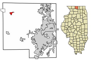
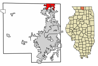
Machesney Park is a village located in Winnebago County, Illinois, United States. The population was 23,499 at the 2010 census, up from 20,759 in 2000. Machesney Park is part of the Rockford, Illinois Metropolitan Statistical Area.

<span class="mw-page-title-main">Roscoe, Illinois</span> Village in Illinois, United States

Roscoe is a village in Winnebago County, Illinois, along the Rock River. It is in a suburban area of the Rockford, Illinois Metropolitan Statistical Area. As of the 2010 census, the village population was 10,785, up from 6,244 at the 2000 census. The area has been undergoing a period of rapid growth. There have been numerous border disputes with its neighbor to the west, Rockton, Illinois, and development and annexations continue by both villages. Recent growth has included the Promontory Ridge and Hidden Creek custom home subdivisions east of the Illinois Tollway, I-39/I-90.

<span class="mw-page-title-main">South Beloit, Illinois</span> City in Illinois, United States

South Beloit, is a city located in Winnebago County, Illinois, USA. It is part of the Rockford Metropolitan Area, but it is also a suburban extension of Beloit, Wisconsin. South Beloit, is directly along the border of smaller cities and towns north of Rockfords border. At the 2010 census, the city's population was 7,892, up from 5,297 in 2000.

<span class="mw-page-title-main">Winnebago, Illinois</span> Village in Illinois, United States

Winnebago is a village in Winnebago County, Illinois. It is part of the Rockford-Winnebago Metropolitan Statistical Area. The population was 3,101 at the 2010 census, up from 2,958 in 2000.

<span class="mw-page-title-main">Galena and Chicago Union Railroad</span>

The Galena and Chicago Union Railroad (G&CU) was a railroad running west from Chicago to Freeport, Illinois, never reaching Galena, Illinois. A later route went to Clinton, Iowa. Incorporated in 1836, the G&CU became the first railroad built out from Chicago.

<span class="mw-page-title-main">Pecatonica River</span> River

The Pecatonica River is a tributary of the Rock River, 194 miles (312 km) long, in southern Wisconsin and northern Illinois in the United States.

<span class="mw-page-title-main">Rockford metropolitan area, Illinois</span> Combined Statistical Area in Illinois, United States

The Rockford Metropolitan Statistical Area, as defined by the United States Census Bureau, is an area consisting of four counties in north-central Illinois, anchored by the city of Rockford. As of the 2010 census, the MSA had a population of 349,431. The Rockford MSA abuts the southern portions of the Janesville-Beloit MSA and the Chicago MSA. It forms the main part of the larger Rockford–Freeport–Rochelle Combined Statistical Area.

The Galena–Chicago trail was a stagecoach route located in northern Illinois that ran from the mid-to-late 1830s until 1854. As indicated by its name, the route linked Chicago, located in the northeast of the state, with Galena which was located in the lead mining district of the northwest. The Chicago-Galena trail includes the "Stagecoach Trail" that runs between Galena and Lena, Illinois. East of Lena the stage route follows U.S. Route 20 and Business U.S. Route 20 through Eleroy, Freeport and Rockford to Belvidere. This road began as the old State Road number 2 established on 15 January 1836 and laid out by June 1837.

<span class="mw-page-title-main">Pecatonica High School (Illinois)</span> Public secondary school in Pecatonica, Illinois, United States

Pecatonica High School, affectionately known as "Pec", is located in the town of Pecatonica, Illinois. The campus is located 15 miles west of Rockford and 15 miles east of Freeport. It is located just one mile north of U.S. Route 20, a major East-West highway connected to Interstate 90. The Pecatonica Community School District ranks as the sixth largest in Winnebago County. Only the districts of Rockford, Rockton Hononegah, Machesney Park Harlem, Winnebago and South Beloit are larger.

References

  1. "President Bill Smull – Village of Pecatonica".
  2. "2020 U.S. Gazetteer Files". United States Census Bureau. Retrieved March 15, 2022.
  3. "USGS detail on Newtown" . Retrieved October 21, 2007.
  4. Chicago and North Western Railway Company (1908). A History of the Origin of the Place Names Connected with the Chicago & North Western and Chicago, St. Paul, Minneapolis & Omaha Railways. p. 112.
  5. "Civil War records of Illinois". Archived from the original on January 8, 2006. Retrieved November 4, 2005.
  6. "Knowlton's Queen Anne Victorian house on Main Street" . Retrieved September 28, 2021.
  7. 1 2 Carlson, Norman (Winter 2005–2006). "A Capsule History of the Rockford & Interurban" (PDF). First & Fastest. Shore Line Interurban Historical Society. pp. 10–15. Retrieved September 28, 2021. A 121-series car is at the Pecatonica station, circa 1905. Going west on the line to Freeport from Rockford, the two major towns that the rail-way served were Winnebago and Pecatonica.
  8. "Prairie Path". Archived from the original on June 25, 2006. Retrieved July 18, 2006.
  9. "Pecatonica Prairie Trail". Pecatonica Prairie Path Commission. Retrieved September 28, 2021.
  10. "Pecatonica Prairie Trail brochure" (PDF). Village of Winnebago. Retrieved September 28, 2021.
  11. "US Gazetteer files: 2010, 2000, and 1990". United States Census Bureau. February 12, 2011. Retrieved April 23, 2011.
  12. "G001 – Geographic Identifiers – 2010 Census Summary File 1". United States Census Bureau. Archived from the original on February 13, 2020. Retrieved December 25, 2015.
  13. "Census of Population and Housing". Census.gov. Retrieved June 4, 2015.
  14. "U.S. Census website". United States Census Bureau . Retrieved January 31, 2008.
  15. Paytas, Trisha (May 11, 2013). "Draw My Life!!! Trisha Paytas". YouTube. Archived from the original on July 4, 2016. Retrieved September 14, 2022.
  16. Stingl, Jim (March 7, 2009). "A woman named Marijuana plays it straight - and wins". Milwaukee Journal Sentinel. Gannett. Archived from the original on July 5, 2019. Retrieved June 20, 2019.
  17. Stingl, Jim (June 18, 2019). "Stingl: Yes, her name really is Marijuana Pepsi, and now she's Dr. Marijuana Pepsi to you". Milwaukee Journal Sentinel. Gannett Co. Archived from the original on June 21, 2019. Retrieved June 21, 2019.