Sterling, Illinois

Last updated

Sterling, Illinois
SterlingIllinois1.jpg
Whiteside County Illinois Incorporated and Unincorporated areas Sterling Highlighted.svg
Location of Sterling in Whiteside County, Illinois.
USA Illinois relief location map.svg
Red pog.svg
Sterling
Usa edcp relief location map.png
Red pog.svg
Sterling
Coordinates: 41°47′48″N89°41′36″W / 41.79667°N 89.69333°W / 41.79667; -89.69333
CountryUnited States
StateIllinois
County Whiteside
Government
  MayorDiana Merdian
Area
[1]
  Total6.16 sq mi (15.96 km2)
  Land5.95 sq mi (15.40 km2)
  Water0.22 sq mi (0.57 km2)
Population
 (2020)
  Total14,764
  Density2,483.01/sq mi (958.75/km2)
Time zone UTC−6 (CST)
  Summer (DST) UTC−5 (CDT)
ZIP Code(s)
61081, 61082
Area code 815
FIPS code 17-72546
Wikimedia CommonsSterling, Illinois
Website City of Sterling Web Site

Sterling is a city in Whiteside County, Illinois, United States, along the Rock River. The population was 14,782 at the 2020 census, down from 15,370 in 2010. Formerly nicknamed "Hardware Capital of the World", the city has long been associated with manufacturing and the steel industry.

Contents

Geography

Sterling lies along the north bank of the Rock River, opposite its twin city, Rock Falls. The terrain is mostly flat. The land immediately outside of town is almost entirely farmland. The prairie soil is part of one of the world's most fertile growing areas. According to the 2010 census, Sterling has a total area of 5.943 square miles (15.39 km2), of which 5.71 square miles (14.79 km2) (or 96.08%) is land and 0.233 square miles (0.60 km2) (or 3.92%) is water. [2]

Demographics

Historical population
CensusPop.Note
1860 2,428
1870 3,99864.7%
1880 5,08727.2%
1890 5,82414.5%
1900 6,3098.3%
1910 7,46718.4%
1920 8,1829.6%
1930 10,01222.4%
1940 11,36313.5%
1950 12,81712.8%
1960 15,68822.4%
1970 16,1132.7%
1980 16,2811.0%
1990 15,132−7.1%
2000 15,4512.1%
2010 15,370−0.5%
2020 14,764−3.9%
U.S. Decennial Census [3]

2020 census

Sterling city, Illinois – Racial and ethnic composition
Note: the US Census treats Hispanic/Latino as an ethnic category. This table excludes Latinos from the racial categories and assigns them to a separate category. Hispanics/Latinos may be of any race.
Race / Ethnicity (NH = Non-Hispanic)Pop 2010 [4] Pop 2020 [5] % 2010% 2020
White alone (NH)10,8559,64470.62%65.32%
Black or African American alone (NH)4113942.67%2.67%
Native American or Alaska Native alone (NH)15160.10%0.11%
Asian alone (NH)1021500.66%1.02%
Pacific Islander alone (NH)050.00%0.03%
Some Other Race alone (NH)20370.13%0.25%
Mixed Race or Multi-Racial (NH)2525741.64%3.89%
Hispanic or Latino (any race)3,7153,94424.17%26.71%
Total15,37014,764100.00%100.00%

As of the census [6] of 2000, there were 15,596 people, 6,234 households, and 3,946 families residing in the city. The population density was 3,307.0 inhabitants per square mile (1,276.8/km2). There were 6,596 housing units at an average density of 1,411.8 per square mile (545.1/km2). The racial makeup of the city was 84.36% White, 2.25% African American, 0.41% Native American, 0.81% Asian, 0.01% Pacific Islander, 9.82% from other races, and 2.35% from two or more races. Hispanic or Latino of any race were 19.24% of the population.

There were 6,234 households, out of which 30.3% had children under the age of 18 living with them, 47.2% were married couples living together, 12.2% had a female householder with no husband present, and 36.7% were non-families. 31.4% of all households were made up of individuals, and 14.0% had someone living alone who was 65 years of age or older. The average household size was 2.41 and the average family size was 3.04.

In the city, the population was spread out, with 25.1% under the age of 18, 9.5% from 18 to 24, 28.7% from 25 to 44, 19.8% from 45 to 64, and 16.9% who were 65 years of age or older. The median age was 36 years. For every 100 females, there were 90.9 males. For every 100 females age 18 and over, there were 86.9 males.

The median income for a household in the city was $37,664, and the median income for a family was $45,531. Males had a median income of $33,047 versus $21,944 for females. The per capita income for the city was $19,432. About 7.6% of families and 10.8% of the population were below the poverty line, including 17.0% of those under age 18 and 5.4% of those age 65 or over.

History

The Lawrence Hardware building (right) overlooking the bridge to Rock Falls, Illinois SterlingIllinois.jpg
The Lawrence Hardware building (right) overlooking the bridge to Rock Falls, Illinois

In 1834, Hezekiah Brink built the first cabin in what was to become Harrisburg. Two years later, William Kirkpatrick settled downstream in an area that became Chatham. In 1838, Harrisburg and Chatham merged to become the Town of Sterling in an effort to become the county seat. The name Sterling was chosen to honor Major James Sterling, who distinguished himself in the area during the Blackhawk War in 1832. On February 16, 1857, Sterling was incorporated as a city by state law.

On July 18, 1856, Abraham Lincoln visited Sterling to speak at a rally for the presidential candidate John C. Fremont. He spent the night at the home of Sheriff William Manahan, which has since been preserved and renovated into the Lincoln-Manahan Home. He gave his speech in Propheter Park, where a statue has been erected in his honor.

The Rock River failed to become a major navigational route as once hoped, but it provided power for the saw and grist mills, and later to a booming industrial base. In 1856, the first rail lines were laid in the area. With the power from the river and the transportation provided by the railroads, Sterling's business and industry grew. During the late 19th and early 20th century, the community's industrial bedrock was laid with the founding of Northwestern Steel & Wire Co., Lawrence Brothers Inc, National Manufacturing Co., The Frantz Manufacturing Company, and the Wahl Clipper Corporation.

Sterling has diversified and adapted to the 21st century. Its industrial base has expanded; the city has filled two industrial parks and made development for a third and fourth. Retail sales for the region have expanded as Sterling has emerged as a regional retail hub. Outside the city, the landscape is dominated by agricultural fields that typify most of the Midwest.

The cities of Sterling, Nebraska, and Sterling, Colorado, were both founded by former residents of Sterling, Illinois, as they branched out across the West.

Education

Sterling is served by Community Unit School District 5, which operates Sterling High School, Challand Middle School, Franklin Elementary, Jefferson Elementary, Lincoln Elementary, and Washington Elementary Schools. Wallace School serves as Sterling's public pre-K institution, along with classrooms in Franklin and Jefferson Elementary Schools. [7]

Sterling is also home to the Whiteside Area Career Center, adjacent to Sterling High School. WACC hosts a variety of vocational courses, available to students of its member schools in the Sauk Valley. [8]

The Roman Catholic Diocese of Rockford runs two schools in the city: St. Mary's School, [9] serving as both grade school and middle school, and Newman Central Catholic High School. These schools serve both local parishes, Sacred Heart Church and St. Mary's Church.

Christ Lutheran, a Protestant school affiliated with the Lutheran Church Missouri Synod, serves students from age 3 through 8th grade. [10]

Parks

Sterling City Parks

Sterling Park District Parks

Douglas Park was developed in 1955 when Cellular Concrete Contractors donated 2 acres (8,100 m2) of property for a park in the Douglas Park Subdivision. Douglas Park is at Chestnut Avenue and Lynn Boulevard.

Eberley Park sits on 25 acres (100,000 m2) of wooded land. It officially opened a 1.5-mile (2.4 km) course in 1978 and is a popular place for joggers and walkers to go. Eberley Park is at Douglas Drive and West LeFevre Road.

The Gartner Park Baseball Complex was developed in 1961 and included 7 regulation baseball diamonds and a playground area. Since then, there has been renovation on the diamonds to include press boxes, lights and field improvements. Gartner Park is on West LeFevre Road.

Harry Kidd Field was acquired through an Open Space Land & Water Grant in 1976. It is used by Sterling Jr. Tackle as their Home field for the 5th-8th grade tackle program. Harry Kidd Field is at West 7th Street and Woodburn Avenue.

The Hoover Park property was purchased from Edward Hoover in 1941 as an extension of Sinnissippi Park. The two parks are connected via the S.M.A.R.T. trail system. Hoover Park is at 37th Avenue and Woodlawn Road.

Kilgour Park was purchased in 1935. This 12-acre (49,000 m2) park was once the site of Civil War Colonel William M. Kilgour's own personal farm. The site is now known for the Imagination Station play area and basketball and tennis courts. Kilgour Park is at West LeFevre Road and Avenue F.

Lawrence Park was acquired in 1925. It is considered the first park of Sterling, and was named for the Lawrence family in honor of their bequests to the then Sterling-Coloma Township Park District. The pool was constructed in the late 1920s and is the home pool for the Sterling Sterling Stingray Swim Club. Lawrence Park is on the Avenue G Island.

The Sinnissippi Dam Walkway and Martin's Landing officially opened on September 20, 2008, after years of combined effort from the Sterling Park District, the City of Sterling, the City of Rock Falls, the Coloma Township Park District and the Illinois Department of Natural Resources. The Sinnissippi Dam Walkway provides a link between the ever-expanding trail system in Sterling and the Hennepin Feeder Canal in Rock Falls. The Sinnissippi Dam Walkway offers bicyclists, runners, walkers and other recreational users a safe and scenic route across the Rock River and Martin's Landing is the welcoming point to Sterling and the entry to the ever-expanding trail system in Sterling. Martin's Landing and the Sinnissippi Dam Walkway are at 10th Avenue and 2nd Street (behind the Dillon Home Museum).

In 1968, the Park District received a recreational lease from the United States Army Corps of Engineers on 31 acres (130,000 m2), which is now known as Harry Oppold Marina. In 1971, the Harbor House, park roads and lighting, a 50-foot (15 m) launch ramp, a 100-foot (30 m) main dock and parking lots were developed through a 100% funded grant. Since the leasing of Oppold, Oxbow Lake was dredged and boat slips, two picnic shelters, picnic units, playground areas, landscaping, and more has been added. Oppold Marina is on Stouffer Road.

The Propheter Park property was donated to the Sterling Park District in 1986 by Bob Propheter. The park was named and dedicated in his honor. Propheter Park is at 6th Avenue and East 6th Street.

In 1967, the Park District acquired the 14-acre (57,000 m2) site known as Scheid Park. In the late 1990s, major renovations include improvement of the basketball courts, soccer field, playground equipment, and the addition of a shelter. Scheid Park is at Woodburn Avenue and West 11th Street.

The largest of the Sterling Park District parks, Sinnissippi Park was acquired in parcels beginning in 1934. It is the site for Hopewillian Indian Mounds, which is on the National Register of Historic Places. Sinnissippi Park is linked to Hoover Park via the S.M.A.R.T. trail system. Sinnissippi Park is on Sinnissippi Road.

The Skate Park was built in 2004 by the Sterling Park District. It is behind the Duis Recreation Center and the Frasor Center at St. Mary's Road and Third Avenue. It is no longer operational and was taken down in the summer of 2020 due to vandalism and falling popularity of skate park related sports.

The 12.25-acre (49,600 m2) site of Thomas Park was purchased from Sterling Farms, Inc., in 1966 in a joint venture with the Sterling School District (where Franklin School was built). The park was named after Ralph Thomas, former president and member of the Board of Commissioners from 1944 to 1959. Thomas Park is at 12th Avenue & Lynn Boulevard. During the winter, it serves as an ice hockey rink for hockey enthusiasts.

Notable people

See also

Related Research Articles

<span class="mw-page-title-main">Wayne County, Michigan</span> County in Michigan, United States

Wayne County is the most populous county in the U.S. state of Michigan. As of 2020, the United States Census placed its population at 1,793,561, making it the 19th-most populous county in the United States. The county seat is Detroit. The county was founded in 1796 and organized in 1815. Wayne County is included in the Detroit-Warren-Dearborn, MI Metropolitan Statistical Area. It is one of several U.S. counties named after Revolutionary War-era general Anthony Wayne.

<span class="mw-page-title-main">Hoover, Alabama</span> City in Alabama, United States

Hoover is a city in the Jefferson and Shelby counties in north central Alabama, United States. Hoover is the largest suburban city in Alabama and the 6th largest city in Alabama. The population was 92,606 at the 2020 census. Hoover is part of the Birmingham, AL Metropolitan Statistical Area and is also included in the Birmingham-Cullman-Talladega, AL Combined Statistical Area. Hoover's territory is along the foothills of the Appalachian Mountains.

<span class="mw-page-title-main">Goodyear, Arizona</span> City in Arizona, United States

Goodyear is a city in Maricopa County, Arizona, United States. It is a suburb of Phoenix and at the 2020 census had a population of 95,294, up from 65,275 in 2010 and 18,911 in 2000. It was the third-fastest-growing city in Arizona between 1990 and 2000.

<span class="mw-page-title-main">East Los Angeles, California</span> Unincorporated community in California, United States

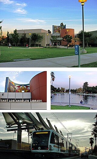
East Los Angeles, or East L.A., is an unincorporated area situated within Los Angeles County, California, United States. According to the United States Census Bureau, East Los Angeles is designated as a census-designated place (CDP) for statistical purposes. The most recent data from the 2020 census reports a population of 118,786, reflecting a 6.1% decrease compared to the 2010 population of 126,496.

<span class="mw-page-title-main">Whittier, California</span> City in the United States

Whittier is a city in Southern California in Los Angeles County, part of the Gateway Cities. The 14.7-square-mile (38.0 km2) city had 87,306 residents as of the 2020 United States census, an increase of 1,975 from the 2010 census figure. Whittier was incorporated in February 1898 and became a charter city in 1955. The city is named for the Quaker poet John Greenleaf Whittier and is home to Whittier College. The city is surrounded by three unincorporated areas sharing the Whittier name, West Whittier-Los Nietos, South Whittier, and East Whittier, which combined are home to a larger population than Whittier proper.

<span class="mw-page-title-main">Berwyn, Illinois</span> City in Illinois, United States

Berwyn is a suburban city in Cook County, Illinois, United States, coterminous with Berwyn Township, which was formed in 1908 after breaking off from Cicero Township. As of the 2020 census, the city had a total population of 57,250. It is part of the Chicago metropolitan area.

<span class="mw-page-title-main">Bridgeview, Illinois</span> Village in Illinois, United States

Bridgeview is a village in Cook County, Illinois, United States. It is located approximately 15 miles (24 km) southwest of the Chicago Loop. As of the 2020 census, the village population was 17,027.

<span class="mw-page-title-main">Cicero, Illinois</span> Town in Illinois, United States

Cicero is a town in Cook County, Illinois, United States, and a suburb of Chicago. As of the 2020 census, the population was 85,268, making it the 11th-most populous municipality in Illinois. The town is named after Marcus Tullius Cicero, a Roman statesman and orator.

<span class="mw-page-title-main">Elk Grove Village, Illinois</span> Village in Illinois, United States

Elk Grove Village is a village in Cook and DuPage counties in the U.S. state of Illinois. Per the 2020 census, the population was 32,812. Located 20 miles (32 km) northwest of Chicago along the Golden Corridor, the Village of Elk Grove Village was incorporated on July 17, 1956. It is directly adjacent to O'Hare International Airport and is economically important to the Chicago metropolitan area due to its large industrial park, located on the eastern border of the village. The community is served by several Interstate highways including I-90, I-290/I-355/Route 53, and IL-390. Elk Grove is also expected to be served by the I-490 Western O'Hare Bypass upon completion of the project.

<span class="mw-page-title-main">Hickory Hills, Illinois</span> City in Illinois, United States

Hickory Hills is a city in Cook County, Illinois. Located principally in Palos Township, it is a suburb of Chicago. The population in 2020 was 14,505.

<span class="mw-page-title-main">Matteson, Illinois</span> Village in Illinois, United States

Matteson is a village in Cook County, Illinois, United States. The population was 19,073 at the 2020 census. It is a suburb of Chicago.

<span class="mw-page-title-main">Morton Grove, Illinois</span> Village in Illinois, United States

Morton Grove is a village in Cook County, Illinois, United States. Per the 2020 census, the population was 25,297. It is part of the Chicago metropolitan area.

<span class="mw-page-title-main">Oak Forest, Illinois</span> City in Illinois, United States

Oak Forest is a city in Cook County, Illinois, United States. The city is out 24 miles (39 km) south-southwest of downtown Chicago in Bremen Township. Per the 2020 census, the population was 27,478.

<span class="mw-page-title-main">Park Ridge, Illinois</span> City in Illinois, United States

Park Ridge is a city in Cook County, Illinois, United States, and a suburb of Chicago. Per the 2020 census, the population was 39,656. It is located 15 miles (24 km) northwest of downtown Chicago. It is close to O'Hare International Airport, major expressways, and rail transportation. It is a part of the Chicago metropolitan area, bordering three official neighborhoods on Chicago's Far Northwest Side

<span class="mw-page-title-main">Tinley Park, Illinois</span> Village in Illinois, United States

Tinley Park is a village in Cook County, Illinois, United States, and is a suburb of Chicago. Per the 2020 census, the population was 55,971, and it is among the fastest-growing suburbs southwest of Chicago. In 2009, BusinessWeek named Tinley Park the "best place in America" to raise a family.

<span class="mw-page-title-main">Lakemoor, Illinois</span> Village in Illinois, United States

Lakemoor is a village in Lake and McHenry counties in the U.S. state of Illinois. Per the 2020 census, the population was 6,182.

<span class="mw-page-title-main">Dixon, Illinois</span> City in Illinois, United States

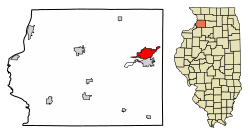
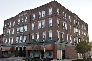
Dixon is a city and the county seat of Lee County, Illinois, United States. The population was 15,274 as of the 2020 census. The city is named after founder John Dixon, who operated a rope ferry service across the Rock River, which runs through the city. The Illinois General Assembly designated Dixon as "Petunia Capital of Illinois" in 1999 and "The Catfish Capital of Illinois" in 2009.

<span class="mw-page-title-main">Oelwein, Iowa</span> City in Iowa, United States

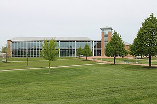
Oelwein is a city in Fayette County, Iowa, United States. The population was 5,920 at the time of the 2020 census, a decrease of 11.5% from the 2000 census. The largest community in Fayette County, it is located at the junction of State Highways 3 and 150.

<span class="mw-page-title-main">Langley Park, Maryland</span> Census-designated place in Maryland, United States

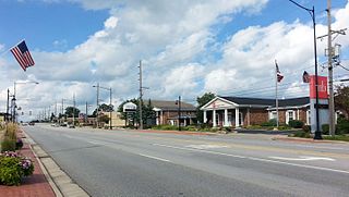
Langley Park is an unincorporated area and census-designated place (CDP) in Prince George's County, Maryland, United States. It is located inside the Capital Beltway, on the northwest edge of Prince George's County, bordering Montgomery County. Per the 2020 census, the population was 20,126.

<span class="mw-page-title-main">Lincoln Village, Ohio</span> Census-designated place in Ohio, United States

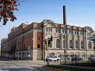
Lincoln Village is a census-designated place (CDP) in Prairie Township, Franklin County, Ohio, United States. It is centered near the intersection of US 40 and I-270 on the west side of Columbus. As of the 2020 census, the population was 9,702.

References

  1. "2020 U.S. Gazetteer Files". United States Census Bureau. Retrieved March 15, 2022.
  2. "G001 – Geographic Identifiers – 2010 Census Summary File 1". United States Census Bureau. Archived from the original on February 13, 2020. Retrieved December 27, 2015.
  3. "Census of Population and Housing". Census.gov. Retrieved June 4, 2015.
  4. "P2 Hispanic or Latino, and Not Hispanic or Latino by Race – 2010: DEC Redistricting Data (PL 94-171) – Sterling city, Illinois". United States Census Bureau .
  5. "P2 Hispanic or Latino, and Not Hispanic or Latino by Race – 2020: DEC Redistricting Data (PL 94-171) - Sterling city, Illinois". United States Census Bureau .
  6. "U.S. Census website". United States Census Bureau . Retrieved January 31, 2008.
  7. "Sterling Schools". Sterling Schools. Retrieved January 2, 2009.
  8. "About WACC". Whiteside Area Career Center. Archived from the original on August 18, 2014. Retrieved January 2, 2009.
  9. "Welcome to St. Mary's School". St. Mary’s School. Retrieved January 2, 2009.
  10. "Christ Lutheran School (2024 Profile) - Sterling, IL". Private School Review. February 16, 2024. Retrieved February 18, 2024.