
Montmorency Township is located in Whiteside County, Illinois. As of the 2010 census, its population was 2,612 and it contained 1,027 housing units. It is located south of the city of Rock Falls.

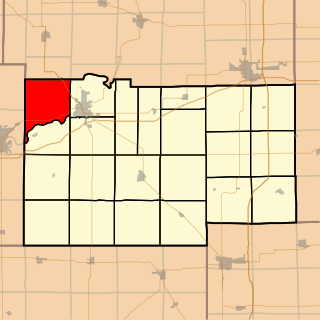
Genesee Township is located in Whiteside County, Illinois. As of the 2010 census, its population was 784 and it contained 329 housing units.
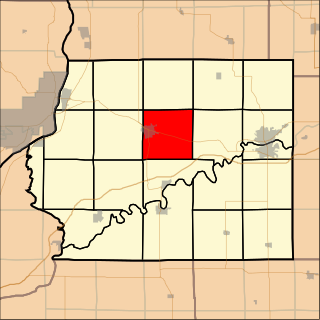
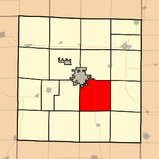
Mount Pleasant Township is located in Whiteside County, Illinois. As of the 2010 census, its population was 4,939 and it contained 2,176 housing units.

Newton Township is located in Whiteside County, Illinois. As of the 2010 census, its population was 450 and it contained 178 housing units.

Prophetstown Township is located in Whiteside County, Illinois. As of the 2010 census, its population was 2,615 and it contained 1,162 housing units.

Sterling Township is located in Whiteside County, Illinois. As of the 2010 census, its population was 18,035 and it contained 8,003 housing units.

Tampico Township is located in Whiteside County in the U.S. state of Illinois. As of the 2010 census, its population was 1,148 and it contained 449 housing units.

Union Grove Township is located in Whiteside County, Illinois. As of the 2010 census, its population was 1,244 and it contained 519 housing units.

Ustick Township is located in Whiteside County, Illinois. As of the 2010 census, its population was 613 and it contained 250 housing units.
Palmyra Township is located in Lee County, Illinois. As of the 2010 census, its population was 2,906 and it contained 1,201 housing units.

Rutland Township is located in LaSalle County, Illinois. As of the 2010 census, its population was 3,698 and it contained 1,627 housing units. Rutland Township changed its name from Trenton Township in May, 1850.
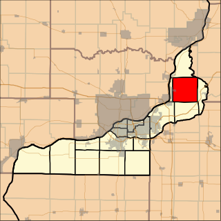
Coe Township is located in Rock Island County, Illinois. As of the 2010 census, its population was 1,657 and it contained 659 housing units. Coe Township originally was named Fremont Township, but changed its name to Penn Township on October 1, 1857. Then changed its name from Penn to Coe in January, 1858.

Greene Township is located in Mercer County, Illinois. As of the 2010 census, its population was 1,640 and it contained 692 housing units.

Preemption Township is located in Mercer County, Illinois. As of the 2010 census, its population was 1,783 and it contained 737 housing units. Preemption Township changed its name from Fairfield Township sometime before 1921.

Colona Township is one of twenty-four townships in Henry County, Illinois, USA. As of the 2010 census, its population was 6,822 and it contained 2,773 housing units. Colona Township changed its name from Green River Township on April 13, 1857.

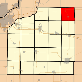
Oxford Township is one of twenty-four townships in Henry County, Illinois, USA. As of the 2010 census, its population was 1,213 and it contained 554 housing units.

Phenix Township is one of twenty-four townships in Henry County, Illinois, USA. As of the 2010 census, its population was 1,672 and it contained 654 housing units.
Yorktown Township is one of twenty-four townships in Henry County, Illinois, USA. As of the 2010 census, its population was 431 and it contained 190 housing units.
Scotland Township is located in McDonough County, Illinois. As of the 2010 census, its population was 448 and it contained 192 housing units.

Spring Grove Township is located in Warren County, Illinois, United States. As of the 2010 census, its population was 1,013 and it contained 598 housing units.


