Belleville, Illinois

Last updated

Belleville, Illinois
Main Street, Belleville, IL.jpg
Main Street
Belleville IL Flag.svg
St. Clair County Illinois Incorporated and Unincorporated areas Belleville Highlighted.svg
USA Illinois relief location map.svg
Red pog.svg
Belleville
Usa edcp relief location map.png
Red pog.svg
Belleville
Coordinates: 38°31′18″N89°59′43″W / 38.52167°N 89.99528°W / 38.52167; -89.99528
Country Flag of the United States.svg  United States
State Flag of Illinois.svg  Illinois
County Flag of St. Clair County, Illinois.svg St. Clair
Founded1814
Government
   Mayor Patty Gregory
Area
[1]
  Total23.49 sq mi (60.84 km2)
  Land23.23 sq mi (60.17 km2)
  Water0.26 sq mi (0.67 km2)
Elevation
[2]
502 ft (153 m)
Population
 (2020)
  Total42,404
  Density1,825.16/sq mi (704.71/km2)
Time zone UTC−6 (CST)
  Summer (DST) UTC−5 (CDT)
ZIP code(s)
62220-62223, 62225, 62226
Area code 618
FIPS code 17-163-04858
GNIS feature ID2394118 [2]
Website belleville.net

Belleville is a city and the county seat of St. Clair County, Illinois, United States. [3] The population was 42,404 at the 2020 census, making it the most populated city in the Metro East region of Greater St. Louis, and in all of Southern Illinois. Due to its proximity to Scott Air Force Base, the city has a significant population of military and federal civilian personnel. It is the seat of the Roman Catholic Diocese of Belleville and home to the National Shrine of Our Lady of the Snows.

Contents

History

Bird's eye view of Belleville in 1867 Bird's Eye View of Belleville, Illinois.jpg
Bird's eye view of Belleville in 1867
Belleville as it appeared in 1910 Bird's-eye view of Belleville, Illinois LCCN2011649524.jpg
Belleville as it appeared in 1910

George Blair named the city of Belleville in 1814, after the French phrase belle ville, meaning "beautiful city". [4] Because Blair donated an acre of his land for the town square and an additional 25 acres (10 ha) adjoining the square for the new county seat, the legislature transferred the county seat from the village of Cahokia. The latter had been established by French colonists as a mission village in the late 17th century.

Belleville was incorporated as a village in 1819, and became a city in 1850. Major immigration in the mid-19th century to this area occurred following revolutions in Germany, and most of the European-American population is of German ancestry. Many of the educated Germans fled their homeland after the failure of the German Revolution in 1848. Belleville was the center of the first important German settlement in Illinois. By 1870, an estimated 90% of the city's population was either German-born or of German descent. [5]

After the Civil War, Belleville became a manufacturing center producing nails, printing presses, gray iron castings, agricultural equipment, and stoves. Belleville became known as "The Stove Capital of the World." The first brewery in Illinois was established in Belleville. In 1868, Gustav Goelitz founded the candy company that is known today as "Jelly Belly." [5]

An immense deposit (400,000 acres (1,600 km2)) of bituminous coal was found in St. Clair County. By 1874, some farmers had become coal miners. One hundred shaft mines were in operation in and around Belleville. The coal brought the steam railroad to town, which allowed for the transport of many tons of coal to be shipped daily from Belleville to St. Louis on the west side of the Mississippi River, for use in its industries, homes and businesses. Later, Belleville had the first electric trolley in the state. [5]

The first style of houses in Belleville were simple brick cottages, known locally as "German street houses" or "row houses." Architectural styles flourished in greater variety, featuring American Foursquare, French Second Empire, Greek Revival, Gothic Revival, Italianate, Queen Anne, and Victorian. [6] The Belleville Historic District, which was listed on the National Register of Historic Places in 1976, comprises 73 contributing properties. [7]

The "Old Belleville Historic District," was defined and recognized in 1974 and is the city's first historic district. [6] The city also has designated two more historic districts: "Hexenbuckel" (est. in 1991) and "Oakland" (est. in 1995). [8]

Belleville's early German immigrants were educated, with most of them having graduated from German universities. They were nicknamed "Latin Farmers" because of this. After 1836 Gustav Koerner contributed to establish the city's public library. The Belleville Public Library is the state's oldest, predating the Illinois State Library by three years. The German settlers also founded choral and dramatic groups, as well as literary societies. They established one of the first kindergartens in the country here. [5] [6]

In 1990, as reported by the Belleville News-Democrat using the US Census data, the city surpassed the neighboring city of East St. Louis to become the most populated city in the Metro East and Southern Illinois. [9]

The National Civic League recognized Belleville in 2011 as one of the ten recipients of the All-America City Award. Belleville is coterminous with the now defunct Belleville Township. [10]

In 2021, residents of the Illinois city elected Patty Gregory as Belleville's first female Mayor. [11] [12]

Geography

Belleville is located at 38°31′18″N89°59′43″W / 38.52167°N 89.99528°W / 38.52167; -89.99528 (38.521567, −89.995208). [13]

According to the 2010 census, Belleville has a total area of 23.49 square miles (60.84 km2), of which 22.74 square miles (58.90 km2) (or 98.83%) is land and 0.269 square miles (0.70 km2) (or 1.17%) is water. [14] Richland Creek flows through much of Belleville.

Climate

Climate data for Belleville SIU Research, Illinois (1991–2020 normals, extremes 1948–present)
MonthJanFebMarAprMayJunJulAugSepOctNovDecYear
Record high °F (°C)75
(24)
83
(28)
89
(32)
91
(33)
97
(36)
106
(41)
110
(43)
105
(41)
103
(39)
96
(36)
84
(29)
77
(25)
110
(43)
Mean maximum °F (°C)64.0
(17.8)
70.2
(21.2)
78.6
(25.9)
84.7
(29.3)
89.8
(32.1)
95.2
(35.1)
97.3
(36.3)
96.8
(36.0)
93.5
(34.2)
87.3
(30.7)
75.2
(24.0)
65.5
(18.6)
98.8
(37.1)
Mean daily maximum °F (°C)42.9
(6.1)
48.6
(9.2)
59.2
(15.1)
70.6
(21.4)
79.1
(26.2)
87.3
(30.7)
90.2
(32.3)
89.1
(31.7)
83.3
(28.5)
72.6
(22.6)
58.1
(14.5)
46.3
(7.9)
68.9
(20.5)
Daily mean °F (°C)33.6
(0.9)
38.3
(3.5)
47.8
(8.8)
58.3
(14.6)
67.7
(19.8)
75.9
(24.4)
79.0
(26.1)
77.2
(25.1)
70.1
(21.2)
59.7
(15.4)
47.5
(8.6)
37.3
(2.9)
57.7
(14.3)
Mean daily minimum °F (°C)24.3
(−4.3)
28.0
(−2.2)
36.3
(2.4)
46.0
(7.8)
56.3
(13.5)
64.5
(18.1)
67.8
(19.9)
65.3
(18.5)
56.9
(13.8)
46.7
(8.2)
36.9
(2.7)
28.3
(−2.1)
46.4
(8.0)
Mean minimum °F (°C)1.7
(−16.8)
8.6
(−13.0)
16.3
(−8.7)
28.7
(−1.8)
39.7
(4.3)
50.7
(10.4)
56.5
(13.6)
53.4
(11.9)
40.3
(4.6)
27.8
(−2.3)
18.0
(−7.8)
8.4
(−13.1)
−1.8
(−18.8)
Record low °F (°C)−27
(−33)
−21
(−29)
−8
(−22)
18
(−8)
28
(−2)
38
(3)
43
(6)
39
(4)
26
(−3)
20
(−7)
2
(−17)
−19
(−28)
−27
(−33)
Average precipitation inches (mm)2.56
(65)
2.16
(55)
3.44
(87)
4.90
(124)
5.05
(128)
4.62
(117)
4.03
(102)
3.92
(100)
3.35
(85)
3.12
(79)
3.60
(91)
2.61
(66)
43.36
(1,101)
Average snowfall inches (cm)3.4
(8.6)
3.3
(8.4)
1.0
(2.5)
0.0
(0.0)
0.0
(0.0)
0.0
(0.0)
0.0
(0.0)
0.0
(0.0)
0.0
(0.0)
0.0
(0.0)
0.6
(1.5)
2.9
(7.4)
11.2
(28)
Average precipitation days (≥ 0.01 in)7.17.59.510.311.58.77.47.26.68.47.77.799.6
Average snowy days (≥ 0.1 in)2.21.90.60.00.00.00.00.00.00.00.41.97.0
Source: NOAA [15] [16]

Demographics

Historical population
CensusPop.Note
1850 2,941
1860 7,520155.7%
1870 8,1468.3%
1880 10,68331.1%
1890 15,36143.8%
1900 17,48413.8%
1910 21,12220.8%
1920 24,82317.5%
1930 28,42514.5%
1940 28,405−0.1%
1950 32,72115.2%
1960 37,26413.9%
1970 41,22310.6%
1980 41,5800.9%
1990 42,7852.9%
2000 41,410−3.2%
2010 44,4787.4%
2020 42,404−4.7%
U.S. Decennial Census [17] [18]
Cathedral of Saint Peter Cathedral of Saint Peter - Belleville, Illinois 01.jpg
Cathedral of Saint Peter

At the 2000 census there were 41,410 people, 17,603 households, and 10,420 families living in the city. The population density was 2,196.4 inhabitants per square mile (848.0/km2). There were 19,142 housing units at an average density of 1,015.3 per square mile (392.0/km2). The racial makeup of the city was 81.51% White, 15.51% African American, 0.26% Native American, 0.81% Asian, 0.07% Pacific Islander, 0.41% from other races, and 1.43% from two or more races. Hispanic or Latino of any race were 1.63%. [19]

Of the 17,603 households 28.4% had children under the age of 18 living with them, 42.0% were married couples living together, 13.5% had a female householder with no husband present, and 40.8% were non-families. 35.1% of households were one person and 14.0% were one person aged 65 or older. The average household size was 2.27 and the average family size was 2.95.

The age distribution was 23.4% under the age of 18, 9.0% from 18 to 24, 30.3% from 25 to 44, 20.1% from 45 to 64, and 17.2% 65 or older. The median age was 37 years. For every 100 females, there were 88.9 males. For every 100 females age 18 and over, there were 85.0 males.

The median household income was $35,979 and the median family income was $46,426. Males had a median income of $33,361 versus $25,375 for females. The per capita income for the city was $18,990. About 9.3% of families and 11.7% of the population were below the poverty line, including 16.2% of those under age 18 and 9.3% of those age 65 or over.

2010 census

As of the 2010 Census, there were 44,478 people, 18,795 households, 11,081 families living in the city. The population density was. The racial makeup of the city was 69.8% White, 25.4% African American, 0.3% Native American, 1.0% Asian, 0.1% Pacific Islander, 0.6% from other races, and 2.8% from two or more races. Hispanic or Latino of any race were 2.6% of the population

Of the 18,795 households 27.7% had children under the age of 18 living with them, 38% were married couples living together, 16.4 had a female householder with no man present, and 41% were non-families. 34.4% of households were one person and 10.8% had someone living alone who was 65 years of age of older. The average household size was 2.3 and the average family size was 2.9.

The age distribution was 23.3% under the age of 18, and 12.9% over the age of 65. [20]

Arts and culture

Lincoln Theatre Lincoln Theater, Belleville, IL.jpg
Lincoln Theatre

The Belleville Philharmonic Society was formed in 1866, making it the second oldest philharmonic orchestra in the country. [21] With the increase in the black population and migrants from the South, musicians developed who played blues and jazz; later rock clubs were added to the scene.

Jay Farrar (now of Son Volt), Mike Heidorn, and Jeff Tweedy (now of Wilco) of the now-defunct alt country group Uncle Tupelo are from Belleville. Another major musician was Neal Doughty, keyboardist for 1970s rock band REO Speedwagon.

National Register of Historic Places

Sports

Education

Within Belleville are four high schools; namely, the public Belleville High School-East and Belleville High School-West, and the private Althoff Catholic High School and Governor French Academy. In addition, small portions of the city are within the districts for East St. Louis Senior High School, Mascoutah Community High School, and Freeburg Community High School.

Belleville is also home to numerous grade school districts, including Belleville School District 118, Belle Valley School District 119, Harmony Emge School District 175, Signal Hill School District 181, and Whiteside School District 115. Parochial grade schools include St. Peter's Cathedral, St. Augustine of Canterbury Church, St. Teresa, Blessed Sacrament, Our Lady Queen of Peace, and Zion Lutheran School. [24]

Higher education in Belleville includes Southwestern Illinois College, a public community college. The city was formerly home to Lindenwood University – Belleville from 2009 to 2020.

Media

The Belleville News-Democrat , is the city's daily newspaper. The News-Democrat is part of the McClatchy chain and covers the Metro East region and Southwestern Illinois. The city is also served by the St. Louis Post-Dispatch , the area's major metropolitan daily. Belleville receives the signals of most radio and TV stations based in St. Louis.

Transportation

Former Illinois Central Railroad station Former Illinois Central station in Belleville, July 6, 2013.jpg
Former Illinois Central Railroad station

Belleville has three St. Louis MetroLink stations connecting it to St. Louis and the network via light rail: Memorial Hospital, Belleville, and College.

Illinois State Highways 15, 158, 159, 177, 13 and 161 all pass through Belleville. Belleville is also adjacent to Interstate highways 64 and 255. I-64 is an east–west highway extending from Wentzville, Missouri to Virginia Beach, Virginia and is the major route from Belleville to downtown St. Louis. I-255 is part of a system of expressways that together form a loop around St. Louis.

Belleville has a bicycle trail that runs through the city from Southside Park to Southwestern Illinois College and Scott Air Force Base; it is mainly used for recreational purposes.

Belleville's area airports are Scott Air Force Base and MidAmerica St. Louis Airport, which is served by Allegiant Air. The nearest major airport with regularly scheduled commercial passenger service is St. Louis Lambert International Airport.

Healthcare

Bethany Place in Belleville provides services for those with HIV/AIDS. [25] [26] [27] [28]

Notable people

1882 Harrison Machine Works tractor, made in Belleville Harrison Machine Works 1882 tractor.JPG
1882 Harrison Machine Works tractor, made in Belleville

Sister city

Belleville has one sister city:

Related Research Articles

<span class="mw-page-title-main">Washington County, Illinois</span> County in Illinois, United States

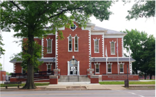
Washington County is a county located in the U.S. state of Illinois. As of the 2020 census, it had a population of 13,761. Its county seat is Nashville. It is located in the southern portion of Illinois known locally as "Little Egypt".

<span class="mw-page-title-main">St. Clair County, Illinois</span> County in Illinois, United States

St. Clair County is the ninth most populous county in Illinois. Located directly east of St. Louis, the county is part of the Metro East region of the Greater St. Louis metropolitan area in southern Illinois. As of the 2020 United States census, St. Clair County had a population of 257,400, making it the third most populous county in Illinois outside the Chicago metropolitan area. Belleville is the county’s seat and largest city.

<span class="mw-page-title-main">Monroe County, Illinois</span> County in Illinois, United States

Monroe County is a county located in the U.S. state of Illinois. According to the 2020 census, it had a population of 34,962. Its county seat and largest city is Waterloo.

<span class="mw-page-title-main">Madison County, Illinois</span> County in Illinois, United States

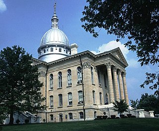
Madison County is a county in the U.S. state of Illinois. It is a part of the Metro East in southern Illinois. According to the 2020 census, it had a population of 264,776, making it the eighth-most populous county in Illinois and the most populous in the southern portion of the state. The county seat is Edwardsville, and the largest city is Granite City.

<span class="mw-page-title-main">Macoupin County, Illinois</span> County in Illinois, United States

Macoupin County is located in the U.S. state of Illinois. According to the 2020 census, it had a population of 44,967. The county seat is Carlinville.

<span class="mw-page-title-main">Columbia, Illinois</span> City in Illinois, United States

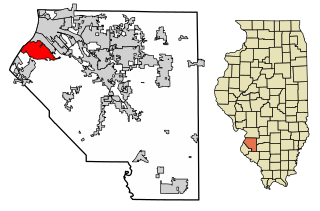
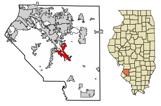
Columbia is a city mainly in Monroe County with a small portion in St. Clair County in the U.S. state of Illinois, about 12 miles (19 km) south of St. Louis, Missouri. The population was 10,999 at the 2020 census.

<span class="mw-page-title-main">Alorton, Illinois</span> Village in Illinois, United States

Alorton was a village in St. Clair County, Illinois, United States. Incorporated in 1944, it was one of three municipalities that merged to form the city of Cahokia Heights on May 6, 2021; the other two were the village of Cahokia and the city of Centreville. Prior to merger, Alorton had a population of 1,566 and land area of 1.8 square miles (4.7 km2) in the 2020 Census.

<span class="mw-page-title-main">Cahokia, Illinois</span> Village in the United States

Cahokia is a settlement and former village in St. Clair County, Illinois, United States, founded as a colonial French mission in 1689. Located east of the Mississippi River in the Greater St. Louis metropolitan area, as of the 2010 census, 15,241 people lived in the village. On May 6, 2021, the village was incorporated into the new city of Cahokia Heights.

<span class="mw-page-title-main">Fairview Heights, Illinois</span> City in Illinois, United States

Fairview Heights is a city in St. Clair County, Illinois, United States within Greater St. Louis. It is an eastern suburb of St. Louis. The population was 17,078 at the 2010 census. Fairview Heights is a dominant shopping center for Greater St. Louis and Southern Illinois and includes numerous shopping plazas and St. Clair Square mall.

<span class="mw-page-title-main">Freeburg, Illinois</span> Village in Illinois, United States

Freeburg is a village in St. Clair County, Illinois, United States. Located within Greater St. Louis, it is a southeastern exurb with many residents commuting to Downtown St. Louis or the Belleville area for employment. As of 2010, Freeburg had a population of 4,354.

<span class="mw-page-title-main">Lebanon, Illinois</span> City in Illinois, United States

Lebanon is a city in St. Clair County, Illinois, United States. The population was 4,691 at the 2020 census It is a part of the Metro East region of the Greater St. Louis metropolitan area. Lebanon is home to McKendree University, the oldest college in Illinois.

<span class="mw-page-title-main">Mascoutah, Illinois</span> City in Illinois, United States

Mascoutah is a city in St. Clair County, Illinois, United States. The population was 8,754 at the 2020 census. It is part of the Metro East region of Greater St. Louis. The city was named for the Mascoutens, a tribe of Algonquian-speaking Native Americans.

<span class="mw-page-title-main">Millstadt, Illinois</span> Village in Illinois, United States

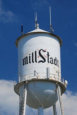
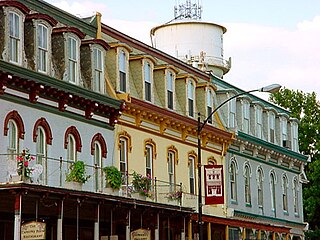
Millstadt is a village in St. Clair County, Illinois, United States, located at the crossing of Illinois Routes 163 and 158. The village is known for its German heritage, with more than half its people of German descent. The population was 4,011 at the 2010 census, but a more recent study in July 2018 estimated the number at 3,885.

<span class="mw-page-title-main">New Athens, Illinois</span> Village in Illinois, United States

New Athens is a village in St. Clair County, Illinois, United States. Based upon common usage, the 'A' is always sounded with a long vowel, rather than a short vowel, by its residents, unlike the most commonly used English pronunciation of the city in Greece.

<span class="mw-page-title-main">O'Fallon, Illinois</span> City in Illinois, United States

O'Fallon is a city in St. Clair County, Illinois, United States. The 2020 census listed the population at 32,289. The city is the second largest city in the Metro East region of the St. Louis metropolitan area and Southern Illinois. It sits 5 miles (8.0 km) from Scott Air Force Base and 18 miles (29 km) from Downtown St. Louis.

<span class="mw-page-title-main">Shiloh, Illinois</span> Village in Illinois, United States

Shiloh is a village in St. Clair County, Illinois, United States. The 2010 census recorded a population of 12,651. Shiloh is located within the St. Louis metropolitan area

<span class="mw-page-title-main">Swansea, Illinois</span> Village in Illinois, United States

Swansea is a village in St. Clair County, Illinois. It is a part of the St. Louis metropolitan area and Metro East in southern Illinois. It is surrounded by the communities of Fairview Heights, Belleville, O’Fallon, and Shiloh. The population was 13,430 at the 2010 census, an increase from 10,579 in 2000.

<span class="mw-page-title-main">Washington Park, Illinois</span> Village in Illinois, United States

Washington Park is a village in St. Clair County, Illinois, United States. The population was 2,592 as of the 2020 census, down from 4,196 in 2010.

<span class="mw-page-title-main">Metro East</span> Region in Illinois, United States

The Metro East is an urban area in Southern Illinois, United States that contains the eastern and northern suburbs and exurbs of St. Louis, Missouri. It encompasses five counties in the Greater St. Louis area and constitutes the second-most populous urban area in Illinois. The region's most populated city is Belleville, with 42,404 residents.

<span class="mw-page-title-main">Stookey Township, St. Clair County, Illinois</span> Township in Illinois, United States

Stookey Township is a township located in St. Clair County, Illinois. It is an unincorporated part of Belleville, Illinois located just west of downtown Belleville, for that reason it is often referred to by locals as Belleville West. As of the 2010 census, its population was 10,007 and it contained 4,394 housing units.

References

  1. "2020 U.S. Gazetteer Files". United States Census Bureau. Retrieved March 15, 2022.
  2. 1 2 U.S. Geological Survey Geographic Names Information System: Belleville, Illinois
  3. "Find a County". National Association of Counties. Archived from the original on July 12, 2012. Retrieved June 7, 2011.
  4. History of St. Clair County, Illinois. With illustrations and biographical sketches of some of its prominent men and pioneers. Philadelphia: Brink McDonough & Co. 1881. p. 183.
  5. 1 2 3 4 "Labor and Industry Museum", Labor and Industry Museum: Belleville History, accessed 1 December 2010]
  6. 1 2 3 "Village Profile", Village Profile: History and Culture, 1997, accessed 1 December 2010]
  7. "National Register Information System". National Register of Historic Places . National Park Service. July 9, 2010.
  8. "Labor and Industry Museum", Labor and Industry Museum: Other Historic Resources, accessed 1 December 2010
  9. "Belleville passes East St Louis to become the most populated city in the Metro East". The Belleville News-Democrat. September 24, 1991. p. 1.
  10. "Belleville officially takes over township's duties". bnd. Retrieved September 7, 2017.
  11. Koziatek, Mike (April 7, 2021). "Gregory looks forward to serving as first female mayor in Belleville's 207 years". Belleville News and Democrat. Retrieved April 7, 2021.
  12. Benchaabane, Nassim (April 7, 2021). "Maplewood, Alton elect first Black mayors; Belleville elects first woman mayor in upsets to local incumbents". St. Louis Dispatch. Retrieved April 7, 2021.
  13. "US Gazetteer files: 2010, 2000, and 1990". United States Census Bureau. February 12, 2011. Retrieved April 23, 2011.
  14. "G001 - Geographic Identifiers - 2010 Census Summary File 1". United States Census Bureau. Archived from the original on February 13, 2020. Retrieved December 25, 2015.
  15. "NowData – NOAA Online Weather Data". National Oceanic and Atmospheric Administration. Retrieved July 24, 2021.
  16. "Station: Belleville SIU RSCH, IL". U.S. Climate Normals 2020: U.S. Monthly Climate Normals (1991–2020). National Oceanic and Atmospheric Administration. Retrieved July 24, 2021.
  17. "Census of Population and Housing". Census.gov. Retrieved June 4, 2016.
  18. "U.S. Census Bureau QuickFacts: Belleville city, Illinois". www.census.gov. Retrieved January 3, 2020.
  19. "U.S. Census website". United States Census Bureau . Retrieved January 31, 2008.
  20. "Belleville, Illinois". United States Census Bureau . Retrieved October 28, 2018.
  21. Belleville Philharmonic Society Symphony Orchestra Archived November 11, 2007, at the Wayback Machine
  22. Watson, Graham (July 11, 2012). "NAIA school unveils the nation's most original football field". Yahoo Sports . Retrieved September 7, 2012.
  23. "Belleville, Illinois Encyclopedia". Baseball-Reference.com.
  24. "St. Clair County Regional Office of Education" Archived February 21, 2009, at the Wayback Machine , St. Clair County Regional Office of Education, 12/2010, accessed 15 December 2010
  25. Michael O'Loughlin (December 29, 2019). "A Catholic Sister learns to serve people with AIDS". Plague: Untold Stories of AIDS & the Catholic Church (Podcast). America . Retrieved January 10, 2019.
  26. O'Loughlin, Michael (January 21, 2019). "The Catholic Nun Who Came to New York to Confront the AIDS Crisis" . Retrieved January 10, 2019.
  27. Freeman, Brittany (November 20, 2014). "Bethany Place provides a new kind of home" . Retrieved January 10, 2019.
  28. Weichert, Heidi (December 30, 2017). "Bethany Place assists metro-east residents who have HIV or AIDS". Belleville News-Democrat. Retrieved January 10, 2019.
  29. "English professor named Fellow of the Royal Society for the Encouragement of Arts, Manufactures and Commerce". St. Mary’s University, Texas on June 24, 2020. June 24, 2020. Retrieved October 12, 2021.
  30. "Mary Ellen Richmond (1861-1928) – Social Work Pioneer, Administrator, Researcher and Author". January 21, 2011. Retrieved January 26, 2023.
  31. Dionne, Matthew S. "Someone you should know: Stephen R. Wigginton, United States Attorney for the Southern District of Illinois". The Public Servant. 14 (2). Illinois State Bar Association.
  32. Belleville Sister Cities, Inc Archived March 24, 2008, at the Wayback Machine is the organization which fosters the relationship between the two cities.