Manchester, Missouri

Last updated

Manchester, Missouri
Manchester MO edited.jpg
Manchester City Hall, located in the Lyceum Building, which is listed on the National Register of Historic Places.
St. Louis County Missouri Incorporated and Unincorporated areas Manchester Highlighted.svg
Location of Manchester, Missouri
Coordinates: 38°34′59″N90°30′23″W / 38.58306°N 90.50639°W / 38.58306; -90.50639
Country United States
State Missouri
County St. Louis
Area
[1]
  Total5.03 sq mi (13.03 km2)
  Land5.03 sq mi (13.03 km2)
  Water0.00 sq mi (0.00 km2)
Elevation
[2]
604 ft (184 m)
Population
 (2020)
  Total18,333
  Density3,643.28/sq mi (1,406.73/km2)
Time zone UTC-6 (Central (CST))
  Summer (DST) UTC-5 (CDT)
FIPS code 29-45668 [3]
GNIS feature ID2395827 [2]
Website www.manchestermo.gov

Manchester is a city in St. Louis County, Missouri, United States. The population was 18,333 at the 2020 census. [4]

Contents

History

Manchester in 1911. "Scenery in Manchester, Mo.".jpg
Manchester in 1911.

Manchester was named by an English settler after Manchester, England. [5]

Geography

According to the United States Census Bureau, the city has a total area of 5.08 square miles (13.16 km2), all land. [6]

Demographics

Historical population
CensusPop.Note
1960 2,021
1970 5,031148.9%
1980 6,35126.2%
1990 6,5423.0%
2000 19,161192.9%
2010 18,094−5.6%
2020 18,3331.3%
U.S. Decennial Census [7]

2020 census

The 2020 United States census [8] counted 18,333 people, 7,430 households, and 4,917 families in Manchester. The population density was 3,644.7 per square mile (1,407.0/km2). There were 7,742 housing units at an average density of 1,539.2 per square mile (594.2/km2). The racial makeup was 81.25% (14,896) white, 3.56% (652) black or African-American, 0.1% (19) Native American, 6.79% (1,245) Asian, 0.01% (2) Pacific Islander, 1.34% (246) from other races, and 6.94% (1,273) from two or more races. Hispanic or Latino of any race was 4.6% (839) of the population.

Of the 7,430 households, 35.8% had children under the age of 18; 56.6% were married couples living together; 23.1% had a female householder with no husband present. Of all households, 28.7% consisted of individuals and 9.9% had someone living alone who was 65 years of age or older. The average household size was 2.4 and the average family size was 3.1.

24.6% of the population was under the age of 18, 6.6% from 18 to 24, 25.8% from 25 to 44, 26.7% from 45 to 64, and 15.1% who were 65 years of age or older. The median age was 39.1 years. For every 100 females, the population had 100.5 males. For every 100 females ages 18 and older, there were 95.9 males.

The 2016-2020 5-year American Community Survey [9] estimates show that the median household income was $78,381 (with a margin of error of +/- $11,143) and the median family income was $100,227 (+/- $6,683). Males had a median income of $52,025 (+/- $6,379) versus $44,271 (+/- $5,783) for females. The median income for those above 16 years old was $49,447 (+/- $4,092). Approximately, 4.7% of families and 6.4% of the population were below the poverty line, including 7.7% of those under the age of 18 and 4.3% of those ages 65 or over.

2010 census

As of the census [10] of 2010, there were 18,094 people, 7,239 households, and 5,048 families living in the city. The population density was 3,561.8 inhabitants per square mile (1,375.2/km2). There were 7,553 housing units at an average density of 1,486.8 per square mile (574.1/km2). The racial makeup of the city was 87.6% White, 3.1% African American, 0.2% Native American, 6.0% Asian, 1.1% from other races, and 2.1% from two or more races. Hispanic or Latino of any race were 2.9% of the population.

There were 7,239 households, of which 32.4% had children under the age of 18 living with them, 57.7% were married couples living together, 8.7% had a female householder with no husband present, 3.3% had a male householder with no wife present, and 30.3% were non-families. 24.3% of all households were made up of individuals, and 7.7% had someone living alone who was 65 years of age or older. The average household size was 2.50 and the average family size was 3.00.

The median age in the city was 38.9 years. 23.5% of residents were under the age of 18; 8% were between the ages of 18 and 24; 26.2% were from 25 to 44; 29.5% were from 45 to 64; and 12.9% were 65 years of age or older. The gender makeup of the city was 48.7% male and 51.3% female.

2000 census

As of the census [3] of 2000, there were 19,161 people, 7,206 households, and 5,332 families living in the city. The population density was 3,834.6 inhabitants per square mile (1,480.5/km2). There were 7,402 housing units at an average density of 1,481.3 per square mile (571.9/km2). The racial makeup of the city was 91.60% White, 2.42% African American, 0.09% Native American, 4.33% Asian, 0.03% Pacific Islander, 0.40% from other races, and 1.13% from two or more races. Hispanic or Latino of any race were 1.52% of the population.

There were 7,206 households, out of which 37.5% had children under the age of 18 living with them, 63.3% were married couples living together, 8.2% had a female householder with no husband present, and 26.0% were non-families. 20.6% of all households were made up of individuals, and 5.4% had someone living alone who was 65 years of age or older. The average household size was 2.66 and the average family size was 3.12.

In the city, the population was spread out, with 27.2% under the age of 18, 7.5% from 18 to 24, 30.8% from 25 to 44, 25.5% from 45 to 64, and 9.0% who were 65 years of age or older. The median age was 36 years. For every 100 females, there were 95.0 males. For every 100 females age 18 and over, there were 90.6 males.

The median income for a household in the city was $64,381, and the median income for a family was $71,329. Males had a median income of $50,783 versus $35,039 for females. The per capita income for the city was $27,663. About 1.5% of families and 3.0% of the population were below the poverty line, including 3.4% of those under age 18 and 1.1% of those age 65 or over.

Education

The Parkway School District has one high school located within the Manchester city limits: Parkway South High School. Two middle schools (South Middle and Southwest Middle) serve this high school area, and several elementary schools bring education to the neighborhood level. [11] Hanna Woods, Carman Trails, and Wren Hollow are some of the elementary schools that serve Manchester.

The Grand Glaize Branch of St. Louis County Library is in Manchester. [12] [13] [14]

Related Research Articles

<span class="mw-page-title-main">Belton, Missouri</span> City in Missouri, US

Belton is a city in northwestern Cass County, Missouri, United States. The population was 23,953 at the 2020 census.

<span class="mw-page-title-main">Washington, Missouri</span> City in the United States

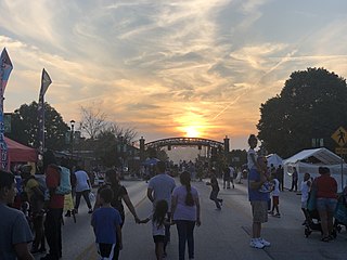
Washington is a city on the south banks of the Missouri River, 50 miles west of St. Louis, Missouri, and the largest in Franklin County, Missouri, United States. The estimated population in July 2022 was 15,075, which is an increase of 3.97% since the 2020 U.S. census. It is notable for being the "corncob pipe capital of the world," with Missouri Meerschaum located on the riverfront.

<span class="mw-page-title-main">Grandview, Missouri</span> City in Missouri, United States

Grandview is a city in Jackson County, Missouri, United States. The population was 24,475 at the 2010 census. It is part of the Kansas City metropolitan area.

<span class="mw-page-title-main">Green Ridge, Missouri</span> City in Missouri, United States

Green Ridge is a city located along Route 127 in Pettis County, Missouri, United States. The population was 476 at the 2010 census.

<span class="mw-page-title-main">Bella Villa, Missouri</span> City in Missouri, United States

Bella Villa is a city in St. Louis County, Missouri, in the United States. As of the 2010 census, the city population was 729.

<span class="mw-page-title-main">Brentwood, Missouri</span> City in Missouri, United States

Brentwood is an inner-ring suburb of St. Louis, located in St. Louis County, Missouri, United States. The population was 8,233 at the 2020 census.

<span class="mw-page-title-main">Country Club Hills, Missouri</span> City in Missouri, United States

Country Club Hills is a city in St. Louis County, Missouri, United States. The population was 1,274 at the 2010 census.

<span class="mw-page-title-main">Crystal Lake Park, Missouri</span> City in Missouri, United States

Crystal Lake Park is a Missouri Class 4 city in St. Louis County, Missouri, United States. The population was 508 at the 2020 census.

<span class="mw-page-title-main">Ellisville, Missouri</span> City in Missouri, United States

Ellisville is a city in St. Louis County, Missouri, United States, within Greater St. Louis. It is a western outer-ring suburb of St. Louis. The population was 9,985 at the 2020 census.

<span class="mw-page-title-main">Flordell Hills, Missouri</span> City in Missouri, United States

Flordell Hills is a city in St. Louis County, Missouri, United States. The population was 822 at the 2010 census.

<span class="mw-page-title-main">Jennings, Missouri</span> City in Missouri, United States

Jennings is a city in St. Louis County, Missouri, United States. Per the 2020 census, the population was 12,895.

<span class="mw-page-title-main">Lakeshire, Missouri</span> City in Missouri, United States

Lakeshire is a city in St. Louis County, Missouri, United States. The population was 1,432 at the 2010 census.

<span class="mw-page-title-main">Maplewood, Missouri</span> City in Missouri, United States

Maplewood is an inner-ring suburb of St. Louis, located in St. Louis County, Missouri, United States.

<span class="mw-page-title-main">Northwoods, Missouri</span> City in Missouri, United States

Northwoods is a city in St. Louis County, Missouri, United States. The population was 4,227 at the 2010 census.

<span class="mw-page-title-main">Pasadena Hills, Missouri</span> City in Missouri, United States

Pasadena Hills is a city in St. Louis County, Missouri, United States. The population was 930 at the 2010 census. The entire city is listed on the National Register of Historic Places.

<span class="mw-page-title-main">Twin Oaks, Missouri</span> City in Missouri, United States

Twin Oaks is a 4th class city in St. Louis County, Missouri, United States. The former Village of Twin Oaks changed its status to that of a city by public election in November 2016. The population was 392 at the 2010 census.

<span class="mw-page-title-main">Velda City, Missouri</span> City in Missouri, United States

Velda City is a city in St. Louis County, Missouri, United States. The population was 1,420 at the 2010 census.

<span class="mw-page-title-main">Winchester, Missouri</span> City in Missouri, United States

Winchester is a city in St. Louis County, Missouri, United States. The population was 1,447 at the 2020 census.

<span class="mw-page-title-main">Clarkson Valley, Missouri</span> City in Missouri, United States

Clarkson Valley is a city in St. Louis County, Missouri, United States. The population was 2,609 at the 2020 census.

<span class="mw-page-title-main">Moline Acres, Missouri</span> City in Missouri, United States

Moline Acres is a city in St. Louis County, Missouri, United States. The population was 2,442 at the 2010 census.

References

  1. "ArcGIS REST Services Directory". United States Census Bureau. Retrieved August 28, 2022.
  2. 1 2 U.S. Geological Survey Geographic Names Information System: Manchester, Missouri
  3. 1 2 "U.S. Census website". United States Census Bureau . Retrieved January 31, 2008.
  4. "United States Census Bureau" . Retrieved February 5, 2022.
  5. Eaton, David Wolfe (1918). How Missouri Counties, Towns and Streams Were Named. The State Historical Society of Missouri. p. 360.
  6. "US Gazetteer files 2010". United States Census Bureau. Archived from the original on January 25, 2012. Retrieved July 8, 2012.
  7. "Census of Population and Housing". Census.gov. Retrieved June 4, 2015.
  8. "Explore Census Data". data.census.gov. Retrieved December 17, 2023.
  9. "Explore Census Data". data.census.gov. Retrieved December 17, 2023.
  10. "U.S. Census website". United States Census Bureau . Retrieved July 8, 2012.
  11. "." Parkway School District Boundary Map. Retrieved on October 8, 2010.
  12. "Grand Glaize Branch Archived 2009-09-03 at the Wayback Machine ." St. Louis County Library. Retrieved on August 18, 2009.
  13. "Manchester city, Missouri." U.S. Census Bureau. Retrieved on August 18, 2009.
  14. "2009 Street Guide [ permanent dead link ]." Village of Twin Oaks (Missouri). Retrieved on August 18, 2009.