
Columbia is a city in the U.S. state of Missouri. It is the county seat of Boone County and home to the University of Missouri. Founded in 1821, it is the principal city of the five-county Columbia metropolitan area. It is Missouri's fourth most-populous and fastest growing city, with an estimated 123,195 residents in 2019.

Howard County is located in the U.S. state of Missouri, with its southern border formed by the Missouri River. As of the 2010 census, the population was 10,144. Its county seat is Fayette. The county was organized January 23, 1816, and named for Benjamin Howard, the first Governor of the Missouri Territory. Settled originally by migrants from the Upper South, it is part of the region historically known as Little Dixie. It is part of the Columbia, Missouri, metropolitan area.
Boone County is a county in the U.S. state of Missouri. Centrally located in Mid-Missouri, its county seat is Columbia, Missouri's fourth-largest city and location of the University of Missouri. As of the 2010 census, the population was 162,642; a 2019 estimate put the population at 180,463, making it the state's seventh-most populous county. The county was organized November 16, 1820 and named for the then recently deceased Daniel Boone, whose kin largely populated the Boonslick area, having arrived in the 1810s on the Boone's Lick Road. Boone County comprises the Columbia Metropolitan Area. The towns of Ashland and Centralia are the second and third most populous towns in the county.
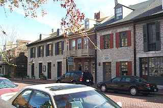
Saint Charles is a city in, and the county seat of, St. Charles County, Missouri, United States. The population was 65,794 at the 2010 census, making St. Charles the ninth-largest city in Missouri. Situated on the Missouri River, it is a northwestern suburb of St. Louis.

Boonville is a city and the county seat of Cooper County, Missouri, United States. The population was 8,319 at the 2010 census. The city was the site of a skirmish early in the Civil War, on July 17, 1861. Union forces defeated a small and poorly equipped force of the Missouri State Guard in the first Battle of Boonville. It is part of the Columbia, Missouri metropolitan area.

Franklin is a city in Howard County, Missouri, United States. It is located along the Missouri River in the central part of the state. Located in a rural area, the city had a population of 95 at the 2010 census. It is part of the Columbia, Missouri Metropolitan Statistical Area.

Arrow Rock is a village in Saline County, Missouri, United States, located near the Missouri River. The entire village is part of the National Historic Landmark Arrow Rock Historic District, designated by the Department of the Interior, National Park Service in 1963. It is significant in the history of Westward Expansion, the Santa Fe Trail, and 19th-century artist George Caleb Bingham.

The Territory of Kansas was an organized incorporated territory of the United States that existed from May 30, 1854, until January 29, 1861, when the eastern portion of the territory was admitted to the Union as the free state of Kansas.

The Santa Fe Trail was a 19th-century route through central North America that connected Franklin, Missouri with Santa Fe, New Mexico. Pioneered in 1821 by William Becknell, who departed from the Boonslick region along the Missouri River, the trail served as a vital commercial highway until 1880, when the railroad arrived in Santa Fe. Santa Fe was near the end of the El Camino Real de Tierra Adentro, which carried trade from Mexico City.

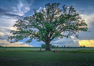
Little Dixie is a historic 13- to 17-county region along the Missouri River in central Missouri, United States. Its early European-American settlers were largely migrants from the hemp and tobacco districts of Virginia, and central Kentucky and Tennessee. They brought enslaved African Americans with them or purchased them as workers in the region. Because Southerners settled there first, the pre-Civil War culture of the region was similar to that of the Upper South. The area was also known as Boonslick country.
Route 87 is a highway in central Missouri. Its southern terminus is at U.S. Route 54 in Eldon, and its northern terminus is at Route 5/240 in Glasgow. Parts of the road are overlapped by the Lewis and Clark Trail and Santa Fe Trail.
William Becknell was an American soldier, politician, and freight operator who is credited by Americans with opening the Santa Fe Trail in 1821. He found a trail for part of the route that was wide enough for wagon trains and draft teams, making it easier for trader and emigrants along this route. The Santa Fe Trail became an early major transportation route through central North America that connected Franklin, Missouri with Santa Fe, New Mexico, serving both trading and emigrant parties. It served as a vital commercial highway from the 1820s until 1880, when the railroad was introduced to Santa Fe. Becknell made use of long-established trails made by Native Americans, and Spanish and French colonial explorers and traders for centuries before his trip.
The Columbia metropolitan area is the region centered around the City of Columbia in the U.S. state of Missouri. Located in Mid-Missouri, it consists of five counties: Boone, Audrain, Randolph, Cooper, and Howard. The population was estimated at 256,640 in 2017, making it the 4th largest metropolitan area in Missouri. Columbia is home to the University of Missouri, and is Missouri's fourth most-populous and fastest growing city, with an estimated 121,717 residents as of 2017. Other significant cities in the area include Moberly, Mexico, Boonville, Vandalia, Centralia, and Fayette.

The history of Columbia, Missouri as an American city spans two hundred years. Founded by pioneers from Kentucky in 1821 to be the county seat of Boone County. Its position astride the Boone's Lick Road led to early growth as settlers flooded into the Boonslick and eventually the West. In the 21st century Columbia is Missouri's fourth largest city and educational center.
In the American Old West, overland trails were built by pioneers and immigrants throughout the 19th century and especially between 1829 and 1870 as an alternative to sea and railroad transport. These immigrants began to help colonize much of North America west of the Great Plains as part of the mass overland migrations of the mid-19th century. Settlers emigrating from the eastern United States were spurred by various motives, among them religious persecution and economic incentives, to move to destinations in the far west via routes including the Oregon Trail, California Trail, and Mormon Trail. After the end of the Mexican–American War in 1849, vast new American conquests again enticed mass immigration. Legislation like the Donation Land Claim Act and significant events like the California Gold Rush further lured people to travel overland to the west.

The Great Osage Trail, also known as the Osage Trace or the Kaw Trace was one of the more well-known Native American trails through the countryside of what are today called the Midwest and Plains States of the U.S., pathways originally created by herds of Buffalo or other migrating wildlife.

The Boone's Lick Road or Boonslick Trail was an early 1800s transportation route from eastern to central Missouri in the United States. Running east-west on the North side and roughly parallel to the Missouri River the trail began in the river port of St. Charles. The trail played a major role in the westward expansion of the United States and the development of Missouri's statehood. The trail's eventual terminus at Franklin was the start of the better-known Santa Fe Trail. First traced by the sons of Daniel Boone, the path originally ended at a salt lick in Howard County used by the pair to manufacture salt. Today the lick is maintained as Boone's Lick State Historic Site.
Millersburg is an unincorporated community in Callaway County, in the U.S. state of Missouri. It is located near the Boone-Callaway county line on the Owl Creek tributary of Cedar Creek. The Little Dixie Lake and Little Dixie Wildlife Management Area lie on Owl Creek just north of the community. It is on Missouri Route J about four miles south of I-70.
Flat Branch is a stream in Columbia, Missouri. It was the original water source for the town of Columbia and its forerunner Smithton. It is a branch of Hinkson Creek and begins Northwest or Downtown Columbia. Flat Branch Park straddles the creek between 4th Street and Providence. Flat Branch was so named on account of its low riverbanks.
The Smithton Land Company was a group of American pioneers who in 1818 established the frontier village of Smithton, Missouri in the Boonslick region of Missouri, then the Missouri Territory. In 1821 the settlement was renamed Columbia, Missouri and relocated slightly East of its original location. Smithton was the first county seat of Boone County. The company and town were named after Thomas Adams Smith, the receiver of the land office in Franklin, Missouri.


