Crawford County, Missouri

Last updated

Crawford County
CrawfordCo courthouse Steeleville MO 20140330-6.jpg
Crawford County Courthouse in Steelville
Map of Missouri highlighting Crawford County.svg
Location within the U.S. state of Missouri
Missouri in United States.svg
Missouri's location within the U.S.
Coordinates: 37°59′N91°18′W / 37.98°N 91.3°W / 37.98; -91.3
CountryFlag of the United States.svg United States
StateFlag of Missouri.svg  Missouri
FoundedJanuary 23, 1829
Named for William H. Crawford
Seat Steelville
Largest city Cuba
Area
  Total744 sq mi (1,930 km2)
  Land743 sq mi (1,920 km2)
  Water1.2 sq mi (3 km2)  0.2%
Population
 (2020)
  Total23,056
  Density31/sq mi (12/km2)
Time zone UTC−6 (Central)
  Summer (DST) UTC−5 (CDT)
Congressional district 8th
Website crawfordcountymo.net

Crawford County is a county located in the east-central portion of the U.S. state of Missouri. At the 2020 Census, the population was 23,056. [1] Its county seat is Steelville. The county was organized in 1829 [2] and is named after U.S. Senator William H. Crawford [3] of Georgia.

Contents

The section of Sullivan which is located in Crawford County is included in the St. Louis, MO-IL Metropolitan Statistical Area.

In 1990, the mean center of U.S. population was located in southwestern Crawford County.

Crawford County was established in 1829 and the County Seat of Steelville was laid out in 1836. [4]

Geography

According to the U.S. Census Bureau, the county has a total area of 744 square miles (1,930 km2), of which 743 square miles (1,920 km2) is land and 1.2 square miles (3.1 km2) (0.2%) is water. [5] [6]

Adjacent counties

Major highways

National protected area

Demographics

Historical population
CensusPop.Note
1830 1,712
1840 3,561108.0%
1850 6,39779.6%
1860 5,823−9.0%
1870 7,98237.1%
1880 10,75634.8%
1890 11,96111.2%
1900 12,9598.3%
1910 13,5764.8%
1920 12,355−9.0%
1930 11,287−8.6%
1940 12,69312.5%
1950 11,615−8.5%
1960 12,6478.9%
1970 14,82817.2%
1980 18,30023.4%
1990 19,1734.8%
2000 22,80418.9%
2010 24,6468.1%
2020 23,056−6.5%
U.S. Decennial Census [7]
1790–1960 [8] 1900–1990 [9]
1990–2000 [10] 2010 [11]

At the 2000 census, [12] there were 22,804 people, 8,858 households and 6,351 families residing in the county. The population density was 31 per square mile (12/km2). There were 10,850 housing units at an average density of 15 units per square mile (5.8/km2). The racial makeup of the county was 98.26% White, 0.14% Black or African American, 0.43% Native American, 0.13% Asian, 0.06% Pacific Islander, 0.14% from other races, and 0.82% from two or more races. Approximately 0.77% of the population were Hispanic or Latino of any race.

There were 8,858 households, of which 32.80% had children under the age of 18 living with them, 58.70% were married couples living together, 9.00% had a female householder with no husband present, and 28.30% were non-families. 24.30% of all households were made up of individuals, and 11.30% had someone living alone who was 65 years of age or older. The average household size was 2.53 and the average family size was 3.00.

26.30% of the population were under the age of 18, 7.90% from 18 to 24, 26.90% from 25 to 44, 23.10% from 45 to 64, and 15.80% who were 65 years of age or older. The median age was 38 years. For every 100 females there were 97.30 males. For every 100 females age 18 and over, there were 94.60 males.

The median household income was $37,554 and the median family income was $45,059. Males had a median income of $28,005 compared with $18,736 for females. The per capita income was $18,203. About 12.70% of families and 16.30% of the population were below the poverty line, including 23.30% of those under age 18 and 14.10% of those age 65 or over.

2020 Census

Crawford County Racial Composition [13]
RaceNum.Perc.
White (NH)20,98091%
Black or African American (NH)1480.64%
Native American (NH)1070.5%
Asian (NH)810.35%
Pacific Islander (NH)140.06%
Other/Mixed (NH)1,2445.4%
Hispanic or Latino 4822.1%

Education

Public schools

Private schools

Public libraries

Communities

Cities and towns

Census-designated place

Unincorporated communities

Townships

Politics

Local

The Republican Party controls politics at the local level in Crawford County. Republicans hold all elected positions in the county.

Crawford County, Missouri
Elected countywide officials
Assessor Kellie Vestal Republican
Circuit Clerk Karen R. Harlan Republican
County Clerk John G. Martin Republican
Collector Pat Schwent Republican
Commissioner
(Presiding)
Leo Sanders Republican
Commissioner
(District 1)
Rob Cummings Republican
Commissioner
(District 2)
Jared Boast Republican
Coroner Paul Hutson Republican
Prosecuting Attorney David Smith Republican
Public Administrator Franky Todd Republican
Recorder Kimberly A. Cook Republican
Sheriff Darin Layman Republican
Surveyor Mark Mueller Republican
Treasurer Karen Sikes Republican

State

Past Gubernatorial Elections Results
Year Republican Democratic Third Parties
2016 59.72%5,89929.28% 2,89211.00% 1,086
2012 52.23%4,97844.85% 4,2752.92% 278
2008 46.18% 4,62751.94%5,2041.88% 188
2004 57.70%5,42240.92% 3,8451.38% 130
2000 52.53%4,35243.74% 3,6243.73% 309
1996 44.72% 3,42552.87%4,0492.42% 185
1992 42.17% 3,47057.83%4,7580.00% 0
1988 66.26%4,63633.04% 2,3120.70% 49
1984 60.87%4,40839.13% 2,8340.00% 0
1980 53.65%3,72245.88% 3,1830.46% 32
1976 49.50% 3,37650.43%3,4390.07% 5
1972 57.31%3,98042.56% 2,9560.13% 9
1968 47.84% 2,98352.16%3,2530.00% 0
1964 46.22% 2,77753.78%3,2310.00% 0
1960 56.30%3,57043.70% 2,7710.00% 0

Crawford County is split between two of the districts that elect members of the Missouri House of Representatives, both of which are currently represented by Republicans.

Missouri House of Representatives — District 62 — Crawford County (2018)
PartyCandidateVotes%±%
Republican Tom Hurst17575.75
Democratic Ashley D. Fajkowski5624.24
Missouri House of Representatives — District 62 — Crawford County (2016) [17]
PartyCandidateVotes%±%
Republican Tom Hurst251100.00%
Missouri House of Representatives — District 62 — Crawford County (2014)
PartyCandidateVotes%±%
Republican Tom Hurst152100.00%+38.55
Missouri House of Representatives — District 62 — Crawford County (2012)
PartyCandidateVotes%±%
Republican Tom Hurst16961.45%
Democratic Greg Stratman10638.55%
Missouri House of Representatives — District 120 — Crawford County (2018)
PartyCandidateVotes%±%
Republican Jason Chipman573969.65
Democratic Theresa Schmitt250030.34
Missouri House of Representatives — District 120 — Crawford County (2016) [17]
PartyCandidateVotes%±%
Republican Jason Chipman8,374100.00%+23.09
Missouri House of Representatives — District 120 — Crawford County (2014)
PartyCandidateVotes%±%
Republican Jason Chipman4,15876.91%+4.31
Democratic Zechariah Hockersmith1,24823.09%−4.31
Missouri House of Representatives — District 120 — Crawford County (Special Election 2013)
PartyCandidateVotes%±%
Republican Shawn Sisco2,34072.60%−27.40
Democratic Zechariah Hockersmith88327.40%+27.40
Missouri House of Representatives — District 120 — Crawford County (2012)
PartyCandidateVotes%±%
Republican Jason T. Smith7,799100.00%

In the Missouri Senate, all of Crawford County is a part of Missouri's 16th District and is represented by Republican Justin Brown. [18]

Missouri Senate — District 16 — Crawford County (2014)
PartyCandidateVotes%±%
Republican Dan Brown4,741100.00%

Federal

U.S. Senate — Missouri — Crawford County (2016) [17]
PartyCandidateVotes%±%
Republican Roy Blunt6,16362.69%+13.79
Democratic Jason Kander3,14431.98%−12.57
Libertarian Jonathan Dine2362.40%−4.15
Green Johnathan McFarland1301.32%+1.32
Constitution Fred Ryman1581.61%+1.61
U.S. Senate — Missouri — Crawford County (2012)
PartyCandidateVotes%±%
Republican Todd Akin4,65448.90%
Democratic Claire McCaskill4,24044.55%
Libertarian Jonathan Dine6236.55%

All of Crawford County is included in Missouri's 8th Congressional District and is currently represented by Republican Jason T. Smith of Salem in the U.S. House of Representatives. Smith won a special election on Tuesday, June 4, 2013, to complete the remaining term of former Republican Jo Ann Emerson of Cape Girardeau. Emerson announced her resignation a month after being reelected with over 70 percent of the vote in the district. She resigned to become CEO of the National Rural Electric Cooperative.

U.S. House of Representatives — Missouri's 8th Congressional District — Crawford County (2016) [17]
PartyCandidateVotes%±%
Republican Jason T. Smith7,58978.17%+2.58
Democratic Dave Cowell1,84919.04%−0.69
Libertarian Jonathan Shell2712.79%+1.22
U.S. House of Representatives — Missouri's 8th Congressional District — Crawford County (2014)
PartyCandidateVotes%±%
Republican Jason T. Smith4,29475.59%−7.32
Democratic Barbara Stocker1,12119.73%+3.88
Libertarian Rick Vandeven891.57+1.05
Constitution Doug Enyart741.30%+0.78
Independent Terry Hampton1031.81%+1.81
U.S. House of Representatives — Missouri's 8th Congressional District — Crawford County (Special Election 2013)
PartyCandidateVotes%±%
Republican Jason T. Smith1,27682.91%+10.74
Democratic Steve Hodges24415.85%−9.13
Libertarian Bill Slantz80.52%−2.32
Constitution Doug Enyart80.52%+0.52
Write-In Thomas Brown20.13%+0.13
Write-In Wayne L. Byington10.07%+0.07
U.S. House of Representatives — Missouri's 8th Congressional District — Crawford County (2012)
PartyCandidateVotes%±%
Republican Jo Ann Emerson6,75772.17%
Democratic Jack Rushin2,33924.98%
Libertarian Rick Vandeven2662.84%

Political culture

United States presidential election results for Crawford County, Missouri [19]
Year Republican Democratic Third party
No.%No.%No.%
2020 8,72579.51%2,11319.26%1351.23%
2016 7,72477.86%1,82418.39%3723.75%
2012 6,43467.17%2,95130.81%1942.03%
2008 6,00759.56%3,91138.78%1671.66%
2004 5,68660.61%3,63238.72%630.67%
2000 4,75457.26%3,35040.35%1982.38%
1996 2,99039.05%3,34943.74%1,31717.20%
1992 2,83133.76%3,51541.92%2,03924.32%
1988 3,85655.19%3,10744.47%240.34%
1984 4,71664.37%2,61035.63%00.00%
1980 4,08158.21%2,71038.65%2203.14%
1976 3,22447.18%3,56552.17%440.64%
1972 4,59567.15%2,24832.85%00.00%
1968 3,52555.78%2,12333.60%67110.62%
1964 2,66043.58%3,44456.42%00.00%
1960 4,06563.00%2,38737.00%00.00%
1956 3,59459.41%2,45540.59%00.00%
1952 3,75360.34%2,45339.44%140.23%
1948 2,65053.55%2,28946.25%100.20%
1944 3,07758.45%2,17741.36%100.19%
1940 3,61556.79%2,73642.99%140.22%
1936 3,04151.01%2,87948.30%410.69%
1932 2,21340.79%3,16658.36%460.85%
1928 2,92666.08%1,47633.33%260.59%
1924 2,33655.77%1,69740.51%1563.72%
1920 2,63460.44%1,65838.04%661.51%
1916 1,64254.35%1,31243.43%672.22%
1912 1,04542.04%1,03741.71%40416.25%
1908 1,75256.77%1,26040.83%742.40%
1904 1,53553.97%1,17541.32%1344.71%
1900 1,47051.94%1,31846.57%421.48%
1896 1,44750.91%1,38348.66%120.42%
1892 1,26950.94%1,17647.21%461.85%
1888 1,25551.48%1,17248.07%110.45%

Crawford County is like most rural counties, socially conservative and vote in favor of the Republican Party. Bill Clinton was the last Democratic presidential nominee to win Crawford County in 1996. Since then, voters in the county have substantially supported Republicans at the national level.

2008 Missouri presidential primary

In the 2008 Missouri Presidential Primary, voters in Crawford County from both political parties supported candidates who finished in second place in the state at large and nationally.

Republican

Former Governor Mike Huckabee (R-Arkansas) won Crawford County by just one vote with 32.71 percent of the vote. U.S. Senator John McCain (R-Arizona) finished in second place in Crawford County with 32.66 percent. Former Governor Mitt Romney (R-Massachusetts) came in third place, receiving 27.76 percent of the vote while libertarian-leaning U.S. Representative Ron Paul (R-Texas) finished fourth with 5.15 percent.

Democratic

Then-U.S. Senator Hillary Clinton (D-New York) won a decisive victory in Crawford County with 66.36 percent of the vote. Then-U.S. Senator Barack Obama (D-Illinois) received 30.07 percent of the vote from Crawford County Democrats. Although he withdrew from the race, former U.S. Senator John Edwards (D-North Carolina) still received 2.61 percent of the vote in Crawford County.

See also

Related Research Articles

<span class="mw-page-title-main">Wright County, Missouri</span> County in Missouri, United States

Wright County is a county located in the southern portion of the U.S. state of Missouri. As of the 2020 census, the population was 18,188. Its county seat is Hartville. The county was officially organized on January 29, 1841, and is named after Silas Wright, a former Congressman, U.S. Senator and Governor of New York.

<span class="mw-page-title-main">Webster County, Missouri</span> County in Missouri, United States

Webster County is a county located in the U.S. state of Missouri. As of the 2020 census, the population was 39,085. Its county seat is Marshfield. The county was organized in 1855 and named for U.S. Senator and U.S. Secretary of State Daniel Webster.

<span class="mw-page-title-main">Washington County, Missouri</span> County in Missouri, United States

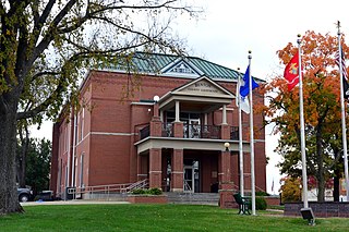
Washington County is located in the southeastern part of the U.S. state of Missouri. As of the 2020 United States census, the population was 23,514. The county seat and largest city is Potosi. The county was officially organized on August 21, 1813, and was named in honor of George Washington, the first President of the United States.

<span class="mw-page-title-main">Warren County, Missouri</span> County in Missouri, United States

Warren County is a county located in the eastern portion of the U.S. state of Missouri. As of the 2020 census, the population was 35,532. The county is located on the north side of the Missouri River. Its county seat is Warrenton. The county was established on January 5, 1833, and was named for General Joseph Warren, who died in the Battle of Bunker Hill during the American Revolutionary War.

<span class="mw-page-title-main">Vernon County, Missouri</span> County in Missouri, United States

Vernon County is located in the western region of the U.S. state of Missouri, on the border with Kansas. As of the 2020 census, the population was 19,707. Its county seat is Nevada. The county was organized on February 27, 1855, considerably later than counties in the eastern part of the state. It was named for Colonel Miles Vernon (1786–1867), a state senator and veteran of the Battle of New Orleans. This area was part of the large historic territory of the Osage Nation of Native Americans.

<span class="mw-page-title-main">Stone County, Missouri</span> County in Missouri, United States

Stone County is located in the southwestern portion of the U.S. state of Missouri. As of the 2020 census, the population was 31,076. Its county seat is Galena.

<span class="mw-page-title-main">Stoddard County, Missouri</span> County in Missouri, United States

Stoddard County is a county located in the southeastern portion of the U.S. state of Missouri. As of the 2020 census, the population was 28,672. The county seat is Bloomfield. The county was officially organized on January 2, 1835, and is named for Amos Stoddard, the first American commandant of Upper Louisiana.

<span class="mw-page-title-main">Mississippi County, Missouri</span> County in Missouri, United States

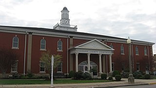
Mississippi County is a county located in the Bootheel of the U.S. state of Missouri, with its eastern border formed by the Mississippi River. As of the 2020 census, the population was 12,577. The largest city and county seat is Charleston. The county was officially organized on February 14, 1845, and was named after the Mississippi River.

<span class="mw-page-title-main">Iron County, Missouri</span> County in Missouri, United States

Iron County is a county located in the Lead Belt region in the U.S. state of Missouri. As of the 2020 census, the population was 9,537. The largest city and county seat is Ironton. Iron County was officially organized on February 17, 1857, and was named after the abundance of iron ore found within its borders.

<span class="mw-page-title-main">Howell County, Missouri</span> County in Missouri, United States

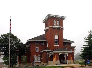
Howell County is in southern Missouri. As of the 2020 census, the population was 39,750. The largest city and county seat is West Plains. The county was officially organized on March 2, 1851, and is named after Josiah Howell, a pioneer settler in the Howell Valley.

<span class="mw-page-title-main">Dallas County, Missouri</span> County in Missouri, United States

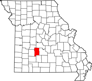
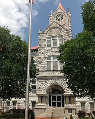
Dallas County is a county located in the U.S. state of Missouri. As of the 2010 census, the population was 17,071. Its county seat is Buffalo. The county was organized in 1842 as Niangua County and then renamed in 1844 for George M. Dallas, who served as Vice President under James K. Polk.

<span class="mw-page-title-main">Cedar County, Missouri</span> County in Missouri, United States

Cedar County is a county located in the southwest portion of the U.S. state of Missouri. As of the 2020 census, the population was 14,188. Its county seat is Stockton. The county was founded February 14, 1845, and named after Cedar Creek, a tributary of the Sac River, which in turn is named from the Eastern red cedar, a common tree of the area.

<span class="mw-page-title-main">Cape Girardeau County, Missouri</span> County in Missouri, United States

Cape Girardeau County is located in the southeastern part of the U.S. state of Missouri; its eastern border is formed by the Mississippi River. At the 2020 census, the population was 81,710. The county seat is Jackson, the first city in the US to be named in honor of President Andrew Jackson. Officially organized on October 1, 1812, the county is named after Ensign Sieur Jean Baptiste de Girardot, an official of the French colonial years. The "cape" in the county's name is named after a former promontory rock overlooking the Mississippi River; this feature was demolished during railroad construction. Cape Girardeau County is the hub of the Cape Girardeau–Jackson metropolitan area. Its largest city is Cape Girardeau.

<span class="mw-page-title-main">Camden County, Missouri</span> County in Missouri, United States

Camden County is a county located in the U.S. state of Missouri. As of the 2020 Census, the population was 42,745. Its county seat is Camdenton. The county was organized on January 29, 1841, as Kinderhook County and renamed Camden County in 1843 after Charles Pratt, 1st Earl Camden, Lord Chancellor of the United Kingdom and leader of the British Whig Party. Camden County is also the primary setting of the Netflix show Ozark.

<span class="mw-page-title-main">Buchanan County, Missouri</span> County in Missouri, United States

Buchanan County is located in the U.S. state of Missouri. As of the 2020 United States Census, the population was 84,793. Its county seat is St. Joseph. When originally formed in 1838, the county was named Roberts County, after settler Hiram Roberts. It was renamed in 1839 for James Buchanan, then a U.S. Senator and later President of the United States. The county was formed from land annexed to Missouri, as were five other counties.

<span class="mw-page-title-main">Benton County, Missouri</span> County in Missouri, United States

Benton County is a county located in the west central part of the U.S. state of Missouri. The population was 19,394 as of the 2020 Census. Its county seat is Warsaw. The county was organized January 3, 1835, and named for U.S. Senator Thomas Hart Benton of Missouri.

<span class="mw-page-title-main">Barton County, Missouri</span> County in Missouri, United States

Barton County is a county located in the southwestern part of the U.S. state of Missouri. As of the 2020 census, the population was 11,637. Its county seat is Lamar. The county was organized in 1855 and named after U.S. Senator David Barton from Missouri.

<span class="mw-page-title-main">Steelville, Missouri</span> City in Missouri, United States

Steelville is a city in Crawford County, Missouri, United States. The population was 1,472 at the 2020 census. It is the county seat of Crawford County. Steelville is the hometown of Congressman Albert Reeves and Missouri State Representative Jason Chipman. The town was named after the landowner James Steel.

<span class="mw-page-title-main">Cuba, Missouri</span> City in Missouri, United States

Cuba is a city in Crawford County, Missouri, United States. The population was 3,356 at the 2010 census. Cuba is the largest city situated entirely in Crawford County.

<span class="mw-page-title-main">St. Charles County, Missouri</span> County in Missouri, United States

St. Charles County is in the central eastern part of the U.S. state of Missouri. As of the 2020 census, the population was 405,262, making it Missouri's third-most populous county. Its county seat is St. Charles. The county was organized October 1, 1812, and named for Saint Charles Borromeo, an Italian cardinal.

References

  1. "Crawford County, Missouri". United States Census Bureau . Retrieved June 13, 2023.
  2. Eaton, David Wolfe (1916). How Missouri Counties, Towns and Streams Were Named. The State Historical Society of Missouri. pp.  281.
  3. Gannett, Henry (1905). The Origin of Certain Place Names in the United States. Govt. Print. Off. pp.  95.
  4. "About". Crawford County, Missouri. Retrieved April 28, 2023.
  5. "2010 Census Gazetteer Files". United States Census Bureau. August 22, 2012. Archived from the original on October 21, 2013. Retrieved November 14, 2014.
  6. "State & County Missouri Ticket Lawyer". Caleb Jones of Columbia, Missouri.
  7. "U.S. Decennial Census". United States Census Bureau. Retrieved November 14, 2014.
  8. "Historical Census Browser". University of Virginia Library. Archived from the original on August 11, 2012. Retrieved November 14, 2014.
  9. "Population of Counties by Decennial Census: 1900 to 1990". United States Census Bureau. Retrieved November 14, 2014.
  10. "Census 2000 PHC-T-4. Ranking Tables for Counties: 1990 and 2000" (PDF). United States Census Bureau. Archived (PDF) from the original on March 27, 2010. Retrieved November 14, 2014.
  11. "State & County QuickFacts". United States Census Bureau. Archived from the original on June 22, 2011. Retrieved September 7, 2013.
  12. "U.S. Census website". United States Census Bureau . Retrieved May 14, 2011.
  13. "P2 HISPANIC OR LATINO, AND NOT HISPANIC OR LATINO BY RACE – 2020: DEC Redistricting Data (PL 94-171) – Crawford County, Missouri".
  14. Breeding, Marshall. "Bourbon Branch Library". Libraries.org. Retrieved May 8, 2017.
  15. Breeding, Marshall. "Recklein Memorial Branch Library". Libraries.org. Retrieved May 8, 2017.
  16. Breeding, Marshall. "Steelville Branch Library". Libraries.org. Retrieved May 8, 2017.
  17. 1 2 3 4 "County Results - State of Missouri - 2016 General Election - November 8, 2016 - Official Results". Missouri Secretary of State. December 12, 2016. Retrieved April 30, 2017.
  18. "Senator Justin Brown – Missouri Senate" . Retrieved May 13, 2020.
  19. Leip, David. "Dave Leip's Atlas of U.S. Presidential Elections". uselectionatlas.org. Retrieved March 25, 2018.

37°59′N91°18′W / 37.98°N 91.30°W / 37.98; -91.30