Crawford County is a county located in the east-central portion of the U.S. state of Missouri. At the 2020 Census, the population was 23,056. Its county seat is Steelville. The county was organized in 1829 and is named after U.S. Senator William H. Crawford of Georgia.
Cherryville is an unincorporated community in southeastern Crawford County, Missouri, United States. It is located on Route 19, approximately ten miles south of Steelville, at the northern terminus of Route 49. It is near the Mark Twain National Forest.
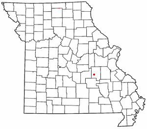
Cook Station is an unincorporated community in southwest Crawford County, Missouri, United States. It is located on the Meramec River, approximately ten miles south of Steelville, along Missouri Route M.
Berryman is an unincorporated community on the border between Crawford and Washington counties in the U.S. state of Missouri. Located along Route 8, it lies in the Mark Twain National Forest, approximately sixteen miles west of Potosi. Courtois Creek flows under Route 8, just west of the village. Berryman Recreation Area and trail lie to the northeast of the village.
Davisville is an unincorporated community in southeastern Crawford County, Missouri, United States. It is located in the Mark Twain National Forest, approximately 13 miles southeast of Steelville.

Dillard is an unincorporated community in southern Crawford County, Missouri, United States. It is located on Huzzah Creek and Missouri Route 49, approximately 22 miles south of Steelville in the Mark Twain National Forest. The Dillard Mill State Historic Site lies about one mile south of the community at the confluence of Indian Creek with Huzzah Creek.
Brazil Creek is a stream in Crawford and Washington counties in the U.S. state of Missouri. It is a tributary to the Meramec River.
Coffeyton is an unincorporated community in northern Crawford County, in the U.S. state of Missouri. The community is located on the railroad line, approximately two miles northeast of Leasburg and three miles southwest of Bourbon.
Crooked Creek is a stream in Crawford and Dent counties in the U.S. state of Missouri. It is a tributary of the Meramec River.
Czar is an unincorporated community in southeastern Crawford County, in the U.S. state of Missouri. The community was located on the east side of Shoal Creek on Missouri Route Y, approximately four miles north of Viburnum. The Czar church and cemetery are about one-half mile northwest and the Czar Lookout Tower is on a ridge about one mile northeast on Route Y.
Delhi is an unincorporated community in Crawford County, in the U.S. state of Missouri. The community was located west-southwest of Bourbon on the Little Bourbeuse River. The community of Argo was also on the river, approximately three miles to the north (downstream).
Harrison Mills is an unincorporated community in Crawford County, in the U.S. state of Missouri.
Keysville is an unincorporated community in southwest Crawford County, in the U.S. state of Missouri. The community is located approximately six miles south of Steelville on Missouri Route AA and is on the banks of Crooked Creek.
Midland is an unincorporated community in Crawford County, in the U.S. state of Missouri. The community was located along Missouri Route 8 near the Missouri Route TT intersection approximately two miles east of Steelville. The Midland School was about one-half mile to the northwest on a bluff above Whittenburg Creek.
Mill Rock Creek is a stream in Crawford and Iron counties in the U.S. state of Missouri. It is a tributary of Huzzah Creek.
Patsy is an unincorporated community in Crawford County, in the U.S. state of Missouri. The community is located on Missouri Route BB, along a ridge southeast of Elayer.
Service is an unincorporated community in eastern Crawford County, in the U.S. state of Missouri. The community is located on a small tributary along the east bank of Courtois Creek, approximately 2.5 miles west of the Crawford-Washington county line. Missouri Route 8 passes on the ridge about one-half mile to the southwest. The community of Butts lies about 1.5 miles downstream (northwest) and Berryman is about four miles to the southeast (upstream). The old Service School was located at the site in the 1940s.
Vilander is an extinct town in eastern Crawford County, in the U.S. state of Missouri. The GNIS classifies it as a populated place.
Westover is an unincorporated community in Crawford County, in the U.S. state of Missouri. The community is on Dry Creek at the end of Missouri Route BB, approximately seven miles south-southeast of Steelville and five miles northeast of Cherryville.
Gascondy is an extinct town in southern Osage County, in the U.S. state of Missouri. The GNIS classifies it as a populated place.