Westover, Missouri

Last updated

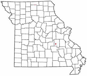
Westover is an unincorporated community in Crawford County, in the U.S. state of Missouri. [1] The community is on Dry Creek at the end of Missouri Route BB about seven miles south-southeast of Steelville and five miles northeast of Cherryville. [2]

Crawford County, Missouri County in the United States

Crawford County is a county located in the east-central portion of the U.S. state of Missouri. At the 2010 Census, the population was 24,696. Its county seat is Steelville. The county was organized in 1829 and is named after U.S. Senator William H. Crawford of Georgia.

U.S. state constituent political entity of the United States

In the United States, a state is a constituent political entity, of which there are currently 50. Bound together in a political union, each state holds governmental jurisdiction over a separate and defined geographic territory and shares its sovereignty with the federal government. Due to this shared sovereignty, Americans are citizens both of the federal republic and of the state in which they reside. State citizenship and residency are flexible, and no government approval is required to move between states, except for persons restricted by certain types of court orders. Four states use the term commonwealth rather than state in their full official names.

Missouri State of the United States of America

Missouri is a state in the Midwestern United States. With over six million residents, it is the 18th-most populous state of the Union. The largest urban areas are St. Louis, Kansas City, Springfield, and Columbia; the capital is Jefferson City. The state is the 21st-most extensive in area. In the South are the Ozarks, a forested highland, providing timber, minerals, and recreation. The Missouri River, after which the state is named, flows through the center of the state into the Mississippi River, which makes up Missouri's eastern border.

The community has a fish hatchery on Dry Creek which is supported by the Westover Springs that arise within the Dry Creek valley to the south of the community. [3]

Fish hatchery place for artificial breeding, hatching and rearing through the early life stages of fish

A fish hatchery is a place for artificial breeding, hatching, and rearing through the early life stages of animals—finfish and shellfish in particular. Hatcheries produce larval and juvenile fish, shellfish, and crustaceans, primarily to support the aquaculture industry where they are transferred to on-growing systems, such as fish farms, to reach harvest size. Some species that are commonly raised in hatcheries include Pacific oysters, shrimp, Indian prawns, salmon, tilapia and scallops. The value of global aquaculture production is estimated to be US$98.4 billion in 2008 with China significantly dominating the market; however, the value of aquaculture hatchery and nursery production has yet to be estimated. Additional hatchery production for small-scale domestic uses, which is particularly prevalent in South-East Asia or for conservation programmes, has also yet to be quantified.

History

A post office called Westover was established in 1901, and remained in operation until 1927. [4] The community was named after J. I. H. Westover, the proprietor of a local mill. [5]

Related Research Articles

Cherryville is an unincorporated community in southeastern Crawford County, Missouri, United States. It is located on Route 19, approximately ten miles south of Steelville, at the northern terminus of Route 49. It is near the Mark Twain National Forest.

Cook Station is an unincorporated community in southwest Crawford County, Missouri, United States. It is located on the Meramec River, approximately ten miles south of Steelville, along Missouri Route M.

Berryman is an unincorporated community on the border between Crawford and Washington counties in the U.S. state of Missouri. Located along Route 8, it lies in the Mark Twain National Forest, approximately sixteen miles west of Potosi. Courtois Creek flows under Route 8, just west of the village. Berryman Recreation Area and trail lie to the northeast of the village.

Davisville is an unincorporated community in southeastern Crawford County, Missouri, United States. It is located in the Mark Twain National Forest, approximately thirteen miles southeast of Steelville.

Wesco, Missouri unincorporated community in Missouri

Wesco is an unincorporated community in southwest Crawford County, Missouri, United States. It is located on the Meramec River, approximately eight miles southwest of Steelville.

Dillard, Missouri unincorporated community in Missouri

Dillard is an unincorporated community in southern Crawford County, Missouri, United States. It is located on Huzzah Creek and Missouri Route 49, approximately 22 miles south of Steelville in the Mark Twain National Forest. The Dillard Mill State Historic Site lies about one mile south of the community at the confluence of Indian Creek with Huzzah Creek.

Butts is an unincorporated community in eastern Crawford County, in the U.S. state of Missouri. The community is on the north side of Henpeck Hollow about one-half mile east of Courtois Creek. Access is via a county road from Missouri Route 8, approximately five miles east of Elayer. The location is within the Mark Twain National Forest and a campground is located on the Courtois River to the west of the site.

Cherry Valley Creek is a stream in Crawford County in the U.S. state of Missouri. It is a tributary of Dry Creek.

Cherry Valley is an unincorporated community in Crawford County, in the U.S. state of Missouri.

Czar is an unincorporated community in southeastern Crawford County, in the U.S. state of Missouri. The community was located on the east side of Shoal Creek on Missouri Route Y, approximately four miles north of Viburnum. The Czar church and cemetery are about one-half mile northwest and the Czar Lookout Tower is on a ridge about one mile northeast on Route Y.

Indian Creek is a stream in Crawford and Dent counties in the U.S. state of Missouri. It is a tributary of Huzzah Creek. The stream headwaters arise in northern Dent County at 37°40′28″N91°17′02″W at an elevation of 1300 feet. The stream flows northeast into Crawford County and enters Hazzah Creek about one mile south of the community of Dillard and Missouri Route 49 at 37°43′02″N91°12′21″W and an elevation of 899 feet.

Keysville is an unincorporated community in southwest Crawford County, in the U.S. state of Missouri. The community is located approximately six miles south of Steelville on Missouri Route AA and is on the banks of Crooked Creek.

Oak Hill is an unincorporated community in northwest Crawford County, in the U.S. state of Missouri. The community is located on the east bank of Brush Creek, one-quarter mile south of the Crawford-Gasconade county line and is on Missouri Route CC, one mile east of Missouri Route 19.

Scotia is an unincorporated community in eastern Crawford County, in the U.S. state of Missouri. The community is located on the south bank of Huzzah Creek, approximately one mile southeast of that stream's confluence with the Meramec River. The community is accessed from the south via Missouri Route E.

Service is an unincorporated community in eastern Crawford County, in the U.S. state of Missouri. The community is located on a small tributary along the east bank of Courtois Creek, approximtealy 2.5 miles west of the Crawford-Washington county line. Missouri Route 8 passes on the ridge about one-half mile to the southwest. The community of Butts lies about 1.5 miles downstream (northwest) and Berryman is about four miles to the southeast (upstream). The old Service School was located at the site in the 1940s.

Vilander is an extinct town in eastern Crawford County, in the U.S. state of Missouri. The GNIS classifies it as a populated place.

Elwood or Elwood Siding is an unincorporated community in Greene County, in the U.S. state of Missouri. The community lies along the railroad southwest of the Springfield airport. The headwaters of Clear Creek are just to the northeast.

Ashley Creek is an unincorporated community in northeastern Texas County, in the U.S. state of Missouri. The community is located along South Ashley Creek, approximately 1.5 miles south of its confluence with North Ashley Creek to form Ashley Creek. The community is on a sharp meander of the stream and Ashley Creek church and cemetery are about one mile downstream. Montauk State Park on Pigeon Creek is about three miles to the north in Dent County.

Big Creek is an unincorporated community in Texas County, in the U.S. state of Missouri. The community was located along Big Creek, approximately 2.5 miles south of Yukon and one-half mile east of Missouri Route 137. The Big Creek school was south of the creek and the Big Creek church was about one-half mile north along a county road.

Dry Creek is a stream in southern Crawford County in southeast Missouri. It is a tributary of Huzzah Creek.

References

  1. U.S. Geological Survey Geographic Names Information System: Westover, Missouri
  2. Missouri Atlas & Gazetteer, DeLorme, 1998, First edition, p. 47 ISBN   0-89933-224-2
  3. Huzzah, Missouri, 7.5 Minute Topographic Quadrangle, USGS, 1978 (1985 rev.)
  4. "Post Offices". Jim Forte Postal History. Retrieved 25 September 2016.
  5. "Crawford County Place Names, 1928–1945 (archived)". The State Historical Society of Missouri. Retrieved 25 September 2016.

Coordinates: 37°55′21″N91°13′41″W / 37.92250°N 91.22806°W / 37.92250; -91.22806

Geographic coordinate system Coordinate system

A geographic coordinate system is a coordinate system that enables every location on Earth to be specified by a set of numbers, letters or symbols. The coordinates are often chosen such that one of the numbers represents a vertical position and two or three of the numbers represent a horizontal position; alternatively, a geographic position may be expressed in a combined three-dimensional Cartesian vector. A common choice of coordinates is latitude, longitude and elevation. To specify a location on a plane requires a map projection.